Knocknavar Plantation

Wood, Forest in Wigtownshire

Scotland

Knocknavar Plantation

Logan Windmill This is all that is left of the windmill that was built shortly before 1684 by Patrick McDouall to lessen his estate's dependence on the nearby watermill which in summer was liable to failure.
Logan Windmill Credit: Patrick Lee

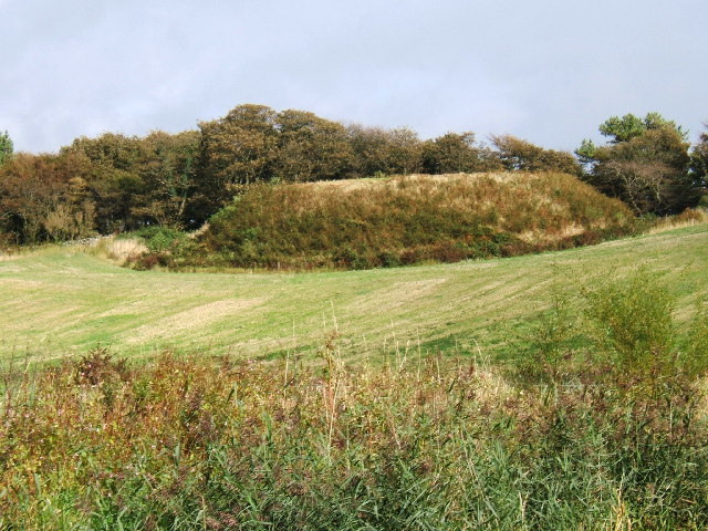
Knocknavar Plantation is a picturesque woodland located in Wigtownshire, a historic county in southwest Scotland. Spread across a sprawling area of land, this plantation is renowned for its rich flora, diverse wildlife, and tranquil environment.

The woodland consists mainly of mature trees, including oak, ash, birch, and beech, which provide a lush canopy and create a serene ambiance. The dense vegetation not only enhances the beauty of the plantation but also provides a habitat for numerous species of birds, mammals, and insects.

Visitors to Knocknavar Plantation can explore the various walking trails that wind through the woodland, allowing them to immerse themselves in nature and enjoy the peaceful surroundings. These trails offer breathtaking views of the surrounding countryside, with glimpses of rolling hills and open meadows.

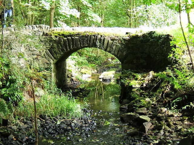
The plantation also features a small stream that meanders through the woodland, adding to its charm and providing a water source for the local wildlife. Many visitors enjoy picnicking by the stream, taking in the sights and sounds of nature while enjoying a peaceful meal.

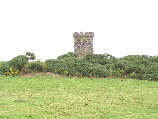
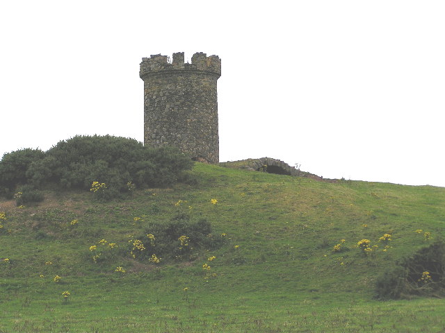
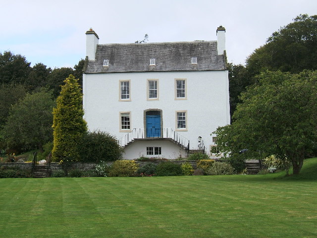
In addition to its natural beauty, Knocknavar Plantation has historical significance. It is believed that the woodland was once part of an old estate and has been preserved over the years. This adds a touch of nostalgia and intrigue to the plantation, inviting visitors to delve into its past.

Overall, Knocknavar Plantation is a hidden gem in Wigtownshire, offering a tranquil escape from the hustle and bustle of everyday life. Its diverse flora and fauna, coupled with its scenic trails and historical significance, make it a must-visit destination for nature enthusiasts and history buffs alike.

If you have any feedback on the listing, please let us know in the comments section below.

Knocknavar Plantation Images

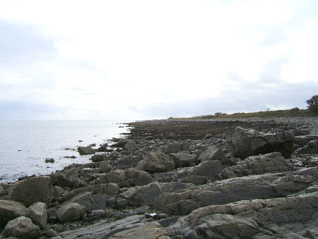
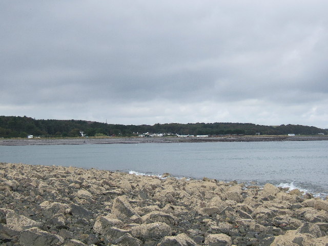
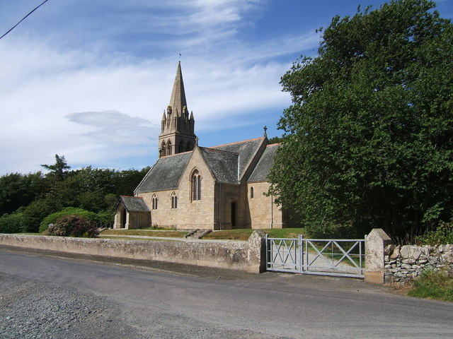
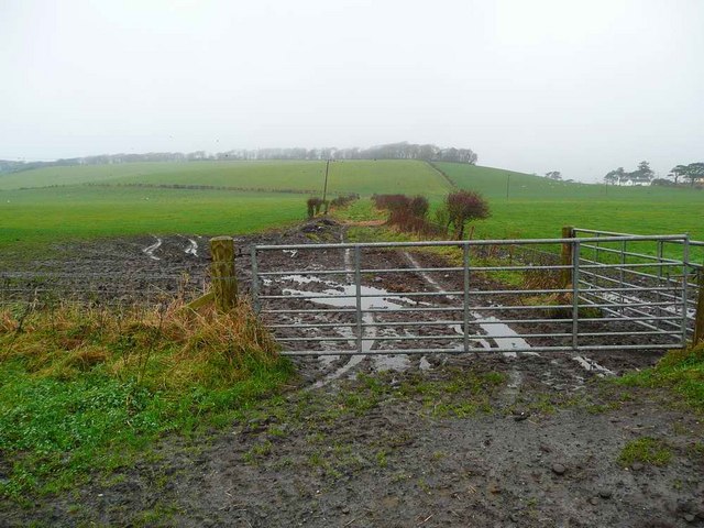
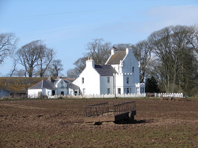
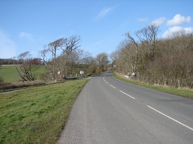
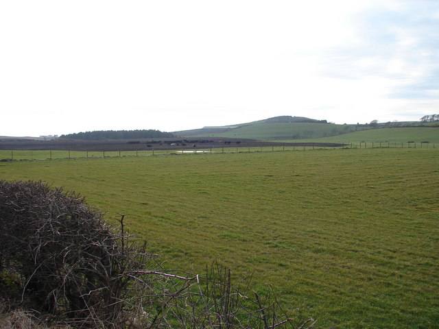
Images are sourced within 2km of 54.75173/-4.9497937 or Grid Reference NX1043. Thanks to Geograph Open Source API. All images are credited.

Logan Windmill This is all that is left of the windmill that was built shortly before 1684 by Patrick McDouall to lessen his estate's dependence on the nearby watermill which in summer was liable to failure.
Logan Windmill
This is all that is left of the windmill that was built shortly before 1684 by Patrick McDouall to lessen his estate's dependence on the nearby watermill which in summer was liable to failure.
Logan Windmill 2 Another view of Logan Windmill showing the curious vaulted structure at its base
Logan Windmill 2
Another view of Logan Windmill showing the curious vaulted structure at its base
Ardwell House, Ardwell, Wigtownshire The estate house at Ardwell owned by and occupied by the Brewis family.
Ardwell House, Ardwell, Wigtownshire
The estate house at Ardwell owned by and occupied by the Brewis family.
An old cartpath and bridge within Ardwell Estate This old bridge is close to Ardwell houses, Ardwell, about 10 miles South of Stranraer.
An old cartpath and bridge within Ardwell Estate
This old bridge is close to Ardwell houses, Ardwell, about 10 miles South of Stranraer.
The rocky shore between Longrigg and Logan Mill Photograph taken around the point from Longrigg near Ardwell.
The rocky shore between Longrigg and Logan Mill
Photograph taken around the point from Longrigg near Ardwell.
The remains of a Motte and Bailey castle, Ardwell, Stranraer These are all that remain of a Motte and Bailey castle within the grounds of Ardwell House, Ardwell, Stranraer. The modern OS maps have it marked as Ardwell Motte and the shape is unmistakable. When closer, the ditch around the Motte is still noticeable and in fact, the estate have built two wooden bridges over the ditch, one at either side of a marked walk.
The remains of a Motte and Bailey castle, Ardwell, Stranraer
These are all that remain of a Motte and Bailey castle within the grounds of Ardwell House, Ardwell, Stranraer. The modern OS maps have it marked as Ardwell Motte and the shape is unmistakable. When closer, the ditch around the Motte is still noticeable and in fact, the estate have built two wooden bridges over the ditch, one at either side of a marked walk.
Chapel Rossan Bay looking across to Ardwell village and caravan site. Chapel Rossan Bay taken from Chapel Rossan and looking across to Ardwell village, about 10 miles South of Stranraer.
Chapel Rossan Bay looking across to Ardwell village and caravan site.
Chapel Rossan Bay taken from Chapel Rossan and looking across to Ardwell village, about 10 miles South of Stranraer.
Ardwell Church, Ardwell, Stranraer Ardwell Church, Ardwell, Stranraer built in 1902.
Ardwell Church, Ardwell, Stranraer
Ardwell Church, Ardwell, Stranraer built in 1902.
Lane near Ardwell Church On the opposite side of the road, running south.
Lane near Ardwell Church
On the opposite side of the road, running south.
Logan Botanic Gardens Entrance of the B7065
Logan Botanic Gardens
Entrance of the B7065
Disused track The twin hedges indicate where this mapped track went, but it's clearly not used much now.
Disused track
The twin hedges indicate where this mapped track went, but it's clearly not used much now.
Auchness Tower, Ardwell The 16 century altered 3-storey tower was formerly known as Auchness Castle; it now forms part of a modern farmhouse. <span class="nowrap"><a title="http://canmore.org.uk/site/61124/auchness-farmhouse" rel="nofollow ugc noopener" href="http://canmore.org.uk/site/61124/auchness-farmhouse">Link</a><img style="margin-left:2px;" alt="External link" title="External link - shift click to open in new window" src="https://s1.geograph.org.uk/img/external.png" width="10" height="10"/></span>
Auchness Tower, Ardwell
The 16 century altered 3-storey tower was formerly known as Auchness Castle; it now forms part of a modern farmhouse. LinkExternal link
Balkelzie Bridge, Logan Toll Junction of the A716 and B7065 at Balkelzie Bridge.
Balkelzie Bridge, Logan Toll
Junction of the A716 and B7065 at Balkelzie Bridge.
Auchabreck, South Rhins View from West Myroch northwest across the cattle crazing fields of Auchabreck.
Auchabreck, South Rhins
View from West Myroch northwest across the cattle crazing fields of Auchabreck.
Carved farm sign for Barhill farm
Ardwell House The house was built in the early 18th century. It has been in the McTaggart family since before 1800.
Ardwell House
The house was built in the early 18th century. It has been in the McTaggart family since before 1800.
Carved stone family crest This owl carving is the crest of the MacTaggart family owners of Ardwell House
Carved stone family crest
This owl carving is the crest of the MacTaggart family owners of Ardwell House
Ardwell House dovecot
Show me another place!

Knocknavar Plantation is located at Grid Ref: NX1043 (Lat: 54.75173, Lng: -4.9497937)

Unitary Authority: Dumfries and Galloway

Police Authority: Dumfries and Galloway

What 3 Words

///unfocused.proceeds.soccer. Near Drummore, Dumfries & Galloway

Related Wikis

Logan Botanic Garden

Logan Botanic Garden is a botanical garden near Port Logan on the Rhins of Galloway, at the south-western tip of Scotland. The Botanic Garden was established...

Ardwell

Ardwell (from Gaelic Àrd Bhaile meaning "high town", pronounced as "Ardwell") is a village in the Scottish unitary council area of Dumfries and Galloway...

Port Logan

Port Logan, formerly Port Nessock, is a small village in the parish of Kirkmaiden in the Rhins of Galloway in Wigtownshire. The Gaelic name is Port Neasaig...

Clachanmore

Clachanmore is a village in the South Rhins of Galloway near Ardwell in the south west of Scotland. It has also been known as Low Ardwell.The name of the...

Nearby Amenities

Located within 500m of 54.75173,-4.9497937
Auchness Hill
Natural: peak
Lat/Long: 54.7524703/-4.946962
Knocknavar
Natural: peak
Lat/Long: 54.7523155/-4.9527759
Knockcappy
Natural: peak
Lat/Long: 54.755558/-4.948464
The data included in this document is from www.openstreetmap.org. The data is made available under ODbL.

Have you been to Knocknavar Plantation?

Leave your review of Knocknavar Plantation below (or comments, questions and feedback).