Dinvin Wood

Wood, Forest in Wigtownshire

Scotland

Dinvin Wood

Dunskey Glen, near Portpatrick
Dunskey Glen, near Portpatrick Credit: David Hawgood

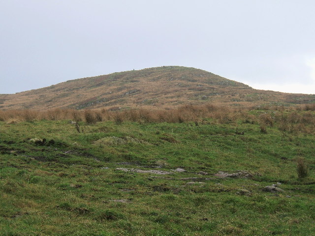
Dinvin Wood is a picturesque forest located in Wigtownshire, Scotland. Covering an area of approximately 300 acres, it is a popular destination for nature enthusiasts and outdoor adventurers alike. The forest is situated near the village of Kirkcowan, offering easy access to visitors from nearby towns and cities.

Dinvin Wood is known for its diverse range of flora and fauna, making it a haven for wildlife enthusiasts. The woodland is primarily composed of native broadleaved trees such as oak, birch, and ash, creating a vibrant and lush environment. Visitors can enjoy leisurely walks along the well-maintained trails, immersing themselves in the tranquility of nature.

The forest is home to various species of birds, including woodpeckers, owls, and songbirds, providing ample opportunities for birdwatchers to observe and appreciate these beautiful creatures. Additionally, the wood is inhabited by small mammals like squirrels and rabbits, which can often be spotted scurrying through the undergrowth.

For those seeking a more active experience, Dinvin Wood offers a range of outdoor activities. Cyclists can explore the forest on designated bike trails, while families can enjoy picnics in designated areas. The forest also features a small play area for children, ensuring there is something for everyone to enjoy.

Dinvin Wood is a true gem in the heart of Wigtownshire, offering visitors a chance to escape the hustle and bustle of everyday life and reconnect with nature. With its stunning landscapes, diverse wildlife, and recreational activities, it is a must-visit destination for nature lovers of all ages.

If you have any feedback on the listing, please let us know in the comments section below.

Dinvin Wood Images

Images are sourced within 2km of 54.85841/-5.1033458 or Grid Reference NX0055. Thanks to Geograph Open Source API. All images are credited.

Dunskey Glen, near Portpatrick
Killantringan Fell near Portpatrick The small hill Killantringan Fell (464 feet) situated south of the Southern Upland Way road to Killantringan Lighthouse.
Killantringan Fell near Portpatrick
The small hill Killantringan Fell (464 feet) situated south of the Southern Upland Way road to Killantringan Lighthouse.
A waterfall over caves at the end of Sandeel Bay (Port Mora Bay) near Portpatrick.
Port Mora
Port Mora
Portpatrick - St Andrew's Auld Kirk This Church was built in the 17th century and has been disused since 1842.
Portpatrick - St Andrew's Auld Kirk
This Church was built in the 17th century and has been disused since 1842.
Glen Cottage, Dunskey Estate This cottage is at the end of a mile and a half track, down through Dunskey Glen. It sits on a grassy cliff between the bays of Port Kale and Port Mora.
Glen Cottage, Dunskey Estate
This cottage is at the end of a mile and a half track, down through Dunskey Glen. It sits on a grassy cliff between the bays of Port Kale and Port Mora.
Gravestones, Dunskey Estate These graves stand on a prominent headland between Port Mora and Port Kale. They belong to the Orr-Ewing family and all served in the army or navy. One was a hero of Colditz. To see them, one must leave the path and climb the headland. It's easiest to take the track up the hill from Port Kale.
Gravestones, Dunskey Estate
These graves stand on a prominent headland between Port Mora and Port Kale. They belong to the Orr-Ewing family and all served in the army or navy. One was a hero of Colditz. To see them, one must leave the path and climb the headland. It's easiest to take the track up the hill from Port Kale.
Clifftop path near Portpatrick This path leads northwards over the cliffs. At this point it is part of the Southern Upland Way. Part of Portpatrick golf course can just be seen on the right and ahead are the bays of Port Mora and Port Kale.
Clifftop path near Portpatrick
This path leads northwards over the cliffs. At this point it is part of the Southern Upland Way. Part of Portpatrick golf course can just be seen on the right and ahead are the bays of Port Mora and Port Kale.
Dunskey Glen The path through the glen as it runs alongside Dunskey Burn.
Dunskey Glen
The path through the glen as it runs alongside Dunskey Burn.
Walkers on the Southern Upland Way The Southern Upland Way 
<span class="nowrap"><a title="http://www.dumgal.gov.uk/dumgal/miniweb.aspx?id=137" rel="nofollow ugc noopener" href="http://www.dumgal.gov.uk/dumgal/miniweb.aspx?id=137">Link</a><img style="margin-left:2px;" alt="External link" title="External link - shift click to open in new window" src="https://s1.geograph.org.uk/img/external.png" width="10" height="10"/></span> is one of Scotland's official long distance paths and runs for 340 km from Portpatrick in the west to Cockburnspath in the east. Here seen near the western end on the road to Black Head. The walkers are walking east to west in the opposite direction to normal.
Walkers on the Southern Upland Way
The Southern Upland Way LinkExternal link is one of Scotland's official long distance paths and runs for 340 km from Portpatrick in the west to Cockburnspath in the east. Here seen near the western end on the road to Black Head. The walkers are walking east to west in the opposite direction to normal.
Gate and rough pasture On a tarmac section of the Southern Upland Way.
Gate and rough pasture
On a tarmac section of the Southern Upland Way.
Southern Upland Way, near Portpartick The house at Killantringan in the distance.
Southern Upland Way, near Portpartick
The house at Killantringan in the distance.
Killantringan Fell from Killantringan
Footbridge on the Southern Upland Way The post has previously marked the presence of an undersea cable;  not sure what the huts were for.
Footbridge on the Southern Upland Way
The post has previously marked the presence of an undersea cable; not sure what the huts were for.
Port Mora
Port Mora
2 Signposts 1 for Killantringan Lighthouse and The Southern Upland Way
2 Signposts
1 for Killantringan Lighthouse and The Southern Upland Way
The way to Killantrignan With a cattle grid as a bonus
The way to Killantrignan
With a cattle grid as a bonus
Signpost for Kennel Park,Dunskey Estate
Show me another place!

Dinvin Wood is located at Grid Ref: NX0055 (Lat: 54.85841, Lng: -5.1033458)

Unitary Authority: Dumfries and Galloway

Police Authority: Dumfries and Galloway

What 3 Words

///soaps.appealing.shirtless. Near Stranraer, Dumfries & Galloway

Related Wikis

Portpatrick railway station

Portpatrick railway station was a railway station serving the village of Portpatrick, Dumfries & Galloway, Scotland. Opened in 1862 the station served...

Portpatrick

Portpatrick is a village and civil parish in the historical county of Wigtownshire, Dumfries and Galloway, Scotland. It is located on the west coast of...

Dunskey

Dunskey Estate (also known as Portree Estate) is north of Portpatrick on the west coast of Scotland. The B-listed mansion dates from the start of the twentieth...

Dunskey Castle

Dunskey Castle is a ruined, 12th-century tower house or castle, located 0.5 miles (0.80 km) south of the village of Portpatrick, Rhinns, Wigtownshire,...

MV Craigantlet

MV Craigantlet was a German-owned, Cyprus-registered container ship operated on time-charter by Cawoods Containers Ltd of Belfast. She ran aground on 26...

Killantringan Lighthouse

Killantringan Lighthouse is a lighthouse located near Portpatrick in Dumfries and Galloway, south-west Scotland. The light came into operation in 1900...

Colfin railway station

Colfin railway station, located in Wigtownshire, Scotland, between Portpatrick and Stranraer, was a station on the Portpatrick and Wigtownshire Joint Railway...

Rhins of Galloway

The Rhins of Galloway, otherwise known as the Rhins of Wigtownshire (or as The Rhins, also spelled The Rhinns; Scottish Gaelic: Na Rannaibh), is a hammer...

Nearby Amenities

Located within 500m of 54.85841,-5.1033458
Power: pole
Lat/Long: 54.8580595/-5.0964251
McCubbin's Hill
Natural: peak
Lat/Long: 54.8606267/-5.1076402
Power: pole
Lat/Long: 54.8576202/-5.0974023
Power: pole
Lat/Long: 54.8570039/-5.0987874
Power: pole
Lat/Long: 54.8563715/-5.1001795
Power: pole
Lat/Long: 54.8558634/-5.1012899
Power: pole
Lat/Long: 54.8554107/-5.1023018
Power: pole
Lat/Long: 54.8547891/-5.1036892
Power: pole
Lat/Long: 54.8542512/-5.1048583
Power: pole
Lat/Long: 54.8540728/-5.1052269
Power: pole
Lat/Long: 54.8575864/-5.0994471
Power: pole
Lat/Long: 54.8582972/-5.0996489
Power: pole
Lat/Long: 54.8590295/-5.0998649
Power: pole
Lat/Long: 54.8597281/-5.1000833
Power: pole
Lat/Long: 54.8604713/-5.1002875
Power: pole
Lat/Long: 54.8611739/-5.1005129
Power: pole
Lat/Long: 54.8618901/-5.1007312
Power: pole
Lat/Long: 54.8626236/-5.1009407
Power: pole
Lat/Long: 54.8625778/-5.1017642
The data included in this document is from www.openstreetmap.org. The data is made available under ODbL.

Have you been to Dinvin Wood?

Leave your review of Dinvin Wood below (or comments, questions and feedback).