Calver

Settlement in Derbyshire Derbyshire Dales

England

Calver

Woodland behind the Eyre Arms This woodland on this hill behind the Eyre Arms is just to the south-west of the centre of SK27.
Woodland behind the Eyre Arms Credit: Roger Temple

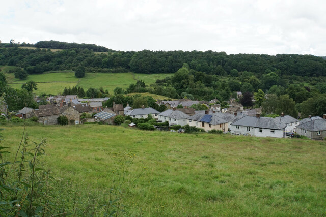
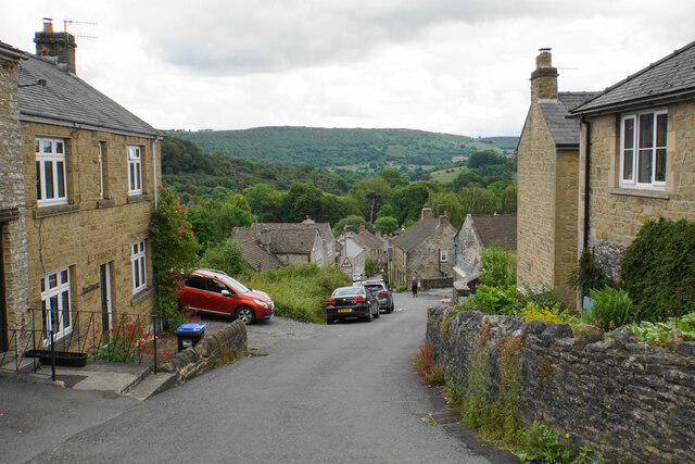
Calver is a small village located in the county of Derbyshire, in the East Midlands region of England. Situated approximately 10 miles southwest of Sheffield and 16 miles northwest of Derby, it is nestled within the Peak District National Park, renowned for its stunning natural landscapes.

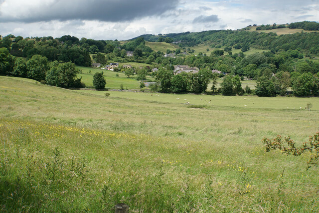
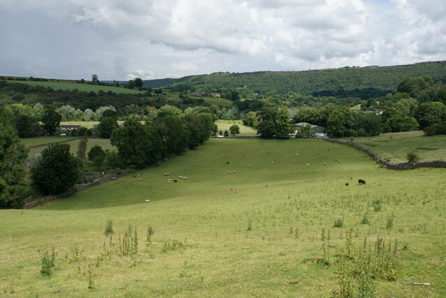
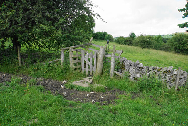
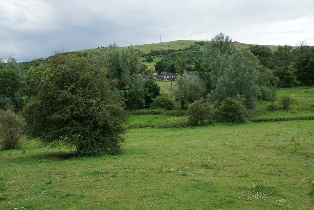
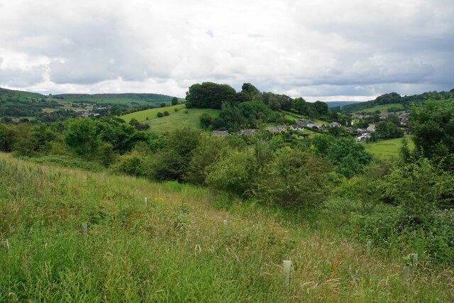
With a population of around 1,000 residents, Calver offers a tranquil and picturesque setting for its inhabitants and visitors alike. The village is split into two parts, Great and Little Calver, which are separated by the River Derwent. This river, along with the surrounding hills and valleys, provides ample opportunities for outdoor activities such as hiking, cycling, and fishing.

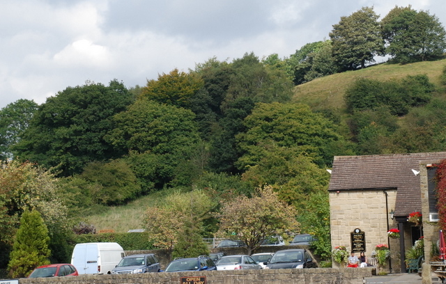
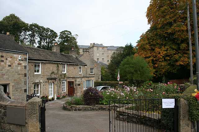
Calver is known for its rich industrial heritage, particularly in the production of gritstone and millstones. The area was once home to several quarries and mills, which played a significant role in the local economy. Today, remnants of this industrial past can still be seen in the form of historical buildings and structures.

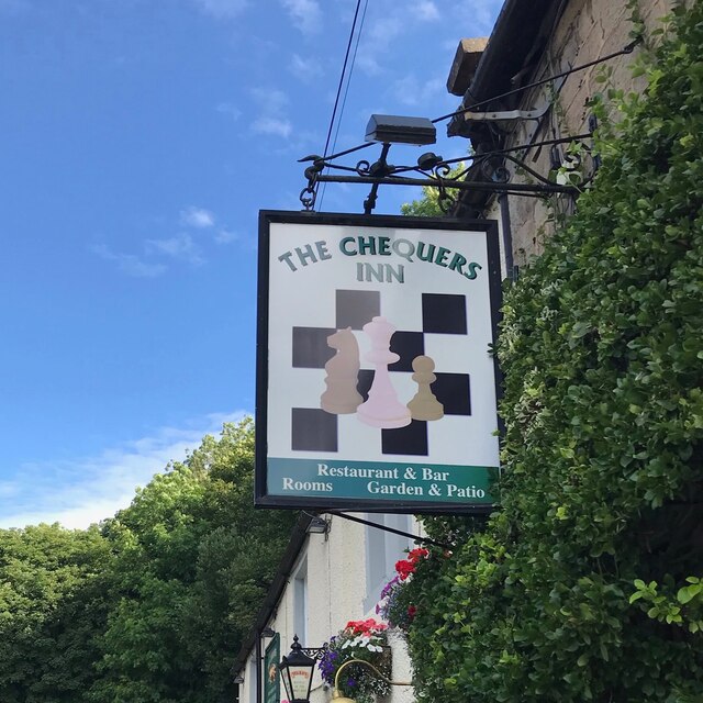
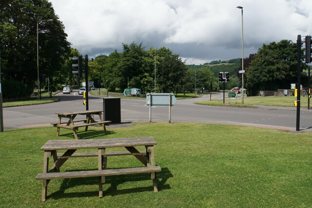
The village boasts a range of amenities to cater to its residents' needs, including a primary school, a village hall, and a local pub. Additionally, Calver is well-connected to nearby towns and cities by road, making it a convenient base for exploring the wider region.

Overall, Calver is a charming and idyllic village, offering a peaceful retreat for those seeking a rural lifestyle, while also providing easy access to the attractions and amenities of the surrounding area.

If you have any feedback on the listing, please let us know in the comments section below.

Calver Images

Images are sourced within 2km of 53.266962/-1.636693 or Grid Reference SK2474. Thanks to Geograph Open Source API. All images are credited.

Woodland behind the Eyre Arms This woodland on this hill behind the Eyre Arms is just to the south-west of the centre of SK27.
Woodland behind the Eyre Arms
This woodland on this hill behind the Eyre Arms is just to the south-west of the centre of SK27.
The Chequers Inn Former Wards brewery pub beside the A625 in Froggatt
The Chequers Inn
Former Wards brewery pub beside the A625 in Froggatt
The sign of The Chequers Inn See <a href="https://www.geograph.org.uk/photo/6922975">SK2476 : The Chequers Inn</a>.
The sign of The Chequers Inn
Chequers Inn wall plaque Dating back to the halcyon days of the Wards brewery in Sheffield.  Oh to be able to drink a pint of that excellent brew again!
Chequers Inn wall plaque
Dating back to the halcyon days of the Wards brewery in Sheffield. Oh to be able to drink a pint of that excellent brew again!
Crossroads in Calver A lot of people will only know Calver from these crossroads, as the A623 passes through, and the A625 turns off. There is a village green here, with more on the opposite side, but the village has quieter and more attractive bits.
Crossroads in Calver
A lot of people will only know Calver from these crossroads, as the A623 passes through, and the A625 turns off. There is a village green here, with more on the opposite side, but the village has quieter and more attractive bits.
Hillside below Calver Low Looking down towards Stoney Middleton. Eyam is just visible further up the far hill.
Hillside below Calver Low
Looking down towards Stoney Middleton. Eyam is just visible further up the far hill.
Field at the bottom of Coombs Dale The A623 runs at the other end of the field. The Derwent valley is in the background with Froggatt Edge on the far side.
Field at the bottom of Coombs Dale
The A623 runs at the other end of the field. The Derwent valley is in the background with Froggatt Edge on the far side.
Footpath and gate above Stoney Middleton The wooden structures around the gate show some evolutionary randomness.
Footpath and gate above Stoney Middleton
The wooden structures around the gate show some evolutionary randomness.
Hillside below Eaton Fold A chance to look down on the rooftops of Stoney Middleton.
Hillside below Eaton Fold
A chance to look down on the rooftops of Stoney Middleton.
Middleton Lane A steeply descending road through Stoney Middleton. The Derwent valley is in the distance.
Middleton Lane
A steeply descending road through Stoney Middleton. The Derwent valley is in the distance.
Green fields at the bottom of Middleton Dale Calver Peak is opposite.
Green fields at the bottom of Middleton Dale
Calver Peak is opposite.
Hillside above Stoke Brook The course of Stoke Brook below is obscured by shrubbery. Opposite is Hare Knoll and Calver.
Hillside above Stoke Brook
The course of Stoke Brook below is obscured by shrubbery. Opposite is Hare Knoll and Calver.
Fields by Knouchley Farm Looking down the Derwent Valley, with Curbar and Baslow Edges up on the left.
Fields by Knouchley Farm
Looking down the Derwent Valley, with Curbar and Baslow Edges up on the left.
Hilly farmland near Knouchley Farm Part of the western side of the Derwent valley opposite Froggatt.
Hilly farmland near Knouchley Farm
Part of the western side of the Derwent valley opposite Froggatt.
Path down to the Derwent Froggatt Edge is at the top of the other side.
Path down to the Derwent
Froggatt Edge is at the top of the other side.
River Derwent Very smooth flowing above Calver Weir.
River Derwent
Very smooth flowing above Calver Weir.
Froggatt Bridge Crossing the River Derwent. Grade II listed and mostly rebuilt in the 19th Century.
Froggatt Bridge
Crossing the River Derwent. Grade II listed and mostly rebuilt in the 19th Century.
River Derwent by New Bridge On the opposite side is the Shuttle House, for which the local authority conservation records are here: <span class="nowrap"><a title="https://her.derbyshire.gov.uk/Monument/MDR3974" rel="nofollow ugc noopener" href="https://her.derbyshire.gov.uk/Monument/MDR3974">Link</a><img style="margin-left:2px;" alt="External link" title="External link - shift click to open in new window" src="https://s1.geograph.org.uk/img/external.png" width="10" height="10"/></span>.
River Derwent by New Bridge
On the opposite side is the Shuttle House, for which the local authority conservation records are here: LinkExternal link.
Show me another place!

Calver is located at Grid Ref: SK2474 (Lat: 53.266962, Lng: -1.636693)

Administrative County: Derbyshire

District: Derbyshire Dales

Police Authority: Derbyshire

What 3 Words

///sponsors.atomic.amaze. Near Baslow, Derbyshire

Related Wikis

Calver

Calver (Old English Calf Slope) is a village and civil parish in Derbyshire, England. The population of the civil parish at the 2011 census was 710....

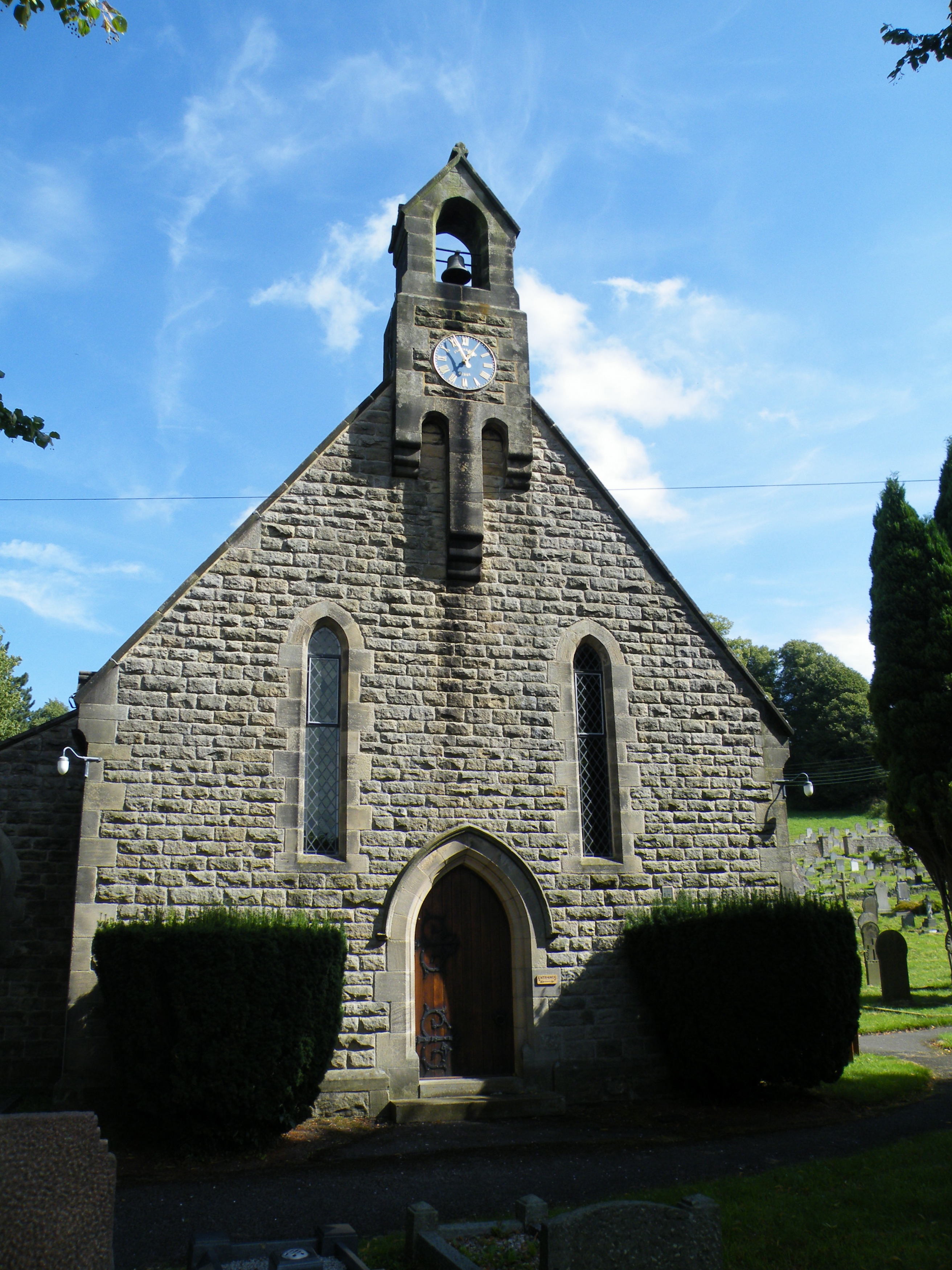
All Saints' Church, Curbar

All Saints’ Church, Curbar is a Church of England parish church in Curbar, Derbyshire. == History == Until the church was built, the nearest parish church...

Upper Derwent Valley

The Upper Derwent Valley is an area of the Peak District National Park in England. It largely lies in Derbyshire, but its north eastern area lies in Sheffield...

Cliff College

Cliff College is a Christian theological college in Calver, Derbyshire, that teaches Biblical Theology at the undergraduate level and a number of mission...

Nearby Amenities

Located within 500m of 53.266962,-1.636693
Calver
Is In: Derbyshire, England, UK
Place: village
Wikidata: Q2073921
Wikipedia: en:Calver
Lat/Long: 53.2684861/-1.6414898
Calver Bridge
Bus: yes
Public Transport: stop_position
Lat/Long: 53.2668144/-1.63401
Pub
The Bridge Inn
Addr City: Hope Valley
Addr Postcode: S32 3XA
Addr Street: Calver Bridge
Addr Suburb: Curbar
Fhrs Id: 1626905
Food: yes
Real Ale: Greene King Abbot, Hardy and Hansons Kimberley, Back of the Net
Lat/Long: 53.2661742/-1.6310557
Pub
The Derwentwater Arms
Lat/Long: 53.268364/-1.6411023
Created By: Merkaartor 0.12
Lat/Long: 53.267936/-1.6294349
Created By: Merkaartor 0.12
Lat/Long: 53.2670498/-1.6301607
Hare Knoll
Natural: peak
Lat/Long: 53.2708583/-1.6384489
Cafe
The Eating House
Addr City: Hope Valley
Addr Postcode: S32 3XA
Addr Street: Calver Bridge
Addr Suburb: Curbar
Fhrs Id: 1626375
Lat/Long: 53.2668539/-1.6329843
Calver Mill
Historic: building
Lat/Long: 53.2678848/-1.6306222
Cafe
Cafe 19 at Whites
Addr City: Hope Valley
Addr Postcode: S32 3XH
Addr Street: Kingsgate
Addr Suburb: Calver
Contact Facebook: https://www.facebook.com/Cafe19atwhites/
Lat/Long: 53.2697342/-1.6424821
Barrier: stile
Material: stone
Source: survey;gps
Stile: stepover
Lat/Long: 53.2644571/-1.6342277
Barrier: stile
Material: wood
Source: survey;gps
Stile: stepover
Lat/Long: 53.2636802/-1.6393356
Barrier: stile
Material: stone
Source: survey;gps
Stile: squeezer
Lat/Long: 53.2665489/-1.6400864
Barrier: stile
Material: stone
Source: survey;gps
Stile: squeezer
Lat/Long: 53.266555/-1.640925
Barrier: stile
Material: stone
Source: survey;gps
Stile: squeezer
Lat/Long: 53.2665875/-1.641057
Barrier: entrance
Source: survey;gps
Lat/Long: 53.2672288/-1.6411239
Calver Weir
Board Type: history
Information: board
Tourism: information
Lat/Long: 53.2679715/-1.6323017
Recycling
Lat/Long: 53.2651857/-1.6302012
Bus Stop
Calver Bridge
Bus: yes
Naptan AtcoCode: 1000DCSK3194
Naptan NaptanCode: dbsajtpt
Public Transport: platform
Lat/Long: 53.2667738/-1.634051
Barrier: stile
Material: stone
Source: survey;gps
Stile: squeezer
Lat/Long: 53.2644272/-1.6335514
Parking
Parking: surface
Lat/Long: 53.2654952/-1.6304114
Post Office
Calver Post Office
Addr City: Hope Valley
Addr Postcode: S32 3XH
Addr Street: Kingsgate
Addr Suburb: Calver
Opening Hours: Mo-Su 07:00-22:00
Ref Pol Id: 126118
Lat/Long: 53.2696492/-1.6421731
Historic: memorial
Lat/Long: 53.2678153/-1.6408699
Post Box
Collection Times: Mo-Fr 16:30; Sa 11:00
Note: Re-located from old Post Office, Main Street in 2015
Post Box Type: wall
Ref: S32 200
Royal Cypher: VR
Lat/Long: 53.2697002/-1.642078
Post Box
Collection Times: Mo-Fr 09:00; Sa 07:30
Post Box Type: pillar
Ref: S32 564D
Lat/Long: 53.2668148/-1.633292
Defibrillator
Access: yes
Check Date: 2023-03-09
Defibrillator Location: On outside wall. Available 24/7.
Emergency: defibrillator
Indoor: no
Opening Hours: 24/7
Ref GB The Circuit: 9DD63F59-C1CA-4D2F-92A3-3592785CEBCA
Lat/Long: 53.2697853/-1.6422877
Bus Stop
Calver Bridge
Bus: yes
Public Transport: platform
Lat/Long: 53.2664371/-1.6323643
Calver Bridge
Bus: yes
Public Transport: stop_position
Lat/Long: 53.266379/-1.6324188
Bus Stop
Calver Hassop Road
Bus: yes
Public Transport: platform
Lat/Long: 53.2683744/-1.6435052
Calver Hassop Road
Bus: yes
Public Transport: stop_position
Lat/Long: 53.2683754/-1.6435641
Defibrillator
Access: yes
Check Date: 2023-03-09
Defibrillator Location: On outside wall. Available 24/7.
Emergency: defibrillator
Indoor: no
Lat/Long: 53.2664105/-1.6374398
Generator Method: photovoltaic
Generator Output Electricity: yes
Generator Source: solar
Generator Type: solar_photovoltaic_panel
Location: roof
Power: generator
Lat/Long: 53.2682158/-1.6426185
Generator Method: photovoltaic
Generator Output Electricity: yes
Generator Source: solar
Generator Type: solar_photovoltaic_panel
Location: roof
Power: generator
Lat/Long: 53.2680875/-1.64242
Generator Method: photovoltaic
Generator Output Electricity: yes
Generator Source: solar
Generator Type: solar_photovoltaic_panel
Location: roof
Power: generator
Lat/Long: 53.2682736/-1.642015
Generator Method: photovoltaic
Generator Output Electricity: yes
Generator Source: solar
Generator Type: solar_photovoltaic_panel
Location: roof
Power: generator
Lat/Long: 53.2690644/-1.6395929
Generator Method: photovoltaic
Generator Output Electricity: yes
Generator Source: solar
Generator Type: solar_photovoltaic_panel
Location: roof
Power: generator
Lat/Long: 53.266584/-1.6370815
Generator Method: photovoltaic
Generator Output Electricity: yes
Generator Source: solar
Generator Type: solar_photovoltaic_panel
Location: roof
Power: generator
Lat/Long: 53.2666112/-1.6369983
Generator Method: photovoltaic
Generator Output Electricity: yes
Generator Source: solar
Generator Type: solar_photovoltaic_panel
Location: roof
Power: generator
Lat/Long: 53.2666209/-1.6368133
Generator Method: photovoltaic
Generator Output Electricity: yes
Generator Source: solar
Generator Type: solar_photovoltaic_panel
Location: roof
Power: generator
Lat/Long: 53.2663466/-1.6368723
Generator Method: photovoltaic
Generator Output Electricity: yes
Generator Source: solar
Generator Type: solar_photovoltaic_panel
Location: roof
Power: generator
Lat/Long: 53.2663305/-1.636934
Generator Method: photovoltaic
Generator Output Electricity: yes
Generator Source: solar
Generator Type: solar_photovoltaic_panel
Location: roof
Power: generator
Lat/Long: 53.2663161/-1.6369635
Generator Method: photovoltaic
Generator Output Electricity: yes
Generator Source: solar
Generator Type: solar_photovoltaic_panel
Location: roof
Power: generator
Lat/Long: 53.2662519/-1.6344637
Generator Method: photovoltaic
Generator Output Electricity: yes
Generator Source: solar
Generator Type: solar_photovoltaic_panel
Location: roof
Power: generator
Lat/Long: 53.2660393/-1.6344999
Generator Method: photovoltaic
Generator Output Electricity: yes
Generator Source: solar
Generator Type: solar_photovoltaic_panel
Location: roof
Power: generator
Lat/Long: 53.2666888/-1.6358176
Parking
Lat/Long: 53.2672402/-1.6300609
Bench
Backrest: yes
Lat/Long: 53.2661289/-1.6304574
Entrance: yes
Lat/Long: 53.266157/-1.6304073
Operator: National Grid Electricity Distribution
Power: pole
Lat/Long: 53.2627768/-1.634569
Operator: National Grid Electricity Distribution
Power: pole
Lat/Long: 53.2643948/-1.6357693
Operator: National Grid Electricity Distribution
Power: pole
Lat/Long: 53.2651704/-1.6363299
Operator: National Grid Electricity Distribution
Power: pole
Lat/Long: 53.2652202/-1.6380478
Location Transition: yes
Operator: National Grid Electricity Distribution
Power: pole
Lat/Long: 53.2661827/-1.6389075
The Derbyshire Gift Centre
Shop: gift
Lat/Long: 53.2668789/-1.6334309
Calver Mill Gallery
Tourism: gallery
Lat/Long: 53.2669097/-1.6321297
Give Way
Direction: forward
Lat/Long: 53.2656397/-1.6308843
Barrier: kissing_gate
Source: survey;gps
Lat/Long: 53.2689142/-1.631906
Bench
Backrest: yes
Lat/Long: 53.268996/-1.6414086
Bench
Backrest: yes
Lat/Long: 53.26887/-1.6407735
Bench
Backrest: no
Lat/Long: 53.2678159/-1.6408482
The data included in this document is from www.openstreetmap.org. The data is made available under ODbL.

Have you been to Calver?

Leave your review of Calver below (or comments, questions and feedback).