Alcove Wood

Wood, Forest in Monmouthshire

Wales

Alcove Wood

West down Castleford Hill, Tutshill, Gloucestershire Viewed from a bend in the B4228.
West down Castleford Hill, Tutshill, Gloucestershire Credit: Jaggery

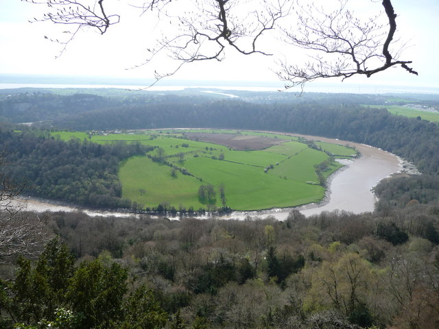
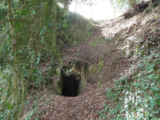
Alcove Wood is a serene and picturesque woodland located in Monmouthshire, Wales. This enchanting forest covers an area of approximately 20 acres and is nestled in the beautiful countryside, offering a peaceful retreat for nature lovers and hikers alike.

The wood is characterized by its dense canopy of towering oak, beech, and ash trees, which provide a sheltered environment for an abundance of wildlife. Visitors can expect to encounter a diverse range of flora and fauna, including bluebells, wood anemones, and ferns. The woodland floor is rich with moss and fallen leaves, creating a soft and inviting path for explorers to wander through.

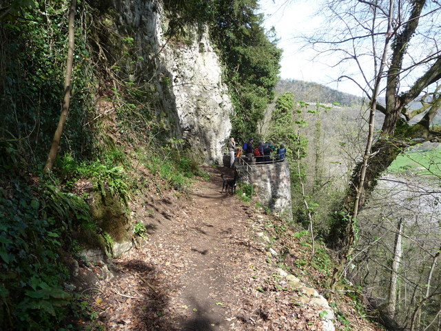
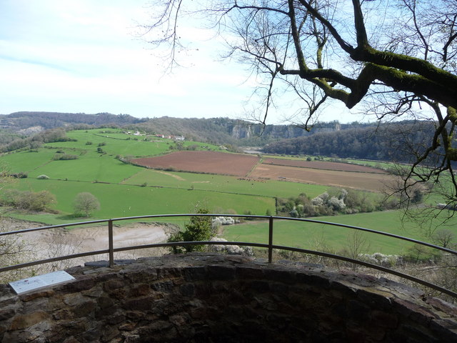
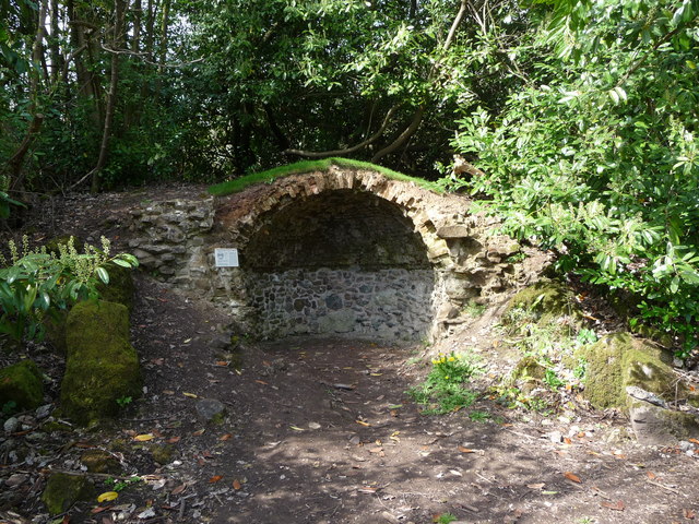
Alcove Wood is crisscrossed by a network of well-maintained footpaths, making it easily accessible for visitors of all abilities. These paths lead to various points of interest, such as a tranquil pond and a small stream that gently meanders through the forest. These water features not only enhance the natural beauty of the wood but also provide a habitat for numerous species of aquatic life.

The wood offers a haven for birdwatchers, as it attracts a variety of bird species, including woodpeckers, nuthatches, and owls. With its peaceful ambiance and diverse ecosystem, Alcove Wood provides an ideal environment for bird nesting and breeding.

Whether one is seeking a peaceful stroll, an opportunity to observe wildlife, or simply a moment of solitude in nature, Alcove Wood in Monmouthshire is a hidden gem waiting to be explored and appreciated.

If you have any feedback on the listing, please let us know in the comments section below.
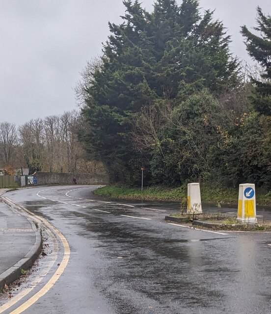
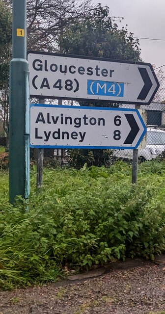
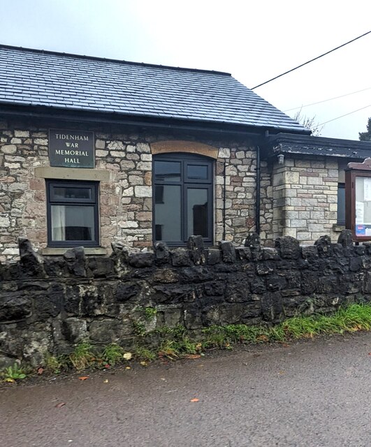
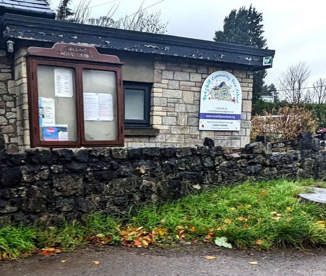
Alcove Wood Images

Images are sourced within 2km of 51.651514/-2.6816272 or Grid Reference ST5294. Thanks to Geograph Open Source API. All images are credited.

West down Castleford Hill, Tutshill, Gloucestershire Viewed from a bend in the B4228.
West down Castleford Hill, Tutshill, Gloucestershire
Viewed from a bend in the B4228.
Alvington 6 Lydney 8 Direction and distances sign at the top of Castleford Hill in Tutshill.
Alvington 6 Lydney 8
Direction and distances sign at the top of Castleford Hill in Tutshill.
In the interest of hygiene NO DOGS ALLOWED, Tutshill, Gloucestershire Notice on recreation ground perimeter railings facing the B4228 Coleford Road.
In the interest of hygiene NO DOGS ALLOWED, Tutshill, Gloucestershire
Notice on recreation ground perimeter railings facing the B4228 Coleford Road.
Tidenham War Memorial Hall nameplate, Tutshill, Gloucestershire Facing the B4228 Coleford Road near the Mopla Road junction. Tutshill is a village 
in the parish of Tidenham in the Forest of Dean district of Gloucestershire.
Tidenham War Memorial Hall nameplate, Tutshill, Gloucestershire
Facing the B4228 Coleford Road near the Mopla Road junction. Tutshill is a village in the parish of Tidenham in the Forest of Dean district of Gloucestershire.
Tidenham Parish Council noticeboard, Tutshill, Gloucestershire The board outside Tidenham War Memorial Hall faces the B4228 Coleford Road.
Tutshill is a village in the parish of Tidenham in the Forest of Dean district 
of Gloucestershire. A Tutshill Community Preschool nameboard is on the right.
Tidenham Parish Council noticeboard, Tutshill, Gloucestershire
The board outside Tidenham War Memorial Hall faces the B4228 Coleford Road. Tutshill is a village in the parish of Tidenham in the Forest of Dean district of Gloucestershire. A Tutshill Community Preschool nameboard is on the right.
Slimming World banner, Tutshill, Gloucestershire Facing the B4228 Coleford Road near Tidenham War Memorial Hall.
Slimming World banner, Tutshill, Gloucestershire
Facing the B4228 Coleford Road near Tidenham War Memorial Hall.
Poppies on a Coleford Road bus shelter, Tutshill, Gloucestershire In November 2023.
Poppies on a Coleford Road bus shelter, Tutshill, Gloucestershire
In November 2023.
Wide field gate, Tutshill, Gloucestershire Alongside the B4228 Coleford Road.
Wide field gate, Tutshill, Gloucestershire
Alongside the B4228 Coleford Road.
Dead leaves, Tutshill, Gloucestershire On the pavement near Tutshill C of E Primary School in November 2023.
Dead leaves, Tutshill, Gloucestershire
On the pavement near Tutshill C of E Primary School in November 2023.
Keep the zig zags clear, Tutshill, Gloucestershire Banner on Tutshill Church of England Primary School perimeter 
railings  viewed from the B4228 Coleford Road in November 2023.
Keep the zig zags clear, Tutshill, Gloucestershire
Banner on Tutshill Church of England Primary School perimeter railings viewed from the B4228 Coleford Road in November 2023.
The Lancaut peninsula from the Eagle's Nest The huge curve in the Wye is a well-known view with Chepstow and the Severn Bridges beyond.
The Lancaut peninsula from the Eagle's Nest
The huge curve in the Wye is a well-known view with Chepstow and the Severn Bridges beyond.
A group of walkers at the Giant's Cave in the Wye Valley This group of retired walkers were enjoying the viewing platform just outside the Giant's Cave as I approached and was spotted by their little dog. They were a mix of local and not so local fellers who were enjoying their firm friendships, relaxed banter, outdoor exercise and the good weather. Not a bad way to spend some of your retirement.
A group of walkers at the Giant's Cave in the Wye Valley
This group of retired walkers were enjoying the viewing platform just outside the Giant's Cave as I approached and was spotted by their little dog. They were a mix of local and not so local fellers who were enjoying their firm friendships, relaxed banter, outdoor exercise and the good weather. Not a bad way to spend some of your retirement.
The northern entrance to the Giant's Cave on the Wye Valley Walk Yes, you are expected to enter or exit through this aperture. It's easier and more fun than it looks. One of many interesting features on this section of the WVW.
The northern entrance to the Giant's Cave on the Wye Valley Walk
Yes, you are expected to enter or exit through this aperture. It's easier and more fun than it looks. One of many interesting features on this section of the WVW.
View from the Giant's Cave viewing platform The view across the graceful curve of the River Wye onto the Lancaut peninsula and above that up to Wintour's Leap and the great cliffs near Woodcroft.
View from the Giant's Cave viewing platform
The view across the graceful curve of the River Wye onto the Lancaut peninsula and above that up to Wintour's Leap and the great cliffs near Woodcroft.
The Grotto in Piercefield Woods This feature, along with several others on a similar 'Romantic' theme, was installed in Piercefield Park and woods and comprised part of a tour through this area between around 1760 and maybe the 1820's. Gentry came from various parts of the country and toured the Wye Valley inspecting folly's, caves, walks, viewpoints and landscapes and often recording their opinions and thoughts in journals and publications. Originally this grotto was of course larger, more complete and lined inside with 'glittering crystalline minerals, glass fragments and iron and copper slag'. This would have created an elaborate decorated effect intended to mimic naturally occurring outcrops. I'm glad to see the Piercefield Walks features receiving some improvement.
The Grotto in Piercefield Woods
This feature, along with several others on a similar 'Romantic' theme, was installed in Piercefield Park and woods and comprised part of a tour through this area between around 1760 and maybe the 1820's. Gentry came from various parts of the country and toured the Wye Valley inspecting folly's, caves, walks, viewpoints and landscapes and often recording their opinions and thoughts in journals and publications. Originally this grotto was of course larger, more complete and lined inside with 'glittering crystalline minerals, glass fragments and iron and copper slag'. This would have created an elaborate decorated effect intended to mimic naturally occurring outcrops. I'm glad to see the Piercefield Walks features receiving some improvement.
View from The Alcove in Alcove Wood This is another welcome viewpoint on the Wye Valley Walk, just outside Chepstow and offers an excellent perspective on the castle, River Wye and the Lancaut peninsula.
View from The Alcove in Alcove Wood
This is another welcome viewpoint on the Wye Valley Walk, just outside Chepstow and offers an excellent perspective on the castle, River Wye and the Lancaut peninsula.
Chepstow Castle entrance A very impressive statement of Norman power and a great feature in Chepstow town.
Chepstow Castle entrance
A very impressive statement of Norman power and a great feature in Chepstow town.
Reaching the Winning Post, Chepstow Racecourse
Show me another place!

Alcove Wood is located at Grid Ref: ST5294 (Lat: 51.651514, Lng: -2.6816272)

Unitary Authority: Monmouthshire

Police Authority: Gwent

What 3 Words

///somewhere.desiring.bonfires. Near Chepstow, Monmouthshire

Related Wikis

Piercefield House

Piercefield House is a largely ruined neo-classical country house near St Arvans, Monmouthshire, Wales, about 1.5 miles (2.4 km) north of the centre of...

Chepstow Racecourse

Chepstow Racecourse is a thoroughbred horse racing course located just north of the town of Chepstow in Monmouthshire, Wales, near the southern end of...

Green Gathering

The Green Gathering, formerly known as the Big Green Gathering is a festival with an environmental and social justice focus, including workshops and talks...

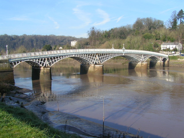
Old Wye Bridge, Chepstow

The Old Wye Bridge or Town Bridge at Chepstow, also known historically as Chepstow Bridge, crosses the River Wye between Monmouthshire in Wales and Gloucestershire...
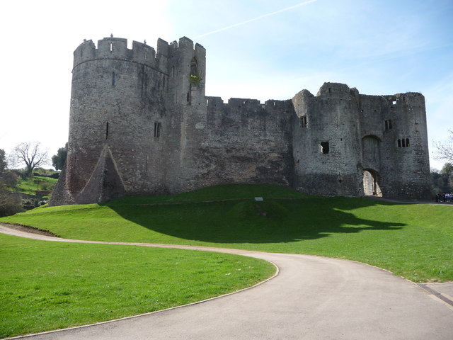
Chepstow Castle

Chepstow Castle (Welsh: Castell Cas-gwent) at Chepstow, Monmouthshire, Wales is the oldest surviving post-Roman stone fortification in Britain. Located...

Castle Terrace, Chepstow

Castle Terrace, originally known as Castle Parade, is an unbroken row of fourteen three-storied Georgian dwellings in Chepstow, Monmouthshire, Wales....
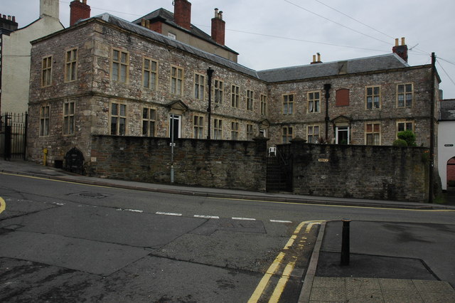
Powis Almshouses

The Powis Almshouses are a block of almshouses in Chepstow, Monmouthshire, Wales, at the junction of Church Street and Bridge Street (formerly St Anne...
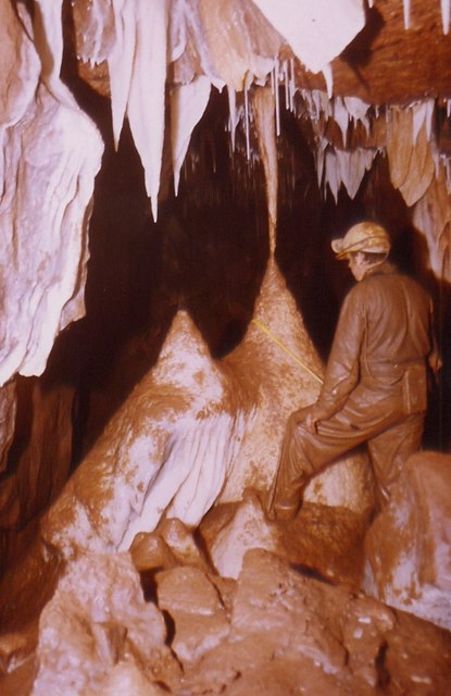
Otter Hole

Otter Hole is perhaps one of the best decorated caves in Britain. Located on the Wales–England border just north of Chepstow, the cave runs from the banks...

Related Videos

Wye Valley Walk with Bernese Mountain Dog | Chepstow to Tintern Abbey

Olly and I walked from Chepstow to Tintern and all the way back. The walk was just under 14 miles. We left Chepstow at 9.30 am ...

I quit my job to go hiking!

Join me on my journey as a relative newbie hiker as I spend the next two weeks hiking the Offa's Dyke trail in Wales and England.

Walking up the #Chepstow #Highstreet #visit #travel

After leaving the Chepstow Castle we walked up the highstreet. There is some lovely architecture there. I had to remove the audio ...

Offa’s Dyke Path

In October 2022 I hiked the Offa's Dyke Path national trail, 177 miles along the historic border between England and Wales.

Nearby Amenities

Located within 500m of 51.651514,-2.6816272
Source: PGS
Lat/Long: 51.6472024/-2.6810784
Source: PGS
Lat/Long: 51.6477338/-2.6810827
Source: PGS
Lat/Long: 51.6491325/-2.680572
Source: PGS
Lat/Long: 51.6499768/-2.6799838
Source: PGS
Lat/Long: 51.6507513/-2.6795074
Source: PGS
Lat/Long: 51.6507473/-2.6789071
Source: PGS
Lat/Long: 51.6511287/-2.678214
Source: PGS
Lat/Long: 51.6516554/-2.6776156
Source: PGS
Lat/Long: 51.6522194/-2.6768872
Source: PGS
Lat/Long: 51.6527702/-2.6762579
Source: PGS
Lat/Long: 51.6533552/-2.6755013
Source: PGS
Lat/Long: 51.65177/-2.674908
Source: PGS
Lat/Long: 51.651642/-2.675114
Source: PGS
Lat/Long: 51.651515/-2.675321
Source: PGS
Lat/Long: 51.651132/-2.675941
Source: PGS
Lat/Long: 51.6508401/-2.6761732
Source: PGS
Lat/Long: 51.650494/-2.676565
Source: PGS
Lat/Long: 51.650365/-2.676771
Source: PGS
Lat/Long: 51.6496039/-2.677808
Source: PGS
Lat/Long: 51.6493616/-2.6781195
Source: PGS
Lat/Long: 51.6491642/-2.6783177
Source: PGS
Lat/Long: 51.6488699/-2.6786249
Source: PGS
Lat/Long: 51.6483684/-2.679054
Source: PGS
Lat/Long: 51.647426/-2.6794524
Source: survey
Tourism: viewpoint
Lat/Long: 51.6495933/-2.6810638
Bench
Source: survey
Lat/Long: 51.6496256/-2.6811715
The data included in this document is from www.openstreetmap.org. The data is made available under ODbL.

Have you been to Alcove Wood?

Leave your review of Alcove Wood below (or comments, questions and feedback).