Orles Wood

Wood, Forest in Monmouthshire

Wales

Orles Wood

Layby and Public Toilets
Layby and Public Toilets Credit: Anthony Parkes

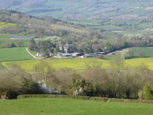
Orles Wood is a picturesque forest located in Monmouthshire, Wales. Covering an area of approximately 100 hectares, this woodland is a haven of natural beauty and tranquility. Situated near the village of Orles, the wood is easily accessible and attracts visitors from both near and far.

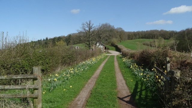
The woodland is primarily composed of deciduous trees, with a rich variety of species including oak, beech, and ash. These trees create a dense canopy that provides shade and shelter for a diverse range of flora and fauna. The forest floor is adorned with carpets of bluebells and wild garlic during the spring, adding a burst of color to the serene surroundings.

Orles Wood is home to a thriving ecosystem, with a wide array of wildlife calling it their habitat. Birdwatchers can spot various species, including woodpeckers, owls, and warblers, while nature enthusiasts may encounter small mammals like foxes, rabbits, and squirrels. The forest also houses a variety of insects, with butterflies and dragonflies flitting through the air on sunny days.

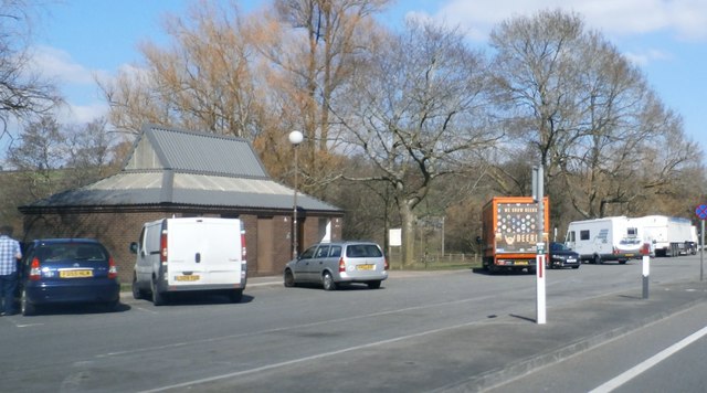
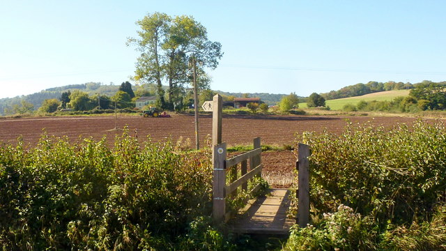
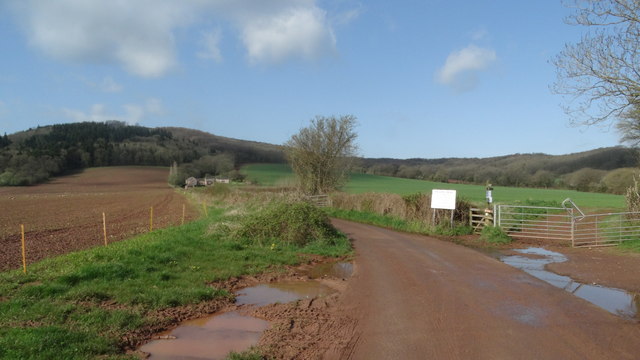
For outdoor enthusiasts, Orles Wood provides an ideal setting for walking, hiking, and exploring nature. A network of well-maintained trails winds through the forest, offering visitors the opportunity to immerse themselves in the peaceful surroundings. Additionally, there are picnic areas and benches scattered throughout the woodland, allowing visitors to relax and enjoy a picnic amidst the natural beauty.

Overall, Orles Wood is a hidden gem in Monmouthshire, offering a serene escape from the hustle and bustle of daily life. Whether it's a leisurely stroll, a family picnic, or wildlife spotting, this woodland provides a captivating experience for nature lovers of all ages.

If you have any feedback on the listing, please let us know in the comments section below.

Orles Wood Images

Images are sourced within 2km of 51.808916/-2.7465731 or Grid Reference SO4812. Thanks to Geograph Open Source API. All images are credited.

Layby and Public Toilets
On the A40 near Mitchel Troy, heading north-east
Farm access bridge over A40 north of Mitchel Troy The bridge carries a farm track and footpath
Farm access bridge over A40 north of Mitchel Troy
The bridge carries a farm track and footpath
Lay-by by the A40 near Mitchel Troy The lay-by extends into <a href="https://www.geograph.org.uk/gridref/SO4911">SO4911</a>; this is a well-equipped lay-by with protection between the traffic and the parked vehicles.
Lay-by by the A40 near Mitchel Troy
The lay-by extends into SO4911; this is a well-equipped lay-by with protection between the traffic and the parked vehicles.
View of Wonastow View across the valley to Wonastow church from near Craig-y-dorth.  This is deceptive as from this viewpoint the church appears to be in a valley, and yet when the church is viewed from the passing A40 it appears to be on a hill <a href="https://www.geograph.org.uk/photo/3209785">SO4810 : A distant view of Wonastow</a>.
View of Wonastow
View across the valley to Wonastow church from near Craig-y-dorth. This is deceptive as from this viewpoint the church appears to be in a valley, and yet when the church is viewed from the passing A40 it appears to be on a hill SO4810 : A distant view of Wonastow.
New Estate - South of Monmouth Green Field Development
New Estate - South of Monmouth
Green Field Development
Autumn cultivation, 1 A field to the west of Rockfield Road on a fine late September morning.
The old crop was rape.
Autumn cultivation, 1
A field to the west of Rockfield Road on a fine late September morning. The old crop was rape.
Autumn cultivation, 2 Preparing the ground for the next crop by the Rockfield Road.
A fine oak beyond.
Autumn cultivation, 2
Preparing the ground for the next crop by the Rockfield Road. A fine oak beyond.
Path and footbridge Croft-y-Bwla and the tractor featured in <a href="https://www.geograph.org.uk/photo/5923747">SO4913 : Autumn cultivation, 1</a> and <a href="https://www.geograph.org.uk/photo/5923753">SO4913 : Autumn cultivation, 2</a> can be seen in the distance.
Path and footbridge
Croft-y-Bwla and the tractor featured in SO4913 : Autumn cultivation, 1 and SO4913 : Autumn cultivation, 2 can be seen in the distance.
Track leading to Bailey Pit Farm from Watery Ln, Monmouth
Boundary stone with bench mark, Whitehill Wood near Monmouth
Track to Backway House, Worthybrook
Ordnance Survey Cut Mark This OS cut mark can be found on No47 Rockfield Road. It marks a point 21.455m above mean sea level.
Ordnance Survey Cut Mark
This OS cut mark can be found on No47 Rockfield Road. It marks a point 21.455m above mean sea level.
Ordnance Survey Cut Mark This OS cut mark can be found on No18 Rolls Avenue. It marks a point 21.567m above mean sea level.
Ordnance Survey Cut Mark
This OS cut mark can be found on No18 Rolls Avenue. It marks a point 21.567m above mean sea level.
Ordnance Survey Cut Mark This OS cut mark can be found on No1 Brook Crescent. It marks a point 21.652m above mean sea level.
Ordnance Survey Cut Mark
This OS cut mark can be found on No1 Brook Crescent. It marks a point 21.652m above mean sea level.
Ordnance Survey Cut Mark This edge of this OS cut mark can be found on No18 Brook Crescent. It marks a point 22.174m above mean sea level.
Ordnance Survey Cut Mark
This edge of this OS cut mark can be found on No18 Brook Crescent. It marks a point 22.174m above mean sea level.
Ordnance Survey Cut Mark This OS cut mark can be found on a building south side of the lane at Ancre Hill. It marks a point 52.718m above mean sea level.
Ordnance Survey Cut Mark
This OS cut mark can be found on a building south side of the lane at Ancre Hill. It marks a point 52.718m above mean sea level.
Old Boundary Marker in Kingswood, Monmouth parish Parish Boundary Marker in parish of Monmouth (Monmouthshire District), Kingswood, 1600m Northeast of Lower Hendre.

Inscription reads:-
MONMOUTH
PARISH
1857
Carved bench mark on centre face.

Surveyed

Milestone Society National ID: MON_MON01pb
Old Boundary Marker in Kingswood, Monmouth parish
Parish Boundary Marker in parish of Monmouth (Monmouthshire District), Kingswood, 1600m Northeast of Lower Hendre. Inscription reads:- MONMOUTH PARISH 1857 Carved bench mark on centre face. Surveyed Milestone Society National ID: MON_MON01pb
Show me another place!

Orles Wood is located at Grid Ref: SO4812 (Lat: 51.808916, Lng: -2.7465731)

Unitary Authority: Monmouthshire

Police Authority: Gwent

What 3 Words

///pining.beads.dose. Near Monmouth, Monmouthshire

Related Wikis

White Hill, Monmouth

White Hill is a hill rising to over 205 metres (673 ft) to the west of the town of Monmouth, South Wales and north of Wonastow. Much of it is covered by...

Croft-Y-Bwla

Croft-Y-Bwla is a country house and farm 1.5 miles (2.4 km) north-west of Monmouth, south-east Wales. The house was built around 1830 and was designed...

Drybridge (Monmouth ward)

Drybridge is an electoral ward in the town of Monmouth, Monmouthshire, Wales. The ward elects councillors to Monmouth Town Council and Monmouthshire County...

Monnow Vale Integrated Health and Social Care Facility

Monnow Vale Integrated Health and Social Care Facility (Welsh: Dyffryn Mynwy Iechyd Integredig a Cyfleuster Gofal Cymdeithasol) is a hospital at Drybridge...

Related Videos

Walking from Monmouth to the Mouth of the River Monnow / Cerdded o Drefynwy i Aber Afon Mynwy

Today we're in Wales taking a walk from the Monmouth Town Gate to the Mouth of the River Monnow for which the town is named.

Monmouth Tourist Information

trefynwy #monmouth #cymru #wales.

Luxury Barn Conversion in Wales #Shorts

Subscribe for more luxury walk-through tours. Full tour coming soon to The Luxury Home Tour Series...

Monmouth - 4K video

Monmouth is a town in Wales, situated on the banks of the River Monnow, The bridge is its most outstanding structure and is the ...

Nearby Amenities

Located within 500m of 51.808916,-2.7465731
Barrier: stile
Lat/Long: 51.8048211/-2.7482015
Barrier: stile
Lat/Long: 51.8057586/-2.7444875
Barrier: stile
Lat/Long: 51.8061851/-2.7423682
The data included in this document is from www.openstreetmap.org. The data is made available under ODbL.

Have you been to Orles Wood?

Leave your review of Orles Wood below (or comments, questions and feedback).