California
Settlement in Yorkshire
England
California

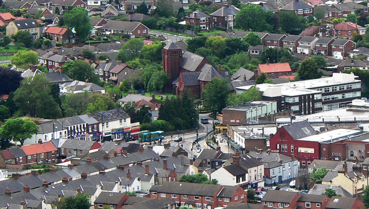
California is a small village located in the county of Yorkshire, in the northern region of England. Situated in the Ryedale district, it lies approximately 11 miles northeast of the city of York. With a population of around 2,500 residents, California is a close-knit community that offers a tranquil and picturesque environment.
The village primarily consists of residential housing, with a mix of traditional stone-built cottages and more modern properties. Nestled in the rolling countryside of Yorkshire, California boasts stunning views and plenty of green spaces, making it an attractive destination for nature lovers and outdoor enthusiasts.
Despite its small size, California is well-connected to nearby towns and cities, with regular bus services providing easy access to York and other surrounding areas. The village itself offers a few amenities, including a local shop, a post office, and a primary school, ensuring that residents have access to essential services within close proximity.
The area around California is rich in history, with several notable landmarks nearby. The iconic Castle Howard, a grand stately home surrounded by beautiful gardens, is just a short drive away. Additionally, the village is within easy reach of the North York Moors National Park, offering endless opportunities for hiking, cycling, and exploring the stunning natural landscapes.
Overall, California, Yorkshire is a charming village that provides a peaceful and idyllic setting for its residents, while also offering access to the rich heritage and natural beauty of the surrounding area.
If you have any feedback on the listing, please let us know in the comments section below.
California Images
Images are sourced within 2km of 54.560933/-1.139376 or Grid Reference NZ5518. Thanks to Geograph Open Source API. All images are credited.


California is located at Grid Ref: NZ5518 (Lat: 54.560933, Lng: -1.139376)
Division: North Riding
Unitary Authority: Redcar and Cleveland
Police Authority: Cleveland
What 3 Words
///shins.young.discrepancy. Near South Bank, North Yorkshire
Nearby Locations
Related Wikis

Greater Eston
Greater Eston is part of the Borough of Redcar and Cleveland, North Yorkshire, England. The name is used by the borough council to describe the centres...
Eston
Eston is an area of Redcar and Cleveland in North Yorkshire, England. The local authority ward covering the area (as well as Lackenby, Lazenby and Wilton...
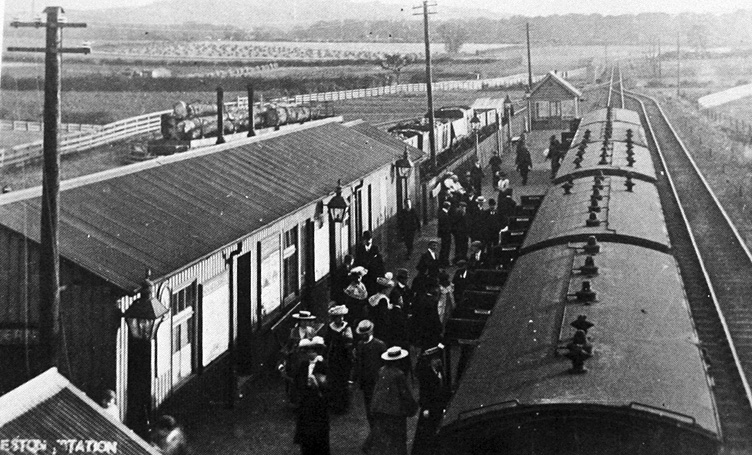
Eston railway station
Eston railway station formerly served the North Yorkshire town of Eston. It was used as a passenger station between 1902 and 1929 and as a goods-only station...

Whale Hill
Whale Hill is an area of Eston in Redcar and Cleveland of North Yorkshire, England, lying at the foot of the Eston Hills. It is within Teesside built-up...
Nearby Amenities
Located within 500m of 54.560933,-1.139376Have you been to California?
Leave your review of California below (or comments, questions and feedback).