Almondbury Common

Settlement in Yorkshire

England

Almondbury Common

St Lucius, Farnley Tyas The church was completed in 1840.
St Lucius, Farnley Tyas Credit: John Illingworth

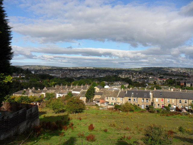
Almondbury Common is a picturesque village located in the district of Kirklees, West Yorkshire, England. Situated approximately two miles southeast of Huddersfield, it is nestled in the foothills of the Pennines and offers stunning views of the surrounding countryside. The village is known for its rich historical heritage and is home to a close-knit community.

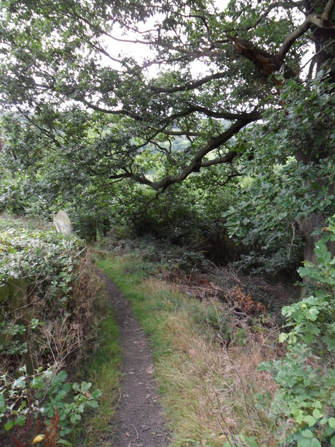
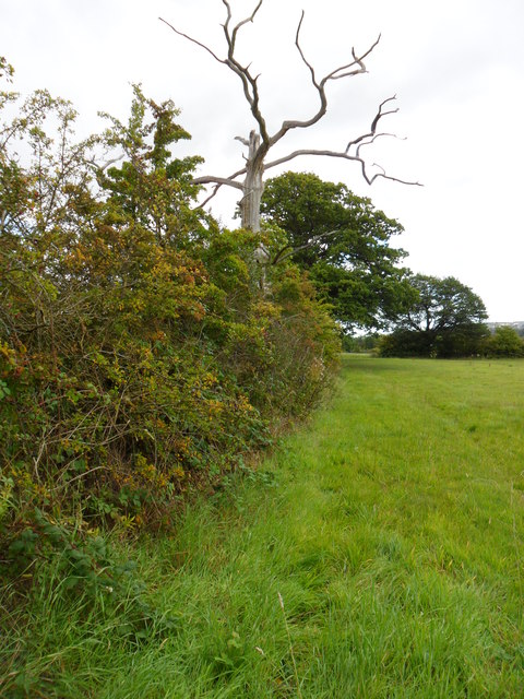
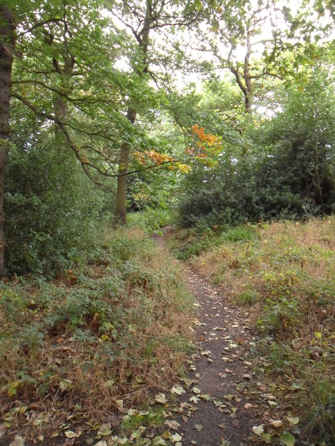
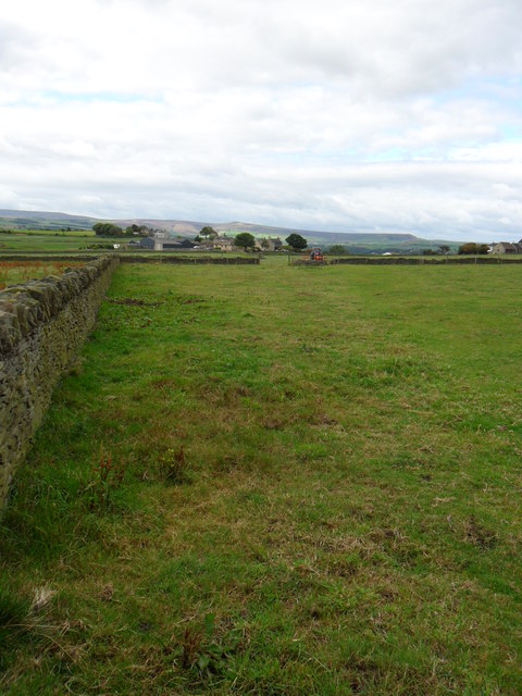
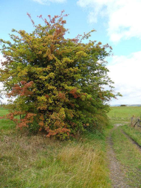
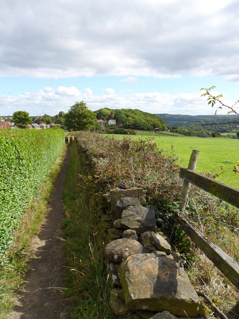
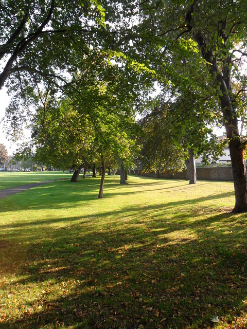
Almondbury Common is renowned for its beautiful natural landscape, with rolling hills and lush green meadows. The area is a popular destination for outdoor enthusiasts, offering ample opportunities for hiking, walking, and exploring the countryside. The stunning scenery also attracts visitors who are drawn to its tranquility and peaceful atmosphere.

The village itself is steeped in history, with evidence of human settlement dating back to the Bronze Age. Almondbury Common is home to All Hallows Church, a Grade I listed building that dates back to the 15th century. The church is a prominent landmark in the area and is known for its impressive architecture and stained glass windows.

In addition to its historical significance, Almondbury Common also boasts a vibrant community spirit. The village has a range of amenities, including local shops, pubs, and restaurants that cater to both residents and visitors. The community actively organizes events and activities throughout the year, fostering a strong sense of belonging and togetherness.

Overall, Almondbury Common offers a delightful blend of natural beauty and historical charm, making it a truly captivating destination for all who visit.

If you have any feedback on the listing, please let us know in the comments section below.

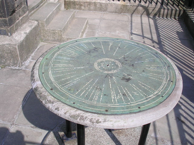
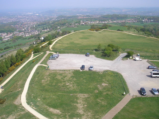
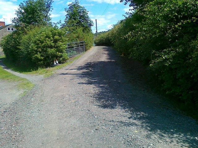
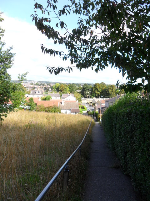
Almondbury Common Images

Images are sourced within 2km of 53.627207/-1.745938 or Grid Reference SE1614. Thanks to Geograph Open Source API. All images are credited.

St Lucius, Farnley Tyas The church was completed in 1840.
St Lucius, Farnley Tyas
The church was completed in 1840.
Cliffe Lane A walled lane out of Farnley Tyas.
Cliffe Lane
A walled lane out of Farnley Tyas.
Direction indicator on Jubilee Tower Taken on one of the occasions when the tower was open to the public.
Direction indicator on Jubilee Tower
Taken on one of the occasions when the tower was open to the public.
Castle Hill car park Taken from the top of Jubilee Tower when it was open to the public.
Castle Hill car park
Taken from the top of Jubilee Tower when it was open to the public.
Access road to Lower Common Farm
Lumb Dike near Almondbury Lumb Dike from footbridge, North-East of Molly Carr Wood.
Lumb Dike near Almondbury
Lumb Dike from footbridge, North-East of Molly Carr Wood.
Felcote Avenue Looking down Felcote Avenue to the tiny wood at the bottom.
Felcote Avenue
Looking down Felcote Avenue to the tiny wood at the bottom.
Cat-Steps, near Felcote Avenue Looking down the 'cat-steps'(public right-of-way) towards Ravensknowle Park (trees in the park are visible in the background).
Cat-Steps, near Felcote Avenue
Looking down the 'cat-steps'(public right-of-way) towards Ravensknowle Park (trees in the park are visible in the background).
Field adjacent to Forest Road Taken from Forest Road looking down to terrace houses on Ravensknowle Road.
Field adjacent to Forest Road
Taken from Forest Road looking down to terrace houses on Ravensknowle Road.
Footpath, Wheat Royd, Almondbury. Footpath leading from Wheat Royd to Lumb Lane.  A grand old oak tree overhangs the path just here.
Footpath, Wheat Royd, Almondbury.
Footpath leading from Wheat Royd to Lumb Lane. A grand old oak tree overhangs the path just here.
Autumn hedgerow near Molly Carr Wood Field-edge path just north of Molly Carr Wood.
Autumn hedgerow near Molly Carr Wood
Field-edge path just north of Molly Carr Wood.
Molly Carr Wood Footpath on the western edge of Molly Carr Wood.
Molly Carr Wood
Footpath on the western edge of Molly Carr Wood.
Farmland just south-west of Castle Hill Looking south-west along field path towards Castle Houses.
Farmland just south-west of Castle Hill
Looking south-west along field path towards Castle Houses.
Clough Hall Lane, Castle Hill A fine Hawthorn tree showing early autumn-tide colours, adjacent to Clough Hall Lane.
Clough Hall Lane, Castle Hill
A fine Hawthorn tree showing early autumn-tide colours, adjacent to Clough Hall Lane.
Footpath near Wheat Royd Looking along part of footpath leading north-east from Castle Hill to Wheat Royd.
Footpath near Wheat Royd
Looking along part of footpath leading north-east from Castle Hill to Wheat Royd.
Penny Spring Wood At the southern end of Penny Spring Wood.  The path on the left of the photo is well-used, though not marked on maps as a public right of way.
Penny Spring Wood
At the southern end of Penny Spring Wood. The path on the left of the photo is well-used, though not marked on maps as a public right of way.
Ravensknowle Park A beautiful early autumn morning in the park, adjacent to Ravensknowle Road.
Ravensknowle Park
A beautiful early autumn morning in the park, adjacent to Ravensknowle Road.
Field path, Oaklands Field path leading down to Oaklands.  Dalton and Rawthorpe are in the distance.
Field path, Oaklands
Field path leading down to Oaklands. Dalton and Rawthorpe are in the distance.
Show me another place!

Almondbury Common is located at Grid Ref: SE1614 (Lat: 53.627207, Lng: -1.745938)

Division: West Riding

Unitary Authority: Kirklees

Police Authority: West Yorkshire

What 3 Words

///upon.blog.poster. Near Kirkburton, West Yorkshire

Related Wikis

King James's School, Almondbury

King James's School is a coeducational secondary school located in Almondbury in the English county of West Yorkshire. == History == King James's Grammar...

South Pennines

The South Pennines is a region of moorland and hill country in northern England lying towards the southern end of the Pennines. In the west it includes...

Almondbury

Almondbury (English: ) is a village 2 miles (3.2 km) south-east of Huddersfield town centre in West Yorkshire, England. The population of Almondbury in...
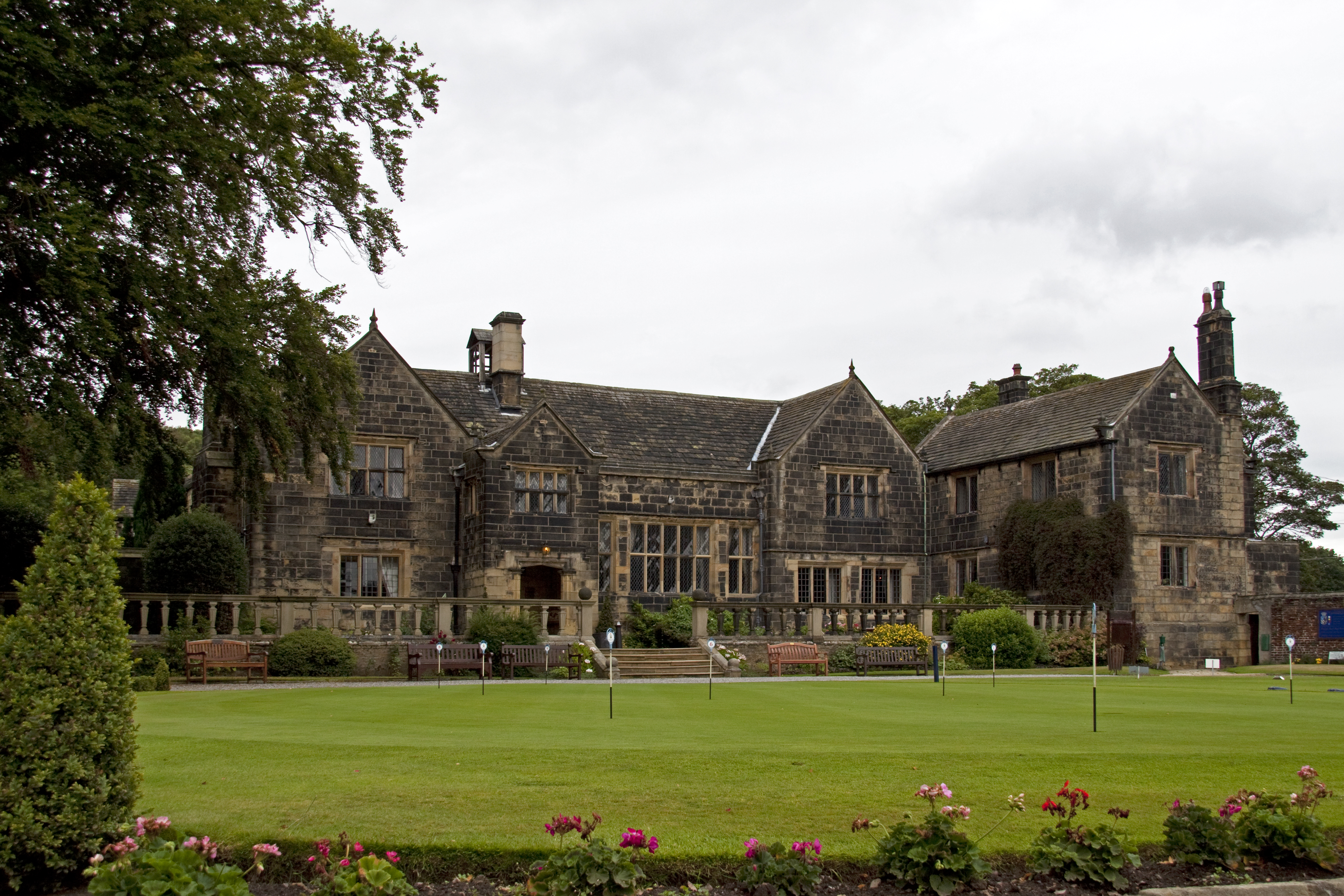
Woodsome Hall

Woodsome Hall is a 16th-century country house in the parish of Almondbury, near Huddersfield, West Yorkshire, England. It is now the clubhouse of Woodsome...

Nearby Amenities

Located within 500m of 53.627207,-1.745938
Give Way
Direction: backward
Lat/Long: 53.6313289/-1.7457122
Bus Stop
Fenay Lane Westgate
Local Ref: 45018765
Naptan AtcoCode: 450018765
Naptan Bearing: W
Naptan CommonName: Fenay Lane Westgate
Naptan Crossing: St Helens gate
Naptan Indicator: Stop 45018765
Naptan PlusbusZoneRef: LEEDS
Naptan ShortCommonName: St. Helens Gate
Naptan Street: Fenay Lane
Naptan Verified: no
Source: naptan_import
Lat/Long: 53.6314062/-1.7450068
Bus Stop
Westgate Longcroft
Local Ref: 45021111
Naptan AtcoCode: 450021111
Naptan Bearing: SW
Naptan CommonName: Westgate Longcroft
Naptan Crossing: Sharp Lane
Naptan Indicator: Stop 45021111
Naptan Landmark: Church
Naptan PlusbusZoneRef: LEEDS
Naptan ShortCommonName: Westgate Almondbury
Naptan Street: Westgate
Naptan Verified: no
Source: naptan_import
Lat/Long: 53.630579/-1.7491703
Bus Stop
Westgate Aimbry Court
Local Ref: 45021112
Naptan AtcoCode: 450021112
Naptan Bearing: W
Naptan CommonName: Westgate Aimbry Court
Naptan Crossing: Aimbry Court
Naptan Indicator: Stop 45021112
Naptan PlusbusZoneRef: LEEDS
Naptan ShortCommonName: Aimbry Court
Naptan Street: Kaye Lane
Naptan Verified: no
Source: naptan_import
Lat/Long: 53.6299463/-1.7518053
Bus Stop
Westgate Longcroft
Local Ref: 45021113
Naptan AtcoCode: 450021113
Naptan Bearing: E
Naptan CommonName: Westgate Longcroft
Naptan Crossing: Longcroft
Naptan Indicator: Stop 45021113
Naptan Notes: OSR taken place 201205
Naptan PlusbusZoneRef: LEEDS
Naptan ShortCommonName: Longcroft
Naptan Street: Kaye Lane
Naptan Verified: no
Source: naptan_import
Lat/Long: 53.630045/-1.7516989
Westgate
Local Ref: 45051066
Naptan AtcoCode: 450051066
Naptan Bearing: NE
Naptan BusStopType: CUS
Naptan CommonName: Westgate
Naptan Crossing: Nr-At Longcroft
Naptan Indicator: Stop 45051066
Naptan Landmark: Library
Naptan PlusbusZoneRef: LEEDS
Naptan ShortCommonName: Westgate
Naptan Street: Westgate
Naptan Verified: no
Source: naptan_import
Lat/Long: 53.63066/-1.7492304
Power: pole
Lat/Long: 53.6228332/-1.747496
Power: pole
Lat/Long: 53.6235866/-1.7457058
Power: pole
Lat/Long: 53.6243698/-1.743843
Power: pole
Lat/Long: 53.625476/-1.7418527
Power: pole
Lat/Long: 53.6264946/-1.7399732
Power: pole
Lat/Long: 53.6272479/-1.7385713
Community Centre
The Wesley Centre
Operator: Almondbury Methodist Church
Source: survey
Lat/Long: 53.6313198/-1.748676
Pub
Radcliffe Arms
Source: survey
Lat/Long: 53.630915/-1.7478815
Pub
The Woolpack
Source: survey
Lat/Long: 53.6312589/-1.7468046
Historic: memorial
Lat/Long: 53.631622/-1.7463593
Rushfield Bridge
Place: locality
Lat/Long: 53.6269091/-1.7408069
Generator Method: photovoltaic
Generator Output Electricity: yes
Generator Source: solar
Generator Type: solar_photovoltaic_panel
Location: roof
Power: generator
Lat/Long: 53.6264351/-1.7470552
Generator Method: photovoltaic
Generator Output Electricity: yes
Generator Source: solar
Generator Type: solar_photovoltaic_panel
Location: roof
Power: generator
Lat/Long: 53.6263333/-1.7463149
Generator Method: photovoltaic
Generator Output Electricity: yes
Generator Source: solar
Generator Type: solar_photovoltaic_panel
Location: roof
Power: generator
Lat/Long: 53.6266053/-1.7483292
Crossing
Lat/Long: 53.6259195/-1.7529101
Parking
Parking: surface
Lat/Long: 53.626799/-1.7503888
Crossing
Crossing: marked
Lat/Long: 53.6285847/-1.7415105
Parking
Parking: surface
Lat/Long: 53.6298489/-1.7419097
Parking
Parking: surface
Lat/Long: 53.6297682/-1.7429707
Parking
Parking: surface
Lat/Long: 53.6293704/-1.7428041
Generator Method: photovoltaic
Generator Output Electricity: yes
Generator Source: solar
Generator Type: solar_photovoltaic_panel
Power: generator
Lat/Long: 53.6291317/-1.7418002
Power: pole
Lat/Long: 53.6253784/-1.7496987
Power: pole
Lat/Long: 53.6244866/-1.7499579
Power: pole
Lat/Long: 53.6236752/-1.7501917
Power: pole
Lat/Long: 53.6237107/-1.7495403
Give Way
Lat/Long: 53.6315556/-1.7462001
Bar
Almondbury Conservative Club
Addr City: Huddersfield
Addr Country: GB
Addr District: Almondbury
Addr Housenumber: 17
Addr Postcode: HD5 8XF
Addr Street: Westgate
Lat/Long: 53.6313354/-1.7466092
Place Of Worship
Almondbury Methodist Church
Addr City: Huddersfield
Addr District: Almondbury
Addr Postcode: HD5 8XJ
Addr Street: Westgate
Denomination: methodist
Religion: christian
Source Url: http://www.almondburymethodist.org.uk/
Url: http://www.almondburymethodist.org.uk/
Lat/Long: 53.6310642/-1.7484934
Restaurant
The Barn
Addr City: Huddersfield
Addr District: Almondbury
Addr Housenumber: 19
Addr Postcode: HD5 8XF
Addr Street: Westgate
Opening Hours: Fr-Sa 17:30 to 22:30
Phone: +44 1484 350146
Website: https://www.barn-almondbury.co.uk/
Lat/Long: 53.631095/-1.746781
Fast Food
Top Chef
Addr City: Huddersfield
Addr District: Almondbury
Addr Housenumber: 87
Addr Postcode: HD5 8XQ
Addr Street: Westgate
Cuisine: chinese;cantonese
Drive Through: no
Opening Hours: Tu_Th 17:00-23:00; Fr-Sa 17:00-23:30; Su 17:00-23:00
Phone: +44 1484 427395
Website: https://topchefhuddersfield.co.uk/
Lat/Long: 53.630858/-1.748165
The data included in this document is from www.openstreetmap.org. The data is made available under ODbL.

Have you been to Almondbury Common?

Leave your review of Almondbury Common below (or comments, questions and feedback).