Almondsbury

Settlement in Gloucestershire

England

Almondsbury

The Aztec Centre The Aztec Centre, Aztec West Business Park
The Aztec Centre Credit: Kate Lambert

Almondsbury is a village and civil parish located in the South West region of England, specifically in the county of Gloucestershire. Situated approximately 10 miles north of the city of Bristol, Almondsbury is nestled within the beautiful countryside of the South Gloucestershire district.

The village is known for its picturesque charm, with a mix of historic and modern buildings that line its streets. The centerpiece of Almondsbury is its Parish Church of St. Mary, a Grade I listed building that dates back to the 12th century. This ancient church stands as a testament to the village's rich history.

Almondsbury is also home to a number of amenities and facilities that cater to its residents. The village boasts a primary school, a community center, and several local shops and businesses. Additionally, its convenient location near Bristol offers easy access to a wider range of services and attractions.

Nature enthusiasts will appreciate the proximity of Almondsbury to the beautiful Avon Gorge, a popular spot for hiking and wildlife spotting. The village is also surrounded by green fields and wooded areas, making it an ideal location for those seeking a tranquil and rural lifestyle.

Transportation is readily available in Almondsbury, with major road links such as the M4 and M5 motorways passing nearby. The village is also served by regular bus services, providing connections to neighboring towns and cities.

Overall, Almondsbury offers a charming and peaceful setting, combined with convenient access to amenities and transport links, making it an attractive place to live or visit in Gloucestershire.

If you have any feedback on the listing, please let us know in the comments section below.
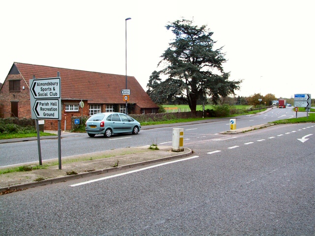
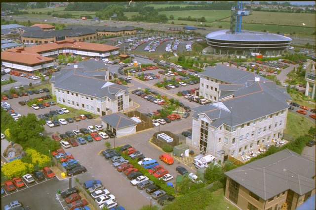
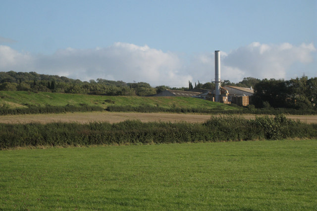
Almondsbury Images

Images are sourced within 2km of 51.554522/-2.573744 or Grid Reference ST6084. Thanks to Geograph Open Source API. All images are credited.

The Aztec Centre The Aztec Centre, Aztec West Business Park
The Aztec Centre
The Aztec Centre, Aztec West Business Park
Almondbury Sports and Social Club The sports ground is behind the club house, situated by the A38 a few hundred yards from the M5 junction.
Almondbury Sports and Social Club
The sports ground is behind the club house, situated by the A38 a few hundred yards from the M5 junction.
RAC control centre, Bristol The tower at the Bristol RAC control centre will be a familiar sight to motorists using the M4/M5 at the Almondsbury interchange, north Bristol. This is a view looking north, with the M5 off to the left.
RAC control centre, Bristol
The tower at the Bristol RAC control centre will be a familiar sight to motorists using the M4/M5 at the Almondsbury interchange, north Bristol. This is a view looking north, with the M5 off to the left.
Recently harvested field Photograph taken from Woodhouse Park Scout Camp Site.
Recently harvested field
Photograph taken from Woodhouse Park Scout Camp Site.
Entrance of Bristol Assembly Hall of Jehovah's Witnesses
Junction of the A38 and Hortham Lane
Church of St Mary, Almondsbury
Cottages in Almondsbury
A Modern Terrace in Almondsbury It's not all chocolate box cottages.
A Modern Terrace in Almondsbury
It's not all chocolate box cottages.
Going under the M4 More a tunnel through an embankment than a bridge.
Going under the M4
More a tunnel through an embankment than a bridge.
Livestock
Livestock
Bowl Inn, Almondsbury Despite its proximity to the northern edge of Bristol's suburbs and the M4/M5 intersection, Almondsbury retains a rural air.  The Bowl is a traditional village pub - seen here from the church gate.
Bowl Inn, Almondsbury
Despite its proximity to the northern edge of Bristol's suburbs and the M4/M5 intersection, Almondsbury retains a rural air. The Bowl is a traditional village pub - seen here from the church gate.
Almondsbury Churchyard Tidy churchyard belonging to St Mary's church.
Almondsbury Churchyard
Tidy churchyard belonging to St Mary's church.
Patchway & RCA Tower This aerial view of the RAC Tower and the M5 in the distance was taken from a 200ft Cellular Tower within the grounds of the Orange mobile telephone network. (The mast had just been built and was not in service).  Thanks due to Orange's Technical Englineering Department for access, and the safety gear!
Patchway & RCA Tower
This aerial view of the RAC Tower and the M5 in the distance was taken from a 200ft Cellular Tower within the grounds of the Orange mobile telephone network. (The mast had just been built and was not in service). Thanks due to Orange's Technical Englineering Department for access, and the safety gear!
Tower House, Almondsbury This late 19th century community hall was converted to 'Almondsbury Hospital' in the early 20th century and continued to be used as such until 1996. Tower House was then taken into private ownership and converted into a modern day dwelling.
Tower House, Almondsbury
This late 19th century community hall was converted to 'Almondsbury Hospital' in the early 20th century and continued to be used as such until 1996. Tower House was then taken into private ownership and converted into a modern day dwelling.
Tower House, Almondsbury (Rear View)
View from Avon Scout Camp Looking across the fields towards the Second Severn Crossing (centre of which is about ST5186), on a lovely summer evening. The M4 passes through this photo, and a motorway sign can just be seen near the middle of the photograph. The ground this side of the first set of pylon wires is in the grid square.
View from Avon Scout Camp
Looking across the fields towards the Second Severn Crossing (centre of which is about ST5186), on a lovely summer evening. The M4 passes through this photo, and a motorway sign can just be seen near the middle of the photograph. The ground this side of the first set of pylon wires is in the grid square.
Campfire at Woodhouse Park Woodhouse Park is run by the Avon Scouts but is available for other groups to use. Here is a group enjoying a campfire on a summer's evening.
Campfire at Woodhouse Park
Woodhouse Park is run by the Avon Scouts but is available for other groups to use. Here is a group enjoying a campfire on a summer's evening.
Show me another place!

Almondsbury is located at Grid Ref: ST6084 (Lat: 51.554522, Lng: -2.573744)

Unitary Authority: South Gloucestershire

Police Authority: Avon and Somerset

What 3 Words

///snails.sleeping.helpfully. Near Almondsbury, Gloucestershire

Nearby Locations

Almondsbury

Related Wikis

Nearby Amenities

Located within 500m of 51.554522,-2.573744
Fixme: This telephone box appears to be missing on Street Level Imagery. Please confirm.
Mapillary: 954926188662803
Removed Amenity: telephone
Survey Date: 2022-08-03
Lat/Long: 51.5548804/-2.5671878
Post Box
Collection Times: Mo-Fr 09:00; Sa 07:00
Post Box Type: lamp
Postal Code: BS32
Ref: BS32 564D
Royal Cypher: EIIR
Royal Cypher Wikidata: Q33102113
Lat/Long: 51.5548247/-2.5673159
Post Box
Collection Times: Mo-Fr 09:00; Sa 07:00
Note: the ref really does end in "D"
Post Box Type: pillar
Ref: BS32 672D
Royal Cypher: EIIR
Royal Cypher Wikidata: Q33102113
Lat/Long: 51.5514994/-2.5699773
Defibrillator
Booth: K6
Covered: booth
Defibrillator Location: inside red phone box next to Old School Village Hall, Church Road, Almondsbury
Disused Amenity: telephone
Emergency: defibrillator
Listed Status: Grade II
Man Made: telephone_box
Lat/Long: 51.5547231/-2.5739389
Bus Stop
Sundays Hill
Naptan AtcoCode: 0170SGB20634
Naptan Bearing: N
Naptan CommonName: Sundays Hill
Naptan Crossing: Over Lane
Naptan NaptanCode: sglajtm
Naptan Street: Sundays Hill
Naptan Verified: no
Source: naptan_import
Lat/Long: 51.5510364/-2.5762313
Bus Stop
Sundays Hill
Naptan AtcoCode: 0170SGB20635
Naptan Bearing: S
Naptan CommonName: Sundays Hill
Naptan Crossing: Over Lane
Naptan NaptanCode: sglajwd
Naptan Street: Sundays Hill
Naptan Verified: no
Source: naptan_import
Lat/Long: 51.5515972/-2.5756701
Bus Stop
Almondsbury School
Naptan AtcoCode: 0170SGB20636
Naptan Bearing: N
Naptan CommonName: Almondsbury School
Naptan Crossing: Hollow Road
Naptan NaptanCode: sglajwp
Naptan Street: Sundays Hill
Naptan Verified: no
Shelter: yes
Source: naptan_import
Lat/Long: 51.5536036/-2.5743538
Bus Stop
Lower Almondsbury Church
Naptan AtcoCode: 0170SGB20637
Naptan Bearing: S
Naptan CommonName: Lower Almondsbury Church
Naptan Crossing: Sundays Hill
Naptan NaptanCode: sglajwt
Naptan Street: Church Road
Naptan Verified: no
Shelter: no
Source: naptan_import
Lat/Long: 51.5548628/-2.5741714
Bus Stop
Lower Almondsbury Church
Naptan AtcoCode: 0170SGB20638
Naptan Bearing: NW
Naptan CommonName: Lower Almondsbury Church
Naptan Crossing: Walnut Tree Close
Naptan NaptanCode: sglajwj
Naptan Street: Church Road
Naptan Verified: no
Shelter: no
Source: naptan_import
Lat/Long: 51.5552852/-2.5752753
Bus Stop
Marshwall Lane
Naptan AtcoCode: 0170SGB20639
Naptan Bearing: N
Naptan CommonName: Marshwall Lane
Naptan Crossing: Marshwall Lane
Naptan NaptanCode: sglajpt
Naptan Street: Tockington Lane
Naptan Verified: no
Source: naptan_import
Lat/Long: 51.5564632/-2.5771076
Bus Stop
Marshwall Lane
Naptan AtcoCode: 0170SGB20640
Naptan Bearing: S
Naptan CommonName: Marshwall Lane
Naptan Crossing: Marshwall Lane
Naptan NaptanCode: sglajtd
Naptan Street: Tockington Lane
Naptan Verified: no
Source: naptan_import
Lat/Long: 51.5565276/-2.5767911
Bus Stop
Over Lane
Bench: no
Bin: no
Lit: no
Naptan AtcoCode: 0170SGB20641
Naptan Bearing: E
Naptan CommonName: Over Lane
Naptan Crossing: Gloucester Road
Naptan NaptanCode: sglamgm
Naptan Street: Over Lane
Naptan Verified: no
Shelter: no
Source: naptan_import
Tactile Paving: no
Lat/Long: 51.5522519/-2.5704307
Bus Stop
Over Lane
Bench: no
Bin: no
Lit: no
Naptan AtcoCode: 0170SGB20642
Naptan Bearing: W
Naptan CommonName: Over Lane
Naptan Crossing: Gloucester Road
Naptan NaptanCode: sglamgp
Naptan Street: Over Lane
Naptan Verified: no
Shelter: no
Source: naptan_import
Tactile Paving: no
Lat/Long: 51.5521436/-2.570476
Bus Stop
The Swan
Bench: yes
Bin: yes
Check Date Shelter: 2023-02-17
Lit: yes
Naptan AtcoCode: 0170SGP90893
Naptan Bearing: N
Naptan CommonName: The Swan
Naptan Crossing: Red House Lane
Naptan NaptanCode: sglamjw
Naptan Street: Gloucester Road
Naptan Verified: no
Shelter: yes
Source: naptan_import
Tactile Paving: yes
Lat/Long: 51.5527687/-2.5695532
Bus Stop
The Swan
Bench: yes
Bin: no
Check Date Shelter: 2023-01-05
Lit: no
Naptan AtcoCode: 0170SGP90894
Naptan Bearing: S
Naptan CommonName: The Swan
Naptan Crossing: The Hill
Naptan NaptanCode: sglampa
Naptan Street: Gloucester Road
Naptan Verified: no
Shelter: yes
Source: naptan_import
Tactile Paving: no
Lat/Long: 51.5527184/-2.5692588
Post Box
Post Box Type: pillar
Ref: BS32 144
Royal Cypher: EIIR
Royal Cypher Wikidata: Q33102113
Lat/Long: 51.5547085/-2.5739095
Barrier: cycle_barrier
Lat/Long: 51.5528226/-2.5732373
Almondsbury
Is In: South Gloucestershire, England, UK
Name Zh: 扁桃里
Place: village
Postal Code: BS32 4
Lat/Long: 51.5538504/-2.5729128
War Memorial
Historic: memorial
Memorial: war_memorial
Wikidata: Q26677256
Lat/Long: 51.5505379/-2.5762261
Bench
Lat/Long: 51.5505745/-2.5761823
Almondsbury Hill
Place: locality
Lat/Long: 51.5524212/-2.5726804
View From Almondsbury Hill
Check Date: 2023-10-26
Information: board
Tourism: information
Lat/Long: 51.552433/-2.5703267
Bench
Lat/Long: 51.5515986/-2.5740943
Tourism: viewpoint
Lat/Long: 51.5516428/-2.5741349
Bench
Lat/Long: 51.5520411/-2.5726287
Tourism: viewpoint
Lat/Long: 51.5520651/-2.5726506
Bench
Lat/Long: 51.5521621/-2.5722828
Waste Basket
Lat/Long: 51.552186/-2.5722134
Waste Basket
Check Date: 2023-10-26
Lat/Long: 51.5522053/-2.570168
Access: customers
Barrier: lift_gate
Lat/Long: 51.5507933/-2.5697934
Clock
Check Date: 2023-02-18
Lat/Long: 51.5515038/-2.5703686
Clock
Lat/Long: 51.553755/-2.5682324
Addr Housenumber: 49
Building: yes
Lat/Long: 51.5504454/-2.575715
Bench
Backrest: yes
Lat/Long: 51.5525649/-2.5699415
Power: substation
Lat/Long: 51.5549324/-2.5671747
Bench
Backrest: yes
Lat/Long: 51.5529174/-2.5690802
Check Date: 2023-11-19
Disused Amenity: drinking_water
Lat/Long: 51.553892/-2.5683722
Building: yes
Lat/Long: 51.551599/-2.5757999
Barrier: cycle_barrier
Bicycle: yes
Foot: yes
Lat/Long: 51.5520283/-2.5744027
Bench
Lat/Long: 51.5522386/-2.5726659
Bench
Lat/Long: 51.5527858/-2.5728757
Bench
Lat/Long: 51.5529074/-2.5732319
Grit Bin
Lat/Long: 51.5529229/-2.5732926
Power: substation
Lat/Long: 51.5521429/-2.5687694
Bench
Lat/Long: 51.5525044/-2.5688123
Grit Bin
Lat/Long: 51.5529174/-2.5681984
Disused Amenity: drinking_water
Lat/Long: 51.5545824/-2.5739168
Recycling
Lat/Long: 51.5546974/-2.5730813
Waste Basket
Lat/Long: 51.5547397/-2.5739557
Bench
Lat/Long: 51.5547705/-2.5742873
Grit Bin
Lat/Long: 51.5554623/-2.5680246
Bench
Lat/Long: 51.5555759/-2.5693256
Waste Basket
Lat/Long: 51.5556636/-2.569544
Power: substation
Lat/Long: 51.5526316/-2.5801863
Grit Bin
Lat/Long: 51.5533826/-2.5744108
Grit Bin
Lat/Long: 51.5547629/-2.5772259
Bench
Lat/Long: 51.5548143/-2.5740456
Bus Stop
Lat/Long: 51.5553378/-2.5754421
Clock
Lat/Long: 51.5543258/-2.5733596
Barrier: cycle_barrier
Bicycle: yes
Foot: yes
Lat/Long: 51.5547177/-2.5732623
Barrier: cycle_barrier
Bicycle: yes
Foot: yes
Lat/Long: 51.5549135/-2.573379
Waste Basket
Lat/Long: 51.5587428/-2.5759091
Addr City: Bristol
Addr Housename: Old School House
Addr Housenumber: 14
Addr Place: Almondsbury
Addr Postcode: BS32 4ED
Addr Province: South Gloucestershire
Addr Street: Church Road
Lat/Long: 51.5550044/-2.5746868
Barrier: stile
Bicycle: yes
Foot: yes
Lat/Long: 51.5503484/-2.5763391
Clock
Lat/Long: 51.5537759/-2.5682472
Bench
Backrest: yes
Lat/Long: 51.552265/-2.570113
Bench
Backrest: yes
Lat/Long: 51.5522621/-2.5703015
Pipeline: marker
Substance: gas
Lat/Long: 51.5520936/-2.5697157
Turning Circle
Lat/Long: 51.5534192/-2.5737731
Entrance: main
Lat/Long: 51.5543503/-2.5735376
Bench
Lat/Long: 51.5544759/-2.573593
Barrier: kissing_gate
Lat/Long: 51.5562432/-2.5737219
Grit Bin
Lat/Long: 51.553135/-2.5694315
Waste Basket
Lat/Long: 51.5527364/-2.5692089
Waste Basket
Lat/Long: 51.5527773/-2.5695817
Grit Bin
Lat/Long: 51.5548595/-2.5712366
Addr Housename: High Water
Addr Housenumber: 4
Addr Street: The Scop
Building: yes
Fixme: approximate
Lat/Long: 51.5551063/-2.5689045
Addr Housename: Many Views
Addr Street: The Scop
Building: yes
Fixme: approximate
Lat/Long: 51.5549003/-2.569174
Bench
Lat/Long: 51.5547102/-2.5726522
Information: board
Tourism: information
Lat/Long: 51.5547532/-2.5739443
Traffic Mirror
Lat/Long: 51.5536946/-2.5741991
Bench
Source: survey
Lat/Long: 51.5526322/-2.5716323
Addr Housename: Berkeley House
Building: yes
Fixme: check
Lat/Long: 51.5533185/-2.5672723
Grit Bin
Lat/Long: 51.5523103/-2.5692907
Direction: 140
Generator Method: photovoltaic
Generator Output Electricity: yes
Generator Solar Modules: 8
Generator Source: solar
Generator Type: solar_photovoltaic_panel
Location: roof
Power: generator
Lat/Long: 51.5550685/-2.5672277
Direction: 120
Generator Method: photovoltaic
Generator Output Electricity: yes
Generator Solar Modules: 16
Generator Source: solar
Generator Type: solar_photovoltaic_panel
Location: roof
Power: generator
Lat/Long: 51.554423/-2.569379
Direction: 165
Generator Method: photovoltaic
Generator Output Electricity: yes
Generator Solar Modules: 5
Generator Source: solar
Generator Type: solar_photovoltaic_panel
Location: roof
Power: generator
Lat/Long: 51.5520037/-2.5720581
Direction: 165
Generator Method: photovoltaic
Generator Output Electricity: yes
Generator Solar Modules: 8
Generator Source: solar
Generator Type: solar_photovoltaic_panel
Location: roof
Power: generator
Lat/Long: 51.5519983/-2.5721264
Direction: 255
Generator Method: photovoltaic
Generator Output Electricity: yes
Generator Solar Modules: 3
Generator Source: solar
Generator Type: solar_photovoltaic_panel
Location: roof
Power: generator
Lat/Long: 51.5519577/-2.5721151
Direction: 150
Generator Method: photovoltaic
Generator Output Electricity: yes
Generator Solar Modules: 12
Generator Source: solar
Generator Type: solar_photovoltaic_panel
Location: roof
Power: generator
Lat/Long: 51.5510939/-2.5718058
Direction: 235
Generator Method: photovoltaic
Generator Output Electricity: yes
Generator Solar Modules: 6
Generator Source: solar
Generator Type: solar_photovoltaic_panel
Location: roof
Power: generator
Lat/Long: 51.5520932/-2.5689857
Direction: 150
Generator Method: photovoltaic
Generator Output Electricity: yes
Generator Solar Modules: 10
Generator Source: solar
Generator Type: solar_photovoltaic_panel
Location: roof
Power: generator
Lat/Long: 51.5528796/-2.5673326
Direction: 175
Generator Method: photovoltaic
Generator Output Electricity: yes
Generator Solar Modules: 4
Generator Source: solar
Generator Type: solar_photovoltaic_panel
Location: roof
Power: generator
Lat/Long: 51.5543604/-2.5716017
Direction: 90
Generator Method: photovoltaic
Generator Output Electricity: yes
Generator Solar Modules: 5
Generator Source: solar
Generator Type: solar_photovoltaic_panel
Location: roof
Power: generator
Lat/Long: 51.5546776/-2.5713089
Direction: 270
Generator Method: photovoltaic
Generator Output Electricity: yes
Generator Solar Modules: 5
Generator Source: solar
Generator Type: solar_photovoltaic_panel
Location: roof
Power: generator
Lat/Long: 51.5546767/-2.5713392
Direction: 210
Generator Method: photovoltaic
Generator Output Electricity: yes
Generator Solar Modules: 18
Generator Source: solar
Generator Type: solar_photovoltaic_panel
Location: roof
Power: generator
Lat/Long: 51.5549703/-2.5735146
Direction: 210
Generator Method: photovoltaic
Generator Output Electricity: yes
Generator Solar Modules: 18
Generator Source: solar
Generator Type: solar_photovoltaic_panel
Location: roof
Power: generator
Lat/Long: 51.5546445/-2.5782006
Direction: 200
Generator Method: photovoltaic
Generator Output Electricity: yes
Generator Solar Modules: 20
Generator Source: solar
Generator Type: solar_photovoltaic_panel
Location: roof
Power: generator
Lat/Long: 51.5539333/-2.5793853
Direction: 160
Generator Method: photovoltaic
Generator Output Electricity: yes
Generator Solar Modules: 10
Generator Source: solar
Generator Type: solar_photovoltaic_panel
Location: roof
Power: generator
Lat/Long: 51.5530155/-2.5805049
Direction: 160
Generator Method: photovoltaic
Generator Output Electricity: yes
Generator Solar Modules: 12
Generator Source: solar
Generator Type: solar_photovoltaic_panel
Location: roof
Power: generator
Lat/Long: 51.5522372/-2.5798279
Direction: 180
Generator Method: photovoltaic
Generator Output Electricity: yes
Generator Solar Modules: 9
Generator Source: solar
Generator Type: solar_photovoltaic_panel
Location: roof
Power: generator
Lat/Long: 51.5552119/-2.5769039
Direction: 200
Generator Method: photovoltaic
Generator Output Electricity: yes
Generator Solar Modules: 8
Generator Source: solar
Generator Type: solar_photovoltaic_panel
Location: roof
Power: generator
Lat/Long: 51.5560243/-2.5776722
Direction: 105
Generator Method: photovoltaic
Generator Output Electricity: yes
Generator Solar Modules: 7
Generator Source: solar
Generator Type: solar_photovoltaic_panel
Location: roof
Power: generator
Lat/Long: 51.5575521/-2.5769745
Direction: 285
Generator Method: photovoltaic
Generator Output Electricity: yes
Generator Solar Modules: 7
Generator Source: solar
Generator Type: solar_photovoltaic_panel
Location: roof
Power: generator
Lat/Long: 51.5575566/-2.5770175
Direction: 285
Generator Method: photovoltaic
Generator Output Electricity: yes
Generator Solar Modules: 10
Generator Source: solar
Generator Type: solar_photovoltaic_panel
Location: roof
Power: generator
Lat/Long: 51.5568753/-2.5766168
Direction: 285
Generator Method: photovoltaic
Generator Output Electricity: yes
Generator Solar Modules: 10
Generator Source: solar
Generator Type: solar_photovoltaic_panel
Location: roof
Power: generator
Lat/Long: 51.5567948/-2.5766426
Direction: 180
Generator Method: photovoltaic
Generator Output Electricity: yes
Generator Solar Modules: 8
Generator Source: solar
Generator Type: solar_photovoltaic_panel
Location: roof
Power: generator
Lat/Long: 51.5560962/-2.5750671
Direction: 180
Generator Method: photovoltaic
Generator Output Electricity: yes
Generator Solar Modules: 8
Generator Source: solar
Generator Type: solar_photovoltaic_panel
Location: roof
Power: generator
Lat/Long: 51.5561446/-2.575025
Generator Method: photovoltaic
Generator Output Electricity: yes
Generator Solar Modules: 16
Generator Source: solar
Generator Type: solar_photovoltaic_panel
Location: roof
Power: generator
Lat/Long: 51.556064/-2.5753771
Direction: 190
Generator Method: photovoltaic
Generator Output Electricity: yes
Generator Solar Modules: 10
Generator Source: solar
Generator Type: solar_photovoltaic_panel
Location: roof
Power: generator
Lat/Long: 51.555858/-2.5752486
Direction: 185
Generator Method: photovoltaic
Generator Output Electricity: yes
Generator Solar Modules: 6
Generator Source: solar
Generator Type: solar_photovoltaic_panel
Location: roof
Power: generator
Lat/Long: 51.5558135/-2.5744593
Direction: 190
Generator Method: photovoltaic
Generator Output Electricity: yes
Generator Solar Modules: 4
Generator Source: solar
Generator Type: solar_photovoltaic_panel
Location: roof
Power: generator
Lat/Long: 51.5562274/-2.5743462
Direction: 190
Generator Method: photovoltaic
Generator Output Electricity: yes
Generator Solar Modules: 2
Generator Source: solar
Generator Type: solar_photovoltaic_panel
Location: roof
Power: generator
Lat/Long: 51.5562082/-2.5743046
The data included in this document is from www.openstreetmap.org. The data is made available under ODbL.

Have you been to Almondsbury?

Leave your review of Almondsbury below (or comments, questions and feedback).