Almondbury

Settlement in Yorkshire

England

Almondbury

Converted warehouse, Aspley This former warehouse and preserved crane are alongside the restored Huddersfield Narrow Canal. The bridge in the background carries a main road out of Huddersfield and its reinstatement was a major piece of enabling work. Beyond it is the Aspley Basin which is also the start of the Broad Canal (Sir John Ramsden's Canal).
Converted warehouse, Aspley Credit: Chris Allen

Almondbury is a small village located in the metropolitan borough of Kirklees, West Yorkshire, England. Situated approximately 2 miles southeast of Huddersfield, it lies in the picturesque Pennine Hills.

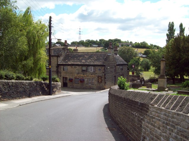
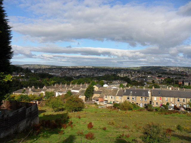
With a population of around 7,000 people, Almondbury has a rich history that dates back to the medieval era. The village is characterized by its charming stone-built houses and narrow winding streets, which give it a distinct old-world charm. The centerpiece of the village is the 16th-century All Hallows Church, a beautiful Grade I listed building that attracts visitors from far and wide.

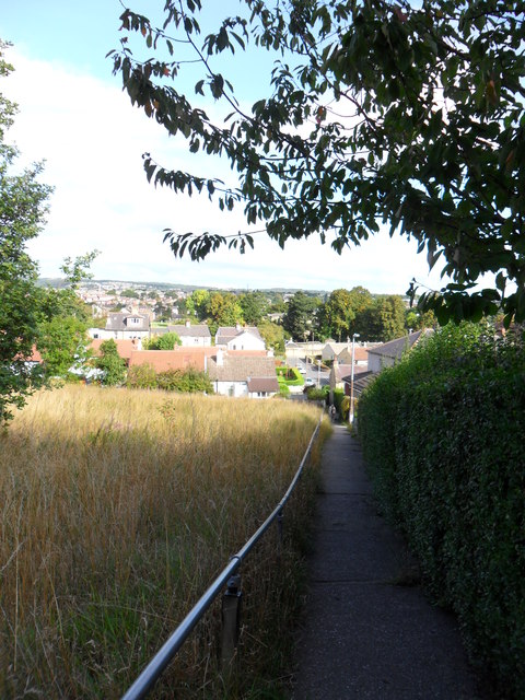
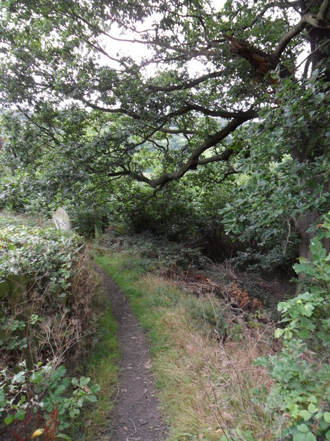
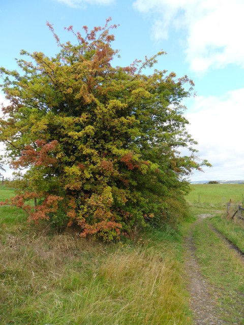
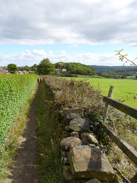
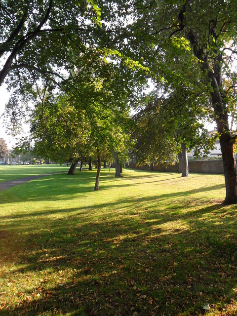
The village is surrounded by stunning countryside, making it a popular destination for nature enthusiasts and hikers. The nearby Castle Hill, a prominent landmark, offers breathtaking panoramic views of the surrounding landscape.

Almondbury boasts a range of amenities to cater to its residents, including local shops, pubs, and restaurants. The village is also home to Almondbury Community School, which provides education to students from primary to secondary levels.

Transportation links in Almondbury are excellent, with regular bus services connecting the village to nearby towns and cities. The village also benefits from its proximity to the M62 motorway, providing easy access to Manchester and Leeds.

Overall, Almondbury is a picturesque village with a rich history, stunning natural beauty, and a strong sense of community. It offers a peaceful and idyllic way of life while still being within reach of larger urban centers.

If you have any feedback on the listing, please let us know in the comments section below.
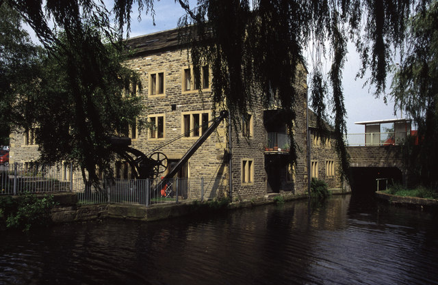
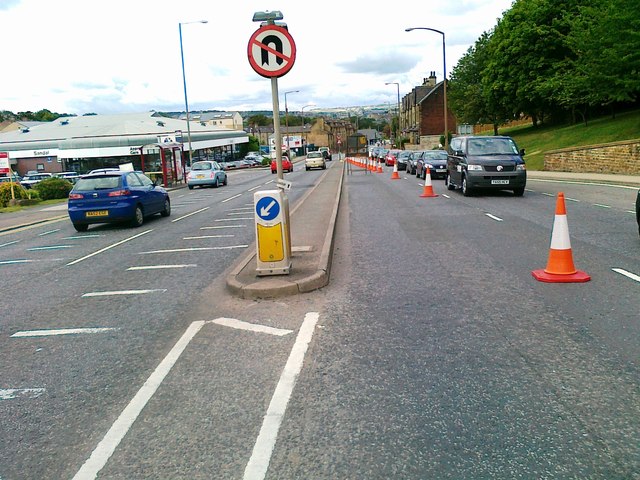
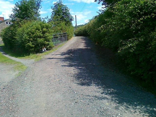
Almondbury Images

Images are sourced within 2km of 53.637546/-1.747389 or Grid Reference SE1615. Thanks to Geograph Open Source API. All images are credited.

Converted warehouse, Aspley This former warehouse and preserved crane are alongside the restored Huddersfield Narrow Canal. The bridge in the background carries a main road out of Huddersfield and its reinstatement was a major piece of enabling work. Beyond it is the Aspley Basin which is also the start of the Broad Canal (Sir John Ramsden's Canal).
Converted warehouse, Aspley
This former warehouse and preserved crane are alongside the restored Huddersfield Narrow Canal. The bridge in the background carries a main road out of Huddersfield and its reinstatement was a major piece of enabling work. Beyond it is the Aspley Basin which is also the start of the Broad Canal (Sir John Ramsden's Canal).
Wakefield Road, Huddersfield
Old Wakefield Road, Mouldgreen
Access road to Lower Common Farm
Church Lane and the Beaumont Arms, Kirkheaton Village pub situated opposite the parish church, the cemetery of which can be partially seen on the right of picture. The pub (known locally as the Kirk Stile) has various historical links with local law enforcement, having served as a courthouse, lock-up and base for a local 'Prosecution Society'. Today it is a Joshua Tetley Heritage Pub and I'd recommend it.
Church Lane and the Beaumont Arms, Kirkheaton
Village pub situated opposite the parish church, the cemetery of which can be partially seen on the right of picture. The pub (known locally as the Kirk Stile) has various historical links with local law enforcement, having served as a courthouse, lock-up and base for a local 'Prosecution Society'. Today it is a Joshua Tetley Heritage Pub and I'd recommend it.
Lumb Dike near Almondbury Lumb Dike from footbridge, North-East of Molly Carr Wood.
Lumb Dike near Almondbury
Lumb Dike from footbridge, North-East of Molly Carr Wood.
Felcote Avenue Looking down Felcote Avenue to the tiny wood at the bottom.
Felcote Avenue
Looking down Felcote Avenue to the tiny wood at the bottom.
Cat-Steps, near Felcote Avenue Looking down the 'cat-steps'(public right-of-way) towards Ravensknowle Park (trees in the park are visible in the background).
Cat-Steps, near Felcote Avenue
Looking down the 'cat-steps'(public right-of-way) towards Ravensknowle Park (trees in the park are visible in the background).
Field adjacent to Forest Road Taken from Forest Road looking down to terrace houses on Ravensknowle Road.
Field adjacent to Forest Road
Taken from Forest Road looking down to terrace houses on Ravensknowle Road.
Footpath, Wheat Royd, Almondbury. Footpath leading from Wheat Royd to Lumb Lane.  A grand old oak tree overhangs the path just here.
Footpath, Wheat Royd, Almondbury.
Footpath leading from Wheat Royd to Lumb Lane. A grand old oak tree overhangs the path just here.
Clough Hall Lane, Castle Hill A fine Hawthorn tree showing early autumn-tide colours, adjacent to Clough Hall Lane.
Clough Hall Lane, Castle Hill
A fine Hawthorn tree showing early autumn-tide colours, adjacent to Clough Hall Lane.
Footpath near Wheat Royd Looking along part of footpath leading north-east from Castle Hill to Wheat Royd.
Footpath near Wheat Royd
Looking along part of footpath leading north-east from Castle Hill to Wheat Royd.
Penny Spring Wood At the southern end of Penny Spring Wood.  The path on the left of the photo is well-used, though not marked on maps as a public right of way.
Penny Spring Wood
At the southern end of Penny Spring Wood. The path on the left of the photo is well-used, though not marked on maps as a public right of way.
Autumn trees, Ravensknowle Park. Looking down to the Wakefield Road entrance to Ravensknowle Park.  A field maple and sycamore tree just turning to autumn colours.
Autumn trees, Ravensknowle Park.
Looking down to the Wakefield Road entrance to Ravensknowle Park. A field maple and sycamore tree just turning to autumn colours.
Ravensknowle Park A beautiful early autumn morning in the park, adjacent to Ravensknowle Road.
Ravensknowle Park
A beautiful early autumn morning in the park, adjacent to Ravensknowle Road.
Dalton Playing Fields. Playing fields off Grosvenor Road.  A welcome bit of open space in a built-up area.
Dalton Playing Fields.
Playing fields off Grosvenor Road. A welcome bit of open space in a built-up area.
Field path, Oaklands Field path leading down to Oaklands.  Dalton and Rawthorpe are in the distance.
Field path, Oaklands
Field path leading down to Oaklands. Dalton and Rawthorpe are in the distance.
Field path, Almondbury. Looking along the public footpath leading from Bank End Lane to Fernside Avenue.
Field path, Almondbury.
Looking along the public footpath leading from Bank End Lane to Fernside Avenue.
Show me another place!

Almondbury is located at Grid Ref: SE1615 (Lat: 53.637546, Lng: -1.747389)

Division: West Riding

Unitary Authority: Kirklees

Police Authority: West Yorkshire

What 3 Words

///feared.loops.demand. Near Huddersfield, West Yorkshire

Related Wikis

Hill View Academy

Hill View Academy (formerly Almondbury Community School) is a 3–11 mixed primary school with academy status in Almondbury, West Yorkshire, England. It...

Almondbury

Almondbury (English: ) is a village 2 miles (3.2 km) south-east of Huddersfield town centre in West Yorkshire, England. The population of Almondbury in...

King James's School, Almondbury

King James's School is a coeducational secondary school located in Almondbury in the English county of West Yorkshire. == History == King James's Grammar...
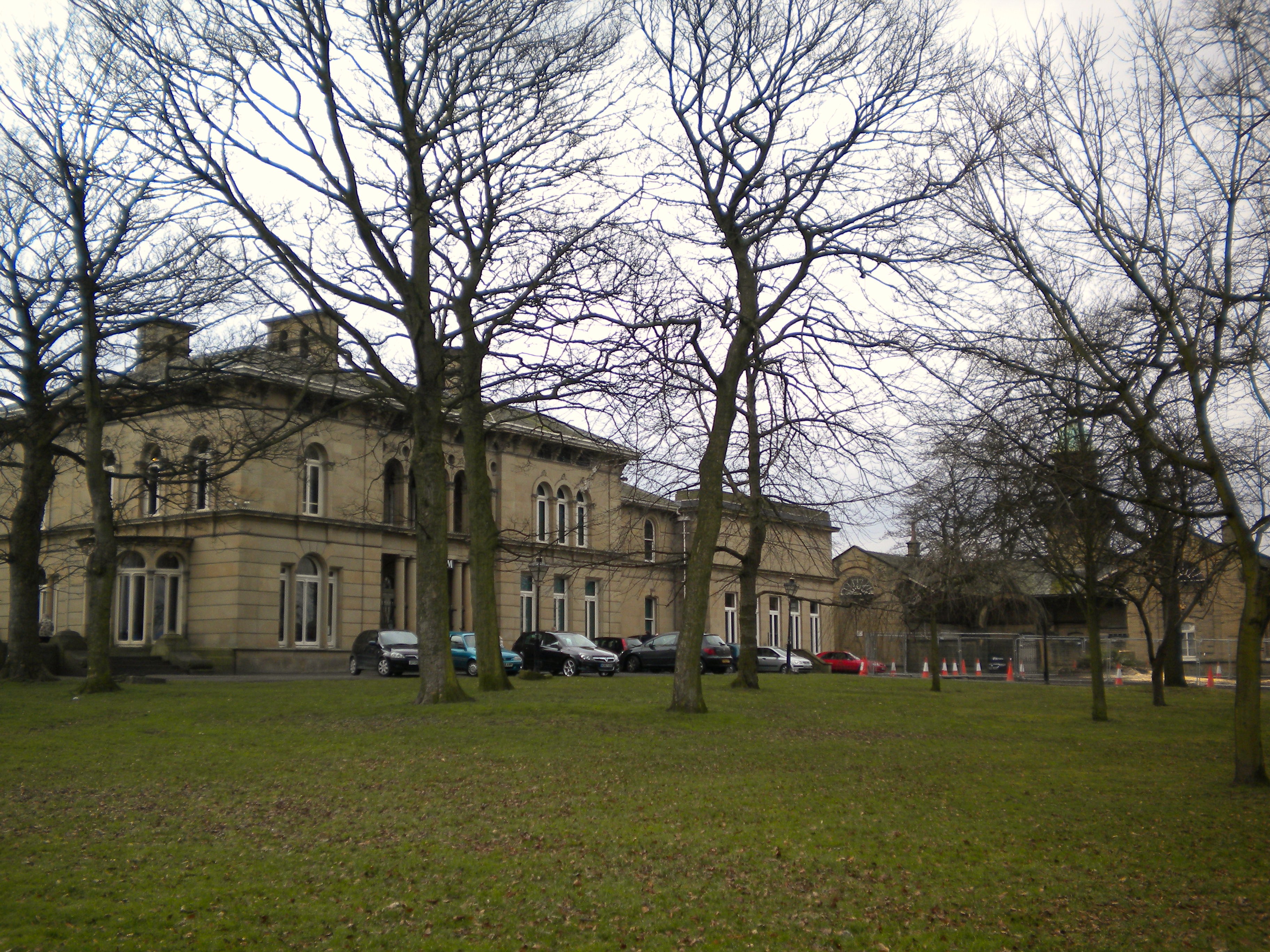
Tolson Museum

The Tolson Memorial Museum, also known as Tolson Museum, is housed in Ravensknowle Hall, a Victorian mansion in Ravensknowle Park on Wakefield Road in...

Nearby Amenities

Located within 500m of 53.637546,-1.747389
Traffic Calming: cushion
Lat/Long: 53.6398715/-1.7529458
Bus Stop
Town End Fernside Avenue
Local Ref: 45018763
Naptan AtcoCode: 450018763
Naptan Bearing: NW
Naptan CommonName: Town End Fernside Avenue
Naptan Crossing: Fernside Avenue
Naptan Indicator: Stop 45018763
Naptan PlusbusZoneRef: LEEDS
Naptan ShortCommonName: Fernside Avenue
Naptan Street: Town End
Naptan Verified: no
Source: naptan_import
Lat/Long: 53.6370764/-1.7528675
Bus Stop
Town End Fernside Avenue
Local Ref: 45018764
Naptan AtcoCode: 450018764
Naptan Bearing: SE
Naptan CommonName: Town End Fernside Avenue
Naptan Crossing: Fernside Avenue
Naptan Indicator: Stop 45018764
Naptan PlusbusZoneRef: LEEDS
Naptan ShortCommonName: Fernside Avenue
Naptan Street: Town End
Naptan Verified: no
Source: naptan_import
Lat/Long: 53.6369585/-1.752354
Bus Stop
Southfield Road Hudroyd
Local Ref: 45018766
Naptan AtcoCode: 450018766
Naptan Bearing: SW
Naptan CommonName: Southfield Road Hudroyd
Naptan Crossing: Northgate
Naptan Indicator: Stop 45018766
Naptan PlusbusZoneRef: LEEDS
Naptan ShortCommonName: Hudroyd
Naptan Street: Southfield Road
Naptan Verified: no
Source: naptan_import
Lat/Long: 53.6352432/-1.7487495
Bus Stop
Southfield Road Hudroyd
Local Ref: 45018767
Naptan AtcoCode: 450018767
Naptan Bearing: NE
Naptan CommonName: Southfield Road Hudroyd
Naptan Crossing: Hudroyd
Naptan Indicator: Stop 45018767
Naptan PlusbusZoneRef: LEEDS
Naptan ShortCommonName: Hudroyd
Naptan Street: Southfield Road
Naptan Verified: no
Source: naptan_import
Lat/Long: 53.6355208/-1.748279
Bus Stop
Southfield Road Ings Road
Local Ref: 45018768
Naptan AtcoCode: 450018768
Naptan Bearing: W
Naptan CommonName: Southfield Road Ings Road
Naptan Crossing: Hulbert Croft
Naptan Indicator: Stop 45018768
Naptan PlusbusZoneRef: LEEDS
Naptan ShortCommonName: Hulbert Croft
Naptan Street: Southfield Road
Naptan Verified: no
Source: naptan_import
Lat/Long: 53.636528/-1.7442499
Bus Stop
Southfield Road Hulbert Croft
Local Ref: 45018769
Naptan AtcoCode: 450018769
Naptan Bearing: NE
Naptan CommonName: Southfield Road Hulbert Croft
Naptan Crossing: Hulbert Croft
Naptan Indicator: Stop 45018769
Naptan PlusbusZoneRef: LEEDS
Naptan ShortCommonName: Hulbert Croft
Naptan Street: Southfield Road
Naptan Verified: no
Source: naptan_import
Lat/Long: 53.6366893/-1.7440372
Bus Stop
Southfield Road Hurst Knowle
Local Ref: 45018770
Naptan AtcoCode: 450018770
Naptan Bearing: W
Naptan CommonName: Southfield Road Hurst Knowle
Naptan Crossing: Hurst Knowle
Naptan Indicator: Stop 45018770
Naptan Landmark: Almondbury Junior School
Naptan PlusbusZoneRef: LEEDS
Naptan ShortCommonName: Hurst Knowle
Naptan Street: Southfield Road
Naptan Verified: no
Source: naptan_import
Lat/Long: 53.6373565/-1.7407965
Bus Stop
Southfield Road Hurst Knowle
Local Ref: 45018771
Naptan AtcoCode: 450018771
Naptan Bearing: E
Naptan CommonName: Southfield Road Hurst Knowle
Naptan Crossing: Hurst Knowle
Naptan Indicator: Stop 45018771
Naptan Landmark: Almondbury Junior School
Naptan PlusbusZoneRef: LEEDS
Naptan ShortCommonName: Hurst Knowle
Naptan Street: Southfield Road
Naptan Verified: no
Shelter: yes
Source: naptan_import
Lat/Long: 53.6374664/-1.7408036
Bus Stop
Somerset Road Benomley Road
Local Ref: 45021103
Naptan AtcoCode: 450021103
Naptan Bearing: SE
Naptan CommonName: Somerset Road Benomley Road
Naptan Crossing: Benomley Road
Naptan Indicator: Stop 45021103
Naptan Landmark: Dental Surgery
Naptan PlusbusZoneRef: LEEDS
Naptan ShortCommonName: Benomley Road
Naptan Street: Somerset Road
Naptan Verified: no
Source: naptan_import
Lat/Long: 53.6367177/-1.753278
Bus Stop
Almondbury Waste Lane
Local Ref: 45021104
Naptan AtcoCode: 450021104
Naptan Bearing: NW
Naptan CommonName: Almondbury Waste Lane
Naptan Crossing: Waste Lane
Naptan Indicator: Stop 45021104
Naptan PlusbusZoneRef: LEEDS
Naptan ShortCommonName: Benomley Road
Naptan Street: Somerset Road
Naptan Verified: no
Source: naptan_import
Lat/Long: 53.6363752/-1.7528111
Bus Stop
Northgate Southfield Road
Local Ref: 45021105
Naptan AtcoCode: 450021105
Naptan Bearing: NW
Naptan CommonName: Northgate Southfield Road
Naptan Crossing: Southfield Road
Naptan Indicator: Stop 45021105
Naptan Landmark: Almondbury Housing Office
Naptan PlusbusZoneRef: LEEDS
Naptan ShortCommonName: Southfield Road
Naptan Street: Northgate
Naptan Verified: no
Source: naptan_import
Lat/Long: 53.6348135/-1.7495989
Bus Stop
Northgate Brickbank
Local Ref: 45021106
Naptan AtcoCode: 450021106
Naptan Bearing: SE
Naptan CommonName: Northgate Brickbank
Naptan Crossing: Southfield Road
Naptan Indicator: Stop 45021106
Naptan Landmark: Rose & Crown PH
Naptan PlusbusZoneRef: LEEDS
Naptan ShortCommonName: Brickbank
Naptan Street: Northgate
Naptan Verified: no
Source: naptan_import
Lat/Long: 53.6344886/-1.7489808
Fernside Avenue
Local Ref: 45024620
Naptan AtcoCode: 450024620
Naptan Bearing: SW
Naptan BusStopType: CUS
Naptan CommonName: Fernside Avenue
Naptan Crossing: Rockley Close
Naptan Indicator: Stop 45024620
Naptan PlusbusZoneRef: LEEDS
Naptan ShortCommonName: Rockley Close
Naptan Street: Fernside Avenue
Naptan Verified: no
Source: naptan_import
Lat/Long: 53.6377758/-1.7520618
Turning Circle
Vale Close
Lat/Long: 53.6334458/-1.7489826
Post Box
Operator: Royal Mail
Lat/Long: 53.6367013/-1.7537787
Library
Almondbury Library
Addr City: Huddersfield
Addr Postcode: HD5 8TD
Addr Street: Farfield Road
Addr Suburb: Almondbury
Internet Access: yes
Internet Access Fee: yes
Opening Hours: Mo 13:00-17:00,Tu 10:00-13:00,We Off,Th 14:00-19:00,Fri Off,Sa 10:00-13:00,Su Off
Operator: Kikrklees Libraries
Operator Type: local_authority
Source: Kirklees Libraries website
Lat/Long: 53.6341766/-1.7475044
Crossing
Crossing: zebra
Crossing Ref: zebra
Lat/Long: 53.6334078/-1.7478958
Parking
Operator: Kirklees Council
Parking: surface
Lat/Long: 53.6344446/-1.7470421
Shop: convenience
Lat/Long: 53.6356158/-1.748084
Turning Circle
Lat/Long: 53.6358349/-1.7490213
Turning Circle
Nowell Place
Lat/Long: 53.6372434/-1.7514019
Turning Circle
Neville Grove
Source: survey
Lat/Long: 53.6378501/-1.749734
Cafe
Lat/Long: 53.6392883/-1.7404557
Parking
Parking: surface
Source: survey
Lat/Long: 53.6408083/-1.7451065
Pharmacy
Source: survey
Lat/Long: 53.6337836/-1.7480069
Crossing
Crossing: zebra
Crossing Ref: zebra
Source: survey
Lat/Long: 53.6347669/-1.7494396
Post Box
Post Box Design: type_k
Post Box Type: pillar
Royal Cypher: EIIR
Royal Cypher Wikidata: Q33102113
Lat/Long: 53.6350371/-1.7495869
Fast Food
Sharkeys
Addr City: Huddersfield
Addr District: Almondbury
Addr Housenumber: 5
Addr Postcode: HD5 8RY
Addr Street: Southfield Road
Cuisine: fish_and_chips
Drive Through: no
Phone: +44 1484 425000
Website: https://www.just-eat.co.uk/restaurants-sharkys-fish-and-chips-kirkheaton
Lat/Long: 53.635284/-1.7491274
Turning Circle
Lat/Long: 53.6367307/-1.7477777
Turning Circle
Lat/Long: 53.6369237/-1.7445228
Waste Basket
Source: survey
Lat/Long: 53.6378593/-1.7399511
Waste Basket
Source: survey
Lat/Long: 53.6379918/-1.7403459
Leisure: pitch
Lit: no
Sport: soccer
Lat/Long: 53.6364973/-1.7461224
Leisure: pitch
Sport: soccer
Lat/Long: 53.6381895/-1.7437039
Leisure: pitch
Sport: soccer
Lat/Long: 53.6389934/-1.7437251
Leisure: track
Sport: running
Lat/Long: 53.638923/-1.7439877
Leisure: pitch
Sport: cricket
Lat/Long: 53.6387097/-1.743391
Description: 18 panels
Generator Method: photovoltaic
Generator Output Electricity: small_installation
Generator Source: solar
Generator Type: solar_photovoltaic_panel
Note: roof household
Power: generator
Lat/Long: 53.6346999/-1.7423613
Generator Method: photovoltaic
Generator Output Electricity: small_installation
Generator Source: solar
Generator Type: solar_photovoltaic_panel
Power: generator
Lat/Long: 53.634291/-1.7452943
Description: 12 panels
Generator Method: photovoltaic
Generator Output Electricity: small_installation
Generator Source: solar
Generator Type: solar_photovoltaic_panel
Note: 1 panels
Power: generator
Lat/Long: 53.6345354/-1.7460499
Description: 16 panels
Generator Method: photovoltaic
Generator Output Electricity: small_installation
Generator Solar Modules: 16
Generator Source: solar
Generator Type: solar_photovoltaic_panel
Location: roof
Note: roof household
Power: generator
Lat/Long: 53.6360725/-1.751427
Description: 12 panels
Generator Method: photovoltaic
Generator Output Electricity: small_installation
Generator Source: solar
Generator Type: solar_photovoltaic_panel
Note: roof household
Power: generator
Lat/Long: 53.6363834/-1.7523684
Description: 4 panels
Generator Method: photovoltaic
Generator Output Electricity: small_installation
Generator Source: solar
Generator Type: solar_photovoltaic_panel
Note: roof household
Power: generator
Lat/Long: 53.6341939/-1.7517725
Description: 16 panels
Generator Method: photovoltaic
Generator Output Electricity: small_installation
Generator Source: solar
Generator Type: solar_photovoltaic_panel
Note: roof household
Power: generator
Lat/Long: 53.6394007/-1.7535727
Description: 14 panels
Generator Method: photovoltaic
Generator Output Electricity: small_installation
Generator Source: solar
Generator Type: solar_photovoltaic_panel
Note: roof household
Power: generator
Lat/Long: 53.6396165/-1.7532683
Description: 12 panels
Generator Method: photovoltaic
Generator Output Electricity: small_installation
Generator Source: solar
Generator Type: solar_photovoltaic_panel
Note: roof household
Power: generator
Lat/Long: 53.6373533/-1.7509491
Parking
Parking: surface
Lat/Long: 53.6363519/-1.7421802
Generator Method: photovoltaic
Generator Output Electricity: yes
Generator Source: solar
Generator Type: solar_photovoltaic_panel
Location: roof
Power: generator
Lat/Long: 53.6419205/-1.7478145
Give Way
Direction: forward
Lat/Long: 53.6392657/-1.7537469
Parking
Parking: surface
Lat/Long: 53.6333092/-1.7471741
Parking
Capacity: 8
Capacity Disabled: 0
Parking: surface
Lat/Long: 53.6334512/-1.7455697
Parking
Capacity: 4
Capacity Disabled: 0
Parking: surface
Lat/Long: 53.6339535/-1.746071
Parking
Parking: surface
Lat/Long: 53.6337261/-1.7462901
Parking
Parking: surface
Lat/Long: 53.6353808/-1.7486972
Parking
Parking: surface
Lat/Long: 53.6344841/-1.7483078
Parking
Parking: surface
Lat/Long: 53.6347837/-1.7478373
Parking
Parking: surface
Lat/Long: 53.6398334/-1.7450369
Parking
Parking: surface
Lat/Long: 53.6403122/-1.7442397
Parking
Capacity: 5
Capacity Disabled: 0
Parking: surface
Lat/Long: 53.638292/-1.7408974
Barrier: bollard
Lat/Long: 53.636195/-1.7454169
Bench
Lat/Long: 53.6349396/-1.7498625
Restaurant
Bengal Aroma
Addr City: Huddersfield
Addr District: Almondbury
Addr Housenumber: 95-97
Addr Postcode: HD5 8UU
Addr Street: Westgate
Cuisine: indian
Opening Hours: Mo 17:00-22:00; We-Th 17:00-22:00; Fr-Sa 17:00-23:00; Su 16:00-22:00
Phone: +44 1484 431196
Website: https://www.bengal-aroma.co.uk/
Lat/Long: 53.6331355/-1.7475025
Atm
Cash In: no
Charge: free
Drive Through: no
Lat/Long: 53.6348496/-1.7493262
Cafe
T&Cake
Addr City: Huddersfield
Addr District: Almondbury
Addr Housenumber: 91a
Addr Postcode: HD5 8RX
Addr Street: Northgate
Outdoor Seating: yes
Phone: +44 1484 430005
Website: https://www.facebook.com/TandCakeAlmondbury
Lat/Long: 53.6332914/-1.7475535
Atm
Cash In: no
Charge: free
Drive Through: no
Lat/Long: 53.6343569/-1.7487497
Fast Food
Red Chilli
Addr City: Huddersfield
Addr District: Almondbury
Addr Housenumber: 3
Addr Postcode: HD5 8RY
Addr Street: Southfield Road
Cuisine: indian;balti
Drive Through: no
Phone: +44 1484 559777
Website: https://www.just-eat.co.uk/restaurants-red-chilli-almondbury-kirkheaton
Lat/Long: 53.635255/-1.7492214
Barrier: bollard
Lat/Long: 53.6364232/-1.7445902
The data included in this document is from www.openstreetmap.org. The data is made available under ODbL.

Have you been to Almondbury?

Leave your review of Almondbury below (or comments, questions and feedback).