Dingle Wood

Wood, Forest in Monmouthshire

Wales

Dingle Wood

West along the B4233 towards Hendre, Monmouthshire Extending for 23km (c14 miles) from Monmouth to Abergavenny, the B4233 is a rural B-road in Monmouthshire.
West along the B4233 towards Hendre, Monmouthshire Credit: Jaggery

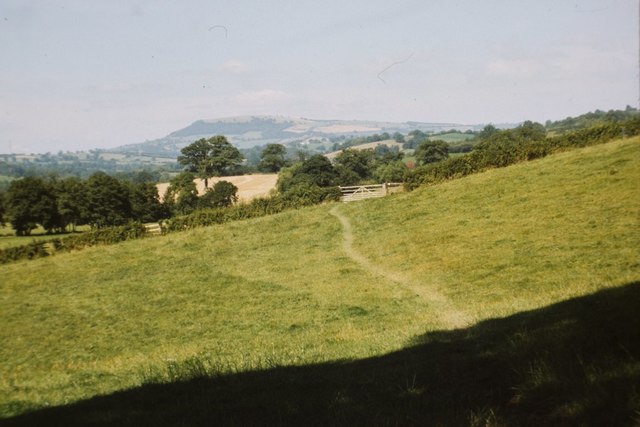
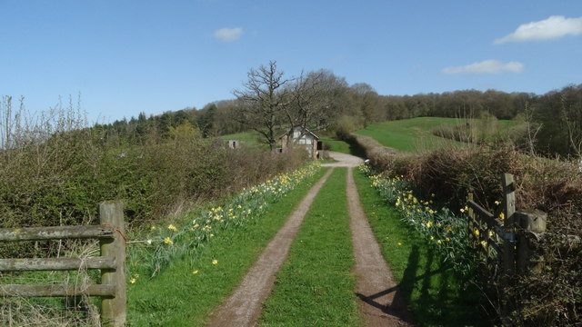
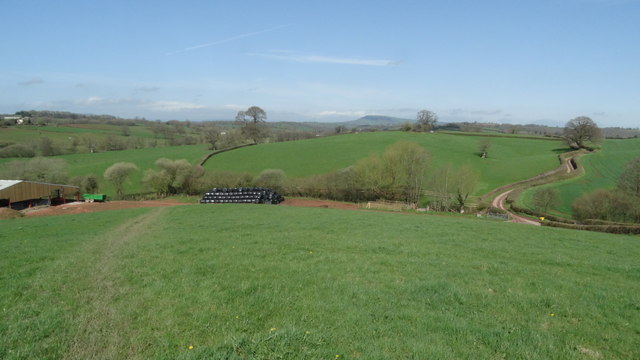
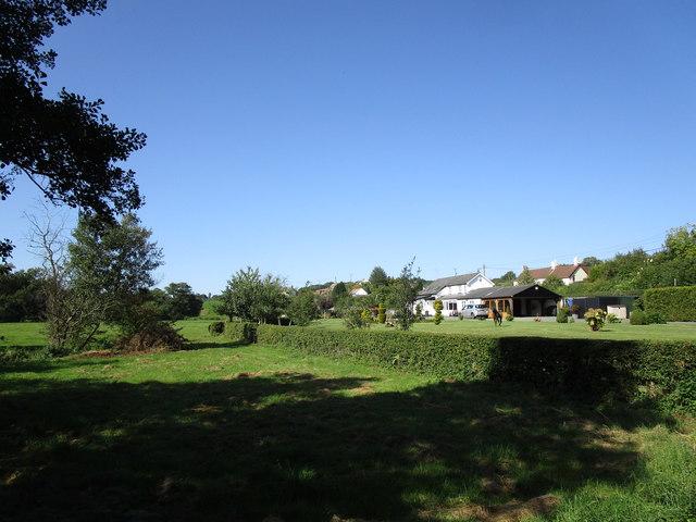
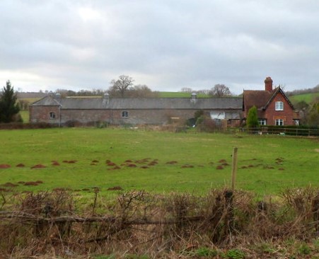
Dingle Wood is a picturesque woodland located in Monmouthshire, Wales. Situated near the village of Dingle, the wood covers an area of approximately 50 acres and is known for its diverse range of flora and fauna.

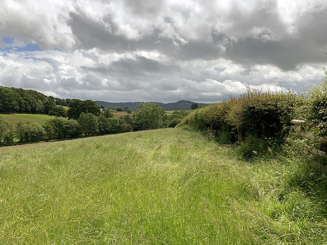
The woodland is primarily composed of native tree species such as oak, beech, and ash, creating a rich and vibrant habitat. The dense canopy formed by these trees provides a cool and shady environment, perfect for a peaceful walk or a picnic. Throughout the wood, there are well-maintained footpaths that allow visitors to explore its beauty while respecting the natural surroundings.

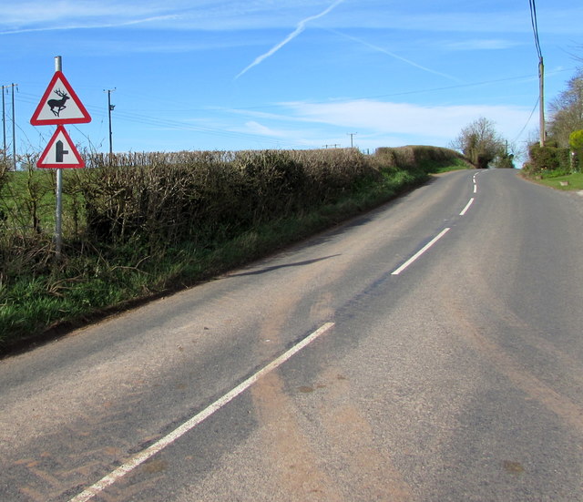
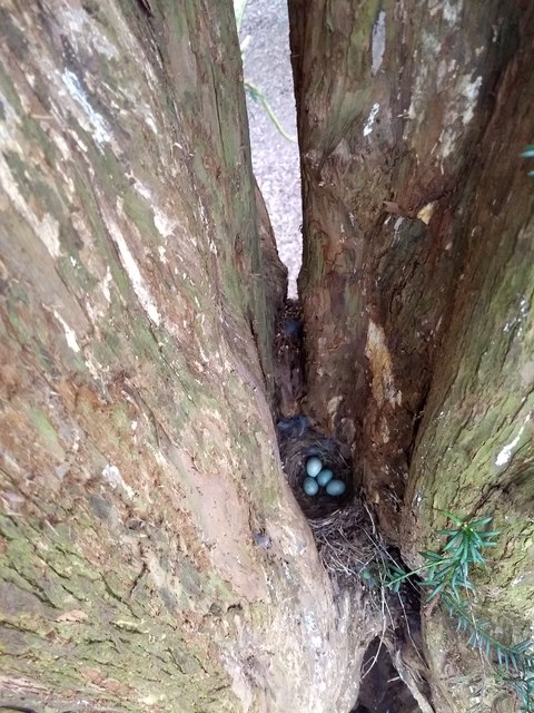
Dingle Wood is home to a variety of wildlife, including birds, mammals, and insects. Birdwatchers will delight in the opportunity to spot species such as woodpeckers, owls, and various songbirds. The woodland also provides a habitat for small mammals like squirrels, rabbits, and even the occasional deer.

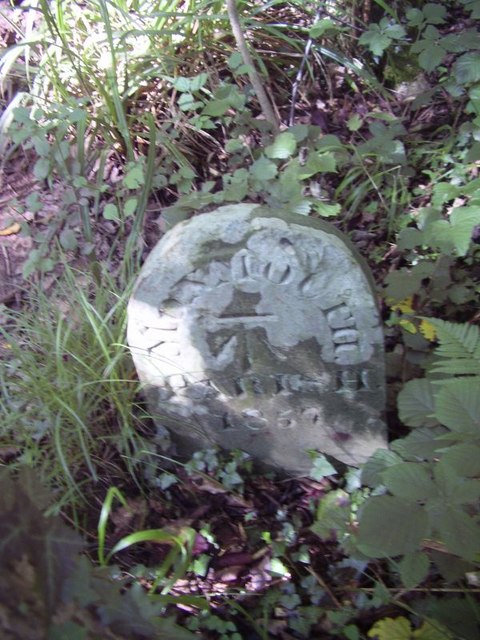
In addition to its natural beauty, Dingle Wood has historical significance. It is believed that the wood has been present for centuries, and it is often associated with local folklore and legends. The tranquility and peacefulness of the wood make it an ideal place for nature lovers, photographers, and those seeking a calming escape from the hustle and bustle of everyday life.

Dingle Wood is easily accessible and offers ample parking facilities for visitors. Whether you are looking for a leisurely stroll, a family outing, or a chance to immerse yourself in nature, Dingle Wood in Monmouthshire is a destination that should not be missed.

If you have any feedback on the listing, please let us know in the comments section below.

Dingle Wood Images

Images are sourced within 2km of 51.810316/-2.7706313 or Grid Reference SO4612. Thanks to Geograph Open Source API. All images are credited.

West along the B4233 towards Hendre, Monmouthshire Extending for 23km (c14 miles) from Monmouth to Abergavenny, the B4233 is a rural B-road in Monmouthshire.
West along the B4233 towards Hendre, Monmouthshire
Extending for 23km (c14 miles) from Monmouth to Abergavenny, the B4233 is a rural B-road in Monmouthshire.
East along the B4233 towards Rockfield, Monmouthshire Extending for 23km (c14 miles) from Abergavenny to Monmouth, the B4233 is a rural B-road in Monmouthshire.
Ahead for Monmouth via Rockfield.
East along the B4233 towards Rockfield, Monmouthshire
Extending for 23km (c14 miles) from Abergavenny to Monmouth, the B4233 is a rural B-road in Monmouthshire. Ahead for Monmouth via Rockfield.
Warning signs alongside the B4233 near Hendre, Monmouthshire Warning of a minor road junction ahead (a certainty) and deer in the road (a possibility), the signs are alongside the B4233, a rural B-road in Monmouthshire extending for 23km (c14 miles) from Monmouth to Abergavenny.
Warning signs alongside the B4233 near Hendre, Monmouthshire
Warning of a minor road junction ahead (a certainty) and deer in the road (a possibility), the signs are alongside the B4233, a rural B-road in Monmouthshire extending for 23km (c14 miles) from Monmouth to Abergavenny.
Muddy field entrance near Hendre, Monmouthshire On the north side of the B4233, a rural B-road in Monmouthshire extending for 23km (c14 miles) from Monmouth to Abergavenny.
Muddy field entrance near Hendre, Monmouthshire
On the north side of the B4233, a rural B-road in Monmouthshire extending for 23km (c14 miles) from Monmouth to Abergavenny.
Direction and distances signs on a bank near Hendre, Monmouthshire Opposite this <a title="https://www.geograph.org.uk/photo/5324617" href="https://www.geograph.org.uk/photo/5324617">Link</a> junction, half-a-mile from Hendre.
Direction and distances signs on a bank near Hendre, Monmouthshire
Opposite this Link junction, half-a-mile from Hendre.
Queen Elizabeth II postbox and the shell of its predecessor near Hendre, Monmouthshire Viewed in late March 2017. The modern postbox alongside the B4233 is 
in front of the shell of a King Edward VII postbox <a title="https://www.geograph.org.uk/photo/5324687" href="https://www.geograph.org.uk/photo/5324687">Link</a> in a small brick pillar.
Queen Elizabeth II postbox and the shell of its predecessor near Hendre, Monmouthshire
Viewed in late March 2017. The modern postbox alongside the B4233 is in front of the shell of a King Edward VII postbox Link in a small brick pillar.
Shell of a King Edward VII postbox near Hendre, Monmouthshire The remains of the old postbox are behind its modern replacement. <a title="https://www.geograph.org.uk/photo/5324679" href="https://www.geograph.org.uk/photo/5324679">Link</a>
Shell of a King Edward VII postbox near Hendre, Monmouthshire
The remains of the old postbox are behind its modern replacement. Link
Offa's Dyke path near Hendre Farm Taken in 1987. See here for a similar, but more recent view: <a href="https://www.geograph.org.uk/photo/167889">SO4512 : Offa's Dyke Path near River Trothy</a>.
Offa's Dyke path near Hendre Farm
Taken in 1987. See here for a similar, but more recent view: SO4512 : Offa's Dyke Path near River Trothy.
Treowen Treowen is a Jacobean manor house built around the 1620s for William Jones.  Later in the 17th century the Jones family built Llanarth Court near Abergavenny and moved out, as a result the house has remained little changed, though it has lost the top floor on the south side of the house.  The top floor may originally have been a Long Gallery.  The house is Grade I listed.  In this view in the foreground in the garden is a sundial.  The house is a member of the Historic Houses Association and is open each year for a few days.
Treowen
Treowen is a Jacobean manor house built around the 1620s for William Jones. Later in the 17th century the Jones family built Llanarth Court near Abergavenny and moved out, as a result the house has remained little changed, though it has lost the top floor on the south side of the house. The top floor may originally have been a Long Gallery. The house is Grade I listed. In this view in the foreground in the garden is a sundial. The house is a member of the Historic Houses Association and is open each year for a few days.
Treowen Treowen is a Jacobean manor house built around the 1620s for William Jones. Later in the 17th century the Jones family built Llanarth Court near Abergavenny and moved out, as a result the house has remained little changed, though it has lost the top floor on the south side of the house. The top floor may originally have been a Long Gallery. The house is Grade I listed.  The house is a member of the Historic Houses Association and is open each year for a few days.
Treowen
Treowen is a Jacobean manor house built around the 1620s for William Jones. Later in the 17th century the Jones family built Llanarth Court near Abergavenny and moved out, as a result the house has remained little changed, though it has lost the top floor on the south side of the house. The top floor may originally have been a Long Gallery. The house is Grade I listed. The house is a member of the Historic Houses Association and is open each year for a few days.
Boundary stone with bench mark, Whitehill Wood near Monmouth
Track to Backway House, Worthybrook
On Offa's Dyke Path, NW of Hendre Farm, Worthybrook
Old Milestone by the B4233, Steppes Farm Cottages, Llangattock Vibon Avel Stone post by the B4233, in parish of Llangattock Vibon Avel (Monmouthshire District), West of Steppes Farm Cottages, North side of road.

Inscription once read:-
: (Abergavenny / 11) : : (Monmouth / 3) :
  
Surveyed

Milestone Society National ID: MON_MMAG03
Old Milestone by the B4233, Steppes Farm Cottages, Llangattock Vibon Avel
Stone post by the B4233, in parish of Llangattock Vibon Avel (Monmouthshire District), West of Steppes Farm Cottages, North side of road. Inscription once read:- : (Abergavenny / 11) : : (Monmouth / 3) : Surveyed Milestone Society National ID: MON_MMAG03
Old Boundary Marker in Kingswood, Monmouth parish Parish Boundary Marker in parish of Monmouth (Monmouthshire District), Kingswood, 1600m Northeast of Lower Hendre.

Inscription reads:-
MONMOUTH
PARISH
1857
Carved bench mark on centre face.

Surveyed

Milestone Society National ID: MON_MON01pb
Old Boundary Marker in Kingswood, Monmouth parish
Parish Boundary Marker in parish of Monmouth (Monmouthshire District), Kingswood, 1600m Northeast of Lower Hendre. Inscription reads:- MONMOUTH PARISH 1857 Carved bench mark on centre face. Surveyed Milestone Society National ID: MON_MON01pb
Farmland above Lower Hendre Seen from the route of Offa's Dyke Path.
Farmland above Lower Hendre
Seen from the route of Offa's Dyke Path.
Blackbird Nest in spruce tree crevice
Jingle Street
Jingle Street
Show me another place!

Dingle Wood is located at Grid Ref: SO4612 (Lat: 51.810316, Lng: -2.7706313)

Unitary Authority: Monmouthshire

Police Authority: Gwent

What 3 Words

///hurry.gradually.rejects. Near Mitchel Troy, Monmouthshire

Related Wikis

White Hill, Monmouth

White Hill is a hill rising to over 205 metres (673 ft) to the west of the town of Monmouth, South Wales and north of Wonastow. Much of it is covered by...
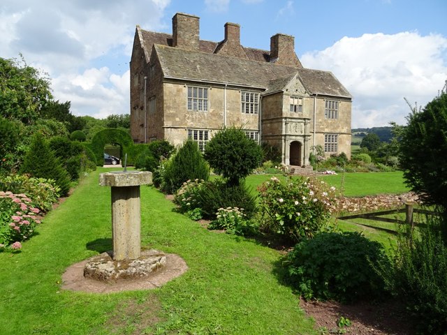
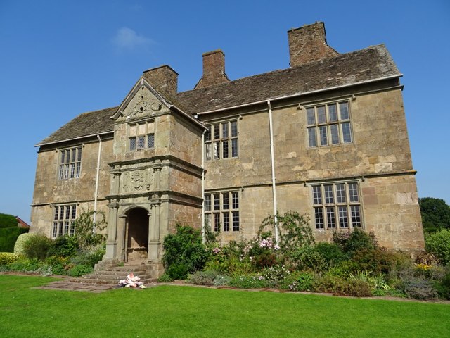
Treowen

Treowen (or Tre-owen) is an early 17th-century house in Monmouthshire, Wales, regarded as "the most important gentry house (of its date) in the county...

The Hendre

The Hendre, (Welsh: Yr Hendre a farmer's winter residence; literally meaning old home) in Rockfield, is the only full-scale Victorian country house in...

Grace Dieu Abbey, Monmouth

Grace Dieu Abbey was a small Cistercian abbey established in 1226 near to the town of Monmouth in south east Wales. No remains of its buildings can now...

Swiss Cottage, Rockfield

The Swiss Cottage, Rockfield, Monmouthshire is a gatehouse to The Hendre estate and was designed by Sir Aston Webb in 1905. It is a Grade II* listed building...

Wonastow

Wonastow (Welsh: Llanwarw) is a village in Monmouthshire, south east Wales. It is located 2 miles (3.2 km) south west of Monmouth. == History and amenities... ==

Croft-Y-Bwla

Croft-Y-Bwla is a country house and farm 1.5 miles (2.4 km) north-west of Monmouth, south-east Wales. The house was built around 1830 and was designed...

Rockfield Studios

Rockfield Studios is a residential recording studio located in the Wye Valley just outside the village of Rockfield, Monmouthshire, Wales. It was originally...

Related Videos

A day at harry potter studio

Like and Subscribe for more content!

How to get a job at Rockfield Studios! - Session Recall Podcast

In this first episode of the podcast Jon and Nick talk about Nick's early years starting out as an assistant at Rockfield Studios, the ...

CityLightz - My Life - Rockfield Studios

Filmed at Rockfield Studios Follow Citylightz on... Spotify: https://open.spotify.com/artist/3Bz1J​... Facebook: ...

Bikers vs Barbed Wire

This is the second time that I've encountered wire strung accross a right of way. I don't think it was done out of malice (the field ...

Have you been to Dingle Wood?

Leave your review of Dingle Wood below (or comments, questions and feedback).