Coed Canol

Wood, Forest in Monmouthshire

Wales

Coed Canol

Bridge over the A449
Bridge over the A449 Credit: Anthony Parkes

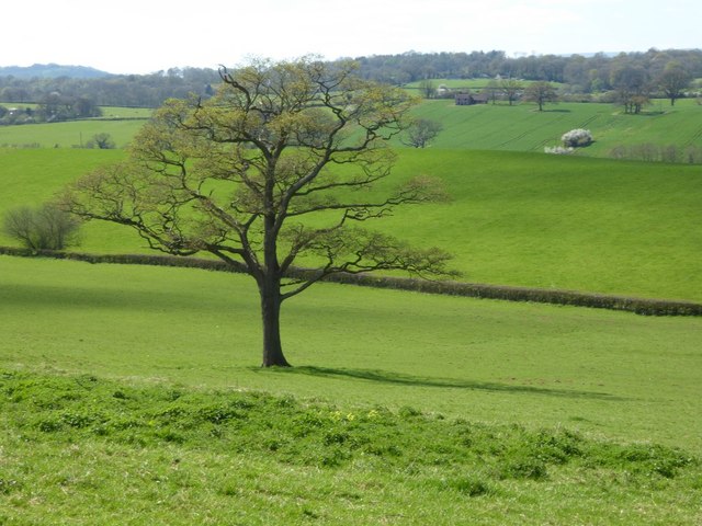
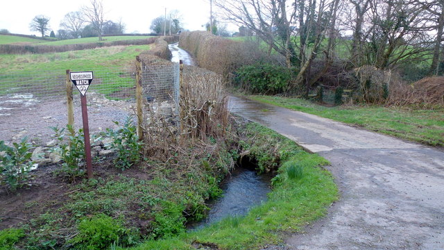
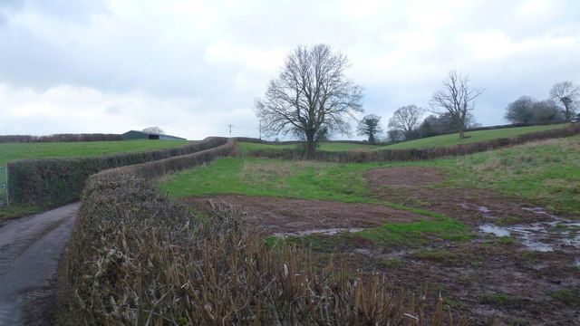
Coed Canol, located in Monmouthshire, Wales, is a picturesque woodland area spread across an approximate area of 100 hectares. The name "Coed Canol" translates to "Middle Wood" in English, aptly describing its central location within the county. This enchanting forest is nestled amidst the rolling hills and lush green landscapes of Monmouthshire, attracting nature enthusiasts and visitors seeking tranquility.

The wood is characterized by its diverse flora and fauna, comprising a mix of broadleaf and coniferous trees. Ancient oaks, beeches, and ash trees dominate the woodland, creating a dense canopy that provides shelter and habitat for various wildlife species. Coed Canol is home to a rich array of birdlife, including woodpeckers, owls, and thrushes, as well as mammals like badgers, foxes, and deer.

Visitors can explore the forest through a network of well-maintained walking trails, allowing them to immerse themselves in the natural beauty of the surroundings. The paths wind through the woods, offering glimpses of wildflowers, ferns, and moss-covered rocks along the way. The tranquil atmosphere and the soothing sounds of babbling brooks make Coed Canol an ideal destination for hikers, nature photographers, and those seeking a peaceful retreat.

Additionally, the woodland also serves as an outdoor classroom, providing educational opportunities for schools and organizations interested in learning about the local ecosystem. Interpretive signs dot the trails, offering information about the forest's history, ecology, and conservation efforts.

Overall, Coed Canol in Monmouthshire is a captivating woodland retreat that offers visitors a chance to connect with nature, discover the region's biodiversity, and enjoy the serenity of the great outdoors.

If you have any feedback on the listing, please let us know in the comments section below.

Coed Canol Images

Images are sourced within 2km of 51.717174/-2.8796096 or Grid Reference SO3902. Thanks to Geograph Open Source API. All images are credited.

Bridge over the A449
Lay-by and minor road crossing A449 near Lanolway Farm
A tree showing signs of spring The leaves are beginning to emerge on this tree in a field to the north of Cefntilla Court.  Barely visible in the picture is what appears to be an abandoned cottage in the distance to the right of the tree.
A tree showing signs of spring
The leaves are beginning to emerge on this tree in a field to the north of Cefntilla Court. Barely visible in the picture is what appears to be an abandoned cottage in the distance to the right of the tree.
Footpath to Llandenny Gate into a field with a footpath sign and footpath to Llandenny.
Footpath to Llandenny
Gate into a field with a footpath sign and footpath to Llandenny.
Llangeview Lodge near Usk, Monmouthshire Dog friendly <a title="https://www.geograph.org.uk/photo/5716203" href="https://www.geograph.org.uk/photo/5716203">Link</a> country pub & restaurant with accommodation (eleven bed & breakfast rooms) alongside 
the B4235 Chepstow Road viewed in March 2018. Formerly the Rat Trap seen here <a title="https://www.geograph.org.uk/photo/1080069" href="https://www.geograph.org.uk/photo/1080069">Link</a> in 2008.
Llangeview Lodge near Usk, Monmouthshire
Dog friendly Link country pub & restaurant with accommodation (eleven bed & breakfast rooms) alongside the B4235 Chepstow Road viewed in March 2018. Formerly the Rat Trap seen here Link in 2008.
Chepstow Road towards Usk, Monmouthshire The B4235 Chepstow Road passes Llangeview Lodge. <a title="https://www.geograph.org.uk/photo/5716180" href="https://www.geograph.org.uk/photo/5716180">Link</a>
Chepstow Road towards Usk, Monmouthshire
The B4235 Chepstow Road passes Llangeview Lodge. Link
Field between the B4235 and A449 near Usk, Monmouthshire Viewed from a field gate at the edge of the B4235 Chepstow Road near Llangeview Lodge. <a title="https://www.geograph.org.uk/photo/5716180" href="https://www.geograph.org.uk/photo/5716180">Link</a>
Field between the B4235 and A449 near Usk, Monmouthshire
Viewed from a field gate at the edge of the B4235 Chepstow Road near Llangeview Lodge. Link
Chepstow Road towards Gwernesney, Monmouthshire Looking to the ENE along the B4235 Chepstow Road. Llangeview Lodge <a title="https://www.geograph.org.uk/photo/5716180" href="https://www.geograph.org.uk/photo/5716180">Link</a> is behind the camera.
Chepstow Road towards Gwernesney, Monmouthshire
Looking to the ENE along the B4235 Chepstow Road. Llangeview Lodge Link is behind the camera.
Dog Friendly Pub sign at the edge of Llangeview Lodge near Usk, Monmouthshire Alongside the B4235 Chepstow Road at the edge of Llangeview Lodge. <a title="https://www.geograph.org.uk/photo/5716180" href="https://www.geograph.org.uk/photo/5716180">Link</a>
Dog Friendly Pub sign at the edge of Llangeview Lodge near Usk, Monmouthshire
Alongside the B4235 Chepstow Road at the edge of Llangeview Lodge. Link
Usk Showground entrance near Gwernesney, Monmouthshire Entrance to the 100 acre showground site from the B4235 Chepstow Road, about 3km (c2 miles) from the centre of Usk. Usk Showground is the location of the Usk Show which celebrates Monmouthshire farming and rural life. Organised by Usk Farmers' Club, Usk Show has been held on the second Saturday in September every year since 1844. It is now one of the biggest one-day agricultural shows in the UK.
Usk Showground entrance near Gwernesney, Monmouthshire
Entrance to the 100 acre showground site from the B4235 Chepstow Road, about 3km (c2 miles) from the centre of Usk. Usk Showground is the location of the Usk Show which celebrates Monmouthshire farming and rural life. Organised by Usk Farmers' Club, Usk Show has been held on the second Saturday in September every year since 1844. It is now one of the biggest one-day agricultural shows in the UK.
Road into Usk Showground near Gwernesney, Monmouthshire Viewed from these gates. <a title="https://www.geograph.org.uk/photo/5716220" href="https://www.geograph.org.uk/photo/5716220">Link</a>
Road into Usk Showground near Gwernesney, Monmouthshire
Viewed from these gates. Link
Gwernesney boundary sign, Monmouthshire The B4235 Chepstow Road from Usk reaches the small village of Gwernesney  (Gwernesni in Welsh).
The National Speed Limit drops to 40mph.
Gwernesney boundary sign, Monmouthshire
The B4235 Chepstow Road from Usk reaches the small village of Gwernesney (Gwernesni in Welsh). The National Speed Limit drops to 40mph.
Warning sign - bend ahead, Chepstow Road, Gwernesney, Monmouthshire On the approach to a bend in the B4235 Chepstow Road at the Monmouth Road junction.
Warning sign - bend ahead, Chepstow Road, Gwernesney, Monmouthshire
On the approach to a bend in the B4235 Chepstow Road at the Monmouth Road junction.
End of the 40mph speed limit beyond Gwernesney, Monmouthshire The speed limit on the B4235 Chepstow Road towards Usk increases to the National Speed Limit. 
The grey back of the Gwernesney boundary sign <a title="https://www.geograph.org.uk/photo/5716261" href="https://www.geograph.org.uk/photo/5716261">Link</a> is on the right.
End of the 40mph speed limit beyond Gwernesney, Monmouthshire
The speed limit on the B4235 Chepstow Road towards Usk increases to the National Speed Limit. The grey back of the Gwernesney boundary sign Link is on the right.
Chepstow Road towards Gwernesney, Monmouthshire The B4235 Chepstow Road approaches the Gwernesney village boundary sign. <a title="https://www.geograph.org.uk/photo/5716261" href="https://www.geograph.org.uk/photo/5716261">Link</a>
Chepstow Road towards Gwernesney, Monmouthshire
The B4235 Chepstow Road approaches the Gwernesney village boundary sign. Link
Raglan Road Looking north towards Raglan (the original A449) at the entrance to Park House.
Footpath sign to Coed Canol on the other side of the road.
Raglan Road
Looking north towards Raglan (the original A449) at the entrance to Park House. Footpath sign to Coed Canol on the other side of the road.
Track and bridleway Towards The Poplars Farm, crossing the Cayo Brook in the foreground.
Track and bridleway
Towards The Poplars Farm, crossing the Cayo Brook in the foreground.
Wet fields by the lane to Gwehelog Common Looking north-west.
Wet fields by the lane to Gwehelog Common
Looking north-west.
Show me another place!

Coed Canol is located at Grid Ref: SO3902 (Lat: 51.717174, Lng: -2.8796096)

Unitary Authority: Monmouthshire

Police Authority: Gwent

What 3 Words

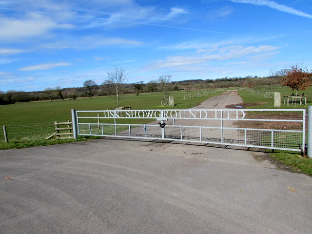
///shippers.carver.budget. Near Usk, Monmouthshire

Nearby Locations

Coed Canol Little Wood

Related Wikis

Cefntilla Court

Cefn Tilla Court, Llandenny, Monmouthshire, Wales, is a country house dating from the mid-19th century. Its origins date from 1616. During the English...

Cefntilla Halt railway station

Cefntilla Halt was a request stop on the former Coleford, Monmouth, Usk and Pontypool Railway. It was opened on 27 March 1954 and was open for less than...

Gwehelog

Gwehelog is a village settlement in the community of Llanarth, in Monmouthshire, south east Wales. == Location == Gwehelog is located 2 miles (3.2 km)...

St David's Church, Llangeview

St David's Church, Llangeview, is a redundant church sited in a round churchyard adjacent to the junction of the A449 and A472 roads 1 mile (1.6 km) to...

Castle House, Usk

Castle House in Usk, Monmouthshire, Wales, originally formed the gatehouse to Usk Castle. Much altered in the eighteenth and nineteenth centuries, it is...

Usk Castle

Usk Castle (Welsh: Castell Brynbuga) is a castle site in the town of Usk in central Monmouthshire, south east Wales, United Kingdom. It was listed Grade...

Usk

Usk (Welsh: Brynbuga) is a town and community in Monmouthshire, Wales, 10 miles (16 km) northeast of Newport. It is located on the River Usk, which is...

Priory Church of St Mary, Usk

The Priory Church of St Mary is the parish church of Usk, Monmouthshire, Wales. Its origin was as the church of Usk Priory, a Benedictine nunnery founded...

Nearby Amenities

Located within 500m of 51.717174,-2.8796096
Direction: WSW
Generator Method: photovoltaic
Generator Output Electricity: yes
Generator Solar Modules: 6
Generator Source: solar
Generator Type: solar_photovoltaic_panel
Location: roof
Power: generator
Lat/Long: 51.7210858/-2.8831789
Direction: WSW
Generator Method: photovoltaic
Generator Output Electricity: yes
Generator Solar Modules: 10
Generator Source: solar
Generator Type: solar_photovoltaic_panel
Location: roof
Power: generator
Lat/Long: 51.7210705/-2.8832124
Direction: SW
Generator Method: photovoltaic
Generator Output Electricity: yes
Generator Solar Modules: 10
Generator Source: solar
Generator Type: solar_photovoltaic_panel
Location: roof
Power: generator
Lat/Long: 51.721161/-2.8808219
Bus Stop
Park House (opposite)
Bus: yes
Naptan AtcoCode: 5330AWB32003
Network: Newport Bus
Operator: Newport Bus
Public Transport: platform
Ref: gwemgdt
Lat/Long: 51.7157252/-2.8838657
Bus Stop
Orchard House (outside)
Bus: yes
Naptan AtcoCode: 5330AWB32002
Network: Newport Bus
Operator: Newport Bus
Public Transport: platform
Ref: gwemgdp
Lat/Long: 51.7155661/-2.8840705
The data included in this document is from www.openstreetmap.org. The data is made available under ODbL.

Have you been to Coed Canol?

Leave your review of Coed Canol below (or comments, questions and feedback).