Wood Garden

Wood, Forest in Radnorshire

Wales

Wood Garden

Harley's Mountain looking south-east from the lane, across Boresford Farm
Harley's Mountain Credit: Andrew Longton

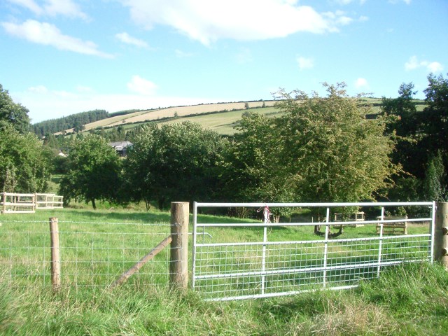
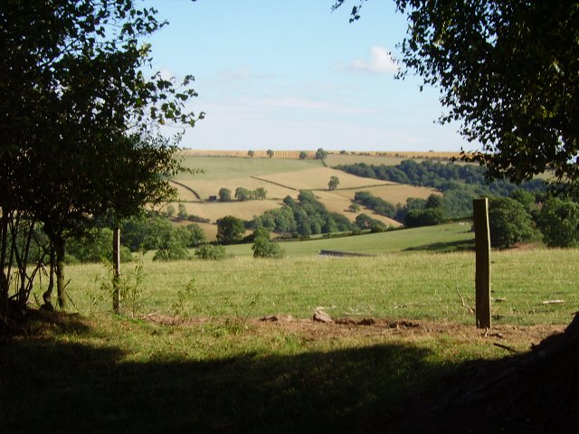
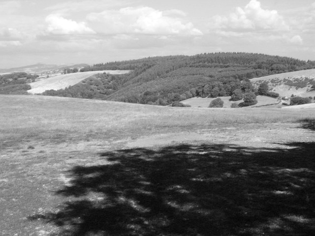
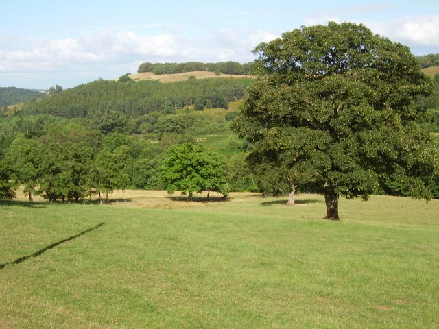
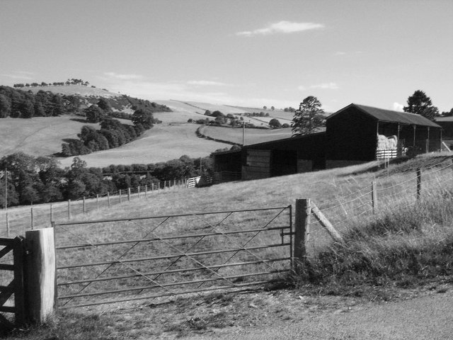
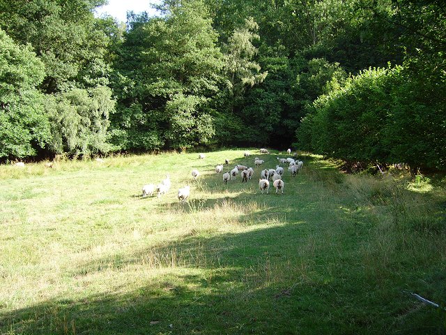
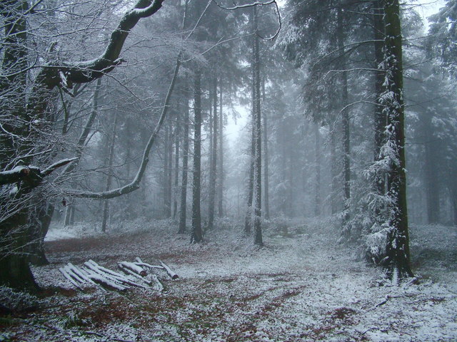
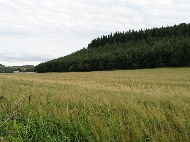
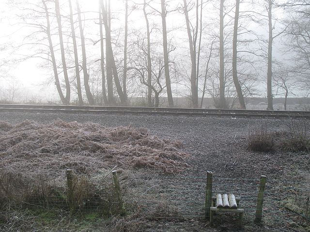
Wood Garden is a picturesque forest located in Radnorshire, Wales. Covering an area of approximately 100 acres, this woodland paradise is home to a diverse range of flora and fauna, making it a popular destination for nature lovers and outdoor enthusiasts.

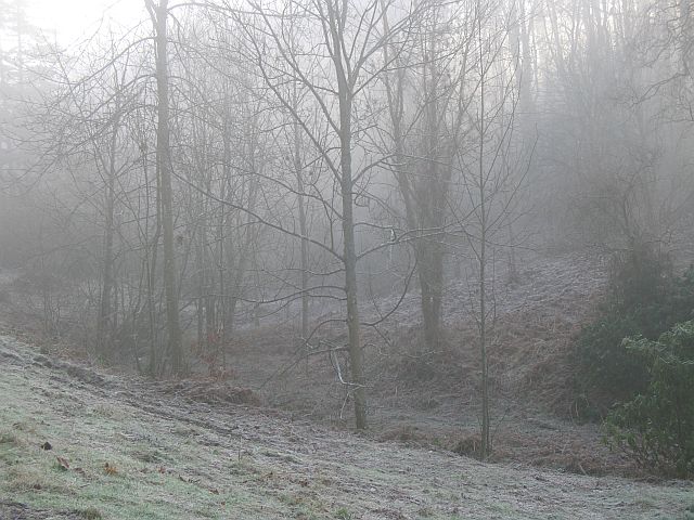
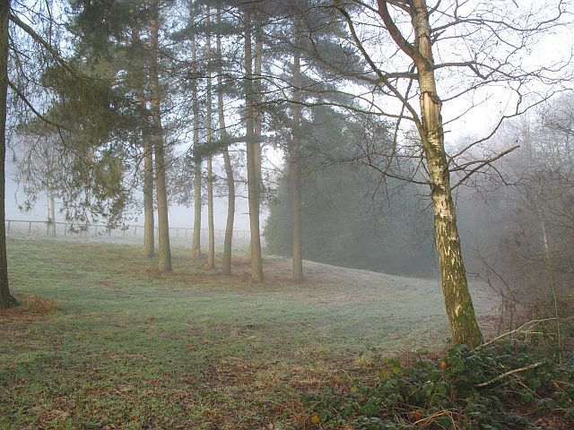
The forest is characterized by a mix of broadleaf and coniferous trees, creating a rich tapestry of colors throughout the seasons. Visitors can expect to see a variety of native plants, including bluebells, wild garlic, and ferns, as well as an abundance of wildlife such as birds, deer, and squirrels.

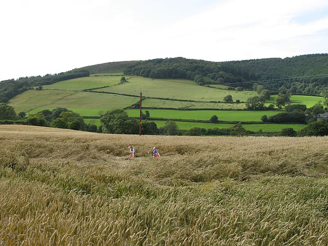
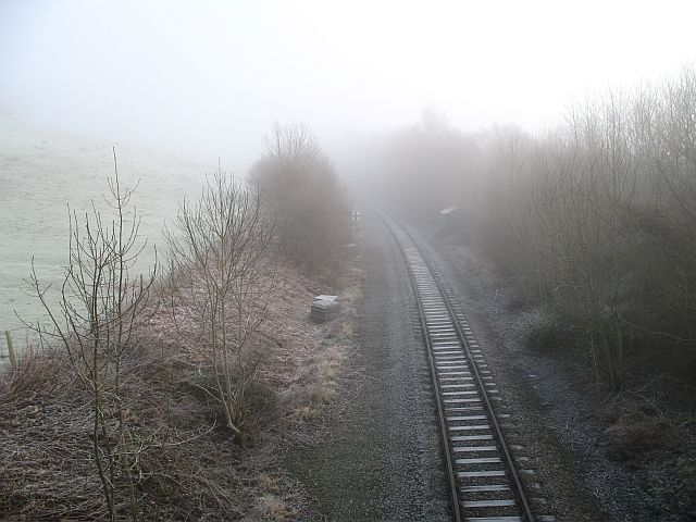
Wood Garden offers visitors a range of activities to enjoy, including hiking trails, birdwatching, and picnicking areas. The peaceful surroundings make it an ideal spot for relaxation and contemplation, allowing visitors to escape the hustle and bustle of everyday life.

Whether you're looking to explore the natural beauty of the forest, or simply unwind in a tranquil setting, Wood Garden in Radnorshire is sure to leave a lasting impression on all who visit.

If you have any feedback on the listing, please let us know in the comments section below.

Wood Garden Images

Images are sourced within 2km of 52.341254/-2.9808083 or Grid Reference SO3371. Thanks to Geograph Open Source API. All images are credited.

Harley's Mountain looking south-east from the lane, across Boresford Farm
Harley's Mountain
looking south-east from the lane, across Boresford Farm
Access To Water Part of the Elan Valley Aqueduct that feeds drinking water from Foel Tower Elan Valley to Frankley Reservoir in Birmingham, for more information visit: <a title="https://www.geograph.org.uk/photo/907757" href="https://www.geograph.org.uk/photo/907757">Link</a>
Access To Water
Part of the Elan Valley Aqueduct that feeds drinking water from Foel Tower Elan Valley to Frankley Reservoir in Birmingham, for more information visit: Link
ATV stile Stile crossed with a cattle grid. Sheep proof but accessible to a quad bike. Folly Farm near Knighton, Rads.
ATV stile
Stile crossed with a cattle grid. Sheep proof but accessible to a quad bike. Folly Farm near Knighton, Rads.
Through the gap View through a hedge into Herefordshire. From the hill road, high above Stanage, Radnorshire.
Through the gap
View through a hedge into Herefordshire. From the hill road, high above Stanage, Radnorshire.
Pedwardine Wood A distant view of the steep side of Pedwardine Wood. When I mapped some of it in the 1980's the steep facing slope was covered in mature Douglas Firs. They were cut down, and the new generation is growing fast. Part of the Brampton Bryan Estate and frequently used for orienteering. 
Taken from near Folly Farm over the border.
Pedwardine Wood
A distant view of the steep side of Pedwardine Wood. When I mapped some of it in the 1980's the steep facing slope was covered in mature Douglas Firs. They were cut down, and the new generation is growing fast. Part of the Brampton Bryan Estate and frequently used for orienteering. Taken from near Folly Farm over the border.
Field on the edge of Stanage Park Grassland, near Black Venn
Field on the edge of Stanage Park
Grassland, near Black Venn
Green Farm Cross border (Wales-England) view towards Brampton Bryan Park.
Green Farm
Cross border (Wales-England) view towards Brampton Bryan Park.
Green Farm Farm on the Radnorshire - Herefordshire border.
Green Farm
Farm on the Radnorshire - Herefordshire border.
Wales - England border. Taken leaning on a gate on the border, looking at a Herefordshire field.
Wales - England border.
Taken leaning on a gate on the border, looking at a Herefordshire field.
Stanage Park woodland Woodland along Stonewall Hill, North of Hill House Farm entrance
Stanage Park woodland
Woodland along Stonewall Hill, North of Hill House Farm entrance
Under Park Bank Barley under Park Bank Wood. The brick structure is an access to the Elan Valley Aqueduct.
Under Park Bank
Barley under Park Bank Wood. The brick structure is an access to the Elan Valley Aqueduct.
Teme Valley wheat Wheat and scarecrows, Lower Stanage, Rads.
Teme Valley wheat
Wheat and scarecrows, Lower Stanage, Rads.
Shrewsbury to Swansea railway near Bucknell Taken from the minor road on the Shropshire side of the Teme, the railway here was once double track. The railway is an amazing survivor, not only of Beeching, but of repeated attempts to close it during the 1980's and since.
Shrewsbury to Swansea railway near Bucknell
Taken from the minor road on the Shropshire side of the Teme, the railway here was once double track. The railway is an amazing survivor, not only of Beeching, but of repeated attempts to close it during the 1980's and since.
Bucknell to Stowe Road Lane on the Shropshire side of the Teme. Very narrow with few passing places. If on a bike, this is preferable to the fast A road on the Radnorshire side.
Bucknell to Stowe Road
Lane on the Shropshire side of the Teme. Very narrow with few passing places. If on a bike, this is preferable to the fast A road on the Radnorshire side.
Shrewsbury to Swansea railway near Stowe The railway runs beside the Teme, just visible.
Shrewsbury to Swansea railway near Stowe
The railway runs beside the Teme, just visible.
Woodland, Stanage Park Stanage Park is mostly woodland, with large clearings. Pegs were out for pheasant shooting.
Woodland, Stanage Park
Stanage Park is mostly woodland, with large clearings. Pegs were out for pheasant shooting.
Stanage Park Woodland beside the road up to Stanage.
Stanage Park
Woodland beside the road up to Stanage.
Shrewsbury to Swansea railway near Bucknell Looking towards Bucknell, with a plate layers hut at the start of a cutting.
Shrewsbury to Swansea railway near Bucknell
Looking towards Bucknell, with a plate layers hut at the start of a cutting.
Show me another place!

Wood Garden is located at Grid Ref: SO3371 (Lat: 52.341254, Lng: -2.9808083)

Unitary Authority: Powys

Police Authority: Dyfed Powys

What 3 Words

///boldest.steamed.forensic. Near Bucknell, Shropshire

Related Wikis

Stanage Park

Stanage Park is a Grade II* listed Welsh country house set in a large park located some 3 miles (4.8 km) east of Knighton, Powys near the settlement of...

Heartsease, Knighton

Heartsease is a small settlement or hamlet in Powys, Wales. It is close to the border with England and lies near the junction of the two counties of Herefordshire...

Milebrook

Milebrook is a hamlet in Powys, Wales. == Location == Milebrook is located on a crossroads of the A4113 road almost alongside the Afon Tefeidiad that,...

Stowe, Shropshire

Stowe or Stow is a small village and civil parish in south Shropshire, England. The parish has a border with Wales and the Welsh town of Knighton is less...

Nearby Amenities

Located within 500m of 52.341254,-2.9808083
Park Bank
Natural: peak
Lat/Long: 52.3440679/-2.9847771
Stanage Park
Place: locality
Lat/Long: 52.3404695/-2.9792469
The data included in this document is from www.openstreetmap.org. The data is made available under ODbL.

Have you been to Wood Garden?

Leave your review of Wood Garden below (or comments, questions and feedback).