Coed Mawr

Wood, Forest in Monmouthshire

Wales

Coed Mawr

Glanfa Goetre / Goetre Wharf Cerddwyr yn cyrraedd Glanfa Goetre.

Walkers arriving at Goetre Wharf (trans. homestead in the wood)
Glanfa Goetre / Goetre Wharf Credit: Alan Richards

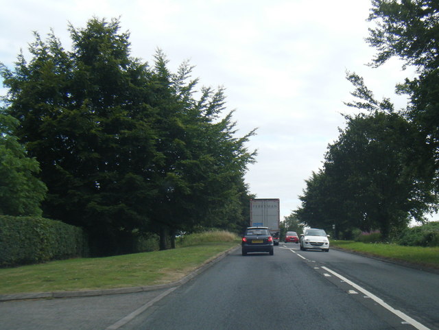
Coed Mawr is a woodland area located in Monmouthshire, Wales. Covering approximately 100 acres, this forest is a diverse ecosystem that is home to a variety of plant and animal species. The woodland consists mainly of oak, beech, and ash trees, creating a lush and vibrant environment for visitors to explore.

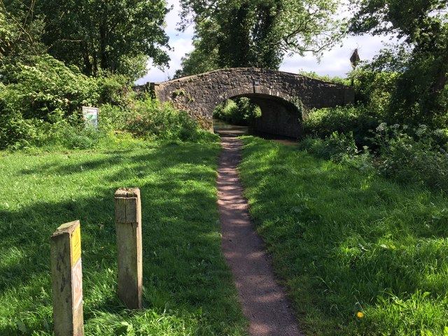
Coed Mawr offers a network of walking trails that wind through the forest, allowing visitors to immerse themselves in the natural beauty of the area. These trails provide opportunities for hiking, birdwatching, and wildlife spotting, making it a popular destination for nature enthusiasts and outdoor adventurers.

In addition to its natural beauty, Coed Mawr also has a rich cultural history. The forest is dotted with ancient monuments and ruins, including the remains of a medieval castle and a Roman road, offering visitors a glimpse into the area's past.

Overall, Coed Mawr is a picturesque and tranquil destination for those looking to escape the hustle and bustle of city life and reconnect with nature. Whether you are seeking a peaceful walk in the woods or a chance to explore the area's historical sites, Coed Mawr has something to offer for everyone.

If you have any feedback on the listing, please let us know in the comments section below.

Coed Mawr Images

Images are sourced within 2km of 51.753581/-2.9987638 or Grid Reference SO3106. Thanks to Geograph Open Source API. All images are credited.

Glanfa Goetre / Goetre Wharf Cerddwyr yn cyrraedd Glanfa Goetre.

Walkers arriving at Goetre Wharf (trans. homestead in the wood)
Glanfa Goetre / Goetre Wharf
Cerddwyr yn cyrraedd Glanfa Goetre. Walkers arriving at Goetre Wharf (trans. homestead in the wood)
Llwybr ger Ffarm y Pentre / Footpath near Pentre Farm Cerddwyr yn dilyn llwybr cyhoeddus ger Ffarm y Pentre.

Walkers following a public footpath near Pentre Farm (trans. village / main farm).
Llwybr ger Ffarm y Pentre / Footpath near Pentre Farm
Cerddwyr yn dilyn llwybr cyhoeddus ger Ffarm y Pentre. Walkers following a public footpath near Pentre Farm (trans. village / main farm).
Llwybr Pen y Stair Footpath Cerddwyr yn dilyn llwybr cyhoeddus heibio i anhedd-dy o'r enw Pen y Stair.

Walkers following a public footpath past a property known as Pen y Stair (trans. top of the stairs?)
Llwybr Pen y Stair Footpath
Cerddwyr yn dilyn llwybr cyhoeddus heibio i anhedd-dy o'r enw Pen y Stair. Walkers following a public footpath past a property known as Pen y Stair (trans. top of the stairs?)
Hen Geuffordd / Old Hollow Way Cerddwyr yn dringo ceuffordd hynafol uwchlaw annedd-dy o'r enw Pen y Stair.

Walkers ascending an ancient hollow way above a property called Pen y Stair (trans. top of the stairs?)
Hen Geuffordd / Old Hollow Way
Cerddwyr yn dringo ceuffordd hynafol uwchlaw annedd-dy o'r enw Pen y Stair. Walkers ascending an ancient hollow way above a property called Pen y Stair (trans. top of the stairs?)
Pant-y-goffry A farm in the middle of nowhere! Actually, Monmouthshire.
Pant-y-goffry
A farm in the middle of nowhere! Actually, Monmouthshire.
A4042 at Lianover village boundary
A4042 south of Llanover
A4042 southbound near Goytre Hall
A4042 at Capel Ed Lane junction
Landscape view from field next to bridge on Monmouthshire and Brecon Canal Corn field in August 2015, taken from near a bridge on the Monmouthshire and Brecon Canal (while on a walk from Goytre wharf).
Landscape view from field next to bridge on Monmouthshire and Brecon Canal
Corn field in August 2015, taken from near a bridge on the Monmouthshire and Brecon Canal (while on a walk from Goytre wharf).
Rape fields Near the Monmouthshire and Brecon Canal
Rape fields
Near the Monmouthshire and Brecon Canal
Canal cottages On the Monmouthshire and Brecon Canal
Canal cottages
On the Monmouthshire and Brecon Canal
A boathouse On the Monmouthshire and Brecon Canal
A boathouse
On the Monmouthshire and Brecon Canal
Bridge 80 On the Monmouthshire and Brecon Canal
Bridge 80
On the Monmouthshire and Brecon Canal
Brynhyfryd Farm In Llanover.
Brynhyfryd Farm
In Llanover.
Llanover park The parkland in the Llanover estate
Llanover park
The parkland in the Llanover estate
Hiking through the park On the Llanover Estate
Hiking through the park
On the Llanover Estate
Cottages on the Llanover Estate At Ty Uchaf
Cottages on the Llanover Estate
At Ty Uchaf
Show me another place!

Coed Mawr is located at Grid Ref: SO3106 (Lat: 51.753581, Lng: -2.9987638)

Unitary Authority: Monmouthshire

Police Authority: Gwent

What 3 Words

///gobbling.braked.rocky. Near Blaenavon, Torfaen

Related Wikis

Ty-Cooke Farmhouse, Mamhilad

Ty-Cooke Farmhouse, Mamhilad, Monmouthshire is a large farmhouse dating from 1710. The farmhouse forms a group with an earlier farmhouse, dating from circa...

Llanover

Llanover (; Welsh: Llanofer) Welsh pronunciation: [ɬaˈnɔvɛr] is a village in the community of Goetre Fawr in Monmouthshire, Wales. == Name == The name...

Goytre, Monmouthshire

Goytre (; Welsh: Goetre) is a village in the community of Goetre Fawr in Monmouthshire, south east Wales, United Kingdom. The population of the whole of...
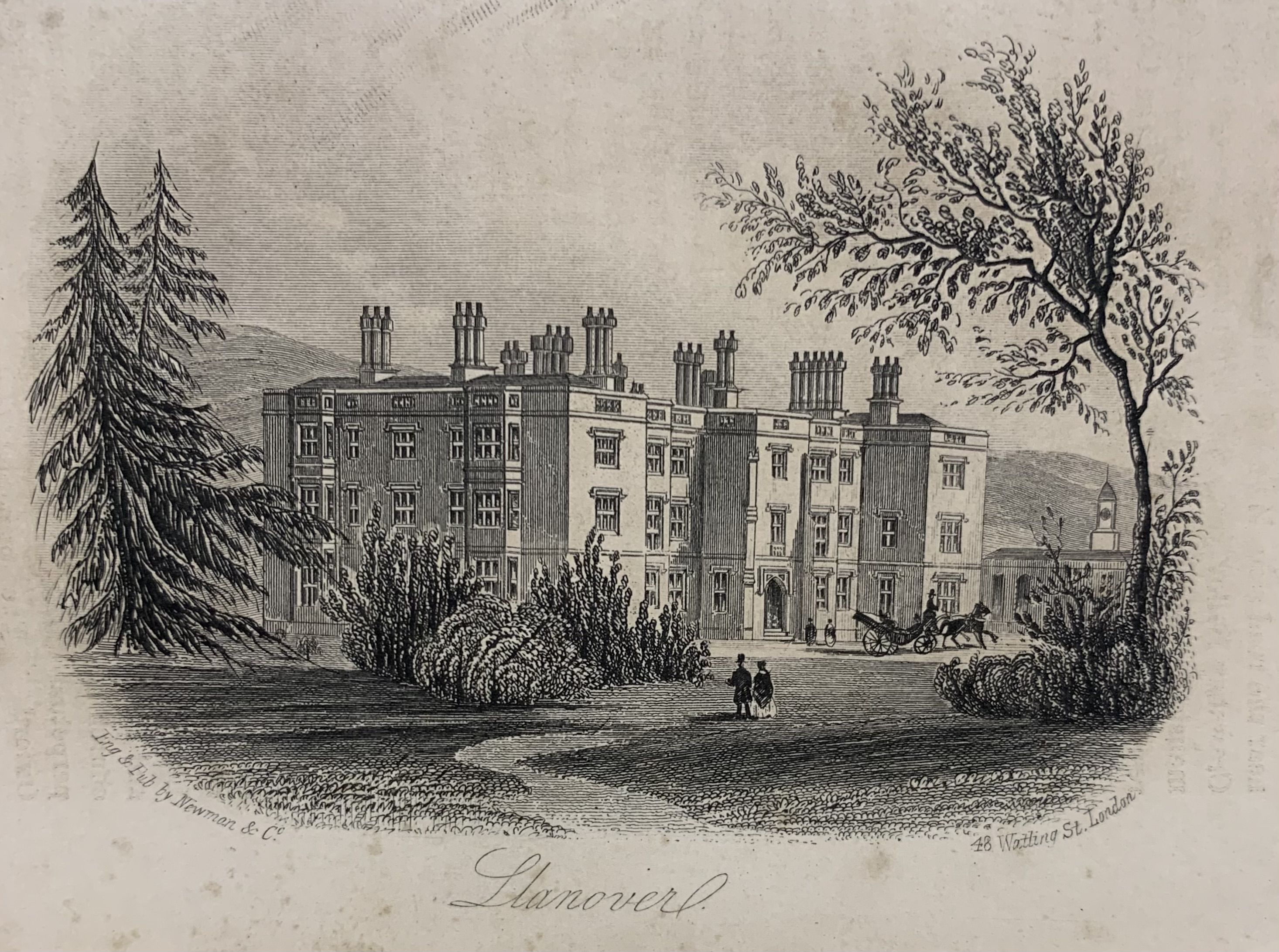
Llanover House

Llanover House, Llanover, Monmouthshire, Wales, was a country house dating from the mid-19th century. Commissioned by Augusta Waddington, and her husband...

Nearby Amenities

Located within 500m of 51.753581,-2.9987638
Cafe
Lat/Long: 51.752096/-2.9971343
Parking
Lat/Long: 51.7531321/-3.0000069
Parking
Lat/Long: 51.7525925/-2.9988429
Board Type: board
Information: board
Name Cy: Lana Goetre
Name En: Goytre Wharf
Tourism: information
Lat/Long: 51.7524863/-2.996788
Bench
Backrest: no
Lat/Long: 51.7516826/-2.9959091
Bench
Backrest: no
Lat/Long: 51.7517318/-2.9959334
Bench
Backrest: yes
Information: map
Map Type: scheme
Tourism: information
Lat/Long: 51.7521502/-2.9962269
Bench
Backrest: no
Lat/Long: 51.7569491/-2.9974422
B75
Note: Jenkin Rosser's Bridge
Lat/Long: 51.7550916/-2.9969981
Barrier: stile
Lat/Long: 51.7580201/-2.9980502
Waterway: water_point
Lat/Long: 51.751633/-2.9959261
Waterway: turning_point
Lat/Long: 51.755651/-2.9975915
The data included in this document is from www.openstreetmap.org. The data is made available under ODbL.

Have you been to Coed Mawr?

Leave your review of Coed Mawr below (or comments, questions and feedback).