Jim Crow's Wood
Wood, Forest in Monmouthshire
Wales
Jim Crow's Wood

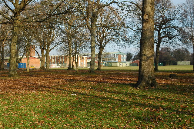
Jim Crow's Wood is a picturesque forest located in Monmouthshire, Wales. Covering an area of approximately 200 acres, this woodland is known for its diverse range of flora and fauna, making it a popular destination for nature enthusiasts and hikers alike.
The name "Jim Crow's Wood" is believed to have originated from a local legend or folklore that dates back several centuries. While the exact origins are uncertain, the name has stuck and become synonymous with the area. It is worth noting, however, that the term "Jim Crow" historically refers to the racial segregation laws enforced in the United States, and has no connection to the wood itself.
The wood boasts an impressive array of tree species, including oak, beech, birch, and conifers. These trees provide a lush and verdant canopy, creating a tranquil and serene atmosphere for visitors. The forest floor is adorned with a rich carpet of moss, ferns, and wildflowers, adding to the enchanting ambiance.
Wildlife enthusiasts will be delighted by the diverse range of animals that call Jim Crow's Wood their home. Birdwatchers can spot various species, such as woodpeckers, owls, and thrushes, while lucky visitors may even catch a glimpse of elusive mammals like badgers, foxes, and deer.
In addition to its natural beauty, Jim Crow's Wood offers a network of well-maintained walking trails, allowing visitors to explore the area at their own pace. Whether it's a leisurely stroll or a more challenging hike, the wood caters to all levels of fitness and provides breathtaking views of the surrounding countryside.
Overall, Jim Crow's Wood is a hidden gem in Monmouthshire, offering a peaceful retreat for those seeking solace in nature's embrace.
If you have any feedback on the listing, please let us know in the comments section below.
Jim Crow's Wood Images
Images are sourced within 2km of 51.655073/-3.0089272 or Grid Reference ST3095. Thanks to Geograph Open Source API. All images are credited.


Jim Crow's Wood is located at Grid Ref: ST3095 (Lat: 51.655073, Lng: -3.0089272)
Unitary Authority: Torfaen
Police Authority: Gwent
What 3 Words
///month.final.closed. Near Cwmbran, Torfaen
Nearby Locations
Related Wikis
Croesyceiliog School
Croesyceiliog School (Welsh: Ysgol Croes-y-ceiliog) is a state-funded secondary school in the Croesyceiliog area of Cwmbran, in South Wales, UK. ��2�...

Croesyceiliog A.F.C.
Croesyceiliog Association Football Club is a football club playing in Croesyceiliog, Cwmbran, Wales. They currently play in the Gwent County League Premier...

County Hall, Cwmbran
County Hall, Cwmbran (Welsh: Neuadd y Sir Cwmbrân) was a municipal facility on Turnpike Road in Croesyceiliog in Cwmbran in Wales. It was the headquarters...
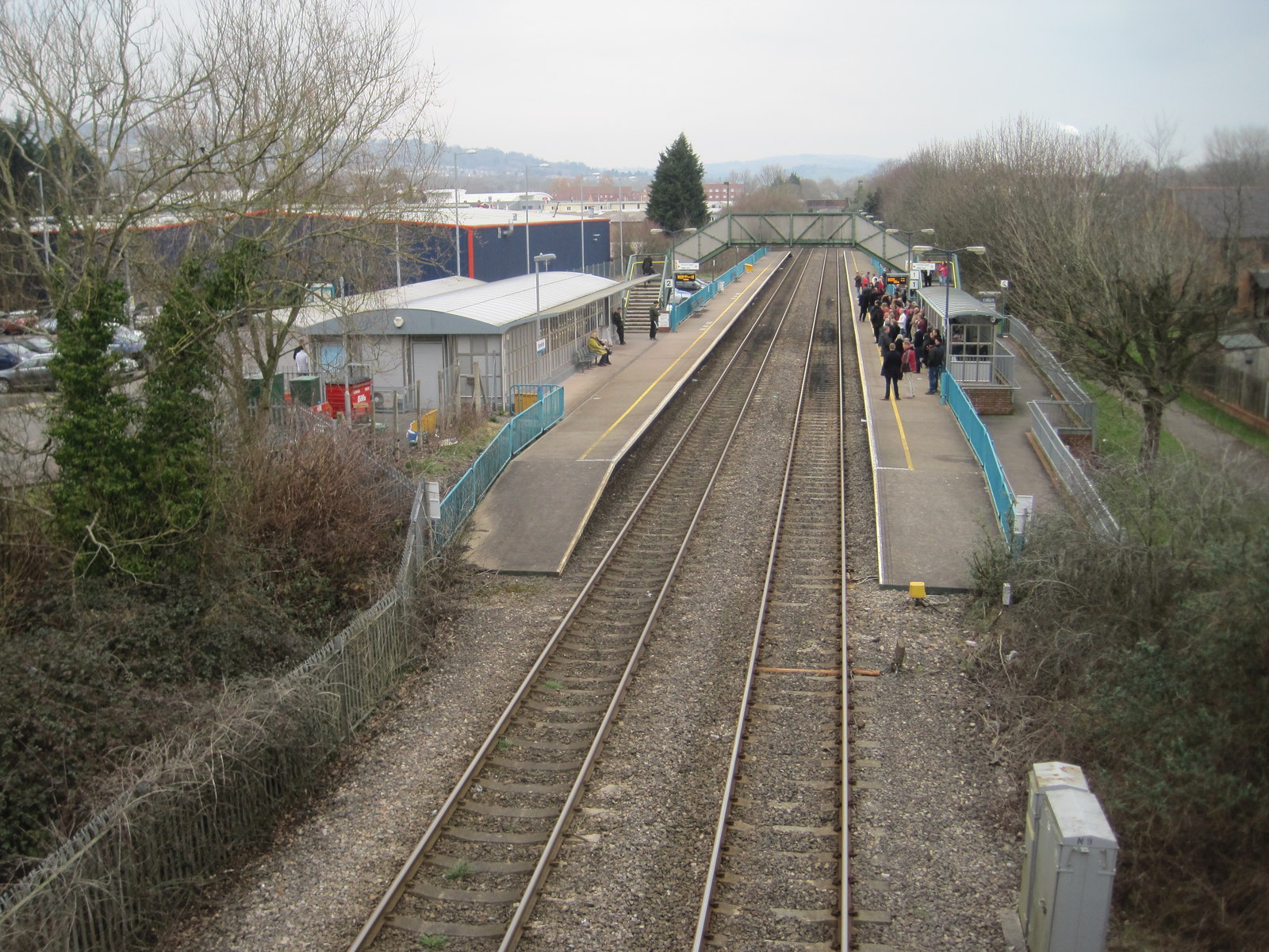
Cwmbran railway station
Cwmbran railway station (Welsh: Gorsaf Rheilffordd Cwmbrân) is in the northeast of Cwmbran town centre, within five minutes' walking distance. It is part...
Nearby Amenities
Located within 500m of 51.655073,-3.0089272Have you been to Jim Crow's Wood?
Leave your review of Jim Crow's Wood below (or comments, questions and feedback).