Allt-yr-yn

Wood, Forest in Monmouthshire

Wales

Allt-yr-yn

Northern edge of St Woolos Cemetery, Newport A small part of a large municipal cemetery. Most burials in Newport were originally in the churchyard of St Woolos cathedral, but by the middle of the 19th century this was totally inadequate for a town with a rapidly-growing population. 15 acres of land to the west of the cathedral, between Risca Road and Bassaleg Road, were obtained from the Tredegar Estate for the new St Woolos Cemetery, which opened in 1854.

It is the UK's oldest municipal cemetery. Its current dimensions are about 600 metres by 400 metres, roughly 60 acres.
Northern edge of St Woolos Cemetery, Newport Credit: Jaggery

Allt-yr-yn, located in Monmouthshire, Wales, is a small village known for its picturesque woodlands and enchanting forest landscapes. The name "Allt-yr-yn" translates to "wood" or "forest" in Welsh, which aptly describes the natural beauty that surrounds this tranquil village.

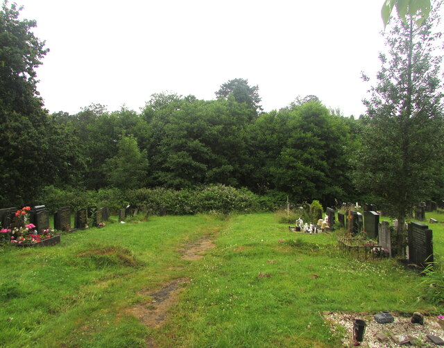
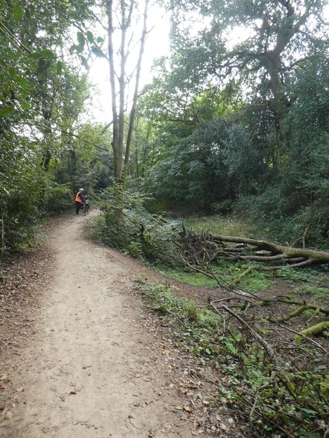
Situated on the western outskirts of Newport, Allt-yr-yn offers a peaceful retreat away from the hustle and bustle of city life. The village is bordered by the Allt-yr-yn Nature Reserve, a protected area that encompasses a diverse range of habitats, including ancient woodland, meadows, and wetlands. This reserve is a haven for nature enthusiasts, offering opportunities for hiking, birdwatching, and exploring the local flora and fauna.

The woodlands of Allt-yr-yn are particularly striking, featuring a mix of native trees such as oak, beech, and ash. The dense foliage provides a serene atmosphere, with sunlight filtering through the canopy and creating dappled patterns on the forest floor. It is not uncommon to spot deer, squirrels, and a variety of bird species while wandering through these enchanting woods.

Aside from its natural beauty, Allt-yr-yn also boasts a close-knit community and a rich history. The village is home to several historic buildings, including the Allt-yr-yn House, a grand Georgian mansion that dates back to the 18th century. The nearby St. David's Church, with its distinctive architecture and centuries-old gravestones, is another testament to the area's past.

Allt-yr-yn offers a perfect blend of natural splendor and historical charm, making it a popular destination for those seeking a peaceful retreat in the heart of Monmouthshire.

If you have any feedback on the listing, please let us know in the comments section below.
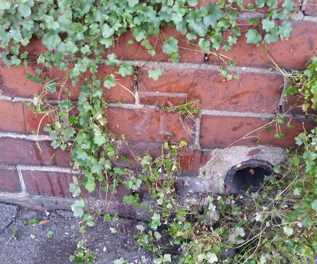
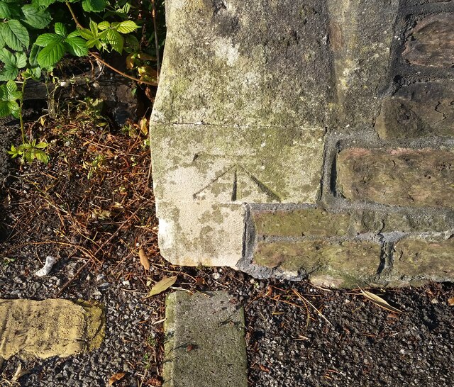
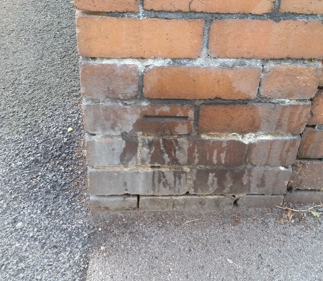
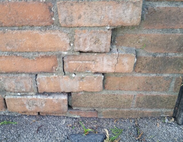
Allt-yr-yn Images

Images are sourced within 2km of 51.590279/-3.009093 or Grid Reference ST3088. Thanks to Geograph Open Source API. All images are credited.

Northern edge of St Woolos Cemetery, Newport A small part of a large municipal cemetery. Most burials in Newport were originally in the churchyard of St Woolos cathedral, but by the middle of the 19th century this was totally inadequate for a town with a rapidly-growing population. 15 acres of land to the west of the cathedral, between Risca Road and Bassaleg Road, were obtained from the Tredegar Estate for the new St Woolos Cemetery, which opened in 1854.

It is the UK's oldest municipal cemetery. Its current dimensions are about 600 metres by 400 metres, roughly 60 acres.
Northern edge of St Woolos Cemetery, Newport
A small part of a large municipal cemetery. Most burials in Newport were originally in the churchyard of St Woolos cathedral, but by the middle of the 19th century this was totally inadequate for a town with a rapidly-growing population. 15 acres of land to the west of the cathedral, between Risca Road and Bassaleg Road, were obtained from the Tredegar Estate for the new St Woolos Cemetery, which opened in 1854. It is the UK's oldest municipal cemetery. Its current dimensions are about 600 metres by 400 metres, roughly 60 acres.
Ordnance Survey Cut Mark This OS cut mark can be found on the west angle of the Gaer Park Club. It marks a point 69.614m above mean sea level.
Ordnance Survey Cut Mark
This OS cut mark can be found on the west angle of the Gaer Park Club. It marks a point 69.614m above mean sea level.
Ordnance Survey Cut Mark This OS cut mark can be found on No10 Highfield Road. It marks a point 65.432m above mean sea level.
Ordnance Survey Cut Mark
This OS cut mark can be found on No10 Highfield Road. It marks a point 65.432m above mean sea level.
Ordnance Survey Cut Mark This OS cut mark can be found on the cemetery wall on Bassaleg Road. It marks a point 64.470m above mean sea level.
Ordnance Survey Cut Mark
This OS cut mark can be found on the cemetery wall on Bassaleg Road. It marks a point 64.470m above mean sea level.
Ordnance Survey Cut Mark This OS cut mark can be found on No83 Bassaleg Road. It marks a point 73.460m above mean sea level.
Ordnance Survey Cut Mark
This OS cut mark can be found on No83 Bassaleg Road. It marks a point 73.460m above mean sea level.
Ordnance Survey Cut Mark This OS cut mark can be found on wall post at the cemetery entrance on Bassaleg Road. It marks a point 78.002m above mean sea level.
Ordnance Survey Cut Mark
This OS cut mark can be found on wall post at the cemetery entrance on Bassaleg Road. It marks a point 78.002m above mean sea level.
Ordnance Survey Cut Mark This OS cut mark can be found on the cemetery wall on Bassaleg Road. It marks a point 79.733m above mean sea level.
Ordnance Survey Cut Mark
This OS cut mark can be found on the cemetery wall on Bassaleg Road. It marks a point 79.733m above mean sea level.
Ordnance Survey Cut Mark This OS cut mark can be found on No76 Stelvio Park Drive. It marks a point 69.630m above mean sea level.
Ordnance Survey Cut Mark
This OS cut mark can be found on No76 Stelvio Park Drive. It marks a point 69.630m above mean sea level.
Ordnance Survey Cut Mark This OS cut mark can be found on the SW parapet of the railway bridge. It marks a point 24.467m above mean sea level.
Ordnance Survey Cut Mark
This OS cut mark can be found on the SW parapet of the railway bridge. It marks a point 24.467m above mean sea level.
Ordnance Survey Rivet This OS rivet can be found on the Motorway Bridge. It marks a point 64.115m above mean sea level.
Ordnance Survey Rivet
This OS rivet can be found on the Motorway Bridge. It marks a point 64.115m above mean sea level.
Ordnance Survey Cut Mark This OS cut mark can be found on the post at the entrance of Coed Melyn Park. It marks a point 70.434m above mean sea level.
Ordnance Survey Cut Mark
This OS cut mark can be found on the post at the entrance of Coed Melyn Park. It marks a point 70.434m above mean sea level.
Ordnance Survey Cut Mark This OS cut mark can be found on the wall of Clewer Court, Oakfield Road. It marks a point 63.108m above mean sea level.
Ordnance Survey Cut Mark
This OS cut mark can be found on the wall of Clewer Court, Oakfield Road. It marks a point 63.108m above mean sea level.
Ordnance Survey Cut Mark This OS cut mark can be found on No2 Upton Road. It marks a point 75.242m above mean sea level.
Ordnance Survey Cut Mark
This OS cut mark can be found on No2 Upton Road. It marks a point 75.242m above mean sea level.
Ordnance Survey Cut Mark This OS cut mark can be found on the cemetery gatepost SW side of Risca Road. It marks a point 76.615m above mean sea level.
Ordnance Survey Cut Mark
This OS cut mark can be found on the cemetery gatepost SW side of Risca Road. It marks a point 76.615m above mean sea level.
Ordnance Survey Cut Mark This OS cut mark can be found on the wall of No18 Woodville Road. It marks a point 75.926m above mean sea level.
Ordnance Survey Cut Mark
This OS cut mark can be found on the wall of No18 Woodville Road. It marks a point 75.926m above mean sea level.
Ordnance Survey Cut Mark This OS cut mark can be found on the wall of No6 Woodville Road. It marks a point 81.064m above mean sea level.
Ordnance Survey Cut Mark
This OS cut mark can be found on the wall of No6 Woodville Road. It marks a point 81.064m above mean sea level.
Houses in High Cross Road, Rogerstone
Cycle path in woodland by Fourteen Locks
Show me another place!

Allt-yr-yn is located at Grid Ref: ST3088 (Lat: 51.590279, Lng: -3.009093)

Unitary Authority: Newport

Police Authority: Gwent

What 3 Words

///stow.forest.prefer. Near Newport

Related Wikis

Newport Civic Centre

Newport Civic Centre (Welsh: Canolfan Ddinesig Casnewydd) is a municipal building in Godfrey Road in Newport, South Wales. The civic centre, which is the...

Newport Crown Court

Newport Crown Court is a Crown Court venue which deals with criminal cases at Faulkner Road in Newport in South Wales. == History == Until the early 1990s...

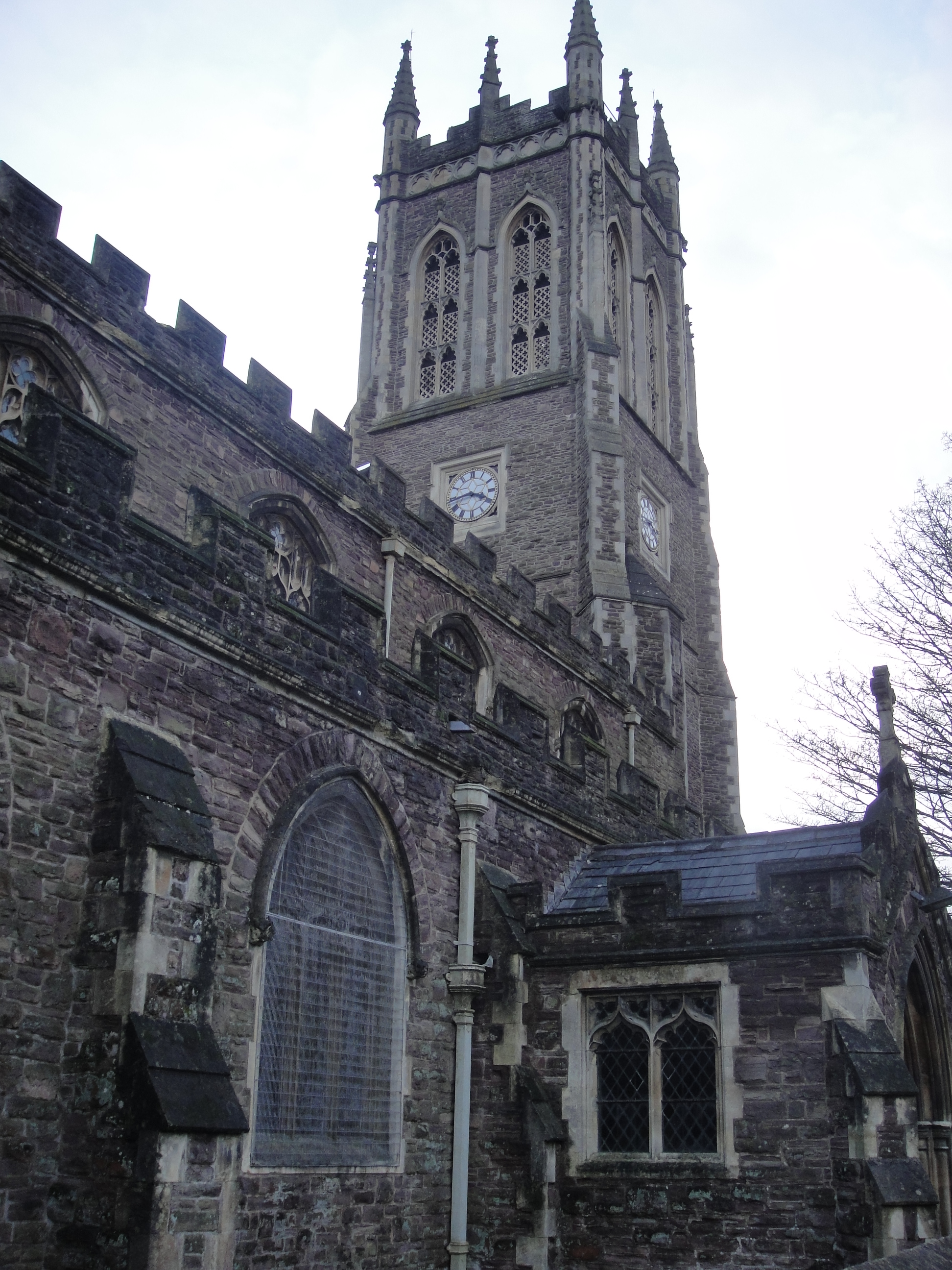
St Mark's Church, Newport

The Church of St Mark is a Church in Wales (Anglican) church located on Gold Tops, in the Allt-yr-yn area of Newport, Wales. It is a Newport landmark and...

Raglan Barracks, Newport

Raglan Barracks is a military installation at Barrack Hill in Allt-yr-yn in Newport, Wales. == History == The barracks were built as a cavalry barracks...

Shire Hall, Newport

The Shire Hall (Welsh: Neuadd y Sir, Casnewydd) is a municipal building in Newport, south Wales. It is a Grade II listed building. == History == Following...

Newport railway station

Newport (Welsh: Gorsaf Rheilffordd Casnewydd) is the second-busiest railway station in Wales, after Cardiff Central). It is situated in Newport city centre...

Stow Hill

Stow Hill is a community civil parish and coterminous electoral district (ward) of the City of Newport, South Wales. It is bounded by the River Usk to...

Allt-yr-yn

Allt-yr-yn (Welsh: Allt-yr-ynn) is a suburb of the city of Newport, south-east Wales. == Name == Pronounced by English-speaking locals as "Olt-er-reen...

Nearby Amenities

Located within 500m of 51.590279,-3.009093
Allt-yr-yn
Is In City: Newport
Name Cy: Allt-yr-ynn
Place: suburb
Source: NPE
Lat/Long: 51.5941188/-3.0115741
Turning Circle
Lat/Long: 51.5863332/-3.0099446
Created By: GPSBabel-1.3.6
Lat/Long: 51.591761/-3.008965
Created By: GPSBabel-1.3.6
Lat/Long: 51.592634/-3.010879
Created By: GPSBabel-1.3.6
Lat/Long: 51.592565/-3.010832
Created By: GPSBabel-1.3.6
Lat/Long: 51.591978/-3.009205
Created By: GPSBabel-1.3.6
Lat/Long: 51.591883/-3.009053
Created By: GPSBabel-1.3.6
Lat/Long: 51.591923/-3.013238
Created By: GPSBabel-1.3.6
Lat/Long: 51.591532/-3.014168
Created By: GPSBabel-1.3.6
Lat/Long: 51.59158/-3.01404
Created By: GPSBabel-1.3.6
Lat/Long: 51.591409/-3.014325
Created By: GPSBabel-1.3.6
Lat/Long: 51.59147/-3.014258
Created By: GPSBabel-1.3.6
Lat/Long: 51.592183/-3.013016
Created By: GPSBabel-1.3.6
Lat/Long: 51.592001/-3.013146
Created By: GPSBabel-1.3.6
Lat/Long: 51.592094/-3.013071
Turning Circle
Lat/Long: 51.5893109/-3.0148099
Created By: GPSBabel-1.3.6
Lat/Long: 51.592983/-3.00438
Place Of Worship
St Mark
Addr City: Newport
Addr Postcode: NP20 4PH
Addr Street: Gold Tops
Alt Name: St Mark's Church
Denomination: anglican
Email: lizmayhoughton@me.com
Religion: christian
Wikidata: Q24182428
Lat/Long: 51.5896121/-3.0028856
Bus Stop
Lodge (E-bound)
Bus: yes
Naptan AtcoCode: 5310AWB30590
Naptan NaptanCode: nwpadad
Public Transport: platform
Lat/Long: 51.5937418/-3.0122104
Bus Stop
Hilla Road
Bus: yes
Naptan AtcoCode: 5310GWX16403
Naptan NaptanCode: nwpajmw
Network: Newport Bus
Operator: Newport Bus
Public Transport: platform
Lat/Long: 51.5859862/-3.0089757
Barrier: lift_gate
Lat/Long: 51.5893818/-3.0057445
Entrance: service
Lat/Long: 51.5884704/-3.0065273
Entrance: main
Lat/Long: 51.5888125/-3.0062167
Access: customers
Addr City: Newport
Addr Housenumber: 22
Addr Postcode: NP20 5EA
Addr Street: Allt-Yr-Yn Road
Club: sport
Email: alltyrynmembership@outlook.com
Opening Hours: Mo-Fr 08:45-21:00; Sa 08:45-18:00; Su 08:45-22:30
Phone: +44 7380 899 648
Website: https://clubspark.lta.org.uk/AlltYrYnLTC
Lat/Long: 51.5924302/-3.0067669
Bus Stop
Sorrel Drive (NW-bound)
Bus: yes
Public Transport: platform
Lat/Long: 51.590586/-3.0069203
Direction: 235
Generator Method: photovoltaic
Generator Output Electricity: yes
Generator Solar Modules: 11
Generator Source: solar
Generator Type: solar_photovoltaic_panel
Location: roof
Power: generator
Lat/Long: 51.5885272/-3.0086004
Barrier: bollard
Lat/Long: 51.5896435/-3.0117569
Civic Centre murals
Artist Name: Hans Feibusch
Artwork Type: mural
Description: Twelve murals depicting the history of Newport
Level: 0
Start Date: 1964-01-01
Tourism: artwork
Lat/Long: 51.5887793/-3.0061163
Direction: SSE
Generator Method: photovoltaic
Generator Output Electricity: yes
Generator Solar Modules: 16
Generator Source: solar
Generator Type: solar_photovoltaic_panel
Location: roof
Power: generator
Lat/Long: 51.587858/-3.0122602
Direction: S
Generator Method: photovoltaic
Generator Output Electricity: yes
Generator Solar Modules: 8
Generator Source: solar
Generator Type: solar_photovoltaic_panel
Location: roof
Power: generator
Lat/Long: 51.5898101/-3.0128855
Direction: ESE
Generator Method: photovoltaic
Generator Output Electricity: yes
Generator Solar Modules: 8
Generator Source: solar
Generator Type: solar_photovoltaic_panel
Location: roof
Power: generator
Lat/Long: 51.5911245/-3.0042501
Direction: SSW
Generator Method: photovoltaic
Generator Output Electricity: yes
Generator Solar Modules: 4
Generator Source: solar
Generator Type: solar_photovoltaic_panel
Location: roof
Power: generator
Lat/Long: 51.5911072/-3.0043115
Direction: ESE
Generator Method: photovoltaic
Generator Output Electricity: yes
Generator Solar Modules: 7
Generator Source: solar
Generator Type: solar_photovoltaic_panel
Location: roof
Power: generator
Lat/Long: 51.5932946/-3.0096035
Direction: S
Generator Method: photovoltaic
Generator Output Electricity: yes
Generator Solar Modules: 13
Generator Source: solar
Generator Type: solar_photovoltaic_panel
Location: roof
Power: generator
Lat/Long: 51.5925056/-3.0134726
Direction: S
Generator Method: photovoltaic
Generator Output Electricity: yes
Generator Solar Modules: 4
Generator Source: solar
Generator Type: solar_photovoltaic_panel
Location: roof
Power: generator
Lat/Long: 51.5898128/-3.0129723
Direction: SSW
Generator Method: photovoltaic
Generator Output Electricity: yes
Generator Solar Modules: 9
Generator Source: solar
Generator Type: solar_photovoltaic_panel
Location: roof
Power: generator
Lat/Long: 51.5907043/-3.0083683
Direction: SSE
Generator Method: photovoltaic
Generator Output Electricity: yes
Generator Solar Modules: 8
Generator Source: solar
Generator Type: solar_photovoltaic_panel
Location: roof
Power: generator
Lat/Long: 51.5891637/-3.0025922
Direction: WSW
Generator Method: photovoltaic
Generator Output Electricity: yes
Generator Solar Modules: 12
Generator Source: solar
Generator Type: solar_photovoltaic_panel
Location: roof
Power: generator
Lat/Long: 51.5904064/-3.0029818
Direction: SE
Generator Method: photovoltaic
Generator Output Electricity: yes
Generator Solar Modules: 10
Generator Source: solar
Generator Type: solar_photovoltaic_panel
Location: roof
Power: generator
Lat/Long: 51.5864748/-3.0066209
Hennah Haywood Law
Addr City: Newport
Addr Housenumber: 13
Addr Postcode: NP20 4PB
Addr Street: Clytha Park Road
Email: hello@hh-law.uk
Office: lawyer
Phone: +44 1633 262 848
Website: https://www.hh-law.uk/
Lat/Long: 51.5873927/-3.0047771
Foxwood Recruitment
Addr City: Newport
Addr Housenumber: 12a
Addr Postcode: NP20 4PB
Addr Street: Clytha Park Road
Email: hello@foxwoodrecruitment.com
Office: employment_agency
Phone: +44 1633 749 400
Website: https://foxwoodrecruitment.com/contact.html
Lat/Long: 51.5873536/-3.0046588
Steve Morgan Associates
Addr City: Newport
Addr Housenumber: 9
Addr Postcode: NP20 4PB
Addr Street: Clytha Park Road
Office: engineering
Website: http://www.smalimited.co.uk
Lat/Long: 51.5871531/-3.0041418
Bicycle Parking
Access: yes
Bicycle Parking: stands
Capacity: 4
Covered: no
Fee: no
Indoor: no
Level: 0
Lit: yes
Lat/Long: 51.5890256/-3.0061327
Bus Stop
Queen's Hill Crescent
Bus: yes
Naptan AtcoCode: 5310AWB30598
Naptan Bearing: NE
Naptan BusStopType: CUS
Naptan CommonName: Queen`s Hill Crescent
Naptan Indicator: o/s 78
Naptan NaptanCode: nwpadaw
Naptan PlusbusZoneRef: NWPTRTG
Naptan Street: Queen`s Hill Crescent
Naptan Verified: no
Network: Newport Bus
Operator: Newport Bus
Public Transport: platform
Lat/Long: 51.59259/-3.0034949
Bus Stop
St Mark's Church
Bus: yes
Naptan AtcoCode: 5310AWA17279
Naptan NaptanCode: nwpgdjm
Network: Newport Bus
Operator: Newport Bus
Public Transport: platform
Lat/Long: 51.5898789/-3.0023517
Bus Stop
Fields Nursing Home
Bus: yes
Naptan AtcoCode: 5310WDB47941
Network: Newport Bus
Operator: Newport Bus
Public Transport: platform
Ref: nwpgmwj
Lat/Long: 51.5899185/-3.0047124
Bus Stop
Civic Centre Btm Car Park
Bus: yes
Naptan AtcoCode: 5310AWA25030
Naptan NaptanCode: nwpgdjt
Network: Newport Bus
Operator: Newport Bus
Public Transport: platform
Lat/Long: 51.5881191/-3.0035902
Bus Stop
Civic Centre Top Car Park (In)
Bus: yes
Network: Newport Bus
Operator: Newport Bus
Public Transport: platform
Lat/Long: 51.5887274/-3.006326
Bus Stop
Civic Centre Top Car Park (before)
Bus: yes
Naptan AtcoCode: 5310WDB47936
Network: Newport Bus
Operator: Newport Bus
Public Transport: platform
Ref: nwpgmtp
Route Ref: 14;JF3;YGI1
Lat/Long: 51.5890073/-3.0070797
Bus Stop
Civic Centre North
Bus: yes
Naptan AtcoCode: 5310AWB30393
Network: Newport Bus
Operator: Newport Bus
Public Transport: platform
Ref: nwpajgt
Lat/Long: 51.5883887/-3.0081768
Bus Stop
Fields Park Crescent (NE-bound)
Bus: yes
Naptan AtcoCode: 5310AWB30391
Network: Newport Bus
Operator: Newport Bus
Public Transport: platform
Ref: nwpajmj
Route Ref: 14;JF3;SJ8;YGI1
Lat/Long: 51.5880518/-3.0093753
Bus Stop
Fields Park Crescent (SW-bound)
Bus: yes
Naptan AtcoCode: 5310AWB30392
Network: Newport Bus
Operator: Newport Bus
Public Transport: platform
Ref: nwpajmp
Route Ref: SJ8;YGI1
Lat/Long: 51.5877608/-3.0097728
Bus Stop
Edward VII Crescent (SW-bound)
Bench: no
Bin: no
Bus: yes
Lit: yes
Network: Newport Bus
Operator: Newport Bus
Public Transport: platform
Shelter: no
Tactile Paving: no
Lat/Long: 51.5867481/-3.0115967
Bus Stop
Edward VII Crescent (NE-bound)
Bench: no
Bin: no
Bus: yes
Lit: yes
Network: Newport Bus
Operator: Newport Bus
Public Transport: platform
Shelter: no
Tactile Paving: no
Lat/Long: 51.5868994/-3.0114396
Bus Stop
Ash Tree View
Bus: yes
Network: Newport Bus
Operator: Newport Bus
Public Transport: platform
Lat/Long: 51.5907216/-3.0134206
Bus Stop
Lodge (W-bound)
Bus: yes
Naptan AtcoCode: 5310AWB30591
Naptan NaptanCode: nwpadag
Network: Newport Bus
Operator: Newport Bus
Public Transport: platform
Lat/Long: 51.5936547/-3.0123871
Bus Stop
Highcroft (SE-bound)
Bus: yes
Network: Newport Bus
Operator: Newport Bus
Public Transport: platform
Lat/Long: 51.593448/-3.0110069
Bus Stop
Highcroft (NW-bound)
Bus: yes
Network: Newport Bus
Operator: Newport Bus
Public Transport: platform
Lat/Long: 51.5932853/-3.0099734
Bus Stop
Tennis Club (NW-bound)
Bus: yes
Network: Newport Bus
Operator: Newport Bus
Public Transport: platform
Lat/Long: 51.5926653/-3.009032
Bus Stop
Tennis Club (SE-bound)
Bus: yes
Naptan AtcoCode: 5310WDB18061
Naptan NaptanCode: nwpgwjw
Network: Newport Bus
Operator: Newport Bus
Public Transport: platform
Lat/Long: 51.5923795/-3.0082604
Bus Stop
Sorrel Drive (SE-bound)
Bus: yes
Naptan AtcoCode: 5310WDB18064
Naptan NaptanCode: nwpgwmg
Network: Newport Bus
Operator: Newport Bus
Public Transport: platform
Lat/Long: 51.5909987/-3.0077933
Bus Stop
Allt-yr-yn Close (opposite)
Bus: yes
Naptan AtcoCode: 5310WDB18015
Naptan NaptanCode: nwpgtma
Network: Newport Bus
Operator: Newport Bus
Public Transport: platform
Lat/Long: 51.5908052/-3.0081613
Bus Stop
Colts Foot Close (NE-bound)
Bus: yes
Naptan AtcoCode: 5310AWB30595
Naptan NaptanCode: nwpadam
Network: Newport Bus
Operator: Newport Bus
Public Transport: platform
Lat/Long: 51.5916708/-3.0056632
Bus Stop
Colts Foot Close (SW-bound)
Bus: yes
Naptan AtcoCode: 5310AWB30594
Naptan NaptanCode: nwpadaj
Network: Newport Bus
Operator: Newport Bus
Public Transport: platform
Lat/Long: 51.5916505/-3.0055418
Bus Stop
Comfrey Close
Bus: yes
Naptan AtcoCode: 5310WDB18068
Naptan NaptanCode: nwpgwmw
Network: Newport Bus
Operator: Newport Bus
Public Transport: platform
Lat/Long: 51.59237/-3.0046685
Tredegar Constitutional Club
Access: yes
Addr City: Newport
Addr Housenumber: 8
Addr Postcode: NP20 4LY
Addr Street: Oakfield Road
Club: social
Contact Facebook: https://www.facebook.com/Tredegarcons
Opening Hours: Mo-Th 17:00-23:30; Fr 17:00-00:00; Sa 12:00-00:00; Su 12:00-23:30
Phone: +44 1633 761 854
Lat/Long: 51.5870317/-3.0075505
Everett Tomlin Lloyd & Pratt
Addr City: Newport
Addr Housenumber: 19-20
Addr Postcode: NP20 4PH
Addr Street: Fields Road
Office: lawyer
Phone: +44 1633 251 801
Website: https://www.etlp.co.uk/
Lat/Long: 51.5899948/-3.0029192
JDW Architects
Addr City: Newport
Addr Housename: Summit House
Addr Housenumber: 5
Addr Postcode: NP20 4PG
Addr Street: Gold Tops
Addr Unit: Suite 2
Email: info@jdwarchitects.co.uk
Office: architect
Opening Hours: Mo-Fr 09:00-17:00; Sa Off; Su Off
Phone: +44 1633 245 020
Website: https://jdwarchitects.co.uk/
Lat/Long: 51.589709/-3.0019334
Clinic
Newport Community Mental Health Team
Addr City: Newport
Addr Housenumber: 6
Addr Postcode: NP20 4PG
Addr Street: Gold Tops
Alt Name: Aneurin Bevan University Health Board CMHT
Healthcare: clinic
Healthcare Speciality: mental_health
Opening Hours: Mo-Fr 09:00-17:00; Sa Off; Su Off
Phone: +44 1633 786 178
Website: https://111.wales.nhs.uk/localservices/ViewLocalService.aspx?id=5510
Lat/Long: 51.5896507/-3.0021453
Hammond Architectural
Addr City: Newport
Addr Housenumber: 10
Addr Postcode: NP20 4PH
Addr Street: Gold Tops
Email: info@hammond-ltd.co.uk
Office: architect
Opening Hours: Mo-Fr 09:00-17:00; Sa Off; Su Off
Phone: +44 1633 844 970
Website: https://www.hammond-ltd.co.uk/
Lat/Long: 51.5893874/-3.0048892
3 Point Surveys
Addr City: Newport
Addr Housenumber: 10
Addr Postcode: NP20 4PH
Addr Street: Gold Tops
Email: info@3pointsurveys.co.uk
Office: surveyor
Opening Hours: Mo-Fr 09:00-17:00; Sa Off; Su Off
Phone: +44 7808 791 936
Website: https://3pointsurveys.co.uk/
Lat/Long: 51.5893608/-3.0048704
Cintec International
Email: info@cintecinflatables.com
Office: engineer
Phone: +44 1633 246 614
Website: https://www.cintecinflatables.com/
Lat/Long: 51.5896541/-3.0054954
M5 Associates
Addr City: Newport
Addr Housenumber: 12
Addr Postcode: NP20 4PH
Addr Street: Gold Tops
Email: enquiries@m5associates.com
Office: property_management
Phone: +44 1633 211 611
Website: https://www.m5associates.com/
Lat/Long: 51.5896824/-3.0053559
Sofinn
Addr City: Newport
Addr Housenumber: 16
Addr Postcode: NP20 4PH
Addr Street: Gold Tops
Email: info@sofinn.com
Opening Hours: Mo-Fr 09:00-17:00; Sa Off; Su Off
Phone: +44 1633 415 355
Shop: medical_supply
Lat/Long: 51.5898557/-3.0042294
Blueygreen
Addr City: Newport
Addr Housenumber: 16
Addr Postcode: NP20 4PH
Addr Street: Gold Tops
Email: hello@blueygreen.com
Office: graphic_design
Opening Hours: Mo-Fr 09:00-17:00; Sa Off; Su Off
Phone: +44 1443 552 123
Website: https://www.blueygreen.com/
Lat/Long: 51.5898407/-3.0042482
3G.co.uk
Addr City: Newport
Addr Housenumber: 16
Addr Postcode: NP20 4PH
Addr Street: Gold Tops
Opening Hours: Mo-Fr 09:00-17:00; Sa Off; Su Off
Shop: mobile_phone
Website: https://3g.co.uk/
Lat/Long: 51.5898174/-3.0042589
ATSLI Casting
Addr City: Newport
Addr Housenumber: 16
Addr Postcode: NP20 4PH
Addr Street: Gold Tops
Office: employment_agency
Opening Hours: Mo-Fr 09:00-17:00; Sa Off; Su Off
Lat/Long: 51.589799/-3.0042562
Associate Financial Advisors
Email: mail@acumenifa.com
Office: financial_advisor
Opening Hours: Mo-Fr 09:00-17:00; Sa Off; Su Off
Phone: +44 8002 986 311
Website: https://www.acumenafs.com/
Lat/Long: 51.5898574/-3.0041865
Watkins & Gunn Solicitors
Addr City: Newport
Addr Housename: Sussex House
Addr Housenumber: 17
Addr Postcode: NP20 4PH
Addr Street: Gold Tops
Email: info@watkinsandgunn.co.uk
Office: lawyer
Opening Hours: Mo-Fr 09:00-17:00; Sa Off; Su Off
Phone: +44 1633 262 122
Website: https://www.watkinsandgunn.co.uk/
Lat/Long: 51.5898853/-3.0039591
Wellfield Clinic
Addr City: Newport
Addr Housenumber: 17
Addr Postcode: NP20 4PH
Addr Street: Gold Tops
Healthcare: alternative
Healthcare Speciality: osteopathy
Opening Hours: Mo-Fr 09:00-17:00; Sa Off; Su Off
Phone: +44 1633 553 148
Lat/Long: 51.5898972/-3.0038269
Live For Holidays
Addr City: Newport
Addr Housename: Goldfields House
Addr Housenumber: 18
Addr Postcode: NP20 4WJ
Addr Street: Gold Tops
Email: liveforholidays@theholidayvillage.com
Opening Hours: Mo-Fr 09:00-17:30; Sa 09:00-15:00; Su Off
Phone: +44 1633 845 100
Shop: travel_agency
Website: https://www.liveforholidays.com/
Lat/Long: 51.5899392/-3.0034928
Arthur Gait & Company
Addr City: Newport
Addr Housename: Goldfields House
Addr Housenumber: 18
Addr Postcode: NP20 4WJ
Addr Street: Gold Tops
Email: admin@arthurgait.co.uk
Office: accountant
Opening Hours: Mo-Fr 09:00-17:00; Sa Off; Su Off
Phone: +44 1633 262 352
Website: https://www.arthurgait.co.uk/
Lat/Long: 51.5899624/-3.003348
Guilfoyle Sage & Co
Addr City: Newport
Addr Housenumber: 21
Addr Postcode: NP20 4PG
Addr Street: Gold Tops
Email: mail@guilfoylesage.co.uk
Office: accountant
Opening Hours: Mo-Fr 09:00-17:00; Sa Off; Su Off
Phone: +44 1633 263 944
Website: https://www.guilfoylesage.co.uk/
Lat/Long: 51.5900503/-3.0022222
Doctors
Bryngwyn Surgery
Addr City: Newport
Addr Housenumber: 4-6
Addr Postcode: NP20 4JS
Addr Street: Bryngwyn Road
Email: enquiries.w93046@wales.nhs.uk
Healthcare: doctor
Healthcare Speciality: general
Opening Hours: Mo-Fr 08:00-18:30; Sa Off; Su Off
Phone: +44 1633 263 463
Website: https://bryngwynsurgery.co.uk
Lat/Long: 51.5869273/-3.0059423
Heron House Financial Management
Addr City: Newport
Addr Housenumber: 1
Addr Postcode: NP20 4JS
Addr Street: Bryngwyn Road
Email: mail@hhfm.co.uk
Office: financial_advisor
Phone: +44 1633 258 200
Website: https://hhfm.co.uk
Lat/Long: 51.5866528/-3.0056902
Atkinsons Solicitors
Office: lawyer
Lat/Long: 51.587591/-3.0051467
Bench
Lat/Long: 51.5877604/-3.0056951
Waste Basket
Lat/Long: 51.5877282/-3.0057136
The data included in this document is from www.openstreetmap.org. The data is made available under ODbL.

Have you been to Allt-yr-yn?

Leave your review of Allt-yr-yn below (or comments, questions and feedback).