Cairncross

Settlement in Angus

Scotland

Cairncross

Cottages at Tarfside Stone built cottages at the little village of Tarfside, the largest community in Glen Esk.
Cottages at Tarfside Credit: Gordon Hatton

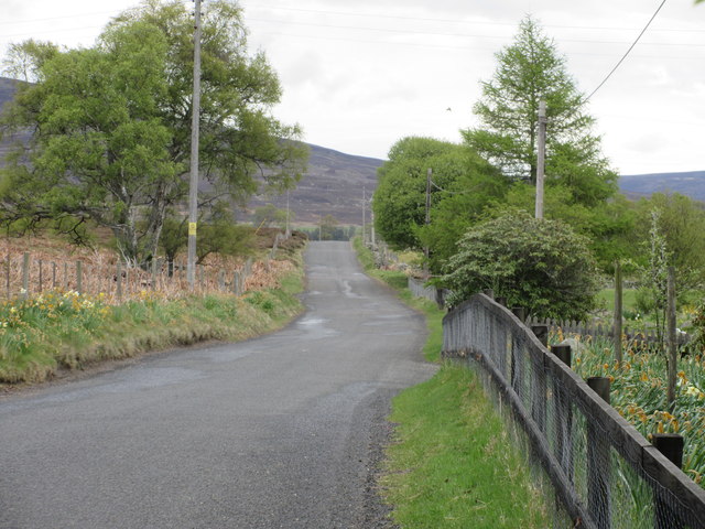
Cairncross is a small village located in the county of Angus, Scotland. Nestled at the foot of the picturesque Grampian Mountains, this rural settlement offers stunning natural beauty and a tranquil atmosphere. The village is situated approximately 6 miles north of Forfar, the nearest town, and enjoys a peaceful setting amidst rolling hills and lush farmland.

Cairncross is known for its rich history, dating back centuries. The area has been inhabited since prehistoric times, with evidence of ancient settlements and burial sites. Today, remnants of the past can still be seen in the form of standing stones and ancient ruins scattered throughout the surrounding countryside.

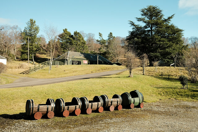
The village itself is characterized by its charming stone houses and traditional architecture, which adds to its timeless appeal. Cairncross is a close-knit community, with a population of around 300 residents. The village is centered around a small square, where a few local businesses and amenities can be found, including a village hall and a local pub.

Despite its small size, Cairncross is a popular destination for outdoor enthusiasts. The surrounding area offers ample opportunities for hiking, cycling, and wildlife spotting. The nearby Glen Clova, part of the Cairngorms National Park, is particularly renowned for its breathtaking landscapes and diverse flora and fauna.

Overall, Cairncross is a hidden gem in the heart of Angus, offering a peaceful retreat and a connection to Scotland's rich history and natural heritage.

If you have any feedback on the listing, please let us know in the comments section below.

Cairncross Images

Images are sourced within 2km of 56.899528/-2.8388906 or Grid Reference NO4979. Thanks to Geograph Open Source API. All images are credited.

Cottages at Tarfside Stone built cottages at the little village of Tarfside, the largest community in Glen Esk.
Cottages at Tarfside
Stone built cottages at the little village of Tarfside, the largest community in Glen Esk.
Train for plants Whisky barrels ready to be planted with flowers at this folk museum
Train for plants
Whisky barrels ready to be planted with flowers at this folk museum
St Drostan's Church The church at Tarfside
St Drostan's Church
The church at Tarfside
Looking towards Hill of Rowan  Grouse butts visible on the right but the map shows field system and hut circles that are not immediately visible.
Looking towards Hill of Rowan
Grouse butts visible on the right but the map shows field system and hut circles that are not immediately visible.
Maule Church The Maule Memorial Church was built following the 1843 schism in the Church of Scotland that led to the foundation of the Free Church. The land on which the church stands was granted in 1852 by Fox Maule Ramsay to his friend and leader of the Free Church, Thomas Guthrie, when he succeeded as the 2nd Lord Panmure.
Maule Church
The Maule Memorial Church was built following the 1843 schism in the Church of Scotland that led to the foundation of the Free Church. The land on which the church stands was granted in 1852 by Fox Maule Ramsay to his friend and leader of the Free Church, Thomas Guthrie, when he succeeded as the 2nd Lord Panmure.
Maule Church The Maule Memorial Church near Tarfside in Glen Esk.
Maule Church
The Maule Memorial Church near Tarfside in Glen Esk.
Maule Church, southern elevation The south side of Maule Memorial Church from inside the grounds.
Maule Church, southern elevation
The south side of Maule Memorial Church from inside the grounds.
Maule Church from the north Maule Church within the woodland, viewed from the roadside to the north.
Maule Church from the north
Maule Church within the woodland, viewed from the roadside to the north.
Tarfside War Memorial The First World War Memorial at Tarfside in Glen Esk.
Tarfside War Memorial
The First World War Memorial at Tarfside in Glen Esk.
St. Drostan's Episcopal Church St. Drostan's Episcopal Church in Tarfside, Glen Esk.
St. Drostan's Episcopal Church
St. Drostan's Episcopal Church in Tarfside, Glen Esk.
Track to the Hill of Rowan The track leading west from Tarfside with the Hill of Rowan and the monument on its summit on the left.
Track to the Hill of Rowan
The track leading west from Tarfside with the Hill of Rowan and the monument on its summit on the left.
Maule Memorial The monument on the summit of the Hill of Rowan viewed from the south-east.
Maule Memorial
The monument on the summit of the Hill of Rowan viewed from the south-east.
The Glen Esk road The undulating minor road up Glen Esk near West Migvie.
The Glen Esk road
The undulating minor road up Glen Esk near West Migvie.
Grazing Field Grazing field by the road to Tarfside
Grazing Field
Grazing field by the road to Tarfside
Road at Cairncross, Tarfside Looking south-eastward.
Road at Cairncross, Tarfside
Looking south-eastward.
Old milestone This is one of several stones surviving on a very minor road which turns off the B966 north of Edzell, goes along Glen Esk on the north side of the River North Esk to end at Invermark Lodge.   I 4 can just be made out on the left face with E 12 on the right.  This stone is near Tarfside
Old milestone
This is one of several stones surviving on a very minor road which turns off the B966 north of Edzell, goes along Glen Esk on the north side of the River North Esk to end at Invermark Lodge. I 4 can just be made out on the left face with E 12 on the right. This stone is near Tarfside
Village hall, Tarfside
Water of Tarf at Tarfside
Show me another place!

Cairncross is located at Grid Ref: NO4979 (Lat: 56.899528, Lng: -2.8388906)

Unitary Authority: Angus

Police Authority: Tayside

What 3 Words

///shuffle.tablet.straying. Near Aboyne, Aberdeenshire

Related Wikis

Tarfside

Tarfside is a small hamlet in Angus, Scotland. It is situated in Glen Esk, on the upper course of the River North Esk, around 8 miles north of Edzell,...

Invermark Castle

Invermark Castle is an oblong tower house dating from the 16th century, at the east of Loch Lee, Angus, Scotland. It is near the head of Glen Esk. ��2...

Milden, Angus

Milden is a hamlet, estate and farmstead in Glenesk, Angus, Scotland. It is situated in the upper course of the Glen Esk valley, where the Burn of Turret...

Invermark Lodge

Invermark Lodge is a hunting lodge which was built near Invermark Castle in 1852 for John Ramsay, 13th Earl of Dalhousie. It is now a listed building...

Loch Lee

National grid reference NO431800 Loch Lee is a loch in Angus, Scotland south of the Grampian Mountains that is fed by the Water of Lee and the Water of...

Colmeallie stone circle

The Colmeallie stone circle is a recumbent stone circle in Glen Esk, Angus, Scotland. It is located 8 km north of Edzell at Colmeallie Farm, adjacent to...

Glen Mark

Glen Mark is a glen in northern Angus, eastern Scotland, through which the Water of Mark flows. Near the mouth of the glen, at Auchronie, the Water of...

Mount Battock

Mount Battock (778 m) is a mountain in the Mounth on the eastern edge of the Scottish Highlands, on the border between Aberdeenshire and Angus. A rounded...

Nearby Amenities

Located within 500m of 56.899528,-2.8388906
Buskhead
Place: isolated_dwelling
Lat/Long: 56.8979503/-2.8364486
Woodhaugh
Place: isolated_dwelling
Lat/Long: 56.8988702/-2.8408046
Tirlybirly
Place: locality
Lat/Long: 56.8986183/-2.8438301
Power: pole
Lat/Long: 56.9031349/-2.8434843
Power: pole
Lat/Long: 56.9034279/-2.8423875
Power: pole
Lat/Long: 56.9037403/-2.8412374
Power: pole
Lat/Long: 56.8981995/-2.8368795
Power: pole
Lat/Long: 56.8986963/-2.837468
Power: pole
Lat/Long: 56.8992918/-2.8381969
Power: pole
Lat/Long: 56.8997102/-2.8387032
Power: pole
Lat/Long: 56.9000438/-2.8390438
Power: pole
Lat/Long: 56.9003089/-2.8392783
Power: pole
Lat/Long: 56.9009043/-2.8398907
Power: pole
Lat/Long: 56.9014745/-2.8404373
Power: pole
Lat/Long: 56.9019133/-2.840875
Power: pole
Lat/Long: 56.9024223/-2.8413992
Power: pole
Lat/Long: 56.9027379/-2.841698
Power: pole
Lat/Long: 56.8995136/-2.8392365
Power: pole
Lat/Long: 56.8993121/-2.8397876
Power: pole
Lat/Long: 56.89914/-2.8405359
Ford: yes
Lat/Long: 56.899543/-2.8306708
The data included in this document is from www.openstreetmap.org. The data is made available under ODbL.

Have you been to Cairncross?

Leave your review of Cairncross below (or comments, questions and feedback).