Blue Cairn

Heritage Site in Angus

Scotland

Blue Cairn

Cottages at Tarfside Stone built cottages at the little village of Tarfside, the largest community in Glen Esk.
Cottages at Tarfside Credit: Gordon Hatton

Blue Cairn is a historically significant heritage site located in Angus, Scotland. Situated on a picturesque hilltop, the site is home to an ancient burial ground dating back to the Neolithic period, around 4000 BC. The cairn itself is a circular stone structure, approximately 20 meters in diameter and 3 meters high, with a distinct blue hue, giving it its name.

The Blue Cairn is believed to have served as a communal burial ground for the local community during the Neolithic era. It is thought to have been used for multiple burials over several centuries, making it an important archaeological site for understanding the burial practices and social structures of this ancient civilization.

Excavations conducted at the Blue Cairn have unearthed various artifacts, including pottery fragments, stone tools, and human remains. These findings have provided valuable insights into the lifestyle, art, and beliefs of the people who once inhabited this area.

The site is also notable for its panoramic views of the surrounding landscape, offering visitors a glimpse into the natural beauty of Angus. It is a popular destination for archaeology enthusiasts, history buffs, and those interested in Scotland's ancient past.

Managed by local authorities, Blue Cairn is accessible to the public, allowing visitors to explore the site, learn about its history, and appreciate the significance of this ancient burial ground. Interpretative panels and guided tours are available to enhance the visitors' experience and provide a deeper understanding of the site's cultural and archaeological importance.

If you have any feedback on the listing, please let us know in the comments section below.

Blue Cairn Images

Images are sourced within 2km of 56.903/-2.83 or Grid Reference NO4979. Thanks to Geograph Open Source API. All images are credited.

Cottages at Tarfside Stone built cottages at the little village of Tarfside, the largest community in Glen Esk.
Cottages at Tarfside
Stone built cottages at the little village of Tarfside, the largest community in Glen Esk.
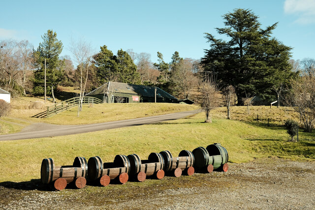
Train for plants Whisky barrels ready to be planted with flowers at this folk museum
Train for plants
Whisky barrels ready to be planted with flowers at this folk museum
St Drostan's Church The church at Tarfside
St Drostan's Church
The church at Tarfside
Looking towards Hill of Rowan  Grouse butts visible on the right but the map shows field system and hut circles that are not immediately visible.
Looking towards Hill of Rowan
Grouse butts visible on the right but the map shows field system and hut circles that are not immediately visible.
Maule Church The Maule Memorial Church was built following the 1843 schism in the Church of Scotland that led to the foundation of the Free Church. The land on which the church stands was granted in 1852 by Fox Maule Ramsay to his friend and leader of the Free Church, Thomas Guthrie, when he succeeded as the 2nd Lord Panmure.
Maule Church
The Maule Memorial Church was built following the 1843 schism in the Church of Scotland that led to the foundation of the Free Church. The land on which the church stands was granted in 1852 by Fox Maule Ramsay to his friend and leader of the Free Church, Thomas Guthrie, when he succeeded as the 2nd Lord Panmure.
Maule Church The Maule Memorial Church near Tarfside in Glen Esk.
Maule Church
The Maule Memorial Church near Tarfside in Glen Esk.
Maule Church, southern elevation The south side of Maule Memorial Church from inside the grounds.
Maule Church, southern elevation
The south side of Maule Memorial Church from inside the grounds.
Maule Church from the north Maule Church within the woodland, viewed from the roadside to the north.
Maule Church from the north
Maule Church within the woodland, viewed from the roadside to the north.
Tarfside War Memorial The First World War Memorial at Tarfside in Glen Esk.
Tarfside War Memorial
The First World War Memorial at Tarfside in Glen Esk.
St. Drostan's Episcopal Church St. Drostan's Episcopal Church in Tarfside, Glen Esk.
St. Drostan's Episcopal Church
St. Drostan's Episcopal Church in Tarfside, Glen Esk.
Track to the Hill of Rowan The track leading west from Tarfside with the Hill of Rowan and the monument on its summit on the left.
Track to the Hill of Rowan
The track leading west from Tarfside with the Hill of Rowan and the monument on its summit on the left.
Grazing Field Grazing field by the road to Tarfside
Grazing Field
Grazing field by the road to Tarfside
Road at Cairncross, Tarfside Looking south-eastward.
Road at Cairncross, Tarfside
Looking south-eastward.
Old milestone This is one of several stones surviving on a very minor road which turns off the B966 north of Edzell, goes along Glen Esk on the north side of the River North Esk to end at Invermark Lodge.   I 4 can just be made out on the left face with E 12 on the right.  This stone is near Tarfside
Old milestone
This is one of several stones surviving on a very minor road which turns off the B966 north of Edzell, goes along Glen Esk on the north side of the River North Esk to end at Invermark Lodge. I 4 can just be made out on the left face with E 12 on the right. This stone is near Tarfside
Village hall, Tarfside
Water of Tarf at Tarfside
St Drostan's, Tarfside Saint Drostan (also sometimes spelled as Drustan, Dustan or Throstan) lived, very approximately, from 560 to 630. He was a follower of Saint Columba who was active in Aberdeenshire. The first church in Glen Esk near Loch Lee is said to have been established in the early 600s. The church here was built in 1879 by Lord Forbes in memory of his brother Alexander Penrose Forbes, Bishop of Brechin, who had died in 1875. 
<span class="nowrap"><a title="https://www.undiscoveredscotland.co.uk/tarfside/stdrostans/index.html" rel="nofollow ugc noopener" href="https://www.undiscoveredscotland.co.uk/tarfside/stdrostans/index.html">Link</a><img style="margin-left:2px;" alt="External link" title="External link - shift click to open in new window" src="https://s1.geograph.org.uk/img/external.png" width="10" height="10"/></span>
St Drostan's, Tarfside
Saint Drostan (also sometimes spelled as Drustan, Dustan or Throstan) lived, very approximately, from 560 to 630. He was a follower of Saint Columba who was active in Aberdeenshire. The first church in Glen Esk near Loch Lee is said to have been established in the early 600s. The church here was built in 1879 by Lord Forbes in memory of his brother Alexander Penrose Forbes, Bishop of Brechin, who had died in 1875. LinkExternal link
Track west of Tarfside
Show me another place!

Blue Cairn is located at Grid Ref: NO4979 (Lat: 56.903, Lng: -2.83)

Unitary Authority: Angus

Police Authority: Tayside

What 3 Words

///taking.signed.kettles. Near Aboyne, Aberdeenshire

Related Wikis

Tarfside

Tarfside is a small hamlet in Angus, Scotland. It is situated in Glen Esk, on the upper course of the River North Esk, around 8 miles north of Edzell,...

Milden, Angus

Milden is a hamlet, estate and farmstead in Glenesk, Angus, Scotland. It is situated in the upper course of the Glen Esk valley, where the Burn of Turret...

Invermark Castle

Invermark Castle is an oblong tower house dating from the 16th century, at the east of Loch Lee, Angus, Scotland. It is near the head of Glen Esk. ��2...

Invermark Lodge

Invermark Lodge is a hunting lodge which was built near Invermark Castle in 1852 for John Ramsay, 13th Earl of Dalhousie. It is now a listed building...

Colmeallie stone circle

The Colmeallie stone circle is a recumbent stone circle in Glen Esk, Angus, Scotland. It is located 8 km north of Edzell at Colmeallie Farm, adjacent to...

Loch Lee

National grid reference NO431800 Loch Lee is a loch in Angus, Scotland south of the Grampian Mountains that is fed by the Water of Lee and the Water of...

Mount Battock

Mount Battock (778 m) is a mountain in the Mounth on the eastern edge of the Scottish Highlands, on the border between Aberdeenshire and Angus. A rounded...

Glen Mark

Glen Mark is a glen in northern Angus, eastern Scotland, through which the Water of Mark flows. Near the mouth of the glen, at Auchronie, the Water of...

Nearby Amenities

Located within 500m of 56.903,-2.83
Bus Stop
Tarfside
Naptan AtcoCode: 6490IM342
Naptan Bearing: SE
Naptan CommonName: Tarfside
Naptan Indicator: opp Post Office
Naptan Landmark: Tarfside Post Office
Naptan NaptanCode: 26424594
Naptan Street: Glenesk
Naptan Verified: no
Source: naptan_import
Lat/Long: 56.905551/-2.833633
Tarfside Post Office
Local Ref: AT
Naptan AtcoCode: 6490IM359
Naptan Bearing: NW
Naptan BusStopType: CUS
Naptan CommonName: Tarfside Post Office
Naptan Indicator: at
Naptan Landmark: Telephone Exchange
Naptan NaptanCode: 26426586
Naptan Street: Unclassified Road
Naptan Verified: no
Source: naptan_import
Lat/Long: 56.9057675/-2.834853
Tarfside
Name Gd: Bruach Tarbha
Old Name: Balhangie
Old Name Gd: Baile Chumhangaidh
Place: village
Wikidata: Q3997481
Wikipedia: en:Tarfside
Lat/Long: 56.9054668/-2.8337235
Historic: memorial
Memorial: war_memorial
Lat/Long: 56.9052335/-2.8330119
Post Box
Collection Times: Mo-Fr 13:00; Sa 12:00
Operator: Royal Mail
Operator Wikidata: Q638098
Post Box Mounting: pier
Post Box Type: lamp
Ref: DD9 62
Royal Cypher: scottish_crown
Lat/Long: 56.9054974/-2.8335087
The Smiddy
Place: isolated_dwelling
Lat/Long: 56.9014607/-2.823797
Manse
Place: isolated_dwelling
Lat/Long: 56.9003843/-2.8238572
Cairncross
Place: isolated_dwelling
Lat/Long: 56.903304/-2.8271011
Mid Cairncross
Place: isolated_dwelling
Lat/Long: 56.9044171/-2.8252558
Power: pole
Lat/Long: 56.9045245/-2.8368798
Power: pole
Lat/Long: 56.9043812/-2.8359684
Power: pole
Lat/Long: 56.9042908/-2.8353983
Power: pole
Lat/Long: 56.9040882/-2.8341318
Power: pole
Lat/Long: 56.9039418/-2.8332481
Power: pole
Lat/Long: 56.9037802/-2.8322183
Power: pole
Lat/Long: 56.9036186/-2.8311945
Power: pole
Lat/Long: 56.9034506/-2.8301372
Power: pole
Lat/Long: 56.9036692/-2.8293718
Power: pole
Lat/Long: 56.9039105/-2.8285827
Power: pole
Lat/Long: 56.9041184/-2.8278804
Power: pole
Lat/Long: 56.9038179/-2.8265844
Power: pole
Lat/Long: 56.9036132/-2.8256572
Power: pole
Lat/Long: 56.9033956/-2.8247439
Power: pole
Lat/Long: 56.9030843/-2.8233512
Power: pole
Lat/Long: 56.9027073/-2.8221419
Power: pole
Lat/Long: 56.9025974/-2.8238601
Power: pole
Lat/Long: 56.9020674/-2.8239568
Power: pole
Lat/Long: 56.9016096/-2.8241442
Power: pole
Lat/Long: 56.9012789/-2.8242704
Power: pole
Lat/Long: 56.9004613/-2.8246196
Telephone
Booth: KX100
Covered: booth
Lat/Long: 56.9056666/-2.8344431
Defibrillator
Access: yes
Emergency: defibrillator
Indoor: no
Lat/Long: 56.9055302/-2.8346361
Ford: yes
Lat/Long: 56.899543/-2.8306708
The data included in this document is from www.openstreetmap.org. The data is made available under ODbL.

Have you been to Blue Cairn?

Leave your review of Blue Cairn below (or comments, questions and feedback).