Reservoir Wood
Wood, Forest in Denbighshire
Wales
Reservoir Wood

Reservoir Wood is a stunning forest located in Denbighshire, a county in north-east Wales. Covering an area of approximately 100 hectares, the wood is nestled within the picturesque landscape of the Clwydian Range Area of Outstanding Natural Beauty.
The forest is primarily composed of native broadleaf trees, including oak, beech, and ash, creating a diverse and vibrant ecosystem. A notable feature of Reservoir Wood is its close proximity to the Alwen Reservoir, a man-made lake that provides a tranquil backdrop and enhances the natural beauty of the surrounding area.
Visitors to Reservoir Wood can enjoy a variety of recreational activities, such as walking, hiking, and cycling. There are several well-marked trails that wind through the forest, offering stunning views of the surrounding countryside and the reservoir.
The wood is home to a rich array of wildlife, including various bird species, small mammals, and insects. Birdwatchers can spot species such as red kites, buzzards, and woodpeckers. Nature enthusiasts will also appreciate the abundant wildflowers and ferns that flourish in the forest during the spring and summer months.
Reservoir Wood is a popular destination for both locals and tourists seeking a peaceful retreat in nature. It offers a peaceful and serene environment, ideal for those looking to escape the hustle and bustle of everyday life. Whether it's a leisurely stroll through the forest or a more challenging hike, Reservoir Wood provides a beautiful and refreshing experience for all who visit.
If you have any feedback on the listing, please let us know in the comments section below.
Reservoir Wood Images
Images are sourced within 2km of 52.930458/-3.0679737 or Grid Reference SJ2837. Thanks to Geograph Open Source API. All images are credited.


Reservoir Wood is located at Grid Ref: SJ2837 (Lat: 52.930458, Lng: -3.0679737)
Unitary Authority: Wrexham
Police Authority: North Wales
What 3 Words
///boast.shun.fats. Near Chirk, Wrexham
Nearby Locations
Related Wikis
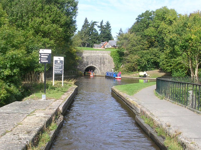
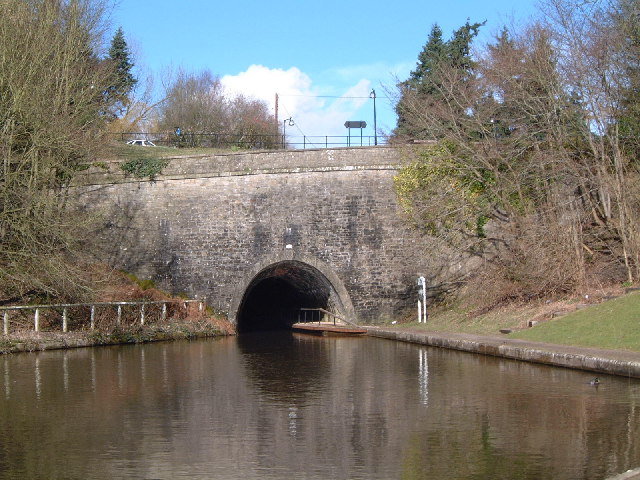
Chirk Tunnel
Chirk Tunnel is a canal tunnel near Chirk, Wales. It lies on the Llangollen Canal, immediately northwards of the Chirk Aqueduct. It is 421 metres (460...
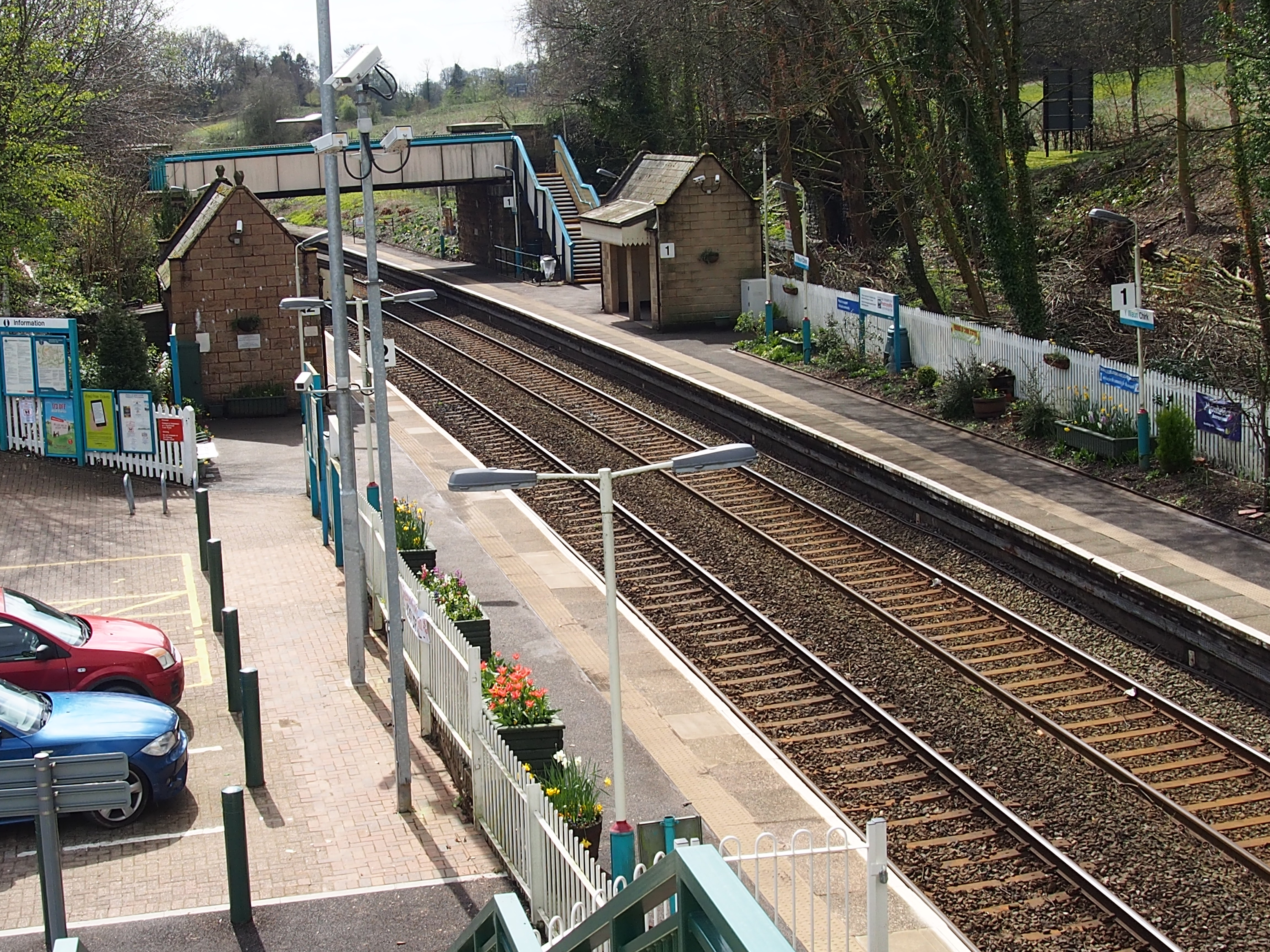
Chirk railway station
Chirk railway station (Welsh: Y Waun) serves the town of Chirk, Wrexham County Borough, Wales. The station is on the Shrewsbury to Chester Line 21 miles...

Chirk Viaduct
The Chirk Viaduct (Welsh: Traphont y Waun) is a Grade II* listed railway viaduct over the River Ceiriog between England and Wales. The viaduct carries...
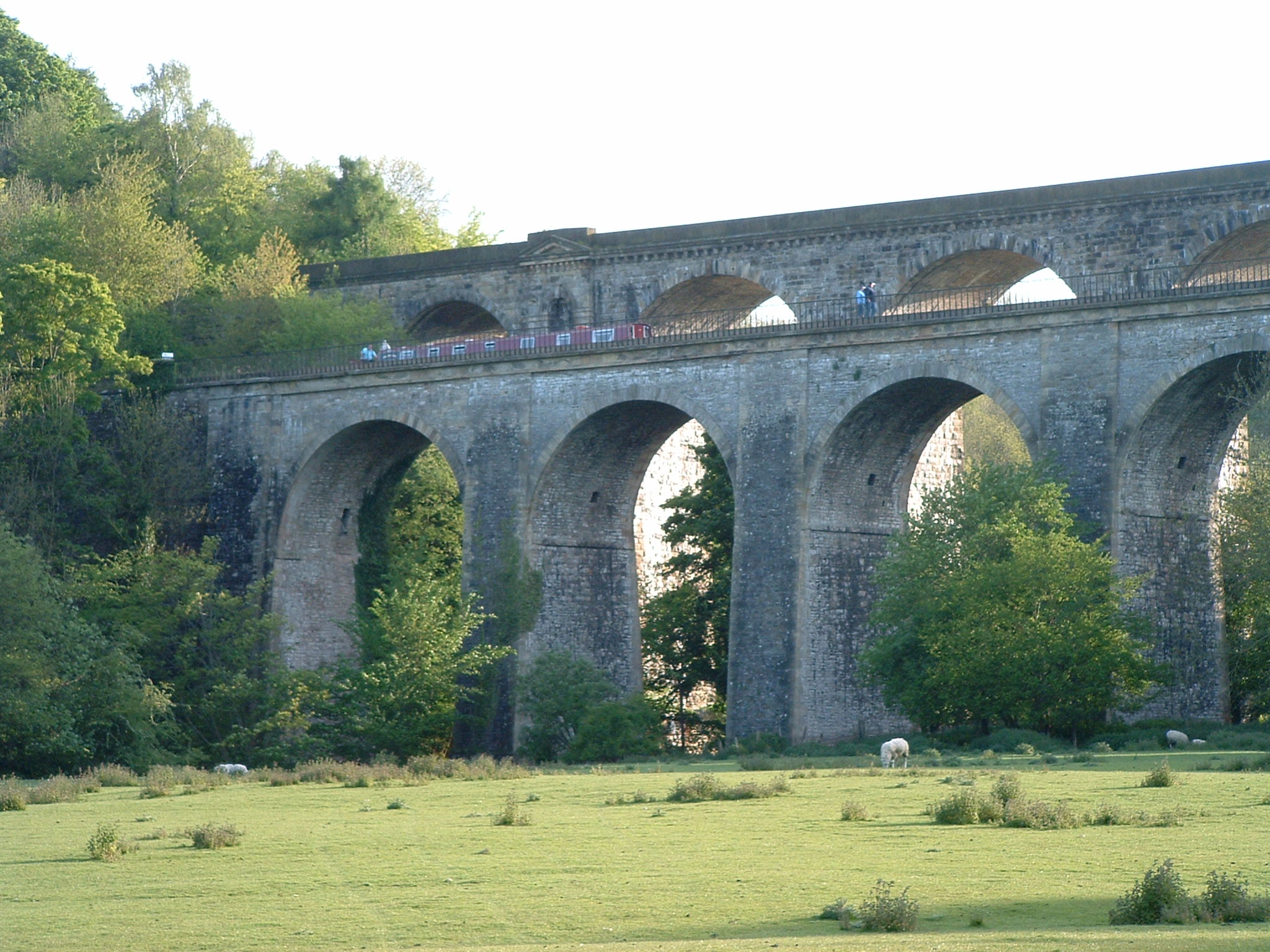
Chirk Aqueduct
Chirk Aqueduct is a 70-foot (21 m) high and 710-foot (220 m) long navigable aqueduct that carries what is now the Llangollen Canal across the Ceiriog Valley...
Nearby Amenities
Located within 500m of 52.930458,-3.0679737Have you been to Reservoir Wood?
Leave your review of Reservoir Wood below (or comments, questions and feedback).