Benbow Wood

Wood, Forest in Radnorshire

Wales

Benbow Wood

Quarry Pool at Nash Quarry View westwards over the ice-covered pool to the steep hillside of Knill Wood. The quarry is disused and the pool looks deep and dangerous.
Quarry Pool at Nash Quarry Credit: Trevor Rickard

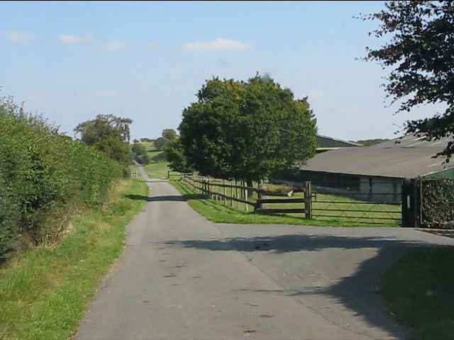
Benbow Wood is a picturesque forest located in the county of Radnorshire, Wales. Covering an area of approximately 300 acres, the wood is known for its diverse ecosystem and stunning natural beauty. It lies in close proximity to the scenic Radnor Forest, adding to its appeal as a tourist destination.

The woodland is predominantly made up of deciduous trees, such as oak, beech, and birch, creating a vibrant and ever-changing landscape throughout the seasons. The dense canopy provides shelter and habitat for a variety of wildlife, including deer, badgers, foxes, and a wide array of bird species. It is not uncommon to catch a glimpse of a red kite soaring above the treetops.

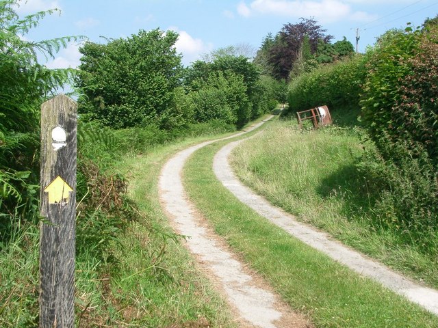
Visitors to Benbow Wood can enjoy a range of activities, including walking, hiking, and birdwatching. The forest is crisscrossed by a network of well-maintained trails, allowing visitors to explore the woodland at their own pace. The paths meander through ancient trees, alongside babbling brooks, and provide breathtaking views of the surrounding countryside.

For those seeking a tranquil escape, the wood offers several secluded picnic spots, where one can relax and immerse themselves in the serenity of nature. The forest also features a small visitor center, providing information about the local flora and fauna, as well as guided tours for those interested in learning more about the wood's history and ecological significance.

In summary, Benbow Wood is a captivating forest in Radnorshire, offering visitors a chance to connect with nature and experience the beauty of the Welsh countryside. Its varied wildlife, well-maintained trails, and peaceful atmosphere make it a popular destination for outdoor enthusiasts and nature lovers alike.

If you have any feedback on the listing, please let us know in the comments section below.

Benbow Wood Images

Images are sourced within 2km of 52.256902/-3.0520967 or Grid Reference SO2862. Thanks to Geograph Open Source API. All images are credited.

Quarry Pool at Nash Quarry View westwards over the ice-covered pool to the steep hillside of Knill Wood. The quarry is disused and the pool looks deep and dangerous.
Quarry Pool at Nash Quarry
View westwards over the ice-covered pool to the steep hillside of Knill Wood. The quarry is disused and the pool looks deep and dangerous.
Shed on the edge of Knill Wood View south-east across the Hindwell valley to Wapley Hill.
Shed on the edge of Knill Wood
View south-east across the Hindwell valley to Wapley Hill.
Quarry spoil tip at Nash Quarry The footpath heads eastwards below large quarry spoil tips.
Quarry spoil tip at Nash Quarry
The footpath heads eastwards below large quarry spoil tips.
Nash Scar - 2 The cliff face it at its highest above the quarry pool.
Nash Scar - 2
The cliff face it at its highest above the quarry pool.
Warning sign at Nash Quarry Like so many abandoned quarries, the pools formed become attractive to youngsters. This one looks particularly dangerous with steep and crumbling sides.
Warning sign at Nash Quarry
Like so many abandoned quarries, the pools formed become attractive to youngsters. This one looks particularly dangerous with steep and crumbling sides.
Warning signs at the entrance to Nash Quarry From the main road looking north-east up the entrance track. Obviously designed to stop people entering and messing about in what is clearly a very dangerous site. The sign on the right reads "£250 reward will be paid to the person or persons providing evidence to the conviction of anyone illegally tipping rubbish or trespassing on property owned by Nash Rocks Ltd". All good stuff, but a shame that this is also the entrance to a public footpath and that Nash Rocks Ltd have provided no such signs when approaching via this footpath from the west. In fact the public footpath direction signs within the quarry site were non-existent, otherwise I might not have strayed so far before realising I had missed this exit!
Warning signs at the entrance to Nash Quarry
From the main road looking north-east up the entrance track. Obviously designed to stop people entering and messing about in what is clearly a very dangerous site. The sign on the right reads "£250 reward will be paid to the person or persons providing evidence to the conviction of anyone illegally tipping rubbish or trespassing on property owned by Nash Rocks Ltd". All good stuff, but a shame that this is also the entrance to a public footpath and that Nash Rocks Ltd have provided no such signs when approaching via this footpath from the west. In fact the public footpath direction signs within the quarry site were non-existent, otherwise I might not have strayed so far before realising I had missed this exit!
Access road near Evenjobb
Lane to Thorn at Pen Offa
Cottage at Thorn
Cottage at Thorn
Lane crossroads at Thorn Single-track lanes meet at this unsigned junction.
Lane crossroads at Thorn
Single-track lanes meet at this unsigned junction.
Rowley Farm In the distance the lane passes through a gate onto common land.
Rowley Farm
In the distance the lane passes through a gate onto common land.
Unfenced lane at Rowley Farm
Eastern end of the unfenced lane
Burfa Bank Parked a short way up forestry track, then a first corner heading NW a muddy track heads upward through trees bluebells and nettles. Top is grassy ridge.
Name: Burfa Bank
Hill number: 5226
Height: 313m / 1027ft
Area: 31B: Welshpool to Hay-on-Wye
Class: Hu
Grid ref: SO 28266 60997
Summit feature: no feature: grass
Drop: 104m
Col: 209m  SO280617
Burfa Bank
Parked a short way up forestry track, then a first corner heading NW a muddy track heads upward through trees bluebells and nettles. Top is grassy ridge. Name: Burfa Bank Hill number: 5226 Height: 313m / 1027ft Area: 31B: Welshpool to Hay-on-Wye Class: Hu Grid ref: SO 28266 60997 Summit feature: no feature: grass Drop: 104m Col: 209m SO280617
On Offa's Dyke Path S of Pen Offa near Evenjobb
Burfa Farm near Lower Harpton
Logging road, Burfa At the foot of the steep Burfa Bank.
Logging road, Burfa
At the foot of the steep Burfa Bank.
Show me another place!

Benbow Wood is located at Grid Ref: SO2862 (Lat: 52.256902, Lng: -3.0520967)

Unitary Authority: Powys

Police Authority: Dyfed Powys

What 3 Words

///circulate.paddock.earplugs. Near Presteigne, Powys

Related Wikis

Burfa Castle

Burfa Castle (also known as Burfa Hillfort, Burfa Bank Hillfort, or Burfa Camp) is an Iron Age hillfort near the tiny town of Old Radnor, Radnorshire in...

Knill

Knill is a village and civil parish in Herefordshire, England. == History == Recorded in the Domesday Book of 1086 as Chenille (from the Old English meaning...

Lower Harpton

Lower Harpton is a settlement and civil parish about 2.5 miles of Knighton, in the county of Herefordshire, England. In 2001, the parish had a population...

Beggar's Bush, Powys

Beggar's Bush is a hamlet in the community of Pencraig, Powys, Wales, which is 55 miles (88 km) from Cardiff and 137 miles (220 km) from London. A round...

Presteign railway station

Presteign Railway Station was a railway station serving the town of Presteigne, Radnorshire, Wales. It was a terminus on the Leominster and Kington Railway...

Radnorshire Arms

The Radnorshire Arms is a well-preserved Jacobean building in the Welsh border town of Presteigne, in Powys. The building has the date 1616 over its door...

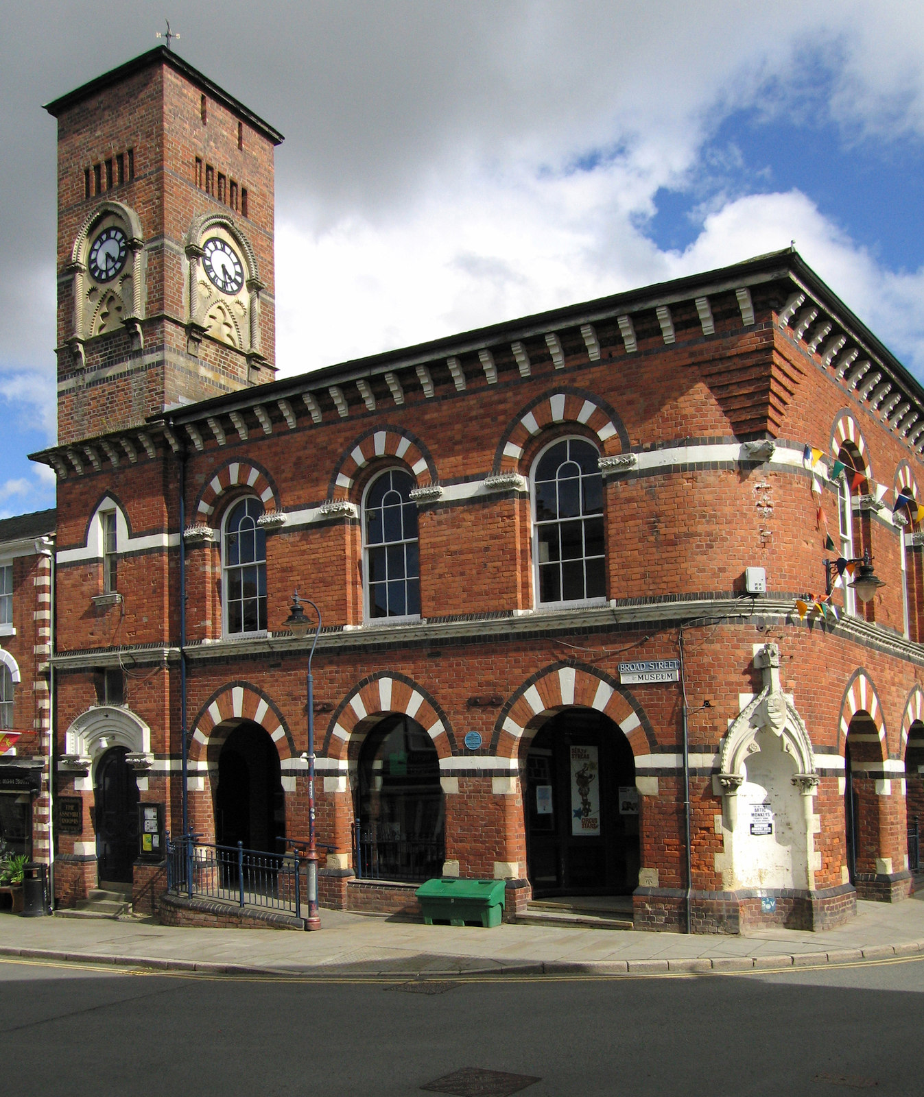
Assembly Rooms, Presteigne

The Assembly Rooms in Presteigne (Welsh: Ystafelloedd Cynnull Llanandras), formerly Presteigne Town Hall (Welsh: Neuadd y Dref Llanandras), is a municipal...

John Beddoes School

John Beddoes School was a secondary or comprehensive school for boys and girls. The school was based on one site in the town of Presteigne.It had a largely...

Nearby Amenities

Located within 500m of 52.256902,-3.0520967
Place: farm
Lat/Long: 52.260494/-3.0516475
The data included in this document is from www.openstreetmap.org. The data is made available under ODbL.

Have you been to Benbow Wood?

Leave your review of Benbow Wood below (or comments, questions and feedback).