Coed Gwaun-y-'ffeiriad

Wood, Forest in Monmouthshire

Wales

Coed Gwaun-y-'ffeiriad

Boulders on grass, Upper Cwmbran Near the northern end of Graig Road.
Boulders on grass, Upper Cwmbran Credit: Jaggery

Coed Gwaun-y-'ffeiriad, located in Monmouthshire, Wales, is a picturesque woodland area renowned for its natural beauty and rich history. The name "Gwaun-y-'ffeiriad" translates to "the meadow of the priests," indicating its historical connection to religious practices.

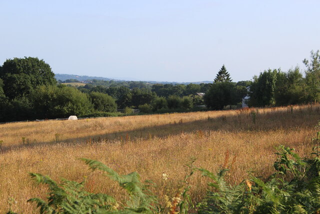
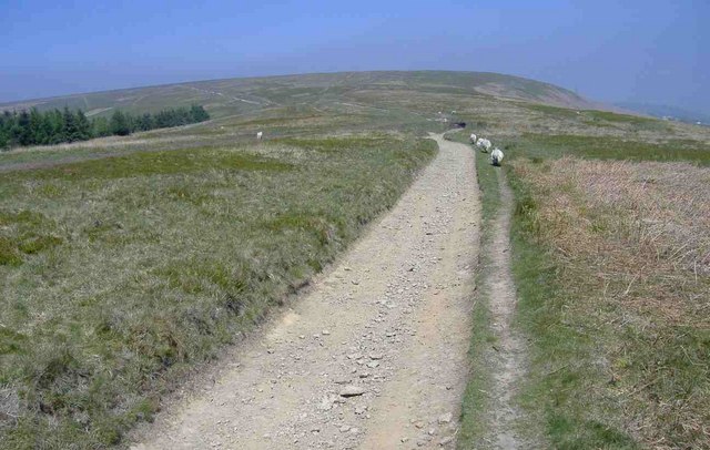
Covering an area of approximately 500 acres, Coed Gwaun-y-'ffeiriad is predominantly composed of native broadleaf trees, including oak, beech, and ash. This diverse woodland ecosystem supports a wide range of flora and fauna, making it a haven for nature enthusiasts and wildlife alike. Visitors can wander through the tranquil forest trails, enjoying the sights and sounds of chirping birds and rustling leaves.

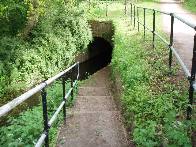
This woodland has a long-standing association with the local community and has been a cherished natural resource for generations. It has served as a place for recreational activities such as walking, hiking, and birdwatching. Additionally, it offers a peaceful environment for individuals seeking solace and a connection to nature.

Coed Gwaun-y-'ffeiriad holds historical significance as well. The remnants of ancient earthworks and burial mounds can be found within the woodland, indicating human occupation dating back thousands of years. These archaeological features provide valuable insights into the region's past and add an extra layer of intrigue to the woodland experience.

Managed by local authorities, Coed Gwaun-y-'ffeiriad is well-maintained and offers amenities such as parking facilities and well-marked trails for visitors. Its accessibility and natural beauty make it a popular destination for nature lovers and those seeking a tranquil escape in the heart of Monmouthshire.

If you have any feedback on the listing, please let us know in the comments section below.

Coed Gwaun-y-'ffeiriad Images

Images are sourced within 2km of 51.670368/-3.057985 or Grid Reference ST2697. Thanks to Geograph Open Source API. All images are credited.

Boulders on grass, Upper Cwmbran Near the northern end of Graig Road.
Boulders on grass, Upper Cwmbran
Near the northern end of Graig Road.
Up a track in Upper Cwmbran Ascending to the SW away from Graig Road.
Up a track in Upper Cwmbran
Ascending to the SW away from Graig Road.
Five lockup garages, Upper Cwmbran Viewed across Graig Road.
Five lockup garages, Upper Cwmbran
Viewed across Graig Road.
Siloam, Upper Cwmbran Siloam Baptist Church viewed in 2024. Opened in 1838 as Siloam Baptist Chapel.
Siloam, Upper Cwmbran
Siloam Baptist Church viewed in 2024. Opened in 1838 as Siloam Baptist Chapel.
Walker by Monmouthshire and Brecon Canal in Pontnewydd The Monmouthshire and Brecon Canal (popularly referred to as the Mon & Brec) was originally two separate canals: the Brecknock & Abergavenny Canal, and the Monmouthshire Canal. The 35-mile navigable section seen today is mostly the former. Following discussions in the 1790s, it was decided to link the two canals at Pontymoile. The Monmouthshire Canal, including a branch from Malpas to Crumlin, was opened in 1799 with the Brecknock & Abergavenny extending from Brecon to Gilwern by 1800, finally reaching Pontymoile by 1812.

Though originally constructed to transport coal, lime and agricultural products the canal was used extensively by ironmasters and industrialists as their main transport network, bringing the raw iron ore up the canal from Newport to Llanfoist Wharf and thence by tramroads to the iron works and returning with trams loaded with iron, the finished product. 

In 1880 the Monmouthshire & Brecon Canals were taken over by the Great Western Railway. Within 35 years, commercial carrying had all but ceased. Throughout the 20th century various parts of the Monmouthshire Canal were filled in for road construction. Both canals were abandoned by the early 1960s but restoration work from Brecon to Pontymoile began in 1968 following vigorous campaigning by canal enthusiasts. Recent developments have included a complete regeneration of the terminus at Brecon, and various works continue to reclaim the navigation between Pontymoile and Newport. The Blaenavon area and a section of the canal were granted World Heritage status in 2000 in recognition of its historical significance. 
<span class="nowrap"><a title="https://canalrivertrust.org.uk/enjoy-the-waterways/canal-and-river-network/monmouthshire-and-brecon-canal" rel="nofollow ugc noopener" href="https://canalrivertrust.org.uk/enjoy-the-waterways/canal-and-river-network/monmouthshire-and-brecon-canal">Link</a><img style="margin-left:2px;" alt="External link" title="External link - shift click to open in new window" src="https://s1.geograph.org.uk/img/external.png" width="10" height="10"/></span>  Canal and River Trust
Walker by Monmouthshire and Brecon Canal in Pontnewydd
The Monmouthshire and Brecon Canal (popularly referred to as the Mon & Brec) was originally two separate canals: the Brecknock & Abergavenny Canal, and the Monmouthshire Canal. The 35-mile navigable section seen today is mostly the former. Following discussions in the 1790s, it was decided to link the two canals at Pontymoile. The Monmouthshire Canal, including a branch from Malpas to Crumlin, was opened in 1799 with the Brecknock & Abergavenny extending from Brecon to Gilwern by 1800, finally reaching Pontymoile by 1812. Though originally constructed to transport coal, lime and agricultural products the canal was used extensively by ironmasters and industrialists as their main transport network, bringing the raw iron ore up the canal from Newport to Llanfoist Wharf and thence by tramroads to the iron works and returning with trams loaded with iron, the finished product. In 1880 the Monmouthshire & Brecon Canals were taken over by the Great Western Railway. Within 35 years, commercial carrying had all but ceased. Throughout the 20th century various parts of the Monmouthshire Canal were filled in for road construction. Both canals were abandoned by the early 1960s but restoration work from Brecon to Pontymoile began in 1968 following vigorous campaigning by canal enthusiasts. Recent developments have included a complete regeneration of the terminus at Brecon, and various works continue to reclaim the navigation between Pontymoile and Newport. The Blaenavon area and a section of the canal were granted World Heritage status in 2000 in recognition of its historical significance. LinkExternal link Canal and River Trust
Monmouthshire and Brecon Canal at southern end of Five Locks The Monmouthshire and Brecon Canal (popularly referred to as the Mon & Brec) was originally two separate canals: the Brecknock & Abergavenny Canal, and the Monmouthshire Canal. The 35-mile navigable section seen today is mostly the former. Following discussions in the 1790s, it was decided to link the two canals at Pontymoile. The Monmouthshire Canal, including a branch from Malpas to Crumlin, was opened in 1799 with the Brecknock & Abergavenny extending from Brecon to Gilwern by 1800, finally reaching Pontymoile by 1812.

Though originally constructed to transport coal, lime and agricultural products the canal was used extensively by ironmasters and industrialists as their main transport network, bringing the raw iron ore up the canal from Newport to Llanfoist Wharf and thence by tramroads to the iron works and returning with trams loaded with iron, the finished product. 

In 1880 the Monmouthshire & Brecon Canals were taken over by the Great Western Railway. Within 35 years, commercial carrying had all but ceased. Throughout the 20th century various parts of the Monmouthshire Canal were filled in for road construction. Both canals were abandoned by the early 1960s but restoration work from Brecon to Pontymoile began in 1968 following vigorous campaigning by canal enthusiasts. Recent developments have included a complete regeneration of the terminus at Brecon, and various works continue to reclaim the navigation between Pontymoile and Newport. The Blaenavon area and a section of the canal were granted World Heritage status in 2000 in recognition of its historical significance. 
<span class="nowrap"><a title="https://canalrivertrust.org.uk/enjoy-the-waterways/canal-and-river-network/monmouthshire-and-brecon-canal" rel="nofollow ugc noopener" href="https://canalrivertrust.org.uk/enjoy-the-waterways/canal-and-river-network/monmouthshire-and-brecon-canal">Link</a><img style="margin-left:2px;" alt="External link" title="External link - shift click to open in new window" src="https://s1.geograph.org.uk/img/external.png" width="10" height="10"/></span>  Canal and River Trust
Monmouthshire and Brecon Canal at southern end of Five Locks
The Monmouthshire and Brecon Canal (popularly referred to as the Mon & Brec) was originally two separate canals: the Brecknock & Abergavenny Canal, and the Monmouthshire Canal. The 35-mile navigable section seen today is mostly the former. Following discussions in the 1790s, it was decided to link the two canals at Pontymoile. The Monmouthshire Canal, including a branch from Malpas to Crumlin, was opened in 1799 with the Brecknock & Abergavenny extending from Brecon to Gilwern by 1800, finally reaching Pontymoile by 1812. Though originally constructed to transport coal, lime and agricultural products the canal was used extensively by ironmasters and industrialists as their main transport network, bringing the raw iron ore up the canal from Newport to Llanfoist Wharf and thence by tramroads to the iron works and returning with trams loaded with iron, the finished product. In 1880 the Monmouthshire & Brecon Canals were taken over by the Great Western Railway. Within 35 years, commercial carrying had all but ceased. Throughout the 20th century various parts of the Monmouthshire Canal were filled in for road construction. Both canals were abandoned by the early 1960s but restoration work from Brecon to Pontymoile began in 1968 following vigorous campaigning by canal enthusiasts. Recent developments have included a complete regeneration of the terminus at Brecon, and various works continue to reclaim the navigation between Pontymoile and Newport. The Blaenavon area and a section of the canal were granted World Heritage status in 2000 in recognition of its historical significance. LinkExternal link Canal and River Trust
North portal of tunnel on Monmouthshire and Brecon Canal The Monmouthshire and Brecon Canal (popularly referred to as the Mon & Brec) was originally two separate canals: the Brecknock & Abergavenny Canal, and the Monmouthshire Canal. The 35-mile navigable section seen today is mostly the former. Following discussions in the 1790s, it was decided to link the two canals at Pontymoile. The Monmouthshire Canal, including a branch from Malpas to Crumlin, was opened in 1799 with the Brecknock & Abergavenny extending from Brecon to Gilwern by 1800, finally reaching Pontymoile by 1812.

Though originally constructed to transport coal, lime and agricultural products the canal was used extensively by ironmasters and industrialists as their main transport network, bringing the raw iron ore up the canal from Newport to Llanfoist Wharf and thence by tramroads to the iron works and returning with trams loaded with iron, the finished product. 

In 1880 the Monmouthshire & Brecon Canals were taken over by the Great Western Railway. Within 35 years, commercial carrying had all but ceased. Throughout the 20th century various parts of the Monmouthshire Canal were filled in for road construction. Both canals were abandoned by the early 1960s but restoration work from Brecon to Pontymoile began in 1968 following vigorous campaigning by canal enthusiasts. Recent developments have included a complete regeneration of the terminus at Brecon, and various works continue to reclaim the navigation between Pontymoile and Newport. The Blaenavon area and a section of the canal were granted World Heritage status in 2000 in recognition of its historical significance. 
<span class="nowrap"><a title="https://canalrivertrust.org.uk/enjoy-the-waterways/canal-and-river-network/monmouthshire-and-brecon-canal" rel="nofollow ugc noopener" href="https://canalrivertrust.org.uk/enjoy-the-waterways/canal-and-river-network/monmouthshire-and-brecon-canal">Link</a><img style="margin-left:2px;" alt="External link" title="External link - shift click to open in new window" src="https://s1.geograph.org.uk/img/external.png" width="10" height="10"/></span>  Canal and River Trust
North portal of tunnel on Monmouthshire and Brecon Canal
The Monmouthshire and Brecon Canal (popularly referred to as the Mon & Brec) was originally two separate canals: the Brecknock & Abergavenny Canal, and the Monmouthshire Canal. The 35-mile navigable section seen today is mostly the former. Following discussions in the 1790s, it was decided to link the two canals at Pontymoile. The Monmouthshire Canal, including a branch from Malpas to Crumlin, was opened in 1799 with the Brecknock & Abergavenny extending from Brecon to Gilwern by 1800, finally reaching Pontymoile by 1812. Though originally constructed to transport coal, lime and agricultural products the canal was used extensively by ironmasters and industrialists as their main transport network, bringing the raw iron ore up the canal from Newport to Llanfoist Wharf and thence by tramroads to the iron works and returning with trams loaded with iron, the finished product. In 1880 the Monmouthshire & Brecon Canals were taken over by the Great Western Railway. Within 35 years, commercial carrying had all but ceased. Throughout the 20th century various parts of the Monmouthshire Canal were filled in for road construction. Both canals were abandoned by the early 1960s but restoration work from Brecon to Pontymoile began in 1968 following vigorous campaigning by canal enthusiasts. Recent developments have included a complete regeneration of the terminus at Brecon, and various works continue to reclaim the navigation between Pontymoile and Newport. The Blaenavon area and a section of the canal were granted World Heritage status in 2000 in recognition of its historical significance. LinkExternal link Canal and River Trust
South tunnel portal on Monmouthshire and Brecon Canal The Cwmbran tunnel is quite short and is approached through a cutting on the south side, where these steps give access to the portal
South tunnel portal on Monmouthshire and Brecon Canal
The Cwmbran tunnel is quite short and is approached through a cutting on the south side, where these steps give access to the portal
Monmouthshire and Brecon Canal, Five Locks The Monmouthshire and Brecon Canal (popularly referred to as the Mon & Brec) was originally two separate canals: the Brecknock & Abergavenny Canal, and the Monmouthshire Canal. The 35-mile navigable section seen today is mostly the former. Following discussions in the 1790s, it was decided to link the two canals at Pontymoile. The Monmouthshire Canal, including a branch from Malpas to Crumlin, was opened in 1799 with the Brecknock & Abergavenny extending from Brecon to Gilwern by 1800, finally reaching Pontymoile by 1812.

Though originally constructed to transport coal, lime and agricultural products the canal was used extensively by ironmasters and industrialists as their main transport network, bringing the raw iron ore up the canal from Newport to Llanfoist Wharf and thence by tramroads to the iron works and returning with trams loaded with iron, the finished product. 

In 1880 the Monmouthshire & Brecon Canals were taken over by the Great Western Railway. Within 35 years, commercial carrying had all but ceased. Throughout the 20th century various parts of the Monmouthshire Canal were filled in for road construction. Both canals were abandoned by the early 1960s but restoration work from Brecon to Pontymoile began in 1968 following vigorous campaigning by canal enthusiasts. Recent developments have included a complete regeneration of the terminus at Brecon, and various works continue to reclaim the navigation between Pontymoile and Newport. The Blaenavon area and a section of the canal were granted World Heritage status in 2000 in recognition of its historical significance. 
<span class="nowrap"><a title="https://canalrivertrust.org.uk/enjoy-the-waterways/canal-and-river-network/monmouthshire-and-brecon-canal" rel="nofollow ugc noopener" href="https://canalrivertrust.org.uk/enjoy-the-waterways/canal-and-river-network/monmouthshire-and-brecon-canal">Link</a><img style="margin-left:2px;" alt="External link" title="External link - shift click to open in new window" src="https://s1.geograph.org.uk/img/external.png" width="10" height="10"/></span>  Canal and River Trust
Monmouthshire and Brecon Canal, Five Locks
The Monmouthshire and Brecon Canal (popularly referred to as the Mon & Brec) was originally two separate canals: the Brecknock & Abergavenny Canal, and the Monmouthshire Canal. The 35-mile navigable section seen today is mostly the former. Following discussions in the 1790s, it was decided to link the two canals at Pontymoile. The Monmouthshire Canal, including a branch from Malpas to Crumlin, was opened in 1799 with the Brecknock & Abergavenny extending from Brecon to Gilwern by 1800, finally reaching Pontymoile by 1812. Though originally constructed to transport coal, lime and agricultural products the canal was used extensively by ironmasters and industrialists as their main transport network, bringing the raw iron ore up the canal from Newport to Llanfoist Wharf and thence by tramroads to the iron works and returning with trams loaded with iron, the finished product. In 1880 the Monmouthshire & Brecon Canals were taken over by the Great Western Railway. Within 35 years, commercial carrying had all but ceased. Throughout the 20th century various parts of the Monmouthshire Canal were filled in for road construction. Both canals were abandoned by the early 1960s but restoration work from Brecon to Pontymoile began in 1968 following vigorous campaigning by canal enthusiasts. Recent developments have included a complete regeneration of the terminus at Brecon, and various works continue to reclaim the navigation between Pontymoile and Newport. The Blaenavon area and a section of the canal were granted World Heritage status in 2000 in recognition of its historical significance. LinkExternal link Canal and River Trust
Monmouthshire and Brecon Canal, north of Five Locks The Monmouthshire and Brecon Canal (popularly referred to as the Mon & Brec) was originally two separate canals: the Brecknock & Abergavenny Canal, and the Monmouthshire Canal. The 35-mile navigable section seen today is mostly the former. Following discussions in the 1790s, it was decided to link the two canals at Pontymoile. The Monmouthshire Canal, including a branch from Malpas to Crumlin, was opened in 1799 with the Brecknock & Abergavenny extending from Brecon to Gilwern by 1800, finally reaching Pontymoile by 1812.

Though originally constructed to transport coal, lime and agricultural products the canal was used extensively by ironmasters and industrialists as their main transport network, bringing the raw iron ore up the canal from Newport to Llanfoist Wharf and thence by tramroads to the iron works and returning with trams loaded with iron, the finished product. 

In 1880 the Monmouthshire & Brecon Canals were taken over by the Great Western Railway. Within 35 years, commercial carrying had all but ceased. Throughout the 20th century various parts of the Monmouthshire Canal were filled in for road construction. Both canals were abandoned by the early 1960s but restoration work from Brecon to Pontymoile began in 1968 following vigorous campaigning by canal enthusiasts. Recent developments have included a complete regeneration of the terminus at Brecon, and various works continue to reclaim the navigation between Pontymoile and Newport. The Blaenavon area and a section of the canal were granted World Heritage status in 2000 in recognition of its historical significance. 
<span class="nowrap"><a title="https://canalrivertrust.org.uk/enjoy-the-waterways/canal-and-river-network/monmouthshire-and-brecon-canal" rel="nofollow ugc noopener" href="https://canalrivertrust.org.uk/enjoy-the-waterways/canal-and-river-network/monmouthshire-and-brecon-canal">Link</a><img style="margin-left:2px;" alt="External link" title="External link - shift click to open in new window" src="https://s1.geograph.org.uk/img/external.png" width="10" height="10"/></span>  Canal and River Trust
Monmouthshire and Brecon Canal, north of Five Locks
The Monmouthshire and Brecon Canal (popularly referred to as the Mon & Brec) was originally two separate canals: the Brecknock & Abergavenny Canal, and the Monmouthshire Canal. The 35-mile navigable section seen today is mostly the former. Following discussions in the 1790s, it was decided to link the two canals at Pontymoile. The Monmouthshire Canal, including a branch from Malpas to Crumlin, was opened in 1799 with the Brecknock & Abergavenny extending from Brecon to Gilwern by 1800, finally reaching Pontymoile by 1812. Though originally constructed to transport coal, lime and agricultural products the canal was used extensively by ironmasters and industrialists as their main transport network, bringing the raw iron ore up the canal from Newport to Llanfoist Wharf and thence by tramroads to the iron works and returning with trams loaded with iron, the finished product. In 1880 the Monmouthshire & Brecon Canals were taken over by the Great Western Railway. Within 35 years, commercial carrying had all but ceased. Throughout the 20th century various parts of the Monmouthshire Canal were filled in for road construction. Both canals were abandoned by the early 1960s but restoration work from Brecon to Pontymoile began in 1968 following vigorous campaigning by canal enthusiasts. Recent developments have included a complete regeneration of the terminus at Brecon, and various works continue to reclaim the navigation between Pontymoile and Newport. The Blaenavon area and a section of the canal were granted World Heritage status in 2000 in recognition of its historical significance. LinkExternal link Canal and River Trust
One lock at Five Locks, Monmouthshire and Brecon Canal The Monmouthshire and Brecon Canal (popularly referred to as the Mon & Brec) was originally two separate canals: the Brecknock & Abergavenny Canal, and the Monmouthshire Canal. The 35-mile navigable section seen today is mostly the former. Following discussions in the 1790s, it was decided to link the two canals at Pontymoile. The Monmouthshire Canal, including a branch from Malpas to Crumlin, was opened in 1799 with the Brecknock & Abergavenny extending from Brecon to Gilwern by 1800, finally reaching Pontymoile by 1812.

Though originally constructed to transport coal, lime and agricultural products the canal was used extensively by ironmasters and industrialists as their main transport network, bringing the raw iron ore up the canal from Newport to Llanfoist Wharf and thence by tramroads to the iron works and returning with trams loaded with iron, the finished product. 

In 1880 the Monmouthshire & Brecon Canals were taken over by the Great Western Railway. Within 35 years, commercial carrying had all but ceased. Throughout the 20th century various parts of the Monmouthshire Canal were filled in for road construction. Both canals were abandoned by the early 1960s but restoration work from Brecon to Pontymoile began in 1968 following vigorous campaigning by canal enthusiasts. Recent developments have included a complete regeneration of the terminus at Brecon, and various works continue to reclaim the navigation between Pontymoile and Newport. The Blaenavon area and a section of the canal were granted World Heritage status in 2000 in recognition of its historical significance. 
<span class="nowrap"><a title="https://canalrivertrust.org.uk/enjoy-the-waterways/canal-and-river-network/monmouthshire-and-brecon-canal" rel="nofollow ugc noopener" href="https://canalrivertrust.org.uk/enjoy-the-waterways/canal-and-river-network/monmouthshire-and-brecon-canal">Link</a><img style="margin-left:2px;" alt="External link" title="External link - shift click to open in new window" src="https://s1.geograph.org.uk/img/external.png" width="10" height="10"/></span>  Canal and River Trust
One lock at Five Locks, Monmouthshire and Brecon Canal
The Monmouthshire and Brecon Canal (popularly referred to as the Mon & Brec) was originally two separate canals: the Brecknock & Abergavenny Canal, and the Monmouthshire Canal. The 35-mile navigable section seen today is mostly the former. Following discussions in the 1790s, it was decided to link the two canals at Pontymoile. The Monmouthshire Canal, including a branch from Malpas to Crumlin, was opened in 1799 with the Brecknock & Abergavenny extending from Brecon to Gilwern by 1800, finally reaching Pontymoile by 1812. Though originally constructed to transport coal, lime and agricultural products the canal was used extensively by ironmasters and industrialists as their main transport network, bringing the raw iron ore up the canal from Newport to Llanfoist Wharf and thence by tramroads to the iron works and returning with trams loaded with iron, the finished product. In 1880 the Monmouthshire & Brecon Canals were taken over by the Great Western Railway. Within 35 years, commercial carrying had all but ceased. Throughout the 20th century various parts of the Monmouthshire Canal were filled in for road construction. Both canals were abandoned by the early 1960s but restoration work from Brecon to Pontymoile began in 1968 following vigorous campaigning by canal enthusiasts. Recent developments have included a complete regeneration of the terminus at Brecon, and various works continue to reclaim the navigation between Pontymoile and Newport. The Blaenavon area and a section of the canal were granted World Heritage status in 2000 in recognition of its historical significance. LinkExternal link Canal and River Trust
The foot of Five Locks, Monmouthshire and Brecon Canal The Monmouthshire and Brecon Canal (popularly referred to as the Mon & Brec) was originally two separate canals: the Brecknock & Abergavenny Canal, and the Monmouthshire Canal. The 35-mile navigable section seen today is mostly the former. Following discussions in the 1790s, it was decided to link the two canals at Pontymoile. The Monmouthshire Canal, including a branch from Malpas to Crumlin, was opened in 1799 with the Brecknock & Abergavenny extending from Brecon to Gilwern by 1800, finally reaching Pontymoile by 1812.

Though originally constructed to transport coal, lime and agricultural products the canal was used extensively by ironmasters and industrialists as their main transport network, bringing the raw iron ore up the canal from Newport to Llanfoist Wharf and thence by tramroads to the iron works and returning with trams loaded with iron, the finished product. 

In 1880 the Monmouthshire & Brecon Canals were taken over by the Great Western Railway. Within 35 years, commercial carrying had all but ceased. Throughout the 20th century various parts of the Monmouthshire Canal were filled in for road construction. Both canals were abandoned by the early 1960s but restoration work from Brecon to Pontymoile began in 1968 following vigorous campaigning by canal enthusiasts. Recent developments have included a complete regeneration of the terminus at Brecon, and various works continue to reclaim the navigation between Pontymoile and Newport. The Blaenavon area and a section of the canal were granted World Heritage status in 2000 in recognition of its historical significance. 
<span class="nowrap"><a title="https://canalrivertrust.org.uk/enjoy-the-waterways/canal-and-river-network/monmouthshire-and-brecon-canal" rel="nofollow ugc noopener" href="https://canalrivertrust.org.uk/enjoy-the-waterways/canal-and-river-network/monmouthshire-and-brecon-canal">Link</a><img style="margin-left:2px;" alt="External link" title="External link - shift click to open in new window" src="https://s1.geograph.org.uk/img/external.png" width="10" height="10"/></span>  Canal and River Trust
The foot of Five Locks, Monmouthshire and Brecon Canal
The Monmouthshire and Brecon Canal (popularly referred to as the Mon & Brec) was originally two separate canals: the Brecknock & Abergavenny Canal, and the Monmouthshire Canal. The 35-mile navigable section seen today is mostly the former. Following discussions in the 1790s, it was decided to link the two canals at Pontymoile. The Monmouthshire Canal, including a branch from Malpas to Crumlin, was opened in 1799 with the Brecknock & Abergavenny extending from Brecon to Gilwern by 1800, finally reaching Pontymoile by 1812. Though originally constructed to transport coal, lime and agricultural products the canal was used extensively by ironmasters and industrialists as their main transport network, bringing the raw iron ore up the canal from Newport to Llanfoist Wharf and thence by tramroads to the iron works and returning with trams loaded with iron, the finished product. In 1880 the Monmouthshire & Brecon Canals were taken over by the Great Western Railway. Within 35 years, commercial carrying had all but ceased. Throughout the 20th century various parts of the Monmouthshire Canal were filled in for road construction. Both canals were abandoned by the early 1960s but restoration work from Brecon to Pontymoile began in 1968 following vigorous campaigning by canal enthusiasts. Recent developments have included a complete regeneration of the terminus at Brecon, and various works continue to reclaim the navigation between Pontymoile and Newport. The Blaenavon area and a section of the canal were granted World Heritage status in 2000 in recognition of its historical significance. LinkExternal link Canal and River Trust
Field near Uplands Farm, Sebastopol Field next to private road to Uplands Farm (Balan Sports).
Field near Uplands Farm, Sebastopol
Field next to private road to Uplands Farm (Balan Sports).
Gateway at start of private road to Uplands Farm The road starts from Oaklands Road on the edge of a housing estate.
Gateway at start of private road to Uplands Farm
The road starts from Oaklands Road on the edge of a housing estate.
Canal towpath Monmouthshire and Brecon canal.
Canal towpath
Monmouthshire and Brecon canal.
Canal Tunnel South Entrance Southern Entrance to tunnel on Monmouthshire and Brecon canal (Map ref 287973)
Canal Tunnel South Entrance
Southern Entrance to tunnel on Monmouthshire and Brecon canal (Map ref 287973)
Canal Tunnel North Entrance Northern Entrance to tunnel on Monmouthshire and Brecon canal (Map ref 287973)
Canal Tunnel North Entrance
Northern Entrance to tunnel on Monmouthshire and Brecon canal (Map ref 287973)
Green Meadow Farm This is the old farm house. Visitors can pet and feed the animals. A lovely day out for all the family.
Green Meadow Farm
This is the old farm house. Visitors can pet and feed the animals. A lovely day out for all the family.
Show me another place!

Coed Gwaun-y-'ffeiriad is located at Grid Ref: ST2697 (Lat: 51.670368, Lng: -3.057985)

Unitary Authority: Torfaen

Police Authority: Gwent

What 3 Words

///plan.loads.fuel. Near Cwmbran, Torfaen

Related Wikis

Upper Cwmbran

Upper Cwmbran (Welsh: Cwmbrân Uchaf) is a suburb of Cwmbran, Torfaen in Wales. It lies in between the suburbs of Pontnewydd and Thornhill. It is a community...

Mynydd Twyn-glas

Mynydd Twyn-glas is a sprawling 472-metre-high mountain extending into Caerphilly and Torfaen county boroughs in South Wales. It lies southwest of Pontypool...

Thornhill, Torfaen

Thornhill is a large council estate on the western side of Cwmbran, Torfaen in Wales. It is adjacent to the suburbs of Greenmeadow and Upper Cwmbran and...

Greenmeadow

Greenmeadow is a suburb of Cwmbran in the county borough of Torfaen, within the historic county boundaries of Monmouthshire, southern Wales, United Kingdom...

Nearby Amenities

Located within 500m of 51.670368,-3.057985
Ford: yes
Lat/Long: 51.6671906/-3.0584157
The data included in this document is from www.openstreetmap.org. The data is made available under ODbL.

Have you been to Coed Gwaun-y-'ffeiriad?

Leave your review of Coed Gwaun-y-'ffeiriad below (or comments, questions and feedback).