Blaen Bran Reservoir

Lake, Pool, Pond, Freshwater Marsh in Monmouthshire

Wales

Blaen Bran Reservoir

Boulders on grass, Upper Cwmbran Near the northern end of Graig Road.
Boulders on grass, Upper Cwmbran Credit: Jaggery

Blaen Bran Reservoir, located in Monmouthshire, is a picturesque freshwater body known for its scenic beauty and diverse wildlife. Nestled amidst rolling hills and lush greenery, this reservoir serves as an important water source for the surrounding communities.

Spanning an area of approximately 50 acres, Blaen Bran Reservoir is a man-made water body that was created in the early 20th century to meet the increasing demand for water. It is fed by several small streams that flow through the region, ensuring a constant supply of freshwater.

The reservoir features a tranquil environment, making it a popular spot for recreational activities such as fishing, boating, and bird-watching. Anglers can indulge in the thrill of catching trout and other freshwater fish species that thrive in its waters. The reservoir is regularly stocked with fish to maintain a healthy population.

Surrounding the reservoir is a freshwater marsh, which provides a habitat for a wide variety of plant and animal species. The marshland is rich in vegetation, including reeds, rushes, and water lilies. It serves as a breeding ground for numerous bird species, such as herons, ducks, and swans, attracting bird enthusiasts from far and wide.

Visitors can enjoy scenic walks along the reservoir's shoreline, taking in the panoramic views of the surrounding countryside. The tranquil atmosphere and natural beauty of Blaen Bran Reservoir make it a perfect destination for nature lovers and those seeking a peaceful escape from the hustle and bustle of daily life.

If you have any feedback on the listing, please let us know in the comments section below.

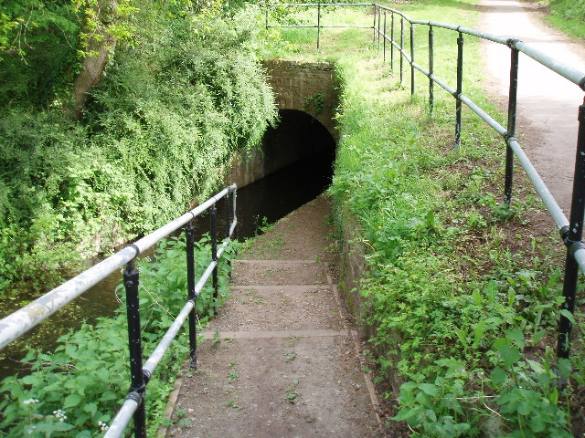
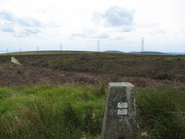
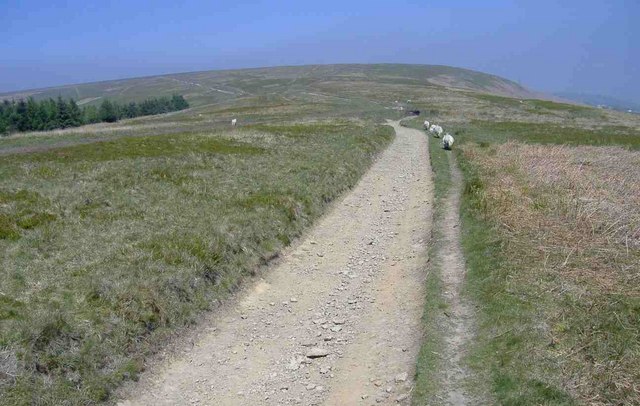
Blaen Bran Reservoir Images

Images are sourced within 2km of 51.667725/-3.0608733 or Grid Reference ST2697. Thanks to Geograph Open Source API. All images are credited.

Boulders on grass, Upper Cwmbran Near the northern end of Graig Road.
Boulders on grass, Upper Cwmbran
Near the northern end of Graig Road.
Up a track in Upper Cwmbran Ascending to the SW away from Graig Road.
Up a track in Upper Cwmbran
Ascending to the SW away from Graig Road.
Five lockup garages, Upper Cwmbran Viewed across Graig Road.
Five lockup garages, Upper Cwmbran
Viewed across Graig Road.
Siloam, Upper Cwmbran Siloam Baptist Church viewed in 2024. Opened in 1838 as Siloam Baptist Chapel.
Siloam, Upper Cwmbran
Siloam Baptist Church viewed in 2024. Opened in 1838 as Siloam Baptist Chapel.
Canal Tunnel South Entrance Southern Entrance to tunnel on Monmouthshire and Brecon canal (Map ref 287973)
Canal Tunnel South Entrance
Southern Entrance to tunnel on Monmouthshire and Brecon canal (Map ref 287973)
Canal Tunnel North Entrance Northern Entrance to tunnel on Monmouthshire and Brecon canal (Map ref 287973)
Canal Tunnel North Entrance
Northern Entrance to tunnel on Monmouthshire and Brecon canal (Map ref 287973)
Green Meadow Farm This is the old farm house. Visitors can pet and feed the animals. A lovely day out for all the family.
Green Meadow Farm
This is the old farm house. Visitors can pet and feed the animals. A lovely day out for all the family.
Cwm Lickey, Pontypool Photograph taken from Northern flank of Mynydd Maen, looking east over Cwm Lickey Pond and Pontypool
Cwm Lickey, Pontypool
Photograph taken from Northern flank of Mynydd Maen, looking east over Cwm Lickey Pond and Pontypool
Cwm Lickey, Pontypool Looking north over Cwm Lickey pond
Cwm Lickey, Pontypool
Looking north over Cwm Lickey pond
Top of 5 Locks Monmouth and Brecon Canal 5 locks is the present southerly limit of navigation on the Brecon arm of the canal hopefully the connection to Newport and the Crumlin arm will be restored soon
Top of 5 Locks Monmouth and Brecon Canal
5 locks is the present southerly limit of navigation on the Brecon arm of the canal hopefully the connection to Newport and the Crumlin arm will be restored soon
Milepost on Monmouth and Brecon Canal This milepost gives the distance to the former sealock at Potter Street in Newport now long since destroyed, the milepost is adjacent to the top of five locks.
Milepost on Monmouth and Brecon Canal
This milepost gives the distance to the former sealock at Potter Street in Newport now long since destroyed, the milepost is adjacent to the top of five locks.
Mynydd Twyn-Glas Triangulation pillar 472 looking SSW towards hillfort and motte at Twmbarlwm ( 6km) and Mynydd Machen
Mynydd Twyn-Glas
Triangulation pillar 472 looking SSW towards hillfort and motte at Twmbarlwm ( 6km) and Mynydd Machen
The Square, Upper Cwmbran Built for the workers of the local coalmine in around 1820. The cottages originally occupied three sides of a square, but some have been demolished. Also shown is the local Methodist Chapel. The photo is taken from the overgrown spoil tip.
The Square, Upper Cwmbran
Built for the workers of the local coalmine in around 1820. The cottages originally occupied three sides of a square, but some have been demolished. Also shown is the local Methodist Chapel. The photo is taken from the overgrown spoil tip.
Blaen Brân Reservoir and Blaen-Brân Community Woodland This picture shows the now disused Blaen-Brân Reservoir with part of the 100 acres of Blaen-Brân Community Woodland and Mynydd Maen in the background. There are two reservoirs shown on the maps but the top one was demolished many years ago. The picture was taken in 2003. The bridge to the water tower has now been removed, for public safety.
Blaen Brân Reservoir and Blaen-Brân Community Woodland
This picture shows the now disused Blaen-Brân Reservoir with part of the 100 acres of Blaen-Brân Community Woodland and Mynydd Maen in the background. There are two reservoirs shown on the maps but the top one was demolished many years ago. The picture was taken in 2003. The bridge to the water tower has now been removed, for public safety.
Blaen Brân Reservoir and Blaen-Brân Community Woodland This shows the same view as geograph 366898 but 4 years later. Sadly the iron bridge to the valve tower has been scrapped for public safety reasons. Blaen-Brân Community Woodland is thriving, with 100 members, and many more local people visiting the woods for quiet recreation. It was bought for the local community with grant aid from the Cydcoed "Woodlands For All" Project. The reservoir is full due to heavy rain.
Blaen Brân Reservoir and Blaen-Brân Community Woodland
This shows the same view as geograph 366898 but 4 years later. Sadly the iron bridge to the valve tower has been scrapped for public safety reasons. Blaen-Brân Community Woodland is thriving, with 100 members, and many more local people visiting the woods for quiet recreation. It was bought for the local community with grant aid from the Cydcoed "Woodlands For All" Project. The reservoir is full due to heavy rain.
The New Ford and the Brân Brook The ford was completed in the autumn of 2006 and the design is believed to be unique. It allows Fire Engines and other authorised vehicles to enter Blaen Brân Community Woodland quickly and safely. The vehicles can cross the stream without disturbing the stream bed. The ford was designed by Chris Harris from an idea by Mark Strickland. It was built for the Community Woodland using grant aid from Cydcoed.
The New Ford and the Brân Brook
The ford was completed in the autumn of 2006 and the design is believed to be unique. It allows Fire Engines and other authorised vehicles to enter Blaen Brân Community Woodland quickly and safely. The vehicles can cross the stream without disturbing the stream bed. The ford was designed by Chris Harris from an idea by Mark Strickland. It was built for the Community Woodland using grant aid from Cydcoed.
Cwm Carn
Cwm Carn
Cairn on Mynydd Maen
Show me another place!

Blaen Bran Reservoir is located at Grid Ref: ST2697 (Lat: 51.667725, Lng: -3.0608733)

Unitary Authority: Torfaen

Police Authority: Gwent

What 3 Words

///orange.filled.search. Near Cwmbran, Torfaen

Related Wikis

Upper Cwmbran

Upper Cwmbran (Welsh: Cwmbrân Uchaf) is a suburb of Cwmbran, Torfaen in Wales. It lies in between the suburbs of Pontnewydd and Thornhill. It is a community...

Mynydd Twyn-glas

Mynydd Twyn-glas is a sprawling 472-metre-high mountain extending into Caerphilly and Torfaen county boroughs in South Wales. It lies southwest of Pontypool...

Thornhill, Torfaen

Thornhill is a large council estate on the western side of Cwmbran, Torfaen in Wales. It is adjacent to the suburbs of Greenmeadow and Upper Cwmbran and...

Greenmeadow

Greenmeadow is a suburb of Cwmbran in the county borough of Torfaen, within the historic county boundaries of Monmouthshire, southern Wales, United Kingdom...

Nearby Amenities

Located within 500m of 51.667725,-3.0608733
Ford: yes
Lat/Long: 51.6671906/-3.0584157
The data included in this document is from www.openstreetmap.org. The data is made available under ODbL.

Have you been to Blaen Bran Reservoir?

Leave your review of Blaen Bran Reservoir below (or comments, questions and feedback).