Coed y Cwrt

Wood, Forest in Monmouthshire

Wales

Coed y Cwrt

Railway bridge over Newport Road, Rogerstone
Railway bridge over Newport Road, Rogerstone Credit: David Smith

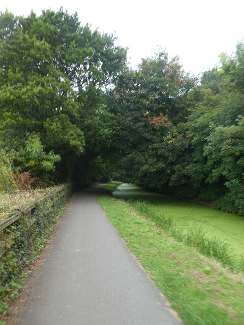
Coed y Cwrt is a beautiful wood located in Monmouthshire, Wales. Covering an area of approximately 180 acres, this forest is a popular destination for nature lovers and outdoor enthusiasts. The wood is home to a variety of native tree species, including oak, beech, and birch, as well as a diverse range of wildlife such as deer, birds, and insects.

Visitors to Coed y Cwrt can enjoy a network of well-marked walking trails that wind through the forest, providing opportunities to explore its tranquil surroundings and appreciate the natural beauty of the area. The wood also features a picnic area, making it a great spot for a leisurely outdoor lunch.

Coed y Cwrt is managed by the Forestry Commission, which works to preserve and protect the woodland for future generations to enjoy. The forest plays an important role in providing habitat for wildlife, as well as contributing to the local ecosystem and helping to maintain biodiversity in the area.

Overall, Coed y Cwrt is a peaceful and scenic woodland that offers a relaxing escape from the hustle and bustle of everyday life.

If you have any feedback on the listing, please let us know in the comments section below.
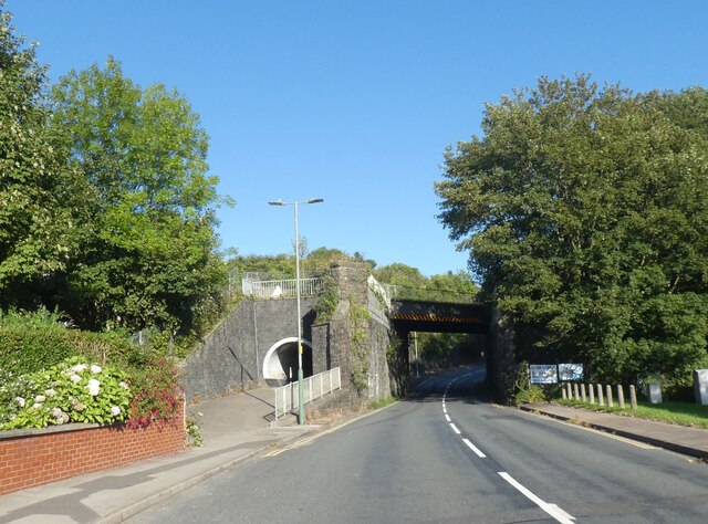
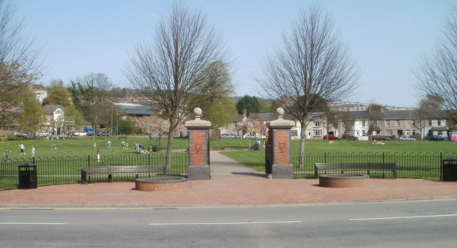
Coed y Cwrt Images

Images are sourced within 2km of 51.619084/-3.0782561 or Grid Reference ST2591. Thanks to Geograph Open Source API. All images are credited.

Railway bridge over Newport Road, Rogerstone
Shared use path by Monmouthshire and Brecon Canal near Pen y Fan The Monmouthshire and Brecon Canal (popularly referred to as the Mon & Brec) was originally two separate canals: the Brecknock & Abergavenny Canal, and the Monmouthshire Canal. The 35-mile navigable section seen today is mostly the former. Following discussions in the 1790s, it was decided to link the two canals at Pontymoile. The Monmouthshire Canal, including a branch from Malpas to Crumlin, was opened in 1799 with the Brecknock & Abergavenny extending from Brecon to Gilwern by 1800, finally reaching Pontymoile by 1812.

Though originally constructed to transport coal, lime and agricultural products the canal was used extensively by ironmasters and industrialists as their main transport network, bringing the raw iron ore up the canal from Newport to Llanfoist Wharf and thence by tramroads to the iron works and returning with trams loaded with iron, the finished product. 

In 1880 the Monmouthshire & Brecon Canals were taken over by the Great Western Railway. Within 35 years, commercial carrying had all but ceased. Throughout the 20th century various parts of the Monmouthshire Canal were filled in for road construction. Both canals were abandoned by the early 1960s but restoration work from Brecon to Pontymoile began in 1968 following vigorous campaigning by canal enthusiasts. Recent developments have included a complete regeneration of the terminus at Brecon, and various works continue to reclaim the navigation between Pontymoile and Newport. The Blaenavon area and a section of the canal were granted World Heritage status in 2000 in recognition of its historical significance. 
<span class="nowrap"><a title="https://canalrivertrust.org.uk/enjoy-the-waterways/canal-and-river-network/monmouthshire-and-brecon-canal" rel="nofollow ugc noopener" href="https://canalrivertrust.org.uk/enjoy-the-waterways/canal-and-river-network/monmouthshire-and-brecon-canal">Link</a><img style="margin-left:2px;" alt="External link" title="External link - shift click to open in new window" src="https://s1.geograph.org.uk/img/external.png" width="10" height="10"/></span>  Canal and River Trust
Shared use path by Monmouthshire and Brecon Canal near Pen y Fan
The Monmouthshire and Brecon Canal (popularly referred to as the Mon & Brec) was originally two separate canals: the Brecknock & Abergavenny Canal, and the Monmouthshire Canal. The 35-mile navigable section seen today is mostly the former. Following discussions in the 1790s, it was decided to link the two canals at Pontymoile. The Monmouthshire Canal, including a branch from Malpas to Crumlin, was opened in 1799 with the Brecknock & Abergavenny extending from Brecon to Gilwern by 1800, finally reaching Pontymoile by 1812. Though originally constructed to transport coal, lime and agricultural products the canal was used extensively by ironmasters and industrialists as their main transport network, bringing the raw iron ore up the canal from Newport to Llanfoist Wharf and thence by tramroads to the iron works and returning with trams loaded with iron, the finished product. In 1880 the Monmouthshire & Brecon Canals were taken over by the Great Western Railway. Within 35 years, commercial carrying had all but ceased. Throughout the 20th century various parts of the Monmouthshire Canal were filled in for road construction. Both canals were abandoned by the early 1960s but restoration work from Brecon to Pontymoile began in 1968 following vigorous campaigning by canal enthusiasts. Recent developments have included a complete regeneration of the terminus at Brecon, and various works continue to reclaim the navigation between Pontymoile and Newport. The Blaenavon area and a section of the canal were granted World Heritage status in 2000 in recognition of its historical significance. LinkExternal link Canal and River Trust
Eastern approach to Harry Roberts Bridge Bridge no. 10 on disused section of Crumlin Arm.
Eastern approach to Harry Roberts Bridge
Bridge no. 10 on disused section of Crumlin Arm.
Path by canal east of Harry Roberts Bridge Path on north side of canal, Crumlin Arm, from minor road to Pontymister Lane.
Path by canal east of Harry Roberts Bridge
Path on north side of canal, Crumlin Arm, from minor road to Pontymister Lane.
Path between bushes to Pontymason Lane Continuation of canal side path <a href="https://www.geograph.org.uk/photo/7469454">ST2589 : Path by canal east of Harry Roberts Bridge</a>.
Path between bushes to Pontymason Lane
Continuation of canal side path ST2589 : Path by canal east of Harry Roberts Bridge.
Canal east of Harry Roberts Bridge Disused section of Crumlin Arm.
Canal east of Harry Roberts Bridge
Disused section of Crumlin Arm.
Western aspect of Harry Roberts Bridge Elliptical stone arch bridge - no. 10 on Crumlin Arm.
Western aspect of Harry Roberts Bridge
Elliptical stone arch bridge - no. 10 on Crumlin Arm.
Canal bridge Over the Monmouthshire and Brecon canal.
Canal bridge
Over the Monmouthshire and Brecon canal.
Clifton Street houses, Pontymister A short row of houses adjacent to a sawmill. The houses and sawmill are at the end of a steep 65 metre ascent <a title="https://www.geograph.org.uk/photo/1749099" href="https://www.geograph.org.uk/photo/1749099">Link</a> from Herbert Avenue.
Clifton Street houses, Pontymister
A short row of houses adjacent to a sawmill. The houses and sawmill are at the end of a steep 65 metre ascent Link from Herbert Avenue.
Pontymister sawmills This is the southern side of T.G. Howell & Sons Ltd sawmills, located at the top of Clifton Street.<a title="https://www.geograph.org.uk/photo/1749099" href="https://www.geograph.org.uk/photo/1749099">Link</a>
Pontymister sawmills
This is the southern side of T.G. Howell & Sons Ltd sawmills, located at the top of Clifton Street.Link
Footbridge across the railway near Risca
Footpath through the saw mill
Welcome to Caerphilly County Borough, Pontymason Lane Pontymason Lane passes from Rogerstone in the City of Newport into Caerphilly County Borough.
Welcome to Caerphilly County Borough, Pontymason Lane
Pontymason Lane passes from Rogerstone in the City of Newport into Caerphilly County Borough.
40 to 30 along Pontymason Lane The 40mph speed limit along a rural section of Pontymason Lane 
decreases to 30mph on the approach to a residential area.
40 to 30 along Pontymason Lane
The 40mph speed limit along a rural section of Pontymason Lane decreases to 30mph on the approach to a residential area.
No track laying vehicles ahead from Pontymason Lane A narrow road descends from Pontymason Lane towards the B4591. Signs on the right show 
No track laying vehicles and a 4 tonnes axle weight limit 200 yards ahead (across a canal bridge). 
It is a curious feature of British road speed limits that the much wider Pontymason Lane in the foreground has a 30mph speed limit whereas this narrow road, little more than the width of a car, 
has a speed limit for most vehicles of 60mph...
No track laying vehicles ahead from Pontymason Lane
A narrow road descends from Pontymason Lane towards the B4591. Signs on the right show No track laying vehicles and a 4 tonnes axle weight limit 200 yards ahead (across a canal bridge). It is a curious feature of British road speed limits that the much wider Pontymason Lane in the foreground has a 30mph speed limit whereas this narrow road, little more than the width of a car, has a speed limit for most vehicles of 60mph...
West side of Harry Roberts canal bridge near Pontymister The bridge over the disused Monmouthshire and Brecon canal (Crumlin Arm) was built in the 1790s, Grade II listed in 1999. It carries a narrow road between Pontymason Lane and the B4591.
West side of Harry Roberts canal bridge near Pontymister
The bridge over the disused Monmouthshire and Brecon canal (Crumlin Arm) was built in the 1790s, Grade II listed in 1999. It carries a narrow road between Pontymason Lane and the B4591.
East side of Harry Roberts canal bridge near Pontymister The bridge over the disused Monmouthshire and Brecon canal (Crumlin Arm) was built in the 1790s, Grade II listed in 1999. It carries a narrow road between Pontymason Lane and the B4591.
East side of Harry Roberts canal bridge near Pontymister
The bridge over the disused Monmouthshire and Brecon canal (Crumlin Arm) was built in the 1790s, Grade II listed in 1999. It carries a narrow road between Pontymason Lane and the B4591.
Gas pipeline marker near Pontymister Alongside a narrow road from Pontymason Lane to the B4591, a white pole on the left marks the location of a gas pipeline under the road. The pole shows the phone number to ring before excavating.
Gas pipeline marker near Pontymister
Alongside a narrow road from Pontymason Lane to the B4591, a white pole on the left marks the location of a gas pipeline under the road. The pole shows the phone number to ring before excavating.
Show me another place!

Coed y Cwrt is located at Grid Ref: ST2591 (Lat: 51.619084, Lng: -3.0782561)

Unitary Authority: Torfaen

Police Authority: Gwent

What 3 Words

///ramble.ambushed.explain. Near Risca, Caerphilly

Related Wikis

Risca

Risca (Welsh: Rhisga) is a town in the Caerphilly County Borough and the historic boundaries of Monmouthshire in south-east Wales. Risca has a railway...

Risca Community Comprehensive School

Risca Community Comprehensive School is a community comprehensive school located in the town of Risca near Newport on the eastern side of the Caerphilly...

Twmbarlwm

Twmbarlwm, also known as Twm Barlwm, Twyn Barlwm or locally known as "the Twmp" (translation: hump), the Nipple or the Pimple because of the mound that...

Risca and Pontymister railway station

Risca and Pontymister railway station (Welsh: Rhisga a Phont-y-meistr) is a station on the Ebbw Valley Railway in south-east Wales. It serves the village...

Nearby Amenities

Located within 500m of 51.619084,-3.0782561
Power: pole
Lat/Long: 51.6225029/-3.0817723
Direction: 150
Generator Method: photovoltaic
Generator Output Electricity: yes
Generator Solar Modules: 14
Generator Source: solar
Generator Type: solar_photovoltaic_panel
Location: roof
Power: generator
Lat/Long: 51.6200999/-3.0726327
Barrier: stile
Material: wood
Step Count: 1
Stile: stepover
Lat/Long: 51.6156478/-3.0791025
The data included in this document is from www.openstreetmap.org. The data is made available under ODbL.

Have you been to Coed y Cwrt?

Leave your review of Coed y Cwrt below (or comments, questions and feedback).