Coed Pant-yr-eos

Wood, Forest in Monmouthshire

Wales

Coed Pant-yr-eos

Railway bridge over Newport Road, Rogerstone
Railway bridge over Newport Road, Rogerstone Credit: David Smith

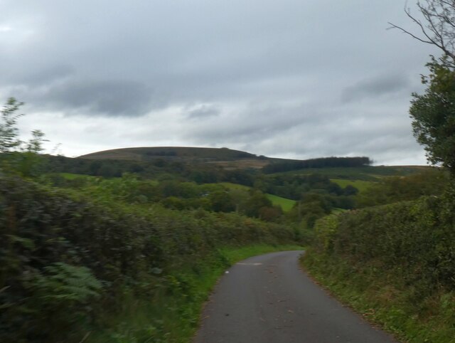
Coed Pant-yr-eos is a picturesque woodland located in Monmouthshire, Wales. Spanning an area of approximately 50 acres, this tranquil forest is a haven for nature lovers and outdoor enthusiasts alike. The name "Pant-yr-eos" translates to "Valley of the Nightingale," and it is not hard to see why. The woodland is known for its rich biodiversity and is home to a wide variety of bird species, including the enchanting nightingale.

The forest is predominantly composed of native broadleaf trees, such as oak, beech, and ash, creating a dense and vibrant canopy overhead. Beneath this canopy, a diverse understory of plants thrives, including bluebells, wild garlic, and ferns. The forest floor is a lush carpet of moss and fallen leaves, providing a perfect habitat for a range of small mammals and invertebrates.

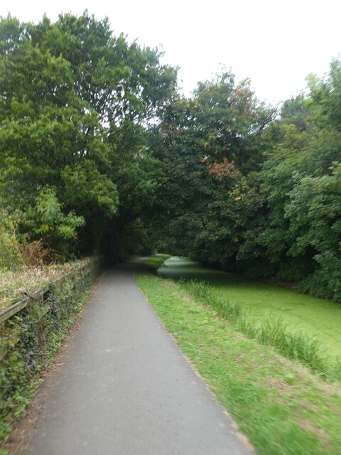
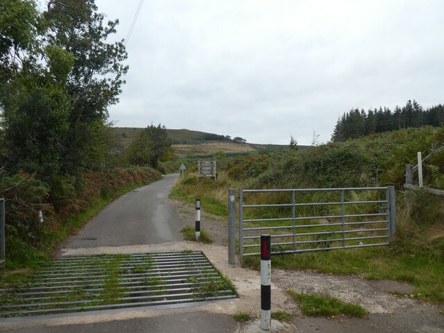
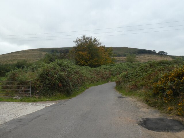
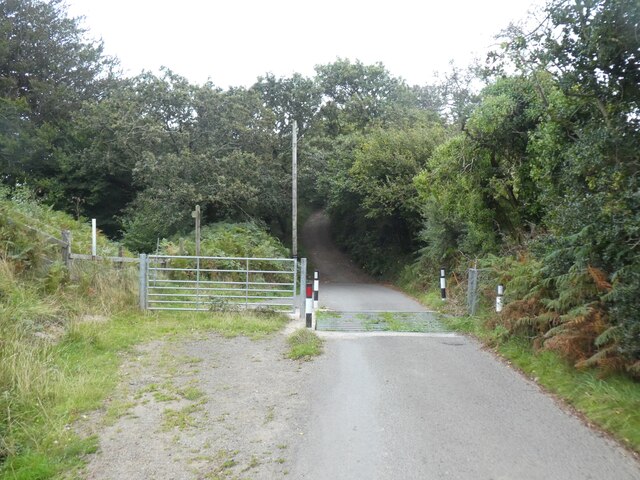
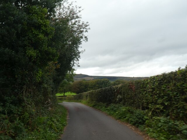
Coed Pant-yr-eos offers visitors a network of well-maintained walking trails, allowing them to explore the forest at their own pace. These trails wind through the woodland, offering glimpses of babbling streams, hidden clearings, and ancient trees. The peaceful ambiance provides an ideal setting for leisurely walks, birdwatching, or simply soaking in the beauty of nature.

The forest is also a popular destination for educational visits and nature study. Local schools and organizations often organize guided tours, where visitors can learn about the forest ecosystem, wildlife conservation, and the history of the area.

Coed Pant-yr-eos is a true gem of Monmouthshire, providing a tranquil escape from the hustle and bustle of everyday life. With its diverse wildlife, stunning scenery, and peaceful atmosphere, it is a must-visit destination for nature enthusiasts and those seeking a connection with the natural world.

If you have any feedback on the listing, please let us know in the comments section below.

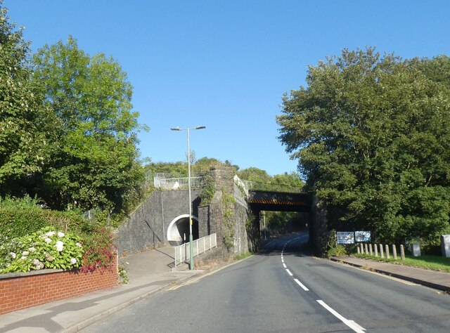
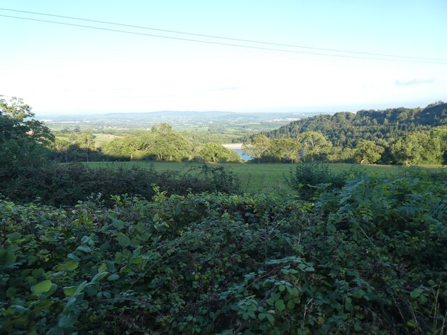
Coed Pant-yr-eos Images

Images are sourced within 2km of 51.619016/-3.0710034 or Grid Reference ST2591. Thanks to Geograph Open Source API. All images are credited.

Railway bridge over Newport Road, Rogerstone
Shared use path by Monmouthshire and Brecon Canal near Pen y Fan The Monmouthshire and Brecon Canal (popularly referred to as the Mon & Brec) was originally two separate canals: the Brecknock & Abergavenny Canal, and the Monmouthshire Canal. The 35-mile navigable section seen today is mostly the former. Following discussions in the 1790s, it was decided to link the two canals at Pontymoile. The Monmouthshire Canal, including a branch from Malpas to Crumlin, was opened in 1799 with the Brecknock & Abergavenny extending from Brecon to Gilwern by 1800, finally reaching Pontymoile by 1812.

Though originally constructed to transport coal, lime and agricultural products the canal was used extensively by ironmasters and industrialists as their main transport network, bringing the raw iron ore up the canal from Newport to Llanfoist Wharf and thence by tramroads to the iron works and returning with trams loaded with iron, the finished product. 

In 1880 the Monmouthshire & Brecon Canals were taken over by the Great Western Railway. Within 35 years, commercial carrying had all but ceased. Throughout the 20th century various parts of the Monmouthshire Canal were filled in for road construction. Both canals were abandoned by the early 1960s but restoration work from Brecon to Pontymoile began in 1968 following vigorous campaigning by canal enthusiasts. Recent developments have included a complete regeneration of the terminus at Brecon, and various works continue to reclaim the navigation between Pontymoile and Newport. The Blaenavon area and a section of the canal were granted World Heritage status in 2000 in recognition of its historical significance. 
<span class="nowrap"><a title="https://canalrivertrust.org.uk/enjoy-the-waterways/canal-and-river-network/monmouthshire-and-brecon-canal" rel="nofollow ugc noopener" href="https://canalrivertrust.org.uk/enjoy-the-waterways/canal-and-river-network/monmouthshire-and-brecon-canal">Link</a><img style="margin-left:2px;" alt="External link" title="External link - shift click to open in new window" src="https://s1.geograph.org.uk/img/external.png" width="10" height="10"/></span>  Canal and River Trust
Shared use path by Monmouthshire and Brecon Canal near Pen y Fan
The Monmouthshire and Brecon Canal (popularly referred to as the Mon & Brec) was originally two separate canals: the Brecknock & Abergavenny Canal, and the Monmouthshire Canal. The 35-mile navigable section seen today is mostly the former. Following discussions in the 1790s, it was decided to link the two canals at Pontymoile. The Monmouthshire Canal, including a branch from Malpas to Crumlin, was opened in 1799 with the Brecknock & Abergavenny extending from Brecon to Gilwern by 1800, finally reaching Pontymoile by 1812. Though originally constructed to transport coal, lime and agricultural products the canal was used extensively by ironmasters and industrialists as their main transport network, bringing the raw iron ore up the canal from Newport to Llanfoist Wharf and thence by tramroads to the iron works and returning with trams loaded with iron, the finished product. In 1880 the Monmouthshire & Brecon Canals were taken over by the Great Western Railway. Within 35 years, commercial carrying had all but ceased. Throughout the 20th century various parts of the Monmouthshire Canal were filled in for road construction. Both canals were abandoned by the early 1960s but restoration work from Brecon to Pontymoile began in 1968 following vigorous campaigning by canal enthusiasts. Recent developments have included a complete regeneration of the terminus at Brecon, and various works continue to reclaim the navigation between Pontymoile and Newport. The Blaenavon area and a section of the canal were granted World Heritage status in 2000 in recognition of its historical significance. LinkExternal link Canal and River Trust
Eastern approach to Harry Roberts Bridge Bridge no. 10 on disused section of Crumlin Arm.
Eastern approach to Harry Roberts Bridge
Bridge no. 10 on disused section of Crumlin Arm.
Path by canal east of Harry Roberts Bridge Path on north side of canal, Crumlin Arm, from minor road to Pontymister Lane.
Path by canal east of Harry Roberts Bridge
Path on north side of canal, Crumlin Arm, from minor road to Pontymister Lane.
Path between bushes to Pontymason Lane Continuation of canal side path <a href="https://www.geograph.org.uk/photo/7469454">ST2589 : Path by canal east of Harry Roberts Bridge</a>.
Path between bushes to Pontymason Lane
Continuation of canal side path ST2589 : Path by canal east of Harry Roberts Bridge.
Canal east of Harry Roberts Bridge Disused section of Crumlin Arm.
Canal east of Harry Roberts Bridge
Disused section of Crumlin Arm.
Western aspect of Harry Roberts Bridge Elliptical stone arch bridge - no. 10 on Crumlin Arm.
Western aspect of Harry Roberts Bridge
Elliptical stone arch bridge - no. 10 on Crumlin Arm.
Canal bridge Over the Monmouthshire and Brecon canal.
Canal bridge
Over the Monmouthshire and Brecon canal.
Pant-yr-eos Reservoir seen from Upper Grippath
Footbridge over Monmouthshire and Brecon Canal The Monmouthshire and Brecon Canal (popularly referred to as the Mon & Brec) was originally two separate canals: the Brecknock & Abergavenny Canal, and the Monmouthshire Canal. The 35-mile navigable section seen today is mostly the former. Following discussions in the 1790s, it was decided to link the two canals at Pontymoile. The Monmouthshire Canal, including a branch from Malpas to Crumlin, was opened in 1799 with the Brecknock & Abergavenny extending from Brecon to Gilwern by 1800, finally reaching Pontymoile by 1812.

Though originally constructed to transport coal, lime and agricultural products the canal was used extensively by ironmasters and industrialists as their main transport network, bringing the raw iron ore up the canal from Newport to Llanfoist Wharf and thence by tramroads to the iron works and returning with trams loaded with iron, the finished product. 

In 1880 the Monmouthshire & Brecon Canals were taken over by the Great Western Railway. Within 35 years, commercial carrying had all but ceased. Throughout the 20th century various parts of the Monmouthshire Canal were filled in for road construction. Both canals were abandoned by the early 1960s but restoration work from Brecon to Pontymoile began in 1968 following vigorous campaigning by canal enthusiasts. Recent developments have included a complete regeneration of the terminus at Brecon, and various works continue to reclaim the navigation between Pontymoile and Newport. The Blaenavon area and a section of the canal were granted World Heritage status in 2000 in recognition of its historical significance. 
<span class="nowrap"><a title="https://canalrivertrust.org.uk/enjoy-the-waterways/canal-and-river-network/monmouthshire-and-brecon-canal" rel="nofollow ugc noopener" href="https://canalrivertrust.org.uk/enjoy-the-waterways/canal-and-river-network/monmouthshire-and-brecon-canal">Link</a><img style="margin-left:2px;" alt="External link" title="External link - shift click to open in new window" src="https://s1.geograph.org.uk/img/external.png" width="10" height="10"/></span>  Canal and River Trust
Footbridge over Monmouthshire and Brecon Canal
The Monmouthshire and Brecon Canal (popularly referred to as the Mon & Brec) was originally two separate canals: the Brecknock & Abergavenny Canal, and the Monmouthshire Canal. The 35-mile navigable section seen today is mostly the former. Following discussions in the 1790s, it was decided to link the two canals at Pontymoile. The Monmouthshire Canal, including a branch from Malpas to Crumlin, was opened in 1799 with the Brecknock & Abergavenny extending from Brecon to Gilwern by 1800, finally reaching Pontymoile by 1812. Though originally constructed to transport coal, lime and agricultural products the canal was used extensively by ironmasters and industrialists as their main transport network, bringing the raw iron ore up the canal from Newport to Llanfoist Wharf and thence by tramroads to the iron works and returning with trams loaded with iron, the finished product. In 1880 the Monmouthshire & Brecon Canals were taken over by the Great Western Railway. Within 35 years, commercial carrying had all but ceased. Throughout the 20th century various parts of the Monmouthshire Canal were filled in for road construction. Both canals were abandoned by the early 1960s but restoration work from Brecon to Pontymoile began in 1968 following vigorous campaigning by canal enthusiasts. Recent developments have included a complete regeneration of the terminus at Brecon, and various works continue to reclaim the navigation between Pontymoile and Newport. The Blaenavon area and a section of the canal were granted World Heritage status in 2000 in recognition of its historical significance. LinkExternal link Canal and River Trust
Seat by the side of Monmouthshire and Brecon Canal The Monmouthshire and Brecon Canal (popularly referred to as the Mon & Brec) was originally two separate canals: the Brecknock & Abergavenny Canal, and the Monmouthshire Canal. The 35-mile navigable section seen today is mostly the former. Following discussions in the 1790s, it was decided to link the two canals at Pontymoile. The Monmouthshire Canal, including a branch from Malpas to Crumlin, was opened in 1799 with the Brecknock & Abergavenny extending from Brecon to Gilwern by 1800, finally reaching Pontymoile by 1812.

Though originally constructed to transport coal, lime and agricultural products the canal was used extensively by ironmasters and industrialists as their main transport network, bringing the raw iron ore up the canal from Newport to Llanfoist Wharf and thence by tramroads to the iron works and returning with trams loaded with iron, the finished product. 

In 1880 the Monmouthshire & Brecon Canals were taken over by the Great Western Railway. Within 35 years, commercial carrying had all but ceased. Throughout the 20th century various parts of the Monmouthshire Canal were filled in for road construction. Both canals were abandoned by the early 1960s but restoration work from Brecon to Pontymoile began in 1968 following vigorous campaigning by canal enthusiasts. Recent developments have included a complete regeneration of the terminus at Brecon, and various works continue to reclaim the navigation between Pontymoile and Newport. The Blaenavon area and a section of the canal were granted World Heritage status in 2000 in recognition of its historical significance. 
<span class="nowrap"><a title="https://canalrivertrust.org.uk/enjoy-the-waterways/canal-and-river-network/monmouthshire-and-brecon-canal" rel="nofollow ugc noopener" href="https://canalrivertrust.org.uk/enjoy-the-waterways/canal-and-river-network/monmouthshire-and-brecon-canal">Link</a><img style="margin-left:2px;" alt="External link" title="External link - shift click to open in new window" src="https://s1.geograph.org.uk/img/external.png" width="10" height="10"/></span>  Canal and River Trust
Seat by the side of Monmouthshire and Brecon Canal
The Monmouthshire and Brecon Canal (popularly referred to as the Mon & Brec) was originally two separate canals: the Brecknock & Abergavenny Canal, and the Monmouthshire Canal. The 35-mile navigable section seen today is mostly the former. Following discussions in the 1790s, it was decided to link the two canals at Pontymoile. The Monmouthshire Canal, including a branch from Malpas to Crumlin, was opened in 1799 with the Brecknock & Abergavenny extending from Brecon to Gilwern by 1800, finally reaching Pontymoile by 1812. Though originally constructed to transport coal, lime and agricultural products the canal was used extensively by ironmasters and industrialists as their main transport network, bringing the raw iron ore up the canal from Newport to Llanfoist Wharf and thence by tramroads to the iron works and returning with trams loaded with iron, the finished product. In 1880 the Monmouthshire & Brecon Canals were taken over by the Great Western Railway. Within 35 years, commercial carrying had all but ceased. Throughout the 20th century various parts of the Monmouthshire Canal were filled in for road construction. Both canals were abandoned by the early 1960s but restoration work from Brecon to Pontymoile began in 1968 following vigorous campaigning by canal enthusiasts. Recent developments have included a complete regeneration of the terminus at Brecon, and various works continue to reclaim the navigation between Pontymoile and Newport. The Blaenavon area and a section of the canal were granted World Heritage status in 2000 in recognition of its historical significance. LinkExternal link Canal and River Trust
Sustrans milepost by Manor Road, Risca The marker is on the shared path beside the Monmouthshire and Brecon Canal
Sustrans milepost by Manor Road, Risca
The marker is on the shared path beside the Monmouthshire and Brecon Canal
Cattle grid on road near Maesmawr
Twmbarlwm seen from road to the hikers' car park
Cattle grid on road past Maesmawr
On Mountain Road
On Mountain Road
Distant view of Twmbarlwm The distinctive shape of the hill silhouetted against the sky
Distant view of Twmbarlwm
The distinctive shape of the hill silhouetted against the sky
The dome of Twmbarlwm
Show me another place!

Coed Pant-yr-eos is located at Grid Ref: ST2591 (Lat: 51.619016, Lng: -3.0710034)

Unitary Authority: Torfaen

Police Authority: Gwent

What 3 Words

///bandage.both.kidney. Near Risca, Caerphilly

Related Wikis

Risca Community Comprehensive School

Risca Community Comprehensive School is a community comprehensive school located in the town of Risca near Newport on the eastern side of the Caerphilly...

Risca

Risca (Welsh: Rhisga) is a town in the Caerphilly County Borough and the historic boundaries of Monmouthshire in south-east Wales. Risca has a railway...

Welsh Oak

The Welsh Oak is a pub located in Pontymister, Caerphilly County Borough, Wales. In recent years, due to a decline in trade, the pub has ceased trading...

Twmbarlwm

Twmbarlwm, also known as Twm Barlwm, Twyn Barlwm or locally known as "the Twmp" (translation: hump), the Nipple or the Pimple because of the mound that...

Tynycwm Halt railway station

Tynycwm Halt railway station served the town of Risca, Monmouthshire, Wales, from 1935 to 1962 on the Monmouthshire Railway. == History == The station...

Panteg A.F.C.

Panteg AFC is a Welsh football club located in Griffithstown, Pontypool, Torfaen, South Wales. The club was founded in 1935 and currently runs two senior...

Risca and Pontymister railway station

Risca and Pontymister railway station (Welsh: Rhisga a Phont-y-meistr) is a station on the Ebbw Valley Railway in south-east Wales. It serves the village...

Risca railway station

Risca railway station was a station on the Monmouthshire Railway and Canal Company Western Valley line, later the Great Western Railway. It was located...

Nearby Amenities

Located within 500m of 51.619016,-3.0710034
Depth: 0
Ford: yes
Lat/Long: 51.6171488/-3.0683198
Barrier: stile
Material: wood
Step Count: 1
Stile: stepover
Lat/Long: 51.6154062/-3.0687554
Direction: 150
Generator Method: photovoltaic
Generator Output Electricity: yes
Generator Solar Modules: 14
Generator Source: solar
Generator Type: solar_photovoltaic_panel
Location: roof
Power: generator
Lat/Long: 51.6200999/-3.0726327
Direction: 215
Generator Method: photovoltaic
Generator Output Electricity: yes
Generator Solar Modules: 17
Generator Source: solar
Generator Type: solar_photovoltaic_panel
Location: roof
Power: generator
Lat/Long: 51.616943/-3.0669069
The data included in this document is from www.openstreetmap.org. The data is made available under ODbL.

Have you been to Coed Pant-yr-eos?

Leave your review of Coed Pant-yr-eos below (or comments, questions and feedback).