Coed Cwm-llwydrew

Wood, Forest in Monmouthshire

Wales

Coed Cwm-llwydrew

57 pigeons A flock of pigeons circling over Abertillery.
57 pigeons Credit: Alan Hughes

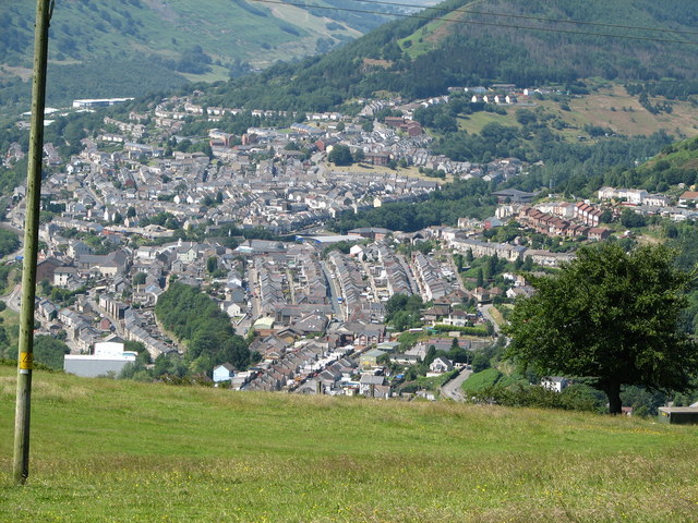
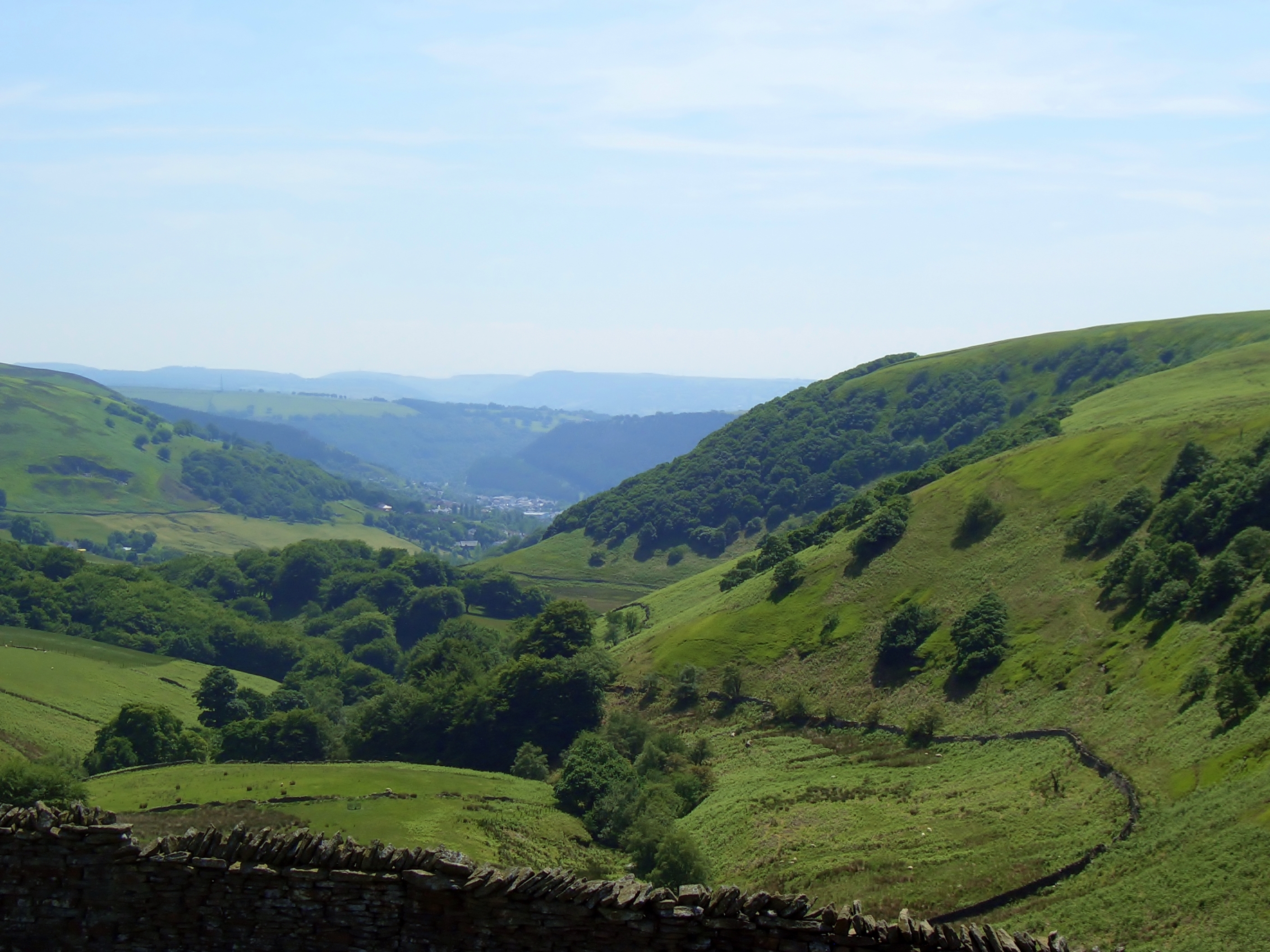
Coed Cwm-llwydrew, located in Monmouthshire, Wales, is a picturesque woodland area known for its natural beauty and rich biodiversity. Spanning approximately 200 acres, this woodland is a haven for nature enthusiasts and outdoor adventurers alike.

The woodland is characterized by its diverse range of tree species, including oak, beech, ash, and birch, which create a stunning tapestry of colors throughout the seasons. The forest floor is adorned with a variety of wildflowers and ferns, adding to its enchanting atmosphere.

Coed Cwm-llwydrew is home to a wide array of wildlife, making it an ideal spot for birdwatching and animal spotting. Visitors may catch a glimpse of red kites, buzzards, owls, and various songbirds that inhabit the forest. Additionally, deer, foxes, badgers, and squirrels can be spotted among the trees, adding to the sense of wilderness and natural tranquility.

The woodland offers a network of well-maintained footpaths and trails, allowing visitors to explore its beauty at their own pace. These paths wind through the forest, offering stunning vistas of the surrounding countryside and providing a peaceful retreat from the hustle and bustle of everyday life.

Coed Cwm-llwydrew is a popular destination for outdoor activities such as hiking, picnicking, and nature photography. Its serene atmosphere and untouched beauty make it an idyllic location for those seeking to reconnect with nature and escape the stresses of modern life.

In summary, Coed Cwm-llwydrew in Monmouthshire is a captivating woodland that offers a rich tapestry of trees, wildlife, and natural beauty. Whether visitors are looking for a peaceful walk, a wildlife encounter, or simply a place to relax and unwind, this forest provides a sanctuary for all who venture into its depths.

If you have any feedback on the listing, please let us know in the comments section below.

Coed Cwm-llwydrew Images

Images are sourced within 2km of 51.717236/-3.1243062 or Grid Reference SO2202. Thanks to Geograph Open Source API. All images are credited.

57 pigeons A flock of pigeons circling over Abertillery.
57 pigeons
A flock of pigeons circling over Abertillery.
Darran Road A typical street in the Welsh valleys.
Darran Road
A typical street in the Welsh valleys.
Chapel Road, Six Bells Tŷ Ebbw Fach alongside the river of the same name.
Chapel Road, Six Bells
Tŷ Ebbw Fach alongside the river of the same name.
Blue plaque on Chapel Road The plaque honours Mervyn Griffiths, international football referee.
Blue plaque on Chapel Road
The plaque honours Mervyn Griffiths, international football referee.
Footpath towards Six Bells
Colliery memorial, Six Bells
Guardian - reflections on a mining disaster The monument was erected in 2010 to commemorate the 50th anniversary of the Six Bells colliery disaster in June 1960 when 45 miners lost their lives.  

Designed and created by artist Sebastien Boyesen, the sculpture is constructed from over 20,000 strips of Cor-Ten steel welded together.

<span class="nowrap"><a title="https://en.wikipedia.org/wiki/Guardian_(sculpture)" rel="nofollow ugc noopener" href="https://en.wikipedia.org/wiki/Guardian_(sculpture)">Link</a><img style="margin-left:2px;" alt="External link" title="External link - shift click to open in new window" src="https://s1.geograph.org.uk/img/external.png" width="10" height="10"/></span>
Guardian - reflections on a mining disaster
The monument was erected in 2010 to commemorate the 50th anniversary of the Six Bells colliery disaster in June 1960 when 45 miners lost their lives. Designed and created by artist Sebastien Boyesen, the sculpture is constructed from over 20,000 strips of Cor-Ten steel welded together. LinkExternal link
Six Bells Primary Campus Abertillery Learning Community
Six Bells Primary Campus
Abertillery Learning Community
Formerly the Six Bells Institute
Bethany Baptist Church, Six Bells
Back lane and garages
Aberbeeg Methodist Church
Footpath gate to Cwm Big forest
Bridge over Afon Ebwy
Christ Church, Aberbeeg
Ordnance Survey Cut Mark This OS cut mark can be found on the former Llanhilleth PH. It marks a point 172.471m above mean sea level.
Ordnance Survey Cut Mark
This OS cut mark can be found on the former Llanhilleth PH. It marks a point 172.471m above mean sea level.
Ordnance Survey Cut Mark This OS cut mark can be found on the old Wesleyan Chapel on Commercial Road. It marks a point 157.231m above mean sea level.
Ordnance Survey Cut Mark
This OS cut mark can be found on the old Wesleyan Chapel on Commercial Road. It marks a point 157.231m above mean sea level.
Ordnance Survey Cut Mark This OS cut mark can be found on the porch of St Mary's Church. It marks a point 151.309m above mean sea level.
Ordnance Survey Cut Mark
This OS cut mark can be found on the porch of St Mary's Church. It marks a point 151.309m above mean sea level.
Show me another place!

Coed Cwm-llwydrew is located at Grid Ref: SO2202 (Lat: 51.717236, Lng: -3.1243062)

Unitary Authority: Blaenau Gwent

Police Authority: Gwent

What 3 Words

///yachting.hurry.compound. Near Abertillery, Blaenau Gwent

Related Wikis

Six Bells Halt railway station

Six Bells Halt railway station was a station which served the Six Bells Colliery near Abertillery in the Welsh county of Monmouthshire. == History == The...

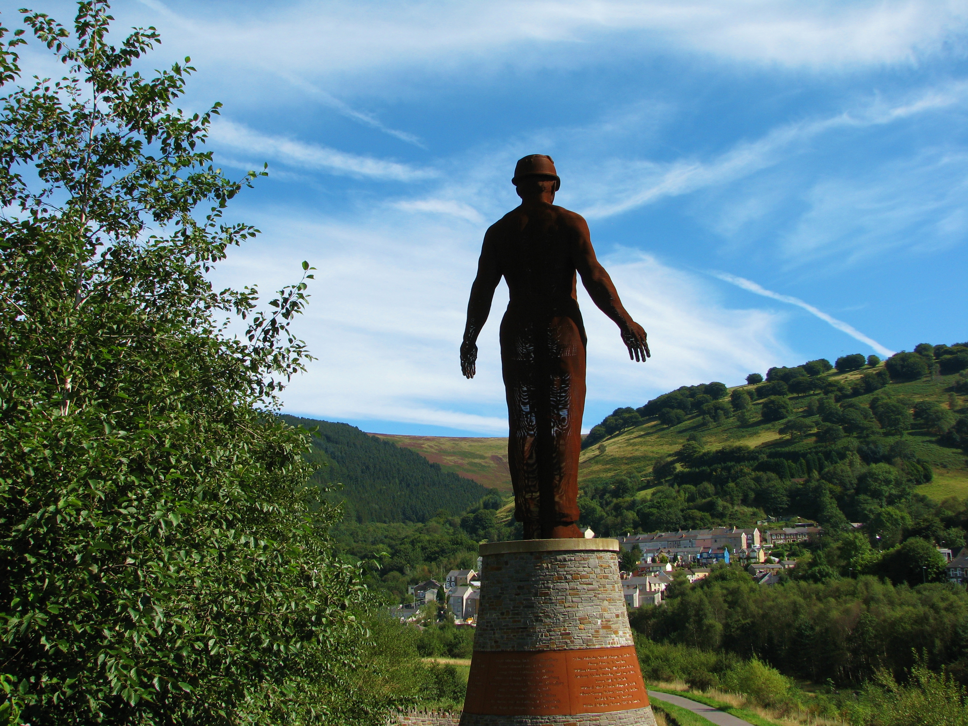
Guardian (sculpture)

The Guardian is a 20 m (66 ft) tall statue overlooking Parc Arael Griffin, the landscaped former Six Bells Colliery site, in the South Wales mining town...
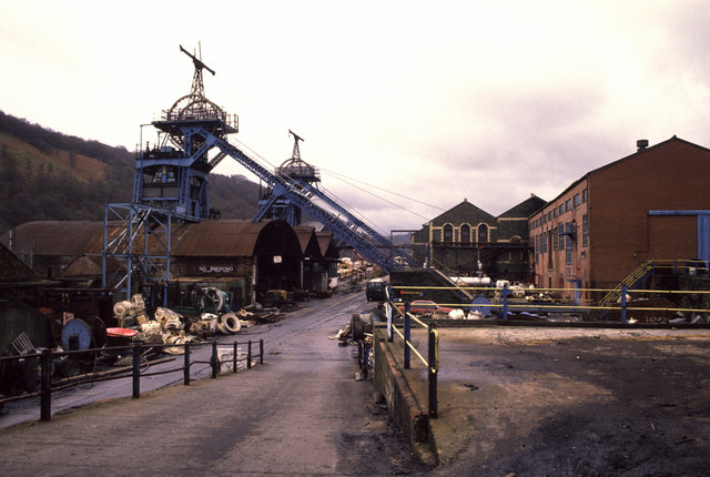
Six Bells Colliery

Six Bells Colliery was a colliery located in Six Bells, Abertillery, Gwent, Wales. On 28 June 1960 it was the site of an underground explosion which killed...
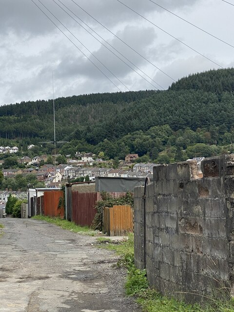
Six Bells

Six Bells (Welsh: Chwe Chloch) is an electoral ward and neighbourhood in Abertillery, Blaenau Gwent, Wales. It was originally a village that grew up around...

Abertillery Bluebirds F.C.

Abertillery Bluebirds are a Welsh football team based in the town of Abertillery. They currently have a senior side in the Cymru South, tier two of the...

St Illtyd

St Illtyd is a hamlet near Aberbeeg, in southeast Wales, within the historic boundaries of Monmouthshire. It is situated on the mountain road between Pontypool...

St Illtyd's Church, Llanhilleth

St Illtyd's Church is a deconsecrated church in Llanhilleth, Blaenau Gwent, Wales. A Grade II* listed building, it is the oldest standing building in the...
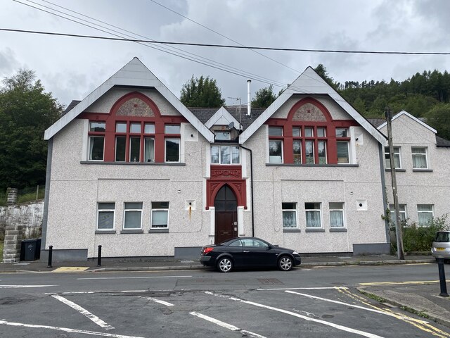
Abertillery

Abertillery (; Welsh: Abertyleri) is a town and a community of the Ebbw Fach valley in the historic county of Monmouthshire, Wales. Following local government...

Nearby Amenities

Located within 500m of 51.717236,-3.1243062
Waterway: weir
Lat/Long: 51.7186766/-3.1310428
Traffic Signals
Traffic Signals: signal
Lat/Long: 51.7207148/-3.128088
Old Miners Memorial
Historic: memorial
Material: stone
Lat/Long: 51.7209466/-3.1282531
Traffic Signals
Traffic Signals: signal
Lat/Long: 51.7206219/-3.1281135
Telephone
Booth: K6
Covered: booth
Operator: British Telecom
Phone: +441495212195
Lat/Long: 51.7196471/-3.1279722
Brand: National Grid
Brand Wikidata: Q1465461
Location: overground
Operator: National Grid Electricity Distribution Plc
Operator Old: Western Power Distribution
Operator Wikidata: Q7988183
Owner: National Grid Electricity Distribution (South Wales) Plc
Owner Wikidata: Q114397937
Power: transformer
Transformer: distribution
Lat/Long: 51.7210807/-3.1278755
Brand: National Grid
Brand Wikidata: Q1465461
Devices: 1
Operator: National Grid Electricity Distribution Plc
Operator Old: Western Power Distribution
Operator Wikidata: Q7988183
Owner: National Grid Electricity Distribution (South Wales) Plc
Owner Wikidata: Q114397937
Phases: 3
Power: transformer
Rating: 11 kv
Lat/Long: 51.7131644/-3.1225314
Access: no
Barrier: stile
Bicycle: yes
Foot: yes
Material: metal
Motor Vehicle: no
Stile: squeezer
Lat/Long: 51.7202387/-3.1288035
Direction: 145
Generator Method: photovoltaic
Generator Output Electricity: yes
Generator Solar Modules: 9
Generator Source: solar
Generator Type: solar_photovoltaic_panel
Location: roof
Power: generator
Lat/Long: 51.7209055/-3.1256399
Direction: 145
Generator Method: photovoltaic
Generator Output Electricity: yes
Generator Solar Modules: 12
Generator Source: solar
Generator Type: solar_photovoltaic_panel
Location: roof
Power: generator
Lat/Long: 51.7208574/-3.1257525
Direction: W
Generator Method: photovoltaic
Generator Output Electricity: yes
Generator Solar Modules: 7
Generator Source: solar
Generator Type: solar_photovoltaic_panel
Location: roof
Power: generator
Lat/Long: 51.7201844/-3.1262621
Direction: E
Generator Method: photovoltaic
Generator Output Electricity: yes
Generator Solar Modules: 7
Generator Source: solar
Generator Type: solar_photovoltaic_panel
Location: roof
Power: generator
Lat/Long: 51.7200797/-3.1264418
Direction: E
Generator Method: photovoltaic
Generator Output Electricity: yes
Generator Solar Modules: 7
Generator Source: solar
Generator Type: solar_photovoltaic_panel
Location: roof
Power: generator
Lat/Long: 51.720216/-3.1264365
Direction: 235
Generator Method: photovoltaic
Generator Output Electricity: yes
Generator Solar Modules: 7
Generator Source: solar
Generator Type: solar_photovoltaic_panel
Location: roof
Power: generator
Lat/Long: 51.719708/-3.1261006
Direction: 215
Generator Method: photovoltaic
Generator Output Electricity: yes
Generator Solar Modules: 8
Generator Source: solar
Generator Type: solar_photovoltaic_panel
Location: roof
Power: generator
Lat/Long: 51.7195251/-3.1266879
Direction: 185
Generator Method: photovoltaic
Generator Output Electricity: yes
Generator Solar Modules: 9
Generator Source: solar
Generator Type: solar_photovoltaic_panel
Location: roof
Power: generator
Lat/Long: 51.7194716/-3.1280753
Direction: 215
Generator Method: photovoltaic
Generator Output Electricity: yes
Generator Solar Modules: 10
Generator Source: solar
Generator Type: solar_photovoltaic_panel
Location: roof
Power: generator
Lat/Long: 51.7197823/-3.1273538
Direction: 265
Generator Method: photovoltaic
Generator Output Electricity: yes
Generator Solar Modules: 7
Generator Source: solar
Generator Type: solar_photovoltaic_panel
Location: roof
Power: generator
Lat/Long: 51.7205167/-3.1274343
Direction: 265
Generator Method: photovoltaic
Generator Output Electricity: yes
Generator Solar Modules: 7
Generator Source: solar
Generator Type: solar_photovoltaic_panel
Location: roof
Power: generator
Lat/Long: 51.7205724/-3.1274429
Barrier: hampshire_gate
Lat/Long: 51.7203127/-3.1293811
The data included in this document is from www.openstreetmap.org. The data is made available under ODbL.

Have you been to Coed Cwm-llwydrew?

Leave your review of Coed Cwm-llwydrew below (or comments, questions and feedback).