Beech Wood

Wood, Forest in Flintshire

Wales

Beech Wood

Farm near Mold
Farm near Mold Credit: David Dixon

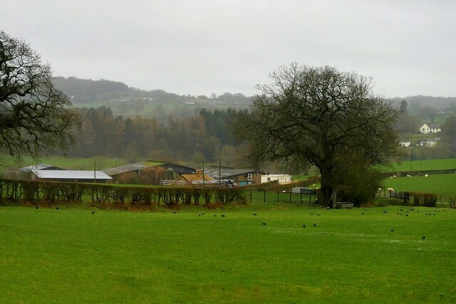
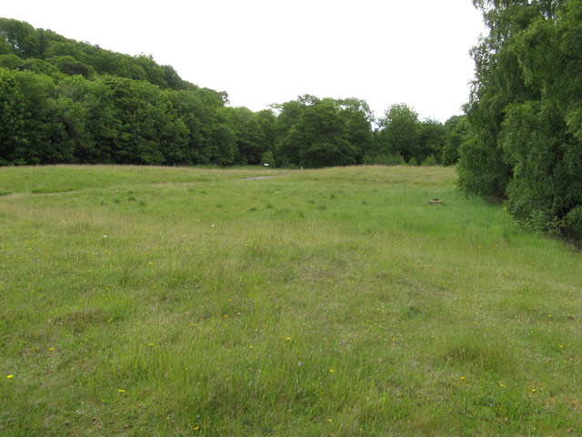
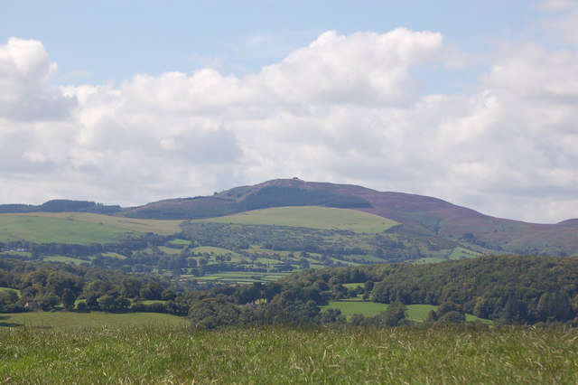
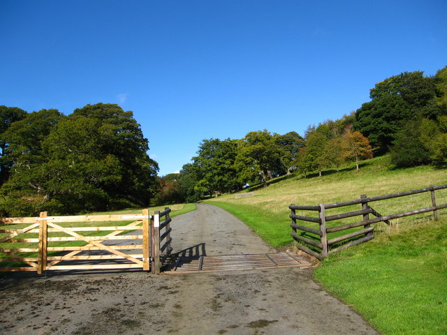
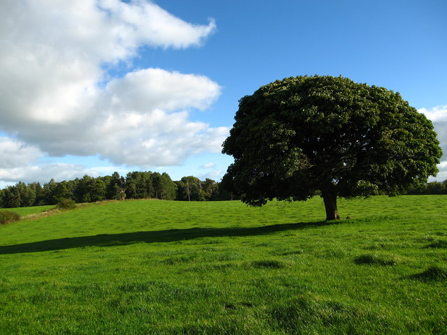
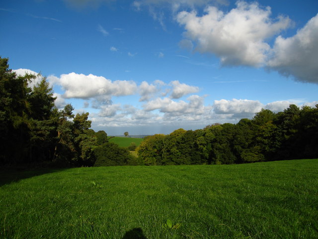
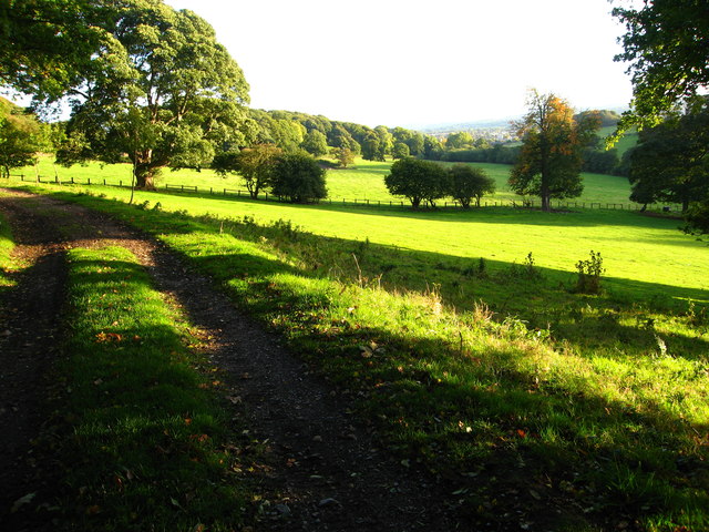
Beech Wood, located in Flintshire, is a picturesque forest known for its stunning beech trees and diverse wildlife. The wood covers a vast area and offers a peaceful and serene environment for nature enthusiasts and outdoor lovers.

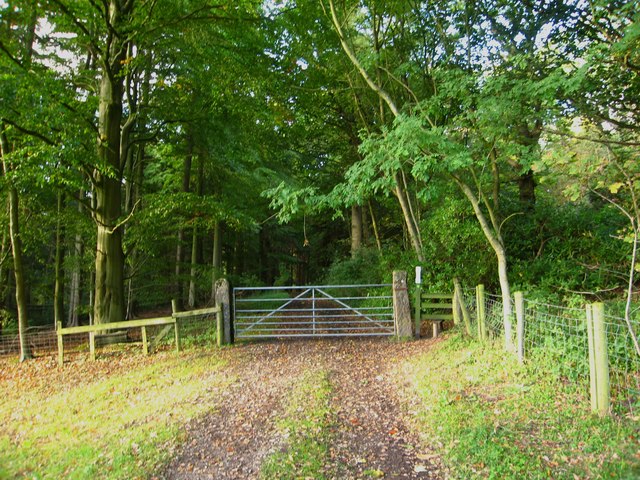
The most prominent feature of Beech Wood is its dense population of beech trees, which give the forest its name. These tall and graceful trees create a lush canopy that provides shade during hot summer days. The wood is particularly enchanting during autumn when the leaves turn brilliant shades of orange and gold, attracting visitors from far and wide.

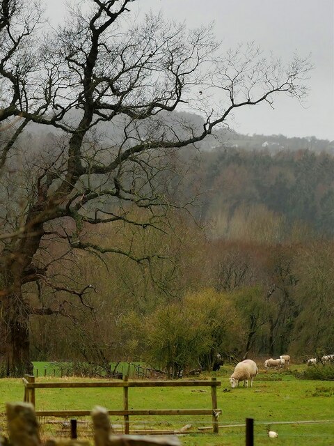
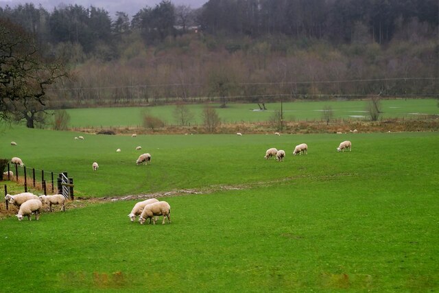
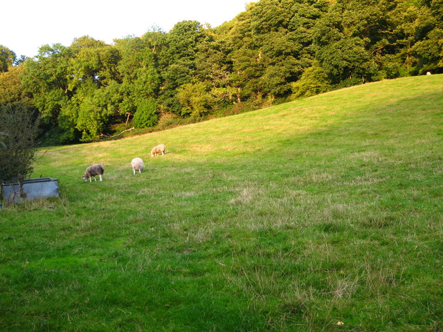
Besides its natural beauty, Beech Wood is also home to a wide range of wildlife. Various bird species nest in the trees, including woodpeckers, owls, and many songbirds. Visitors may also spot mammals such as deer, squirrels, and rabbits roaming among the trees. The forest floor is carpeted with wildflowers and ferns, adding to the charm of the woodland.

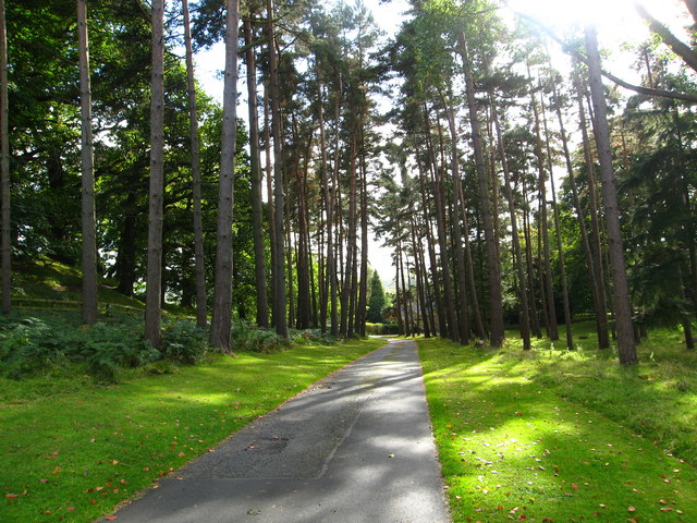
There are several walking trails and footpaths that meander through the wood, allowing visitors to explore its natural wonders. The paths are well-maintained and suitable for all ages and fitness levels. Along the way, there are informative signboards that provide details about the different tree species and wildlife that can be found in the area.

Beech Wood, Flintshire, is a haven for those seeking tranquility and a connection with nature. Its scenic beauty, diverse flora and fauna, and well-maintained trails make it a delightful destination for a peaceful stroll or a picnic amidst the breathtaking surroundings.

If you have any feedback on the listing, please let us know in the comments section below.

Beech Wood Images

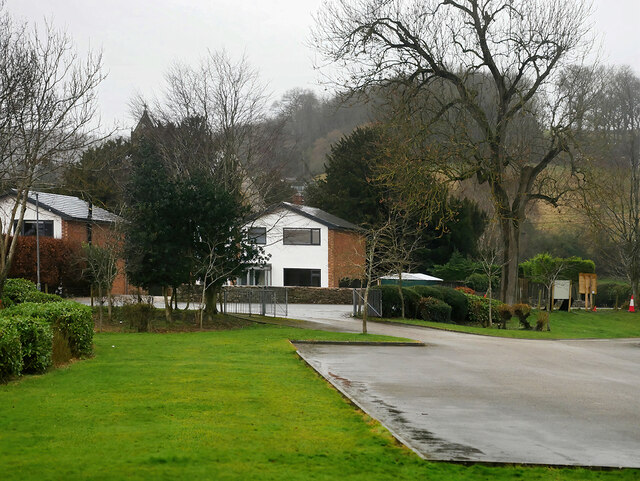
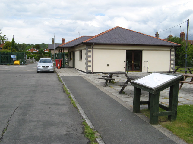
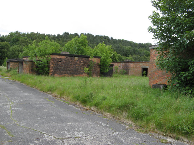
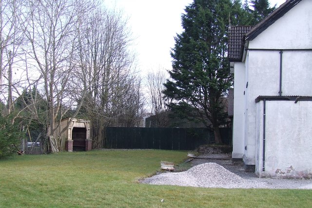
Images are sourced within 2km of 53.191337/-3.1625905 or Grid Reference SJ2266. Thanks to Geograph Open Source API. All images are credited.

Farm near Mold
Farm near Mold
Sheep Grazing in a Field off the A541 near Mold Sheep grazing unperturbed by Storm Eunice.
Sheep Grazing in a Field off the A541 near Mold
Sheep grazing unperturbed by Storm Eunice.
Sheep Grazing near Mold
A541, Rhydymwyn The A541 runs for 26 miles, linking St Asaph with Wrexham. Its northern end starts at the crossroads in the middle of the village of Trefnant (just south of St Asaph). It ends at Wrexham, where it joins the B5101 road. On the way, it passes the town of Mold and also passes through many villages.
A541, Rhydymwyn
The A541 runs for 26 miles, linking St Asaph with Wrexham. Its northern end starts at the crossroads in the middle of the village of Trefnant (just south of St Asaph). It ends at Wrexham, where it joins the B5101 road. On the way, it passes the town of Mold and also passes through many villages.
Rhydymwyn Rhydymwyn is a village located in the upper Alyn valley in Flintshire. Once a district of Mold, it was recognised as a separate parish from 1865. 

The village takes its placename from the ford across the River Alyn (now replaced by a small iron bridge); the name in Welsh means 'Ford of the Ore' (<span class="nowrap"><a title="https://en.wikipedia.org/wiki/Rhydymwyn" rel="nofollow ugc noopener" href="https://en.wikipedia.org/wiki/Rhydymwyn">Link</a><img style="margin-left:2px;" alt="External link" title="External link - shift click to open in new window" src="https://s1.geograph.org.uk/img/external.png" width="10" height="10"/></span> Wikipedia).
Rhydymwyn
Rhydymwyn is a village located in the upper Alyn valley in Flintshire. Once a district of Mold, it was recognised as a separate parish from 1865. The village takes its placename from the ford across the River Alyn (now replaced by a small iron bridge); the name in Welsh means 'Ford of the Ore' (LinkExternal link Wikipedia).
17 Nant Alyn Road The new building at the Rhydymwyn Valley nature reserve which is headquarters to the North East Wales Wildlife.
17 Nant Alyn Road
The new building at the Rhydymwyn Valley nature reserve which is headquarters to the North East Wales Wildlife.
Wartime buildings Buildings remaining on the secret Rhydymwyn wartime manufacturing and supply depot which is now administered as a nature reserve.
Wartime buildings
Buildings remaining on the secret Rhydymwyn wartime manufacturing and supply depot which is now administered as a nature reserve.
Rhydymwyn nature reserve The site of the secret wartime facility has been kept free of interference for so long that it is now maintained as a nature reserve. The River Alyn used to meander across the site between the wooded slopes, but was taken into a culvert at the south-western edge and the floor of the valley levelled by taking the spoil from the creation of a series of huge underground storage levels. The suspicious contours remain from this time but grass has taken over the spoil.
Rhydymwyn nature reserve
The site of the secret wartime facility has been kept free of interference for so long that it is now maintained as a nature reserve. The River Alyn used to meander across the site between the wooded slopes, but was taken into a culvert at the south-western edge and the floor of the valley levelled by taking the spoil from the creation of a series of huge underground storage levels. The suspicious contours remain from this time but grass has taken over the spoil.
Moel Famau and Clwyd range from Rhosesmor
Rhydymwyn Station Site of the disused station at Rhydymwyn on the former railway line between Mold and Denbigh.
Rhydymwyn Station
Site of the disused station at Rhydymwyn on the former railway line between Mold and Denbigh.
Bench mark on a house in Sychdyn This Ordnance Survey bench mark is on the corner of the house at the acute junction of Main Road and Tan-yr-Ysgol. The mark first appears on the 1961 O.S. map, when the mark on the Cross Keys pub opposite disappears. For details of the mark see: <span class="nowrap"><a title="http://www.bench-marks.org.uk/bm42814" rel="nofollow ugc noopener" href="http://www.bench-marks.org.uk/bm42814">Link</a><img style="margin-left:2px;" alt="External link" title="External link - shift click to open in new window" src="https://s1.geograph.org.uk/img/external.png" width="10" height="10"/></span>
Bench mark on a house in Sychdyn
This Ordnance Survey bench mark is on the corner of the house at the acute junction of Main Road and Tan-yr-Ysgol. The mark first appears on the 1961 O.S. map, when the mark on the Cross Keys pub opposite disappears. For details of the mark see: LinkExternal link
Avenue of trees From the footpath along a private drive from Gwasaney Hall to the A541. The Lodge by the entrance is through the trees on the centre right.
Avenue of trees
From the footpath along a private drive from Gwasaney Hall to the A541. The Lodge by the entrance is through the trees on the centre right.
Along the drive to Gwysaney Hall This is a footpath along a private driveway
Along the drive to Gwysaney Hall
This is a footpath along a private driveway
Large field west of Ram Wood The large sychamore is all that remains of a field boundary shown on the Ordnance Survey Map.  The footpath exits on the left
Large field west of Ram Wood
The large sychamore is all that remains of a field boundary shown on the Ordnance Survey Map. The footpath exits on the left
Field between Coed Bryn-eithin and Coed Cae-crwn woods From the footpath across this field, you can see Liverpool on the horizon.
Field between Coed Bryn-eithin and Coed Cae-crwn woods
From the footpath across this field, you can see Liverpool on the horizon.
Footpath along track into Big Wood
Footpath, field and trees beside Bryn-cae-Tudur Wood There is a lovely view from here to the town of Mold
Footpath, field and trees beside Bryn-cae-Tudur Wood
There is a lovely view from here to the town of Mold
Grazing field and woodland Beside a lane leading to Sychdyn from the A541
Grazing field and woodland
Beside a lane leading to Sychdyn from the A541
Show me another place!

Beech Wood is located at Grid Ref: SJ2266 (Lat: 53.191337, Lng: -3.1625905)

Unitary Authority: Flintshire

Police Authority: North Wales

What 3 Words

///flashback.rocked.loads. Near Northop, Flintshire

Related Wikis

Sychdyn

Sychdyn or Soughton (meaning South Town) is a village in Flintshire, Wales. It is situated on the A5119 road, and is just over 1000 yards (1 km) north...

Rhydymwyn railway station

Rhydymwyn railway station was a station in Rhydymwyn, Flintshire, Wales. The station was opened on 6 September 1869, closed to passengers on 30 April 1962...

M. S. Factory, Valley

The M.S. (Ministry of Supply) Factory, Valley was a Second World War site in Rhydymwyn, Flintshire, Wales, that was used for the storage and production...

Rhydymwyn F.C.

Rhydymwyn F.C. is a football club from Rhydymwyn, Wales. They play in the North East Wales Football League in the tier five Championship Division. Their...

Nearby Amenities

Located within 500m of 53.191337,-3.1625905
Bryn-Eithin
Ele: 206
Natural: peak
Wikidata: Q106710216
Lat/Long: 53.1941351/-3.1646434
The data included in this document is from www.openstreetmap.org. The data is made available under ODbL.

Have you been to Beech Wood?

Leave your review of Beech Wood below (or comments, questions and feedback).