Allt Wood

Wood, Forest in Brecknockshire

Wales

Allt Wood

Offa's Dyke Path by Upper Danyforest The path here is descending, as one goes northwards, from Hay Bluff towards Cusop and Hay-on-Wye, with the Wye Valley visible in the distance.
Offa's Dyke Path by Upper Danyforest Credit: A J Paxton

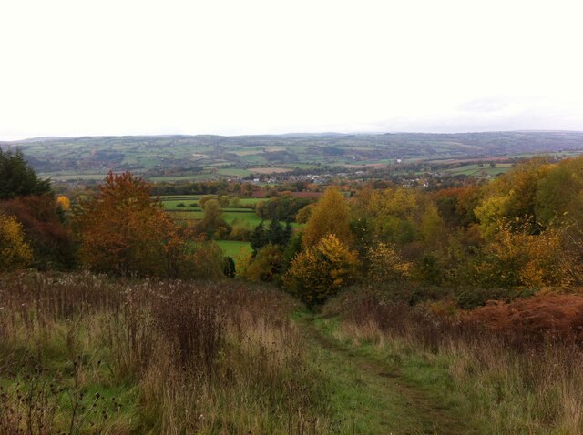
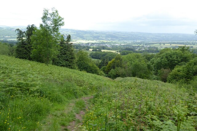
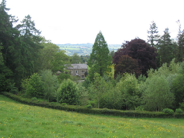
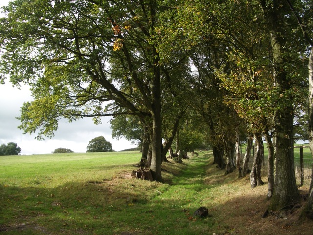
Allt Wood, located in the historic county of Brecknockshire, is a picturesque woodland area renowned for its natural beauty and tranquility. Situated amidst the stunning landscape of Wales, it covers a sprawling expanse of land, making it an ideal destination for nature enthusiasts and outdoor adventurers alike.

The woodland is primarily composed of native tree species such as oak, birch, and beech, which create a breathtaking canopy overhead. This dense forest provides a habitat for numerous wildlife species, including deer, foxes, and various bird species, making it a popular spot for birdwatchers and wildlife photographers.

Visitors can explore Allt Wood through a network of well-maintained walking trails, allowing them to immerse themselves in the serene surroundings and discover hidden gems within the forest. The diverse range of flora and fauna found here also offers great opportunities for nature study and education.

In addition to its natural beauty, Allt Wood has historical significance as well. It is believed to have ancient origins, dating back centuries, and has likely witnessed various historical events over the years. The wood is also home to remnants of old structures and ruins, adding an element of intrigue to the site.

Allt Wood is easily accessible by road, and there is ample parking available for visitors. Whether it's a peaceful stroll, a family picnic, or an exploration of nature's wonders, Allt Wood offers a rejuvenating and memorable experience for all who venture into its enchanting realm.

If you have any feedback on the listing, please let us know in the comments section below.

Allt Wood Images

Images are sourced within 2km of 52.042048/-3.1326299 or Grid Reference SO2238. Thanks to Geograph Open Source API. All images are credited.

Offa's Dyke Path by Upper Danyforest The path here is descending, as one goes northwards, from Hay Bluff towards Cusop and Hay-on-Wye, with the Wye Valley visible in the distance.
Offa's Dyke Path by Upper Danyforest
The path here is descending, as one goes northwards, from Hay Bluff towards Cusop and Hay-on-Wye, with the Wye Valley visible in the distance.
Offa's Dyke Path descending towards Cusop The path here is descending, as one goes northwards, by Upper Danyforest towards Cusop and Hay-on-Wye, with the hills to the north of the Wye visible in the distance.
Offa's Dyke Path descending towards Cusop
The path here is descending, as one goes northwards, by Upper Danyforest towards Cusop and Hay-on-Wye, with the hills to the north of the Wye visible in the distance.
View over the Wye valley View over the Wye valley from Offa's Dyke Path near Upper Daneyforest.
View over the Wye valley
View over the Wye valley from Offa's Dyke Path near Upper Daneyforest.
Offa's Dyke Path above Hay-on-Wye Offa's Dyke Path descending into the Wye valley above Hay-on-Wye.
Offa's Dyke Path above Hay-on-Wye
Offa's Dyke Path descending into the Wye valley above Hay-on-Wye.
Gate to Llanigon Church, Powys
Rainy day above Hay-on-Wye
Rainy day above Hay-on-Wye (2) It can be sunny here as <a href="https://www.geograph.org.uk/photo/4597959">SO2337 : Hay-making in the valley</a> shows.
Rainy day above Hay-on-Wye (2)
It can be sunny here as SO2337 : Hay-making in the valley shows.
Ford at Lanigon This is a second ford on the Digedi Brook at Llanigon.
Ford at Lanigon
This is a second ford on the Digedi Brook at Llanigon.
Ford at Plas Celyn This ford is found at Plas Celyn.
Ford at Plas Celyn
This ford is found at Plas Celyn.
A Llanigon Churchyard Yew The largest Churchyard Yew at Llanigon.
A Llanigon Churchyard Yew
The largest Churchyard Yew at Llanigon.
Offa's Dyke Path near Dan-y-Capel Open grassland on the descent to Hay-on-Wye
Offa's Dyke Path near Dan-y-Capel
Open grassland on the descent to Hay-on-Wye
Llanigon, St Eigon
Llanigon, St Eigon
Middle Maestorglwydd Farm
Farm buildings at Little Farm
Country road near Plas Celyn The sign reads "Unsuitable for HGVs". What lies ahead is scarcely suitable for any kind of vehicle!
Country road near Plas Celyn
The sign reads "Unsuitable for HGVs". What lies ahead is scarcely suitable for any kind of vehicle!
Village street in Llanigon
Marker stone on Hay Common The acorn symbol on the stone is a waymark for Offa's Dyke National Trail. The stone appears to have changed shape in the last ten years - see <a href="https://www.geograph.org.uk/photo/1755408">SO2338 : Offa's Dyke Path</a>. The road is headed for the Gospel Pass. The peak on the skyline is Hay Bluff <a href="https://www.geograph.org.uk/gridref/SO2436">SO2436</a>.
Marker stone on Hay Common
The acorn symbol on the stone is a waymark for Offa's Dyke National Trail. The stone appears to have changed shape in the last ten years - see SO2338 : Offa's Dyke Path. The road is headed for the Gospel Pass. The peak on the skyline is Hay Bluff SO2436.
Sheep on Hay Common The Wye valley beyond.
Sheep on Hay Common
The Wye valley beyond.
Show me another place!

Allt Wood is located at Grid Ref: SO2238 (Lat: 52.042048, Lng: -3.1326299)

Unitary Authority: Powys

Police Authority: Dyfed Powys

What 3 Words

///fights.quietest.roosts. Near Hay, Powys

Nearby Locations

Allt Wood Wenallt

Related Wikis

Hen-allt Common

Hen-allt Common is a Site of Special Scientific Interest in Brecknock, Powys, Wales. Its special features include unimproved grassland, Flat-sedge Blysmus...

Llanigon

Llanigon is a village and community in Powys, Wales on the edge of the Brecon Beacons National Park, north of the Black Mountains, Wales. The community...

Hay Bluff

Hay Bluff (Welsh: Penybegwn) is a prominent hill at the northern tip of the Black Mountains, an extensive upland massif which straddles the border between...

Hay St Marys F.C.

Hay St Marys F.C. are a football club based in Hay-on-Wye. They currently play in the Ardal SE, the third tier of the Welsh football pyramid. The home...

Cusop

Cusop is a village and civil parish in Herefordshire, England that lies at the foot of Cusop Hill next to the town of Hay-on-Wye in Wales. It is a short...

St Mary's Church, Hay-on-Wye

St Mary's (also St Mary the Virgin) is an Anglican parish church in Hay-on-Wye, Brecknockshire, Powys, Wales. Separated by a deep dingle, which probably...

Cheese Market, Hay-on-Wye

The Cheese Market in Hay-on-Wye (Welsh: Marchnad gaws Y Gelli Gandryll), formerly Hay-on-Wye Town Hall, (Welsh: Neuadd y Dref Y Gelli Gandryll), is a municipal...

Gwernyfed

Gwernyfed is a community in Powys, Wales, centred on the village of Aberllynfi. It takes its name from Gwernyfed Park, a medieval deer park within the...

Nearby Amenities

Located within 500m of 52.042048,-3.1326299
Direction: SE
Generator Method: photovoltaic
Generator Output Electricity: yes
Generator Solar Modules: 6
Generator Source: solar
Generator Type: solar_photovoltaic_panel
Location: roof
Power: generator
Lat/Long: 52.0438584/-3.1265558
Direction: SE
Generator Method: photovoltaic
Generator Output Electricity: yes
Generator Solar Modules: 6
Generator Source: solar
Generator Type: solar_photovoltaic_panel
Location: roof
Power: generator
Lat/Long: 52.0438196/-3.1266242
Wenallt
Ele: 400
Natural: peak
Lat/Long: 52.038777/-3.1322213
The data included in this document is from www.openstreetmap.org. The data is made available under ODbL.

Have you been to Allt Wood?

Leave your review of Allt Wood below (or comments, questions and feedback).