Caerdeon
Settlement in Merionethshire
Wales
Caerdeon
Caerdeon is a small village located in the historic county of Merionethshire, Wales. Situated in the southern part of Snowdonia National Park, it lies on the western banks of the River Mawddach, near the town of Dolgellau.
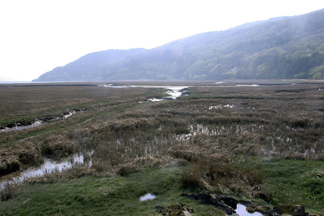
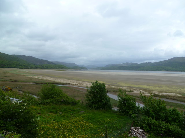
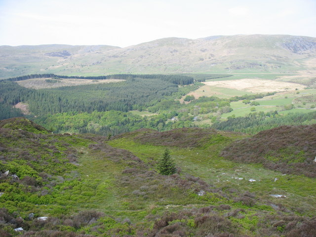
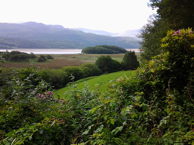
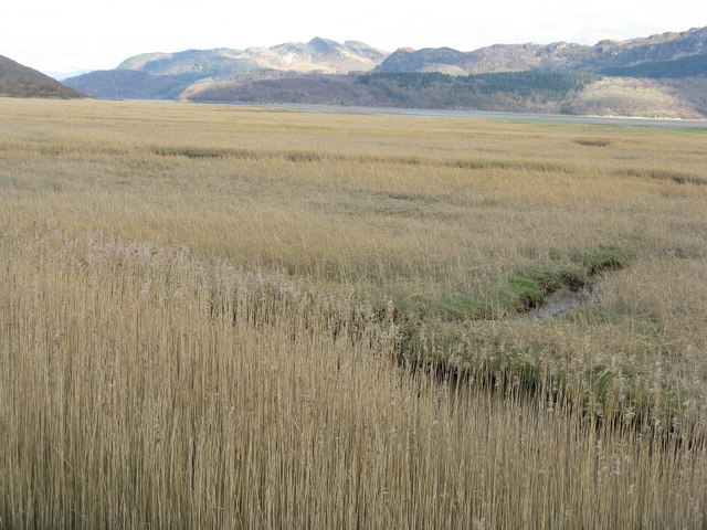
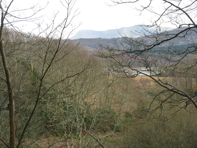
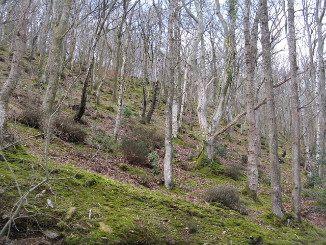
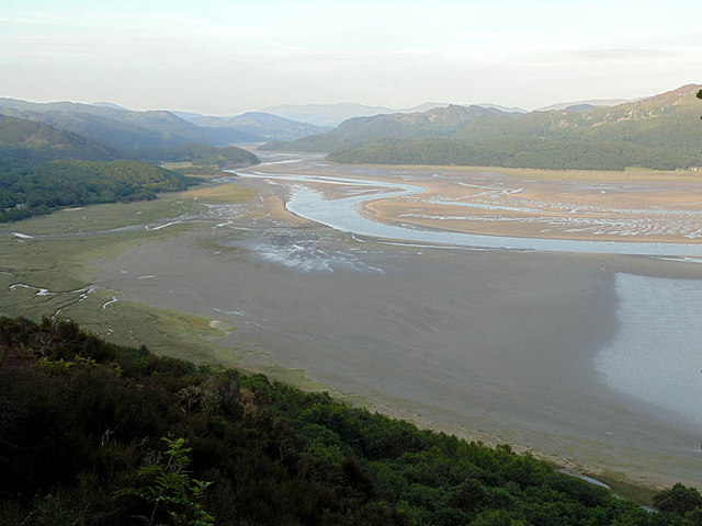
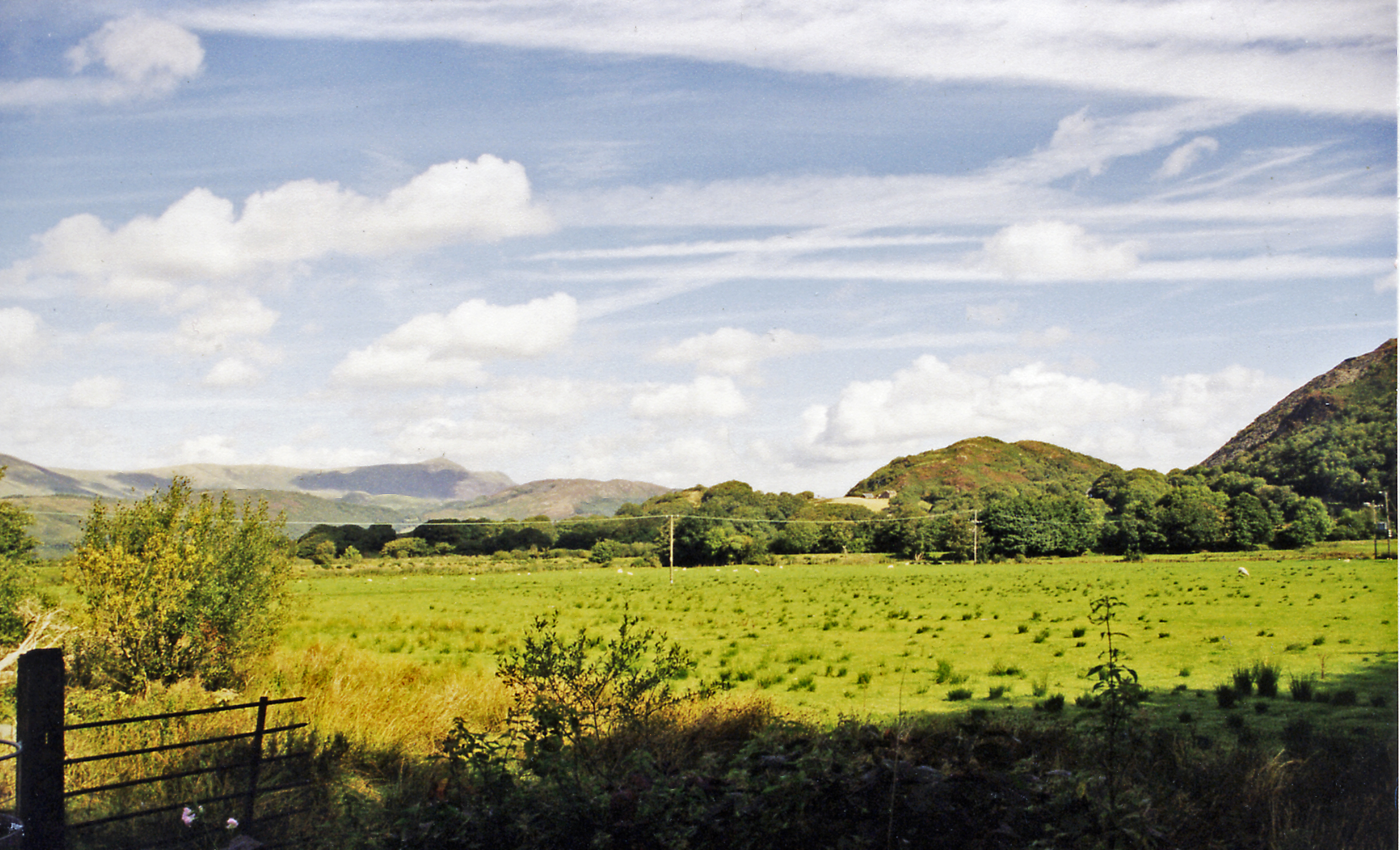
The village is renowned for its picturesque scenery and idyllic setting. Surrounded by rolling hills, lush green valleys, and the stunning peaks of Cadair Idris, Caerdeon offers a tranquil retreat for nature lovers and outdoor enthusiasts. The nearby Mawddach Estuary, a designated Site of Special Scientific Interest, provides a haven for birdwatchers and wildlife enthusiasts.
Caerdeon's history dates back centuries, with evidence of human habitation in the area since prehistoric times. The village itself features a mix of traditional Welsh stone cottages, farmhouses, and a small chapel. The local community is closely-knit, and the village hosts various community events throughout the year, including fairs, festivals, and agricultural shows.
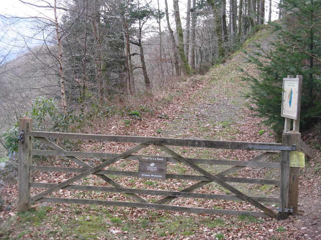
For those seeking adventure, Caerdeon offers numerous opportunities for outdoor activities. Hiking and mountain biking trails crisscross the surrounding countryside, providing access to the breathtaking landscapes and nature reserves. The nearby Mawddach Trail, a former railway line, offers a scenic route for walkers and cyclists, with panoramic views of the estuary and mountains.
In summary, Caerdeon is a picturesque village nestled in the heart of Snowdonia National Park. With its stunning natural surroundings, rich history, and abundance of outdoor activities, it is a charming destination for visitors seeking peace, tranquility, and a true taste of rural Wales.
If you have any feedback on the listing, please let us know in the comments section below.
Caerdeon Images
Images are sourced within 2km of 52.742718/-4.0012327 or Grid Reference SH6518. Thanks to Geograph Open Source API. All images are credited.
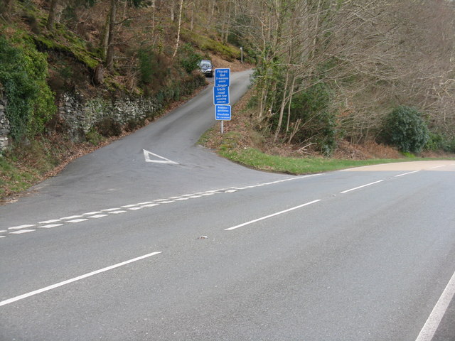
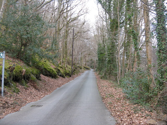
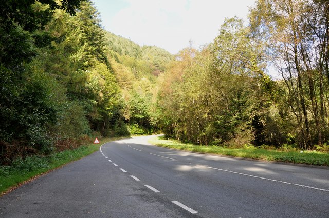
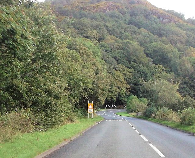
![Going round the bend The road from Dolgellau to Barmouth [A496] running alongside the Mawddach estuary and Coed Tyn-y-coed.](https://s0.geograph.org.uk/geophotos/02/86/24/2862492_4db80275.jpg)
Caerdeon is located at Grid Ref: SH6518 (Lat: 52.742718, Lng: -4.0012327)
Unitary Authority: Gwynedd
Police Authority: North Wales
What 3 Words
///pancake.suggested.steepest. Near Barmouth, Gwynedd
Nearby Locations
Related Wikis

Tyn-y-Coed Farmhouse
Tyn-y-Coed Farmhouse is a grade II Listed Building in Caerdeon, Barmouth, Gwynedd. This Georgian farm house was built in 1756 and later extended and altered...

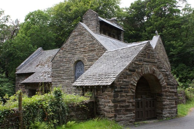
St Philip's Church, Caerdeon
St Philip's Church, Caerdeon, near Barmouth, in Gwynedd, North Wales, is a redundant church and a Grade I listed building. The church was built in 1862...

Mawddach Trail
The Mawddach Trail (Welsh: Llwybr Mawddach) is a cycle path route, part of Lôn Las Cymru, which runs for some 8 miles (13 km) from Dolgellau (52.7446°N...

Bontddu
Bontddu (meaning Black bridge) is a small settlement just east of Barmouth, near the town of Dolgellau in Gwynedd, Wales. It is in the community of Llanelltyd...
Clogau Gold Mine
The Clogau (pronounced "clog-eye") Gold Mine (also known as Clogau St David's) is a gold mine near Bontddu in North Wales. == History == The Clogau mine...
Arthog railway station
Arthog railway station in Gwynedd, Wales, was a station on the Dolgelly [sic] branch of the Aberystwith and Welsh Coast Railway (part of the Ruabon to...

Arthog
Arthog () is a village, post town and community in the Meirionnydd area in Gwynedd, north Wales including the villages of Fairbourne and Friog. It is located...
Borthwnog
Borthwnog is a family name given to the Borthwnog estate in Gwynedd, north-west Wales. Borthwnog Hall was the Manor House of the estate which encompassed...
Nearby Amenities
Located within 500m of 52.742718,-4.0012327Have you been to Caerdeon?
Leave your review of Caerdeon below (or comments, questions and feedback).