Allt Boeth

Downs, Moorland in Merionethshire

Wales

Allt Boeth

Old barn on Banc-y-Frân A solid but roofless stone barn sits on a small rise in the adjacent field. Diffwys can be seen in the distance.
Old barn on Banc-y-Frân Credit: Nigel Brown

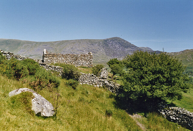
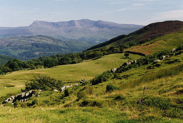
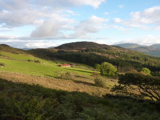
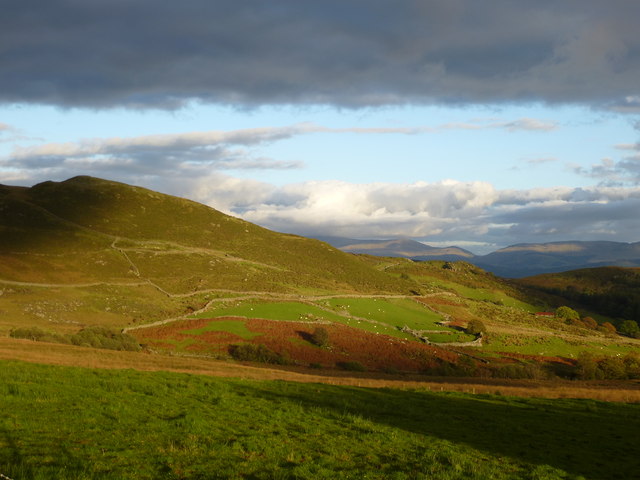
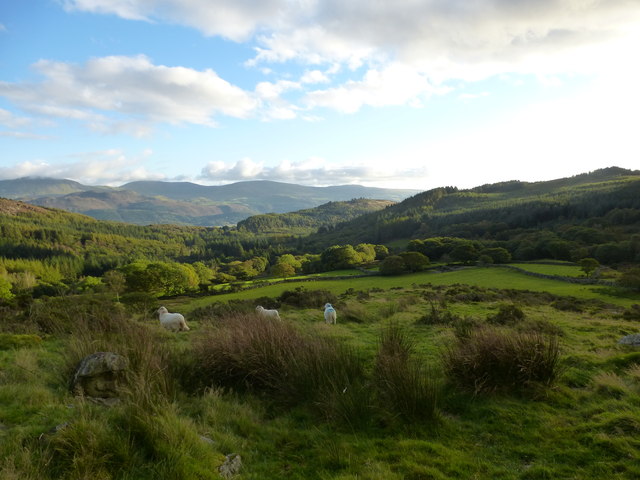
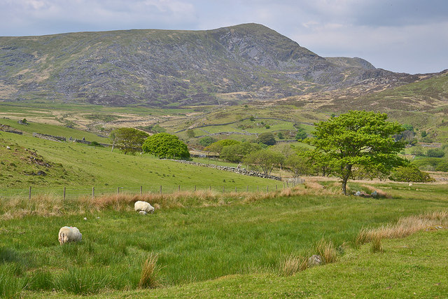
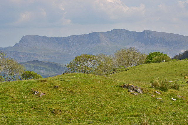
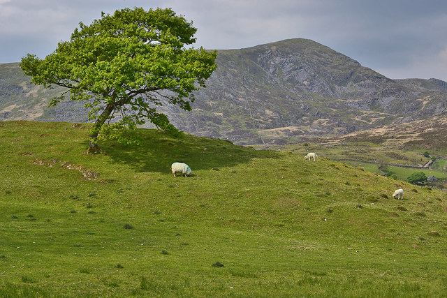
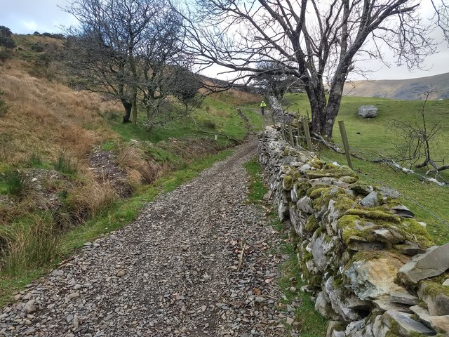
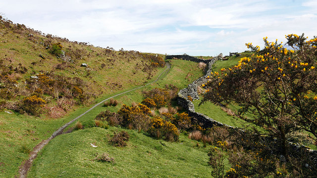
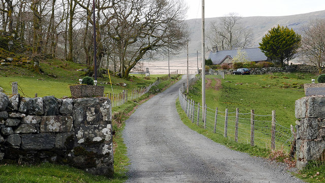
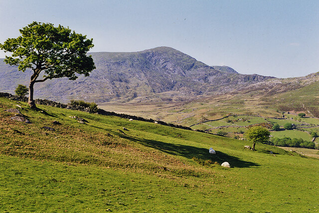
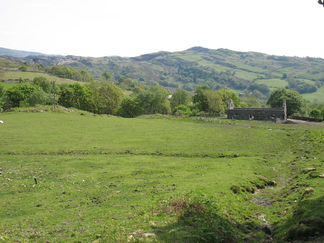
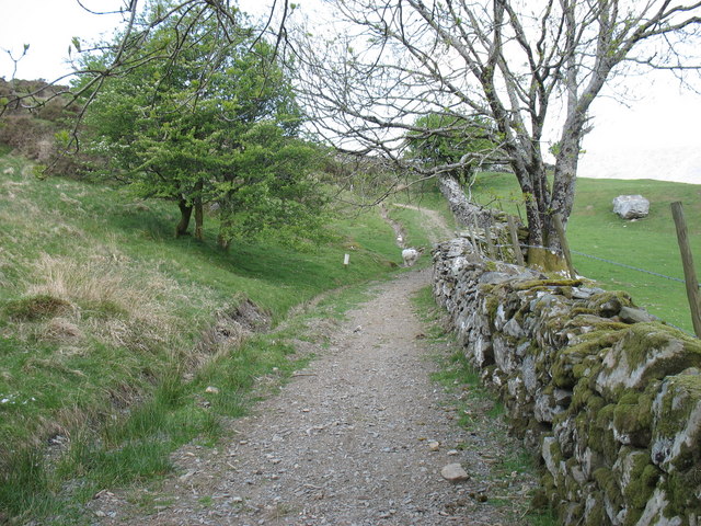
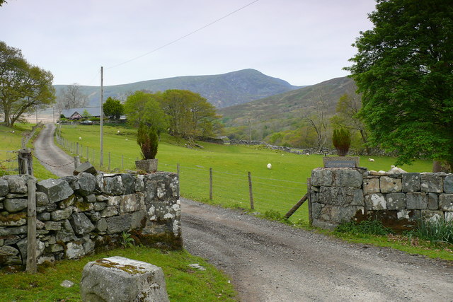
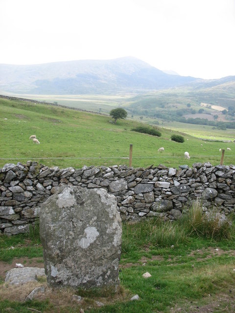
Allt Boeth is a picturesque region located in Merionethshire, Wales. Known for its stunning landscape, it predominantly consists of downs and moorland. The area is characterized by rolling hills, lush greenery, and open expanses, making it a haven for nature enthusiasts and hikers.

The downs of Allt Boeth offer breathtaking views of the surrounding countryside. These elevated areas provide a vantage point from which visitors can experience the beauty of the Welsh landscape. The downs are covered in a variety of flora, including heather, gorse, and grasses, creating a vibrant and colorful vista.

Moorland, a key feature of Allt Boeth, is characterized by its damp, acidic soil and dense cover of heather. This type of terrain attracts a diverse range of wildlife, including birds such as curlews and red grouse. The moorland also serves as a vital habitat for other species like rabbits and various reptiles.

The region's climate is typical of Wales, with mild temperatures throughout the year and frequent rainfall, which contributes to the lush vegetation and vibrant ecosystem. The changing seasons bring a range of colors to Allt Boeth, from the purple hues of blooming heather in the summer to the golden tones of autumn foliage.

Allt Boeth is a popular destination for outdoor activities such as hiking, birdwatching, and photography. Its tranquil atmosphere and stunning vistas make it an ideal location for those seeking to escape the hustle and bustle of city life and immerse themselves in the natural beauty of Wales.

If you have any feedback on the listing, please let us know in the comments section below.

Allt Boeth Images

Images are sourced within 2km of 52.746924/-3.9933061 or Grid Reference SH6518. Thanks to Geograph Open Source API. All images are credited.

Old barn on Banc-y-Frân A solid but roofless stone barn sits on a small rise in the adjacent field. Diffwys can be seen in the distance.
Old barn on Banc-y-Frân
A solid but roofless stone barn sits on a small rise in the adjacent field. Diffwys can be seen in the distance.
Descending Banc-y-Frân Just north of the public road, with the hill of Uwch Mynydd on the right and Cadair Idris in the distance.
Descending Banc-y-Frân
Just north of the public road, with the hill of Uwch Mynydd on the right and Cadair Idris in the distance.
Ordnance Survey Pivot This OS pivot can be found at the gateway on the footpath.
Ordnance Survey Pivot
This OS pivot can be found at the gateway on the footpath.
Landscape near Caegwian Looking south-east from the path to Barmouth.
Landscape near Caegwian
Looking south-east from the path to Barmouth.
Landscape near Caegwian Looking east from the path to Barmouth.
Landscape near Caegwian
Looking east from the path to Barmouth.
Landscape near Caegwian Looking south from the path to Barmouth.

Parts of the Cadair Idris mountain range can be seen in the distance.
Landscape near Caegwian
Looking south from the path to Barmouth. Parts of the Cadair Idris mountain range can be seen in the distance.
Grazing near Cae Goronwy farm With Diffwys providing the background.
Grazing near Cae Goronwy farm
With Diffwys providing the background.
Field with a dramatic backdrop The imposing skyline of Cadair Idris never fails to impress.
Field with a dramatic backdrop
The imposing skyline of Cadair Idris never fails to impress.
Tree and field by Banc-y-Frân With Diffwys in the background.
Tree and field by Banc-y-Frân
With Diffwys in the background.
A win-win situation at Banc-y-Frân  (Crow Bank) The drainage has been cleared and the extracted material has been used to repair the track surface. Good idea!
A win-win situation at Banc-y-Frân (Crow Bank)
The drainage has been cleared and the extracted material has been used to repair the track surface. Good idea!
Old Milestone by Uwch Mynydd, north of Bontddu, Llanelltyd Parish North of the A497 from Bontddu, in parish of Llanelltyd (Gwynedd District), CAE HIR, about 1½ miles North West of village by the side of a track going over the moor to Tal-y-bont.

Inscription reads:-
(North East side) : FROM HARLECH X M :
(South West side) : V FROM TAL Y BONT iiiii M. :

Grade II Listed by Cadw.
Reference Number 16160: <span class="nowrap"><a title="https://cadwpublic-api.azurewebsites.net/reports/listedbuilding/FullReport?lang=&id=16160" rel="nofollow ugc noopener" href="https://cadwpublic-api.azurewebsites.net/reports/listedbuilding/FullReport?lang=&id=16160">Link</a><img style="margin-left:2px;" alt="External link" title="External link - shift click to open in new window" src="https://s1.geograph.org.uk/img/external.png" width="10" height="10"/></span>

Surveyed 

Milestone Society National ID: MER_HLBM10
Old Milestone by Uwch Mynydd, north of Bontddu, Llanelltyd Parish
North of the A497 from Bontddu, in parish of Llanelltyd (Gwynedd District), CAE HIR, about 1½ miles North West of village by the side of a track going over the moor to Tal-y-bont. Inscription reads:- (North East side) : FROM HARLECH X M : (South West side) : V FROM TAL Y BONT iiiii M. : Grade II Listed by Cadw. Reference Number 16160: LinkExternal link Surveyed Milestone Society National ID: MER_HLBM10
Path ascending Banc-y-Frain An uphill section on the general descent from Bwlch y Rhiwgyr.
Path ascending Banc-y-Frain
An uphill section on the general descent from Bwlch y Rhiwgyr.
Entrance to Cae Goronwy Near the end of the metalled road from Bontddu.
Entrance to Cae Goronwy
Near the end of the metalled road from Bontddu.
Grazing on Banc-y-Frân With Diffwys rising in the background.
Grazing on Banc-y-Frân
With Diffwys rising in the background.
Farmland above Bontddu
Start of the bridleway at Banc-y-Fran
Cae Goronwy Mynedfa Cae Goronwy gyda Diffwys yn y cefndir / Cae Goronwy entrance with Diffwys in the background.
Cae Goronwy
Mynedfa Cae Goronwy gyda Diffwys yn y cefndir / Cae Goronwy entrance with Diffwys in the background.
The Parting of the Ways This mile stone, probably of 18thC origin, marks the parting of the route north from Bontddu. Both arms cross the wild Rhiniogydd Mountains, the second highest peak of which (Diffwys 750m) can be seen in the background. The route passing in front of the stone - which, on this side, bears the inscription Talybont 5 miles - runs north-west over Bwlch y Rhiwgyr, the one behind, the old coach road to Harlech, astonishingly climbs to almost 570 m over the Llawlech ridge before snaking down a very steep slope to the valley of the Afon Ysgethin.
The Parting of the Ways
This mile stone, probably of 18thC origin, marks the parting of the route north from Bontddu. Both arms cross the wild Rhiniogydd Mountains, the second highest peak of which (Diffwys 750m) can be seen in the background. The route passing in front of the stone - which, on this side, bears the inscription Talybont 5 miles - runs north-west over Bwlch y Rhiwgyr, the one behind, the old coach road to Harlech, astonishingly climbs to almost 570 m over the Llawlech ridge before snaking down a very steep slope to the valley of the Afon Ysgethin.
Show me another place!

Allt Boeth is located at Grid Ref: SH6518 (Lat: 52.746924, Lng: -3.9933061)

Unitary Authority: Gwynedd

Police Authority: North Wales

What 3 Words

///cutlets.performs.airstrip. Near Barmouth, Gwynedd

Nearby Locations

Allt Boeth Caerdeon

Related Wikis

St Philip's Church, Caerdeon

St Philip's Church, Caerdeon, near Barmouth, in Gwynedd, North Wales, is a redundant church and a Grade I listed building. The church was built in 1862...

Tyn-y-Coed Farmhouse

Tyn-y-Coed Farmhouse is a grade II Listed Building in Caerdeon, Barmouth, Gwynedd. This Georgian farm house was built in 1756 and later extended and altered...
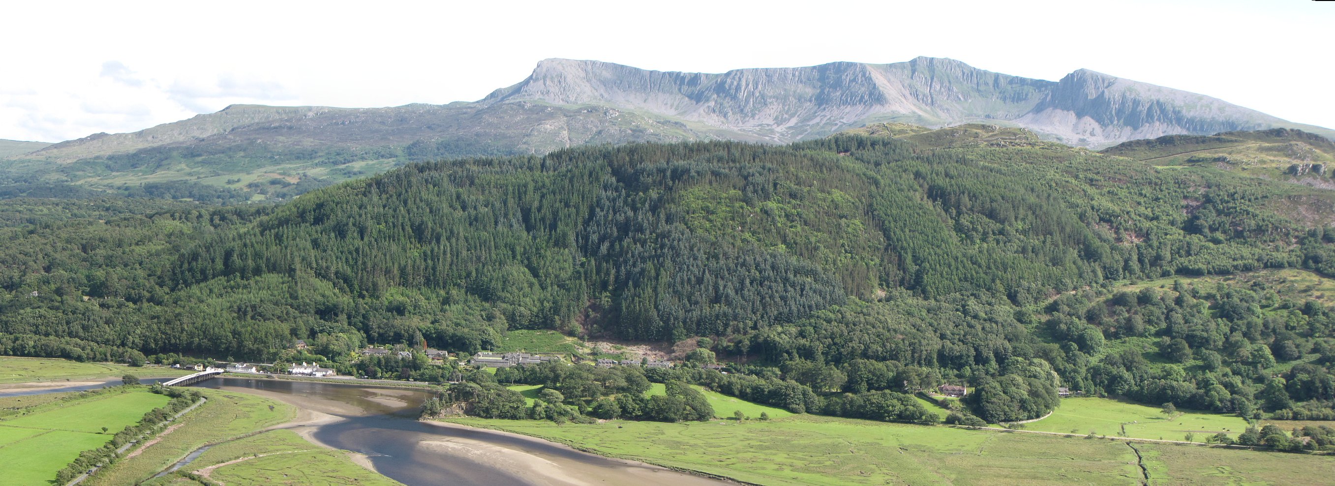
Mawddach Trail

The Mawddach Trail (Welsh: Llwybr Mawddach) is a cycle path route, part of Lôn Las Cymru, which runs for some 8 miles (13 km) from Dolgellau (52.7446°N...

Bontddu

Bontddu (meaning Black bridge) is a small settlement just east of Barmouth, near the town of Dolgellau in Gwynedd, Wales. It is in the community of Llanelltyd...

Clogau Gold Mine

The Clogau (pronounced "clog-eye") Gold Mine (also known as Clogau St David's) is a gold mine near Bontddu in North Wales. == History == The Clogau mine...

Borthwnog

Borthwnog is a family name given to the Borthwnog estate in Gwynedd, north-west Wales. Borthwnog Hall was the Manor House of the estate which encompassed...

Penmaenpool

Penmaenpool (Welsh: Llynpenmaen) is a hamlet on the south side of the estuary of the River Mawddach in Wales, near Dolgellau. A Grade II listed toll bridge...

Penmaenpool railway station

Penmaenpool railway station at Penmaenpool in Gwynedd, North Wales, was formerly a station on the Dolgelly [sic] branch of the Aberystwith and Welsh Coast...

Related Videos

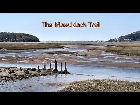
Walking Wales - The Mawddach Trail

Positioned along the estuary of the Mawddach river near Barmouth, this trail follows the coast using the route of a former train line ...

Our first ever proper trip in our van - Wales - day three

Our first trip in our van was for three nights at an off grid campsite near Dolgellau in West Wales. Today we hiked the spectacular ...

Wales Tour - The Barmouth Run

This ride was one of nostalgia. Visiting places we used to go on holiday, or in Jayne's case, where she worked and gained ...

Mawddach Estuary Solo Canoe Trip

A solo trip in an open canoe down and up the Mawddch estuary from Penmaenpool to Barmouth and back. Using the tides and a ...

Nearby Amenities

Located within 500m of 52.746924,-3.9933061
Allt Boeth
Ele: 180
Natural: peak
Lat/Long: 52.7462886/-3.9943839
Mineshaft (disused)
Historic: archaeological_site
Lat/Long: 52.7505569/-3.9943391
Power: pole
Lat/Long: 52.7467599/-3.9868966
Material: wood
Power: pole
Lat/Long: 52.7458621/-3.9874814
Power: pole
Lat/Long: 52.7477731/-3.9862502
Material: wood
Power: pole
Lat/Long: 52.7442451/-3.988499
Power: pole
Lat/Long: 52.7440504/-3.9879583
Material: wood
Power: pole
Lat/Long: 52.7432475/-3.9891265
Power: pole
Lat/Long: 52.7449914/-3.98801
The data included in this document is from www.openstreetmap.org. The data is made available under ODbL.

Have you been to Allt Boeth?

Leave your review of Allt Boeth below (or comments, questions and feedback).