Bailey Wood

Wood, Forest in Radnorshire

Wales

Bailey Wood

Glyndwr's Way near Felindre
Glyndwr's Way near Felindre Credit: Dave Kelly

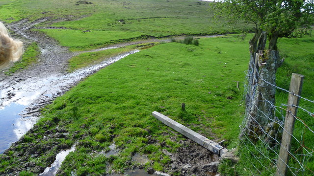
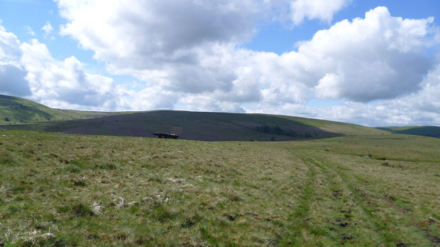
Bailey Wood is a picturesque forest located in Radnorshire, a historic county in central Wales. Covering an area of approximately 100 acres, it is a beloved natural gem that attracts visitors from far and wide.

The woodland is characterized by its dense canopy of mixed broadleaf trees, including oak, birch, and beech. These towering specimens create a mesmerizing tapestry of colors throughout the seasons, with vibrant greens in the spring and summer, followed by a stunning display of golden hues in the autumn.

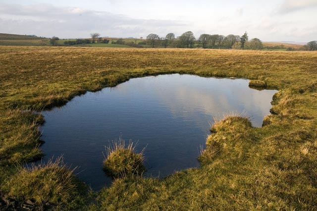
Bailey Wood is renowned for its tranquil atmosphere, offering a peaceful retreat for nature enthusiasts and hikers alike. Numerous trails wind through the forest, allowing visitors to explore its diverse flora and fauna. The forest floor is adorned with a variety of wildflowers, while moss-covered rocks and fallen logs add an enchanting touch to the scenery.

Wildlife is abundant in Bailey Wood, providing a haven for many species. Birdwatchers can spot a range of avian inhabitants, including woodpeckers, jays, and thrushes. Squirrels and rabbits are commonly seen darting among the trees, while lucky visitors may even catch a glimpse of a shy deer or fox.

The forest is also a popular spot for outdoor activities such as camping and picnicking. A dedicated camping area and picnic spots are available, providing visitors with the opportunity to immerse themselves fully in the tranquil surroundings.

Overall, Bailey Wood is a natural treasure in Radnorshire, offering a serene escape from the hustle and bustle of everyday life. Its vibrant woodlands, abundant wildlife, and peaceful ambiance make it a must-visit destination for nature lovers and those seeking a relaxing outdoor experience.

If you have any feedback on the listing, please let us know in the comments section below.
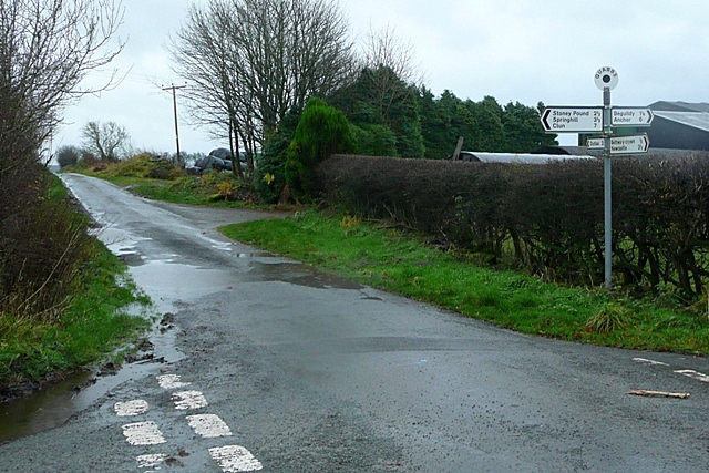
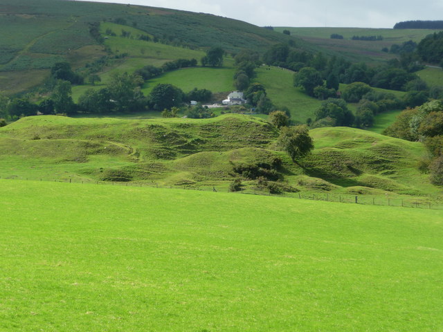
Bailey Wood Images

Images are sourced within 2km of 52.406208/-3.2403406 or Grid Reference SO1579. Thanks to Geograph Open Source API. All images are credited.

Glyndwr's Way near Felindre
On Glyndwr's Way in May Easy upland walking in glorious conditions.

It is May mornings like this that I picture in my mind's eye in the depths of winter when thinking ahead to future walks.
On Glyndwr's Way in May
Easy upland walking in glorious conditions. It is May mornings like this that I picture in my mind's eye in the depths of winter when thinking ahead to future walks.
Cows and calves beside Glyndwr's Way Contentedly chewing the cud here until we approached, they sprung up leaving one lazy calf to rise last. Lovely Welsh Black cattle I think.
Cows and calves beside Glyndwr's Way
Contentedly chewing the cud here until we approached, they sprung up leaving one lazy calf to rise last. Lovely Welsh Black cattle I think.
On an upland section of Glyndwr's Way The stubby new yellow-topped waymarkers prevent cattle, ponies and sheep from rubbing & scratching on them - they are too short, certainly too short for the larger, heavier livestock.
On an upland section of Glyndwr's Way
The stubby new yellow-topped waymarkers prevent cattle, ponies and sheep from rubbing & scratching on them - they are too short, certainly too short for the larger, heavier livestock.
On Glyndwr's Way above Bwlch house A lovely section of GW on a morning like this.
On Glyndwr's Way above Bwlch house
A lovely section of GW on a morning like this.
Waymarker down on Glyndwr's Way near Bwlch House Yet another one down.
Waymarker down on Glyndwr's Way near Bwlch House
Yet another one down.
View from Glyndwr's Way above Bwlch House Lovely hills!
View from Glyndwr's Way above Bwlch House
Lovely hills!
On Glyndwr's Way on Warren Bank in May Lovely upland scene this morning up here.
On Glyndwr's Way on Warren Bank in May
Lovely upland scene this morning up here.
On Glyndwr's Way above Warren Bank in May A fingerpost leans at a tipsy angle.
On Glyndwr's Way above Warren Bank in May
A fingerpost leans at a tipsy angle.
Upland footbridge on Glyndwr's Way Carrying GW across a boggy stream.
Upland footbridge on Glyndwr's Way
Carrying GW across a boggy stream.
On Glyndwr's Way on the slope of the Black Mountain between Knighton and Felindre A steep climb in my direction of travel.
On Glyndwr's Way on the slope of the Black Mountain between Knighton and Felindre
A steep climb in my direction of travel.
On the Black Mountain on Glyndwr's Way Lovely views over serried ranks of hills. Lovely.
On the Black Mountain on Glyndwr's Way
Lovely views over serried ranks of hills. Lovely.
Pool, Cefn Pawl This little peaty pool appears on the 1:25000 map just to the north of the surfaced road on the ridge, about 1/4 mile east of Glyndwr's Way
Pool, Cefn Pawl
This little peaty pool appears on the 1:25000 map just to the north of the surfaced road on the ridge, about 1/4 mile east of Glyndwr's Way
Mountain Ponies beside Glyndwr's Way Mountain ponies graze beside Glyndwr's way, on the route from Cefn Pawl southwards towards Warren Bank and Black Mountain
Mountain Ponies beside Glyndwr's Way
Mountain ponies graze beside Glyndwr's way, on the route from Cefn Pawl southwards towards Warren Bank and Black Mountain
Warren Bank - view to Warren Hill On Glyndwr's Way, the view WSW across the valley to Warren Hill
Warren Bank - view to Warren Hill
On Glyndwr's Way, the view WSW across the valley to Warren Hill
Winter trees, Black Mountain These trees stand amid signs or earlier settlement in the col between Warren Bank and Black Mountain, on Glyndwr's Way near Beacon Hill.

<span class="nowrap"><a title="http://www.geoffspages.co.uk/camerawalks/beacon_hill/index.htm" rel="nofollow ugc noopener" href="http://www.geoffspages.co.uk/camerawalks/beacon_hill/index.htm">Link</a><img style="margin-left:2px;" alt="External link" title="External link - shift click to open in new window" src="https://s1.geograph.org.uk/img/external.png" width="10" height="10"/></span>
Winter trees, Black Mountain
These trees stand amid signs or earlier settlement in the col between Warren Bank and Black Mountain, on Glyndwr's Way near Beacon Hill. LinkExternal link
Maes-gwyn farm Maes-gwyn means 'white field'.
Maes-gwyn farm
Maes-gwyn means 'white field'.
Show me another place!

Bailey Wood is located at Grid Ref: SO1579 (Lat: 52.406208, Lng: -3.2403406)

Unitary Authority: Powys

Police Authority: Dyfed Powys

What 3 Words

///indirect.noses.geek. Near Mochdre, Powys

Related Wikis

Beacon Hill, Powys

Beacon Hill (Welsh: Mynydd Disglair) is a hill in the county of Radnorshire, Wales. It lies within the Powys unitary council area. It is located north...

East Wales

East Wales (Welsh: Dwyrain Cymru) is either a ITL 3 statistical region of Wales or generally a region encompassing the easternmost parts of the country...

Beguildy

Beguildy (Welsh: Bugeildy) is a village and community in Powys, Wales. It lies in a remote tract of countryside, 8 miles (13 km) northwest of Knighton...

Bettws-y-Crwyn

Bettws-y-Crwyn (Welsh: Betws-y-crwyn / Betwsycrowyn) is a small, remote village and civil parish in south-west Shropshire, England. It is close to the...

Quabbs

Quabbs is a small, scattered hamlet in the southwest of Shropshire, near the border between England and Wales. The name, which also occurs in Gloucestershire...

Bryn Amlwg Castle

Bryn Amlwg Castle (Welsh: Castell Bryn Amlwg, lit. 'castle on a prominent hill') was an enclosure castle near Anchor, Shropshire, abutting the England...

Anchor, Shropshire

Anchor is a remote hamlet in southwest Shropshire, England. The hamlet is the most westerly place in Shropshire. == Geography == Anchor lies only 400 metres...

Llanbadarn Fynydd

Llanbadarn Fynydd (meaning Church of Padarn in the mountain) is a village and community in Radnorshire, Powys, Wales, and is 63 miles (101 km) from Cardiff...

Nearby Amenities

Located within 500m of 52.406208,-3.2403406
Place: farm
Lat/Long: 52.4094038/-3.2437046
Building: yes
Lat/Long: 52.4034739/-3.2438762
Power: pole
Lat/Long: 52.4102997/-3.2413381
Power: pole
Lat/Long: 52.4099231/-3.2418413
Power: pole
Lat/Long: 52.4092752/-3.2426942
Direction: 145
Generator Method: photovoltaic
Generator Output Electricity: yes
Generator Solar Modules: 6
Generator Source: solar
Generator Type: solar_photovoltaic_panel
Location: roof
Power: generator
Lat/Long: 52.4023146/-3.2433302
Direction: 145
Generator Method: photovoltaic
Generator Output Electricity: yes
Generator Solar Modules: 10
Generator Source: solar
Generator Type: solar_photovoltaic_panel
Location: roof
Power: generator
Lat/Long: 52.402351/-3.24325
The data included in this document is from www.openstreetmap.org. The data is made available under ODbL.

Have you been to Bailey Wood?

Leave your review of Bailey Wood below (or comments, questions and feedback).