Bwlch

Settlement in Flintshire

Wales

Bwlch

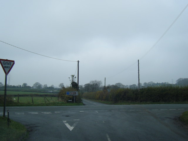
A541 near Nannerch The A541 runs for 26 miles, linking St Asaph with Wrexham. Its northern end starts at the crossroads in the middle of the village of Trefnant (just south of St Asaph). It ends at Wrexham, where it joins the B5101 road. On the way, it passes the town of Mold and also passes through many villages.
A541 near Nannerch Credit: David Dixon

The requested URL returned error: 429 Too Many Requests

If you have any feedback on the listing, please let us know in the comments section below.

Bwlch Images

Images are sourced within 2km of 53.231968/-3.233988 or Grid Reference SJ1771. Thanks to Geograph Open Source API. All images are credited.

A541 near Nannerch The A541 runs for 26 miles, linking St Asaph with Wrexham. Its northern end starts at the crossroads in the middle of the village of Trefnant (just south of St Asaph). It ends at Wrexham, where it joins the B5101 road. On the way, it passes the town of Mold and also passes through many villages.
A541 near Nannerch
The A541 runs for 26 miles, linking St Asaph with Wrexham. Its northern end starts at the crossroads in the middle of the village of Trefnant (just south of St Asaph). It ends at Wrexham, where it joins the B5101 road. On the way, it passes the town of Mold and also passes through many villages.
The Old Mill at Melin y Wern The large, three-storey building set back from the road is a late-Georgian, former mill. It is now used as self-catering holiday accommodation. Grade II-listed (Cadw reference: 529 <span class="nowrap"><a title="http://cadwpublic-api.azurewebsites.net/reports/listedbuilding/FullReport?lang=en&id=529" rel="nofollow ugc noopener" href="http://cadwpublic-api.azurewebsites.net/reports/listedbuilding/FullReport?lang=en&id=529">Link</a><img style="margin-left:2px;" alt="External link" title="External link - shift click to open in new window" src="https://s1.geograph.org.uk/img/external.png" width="10" height="10"/></span> ).
The Old Mill at Melin y Wern
The large, three-storey building set back from the road is a late-Georgian, former mill. It is now used as self-catering holiday accommodation. Grade II-listed (Cadw reference: 529 LinkExternal link ).
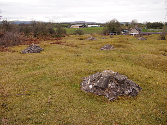
Capped Shafts Near Waen-brodlas
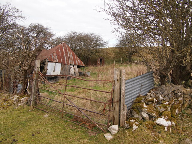
Neglected Enclosure, Below Halkyn Mountain
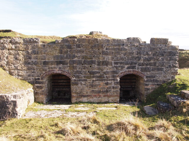
Rhes-y-Cae Lime Kilns
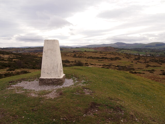
Trig Point, Halkyn Mountain
Lixwm village shop Located in the car park of the Crown Inn in what appears to be a former garage.
Lixwm village shop
Located in the car park of the Crown Inn in what appears to be a former garage.
Rhes y Cae, Flintshire Looking down the main road in Rhes y Cae towards The Miners Arms.
Rhes y Cae, Flintshire
Looking down the main road in Rhes y Cae towards The Miners Arms.
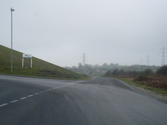
A541 looking east
A541 looking east
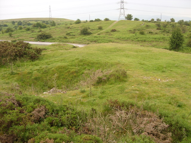
Lead Mine shaft The hollow in the foreground is a run-in Lead Mine shaft. The flat grassed area behind it on the mound has a circular form indicating that there was a Horse Gin here, a horse-powered capstan for winding in the shaft. Although the wooden structure has long since gone the circular track the horse walked around is still visible. These show up well on aerial photographs.
Lead Mine shaft
The hollow in the foreground is a run-in Lead Mine shaft. The flat grassed area behind it on the mound has a circular form indicating that there was a Horse Gin here, a horse-powered capstan for winding in the shaft. Although the wooden structure has long since gone the circular track the horse walked around is still visible. These show up well on aerial photographs.
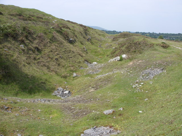
19th century opencast lead workings These form a long and continuous trench where lead was extracted at surface
19th century opencast lead workings
These form a long and continuous trench where lead was extracted at surface
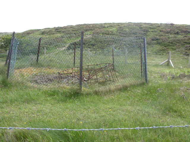
Open lead mine shaft on Halkyn Mountain This 19th century shaft is well fenced and made safe with a metal frame. It is alongside a long opencast working
Open lead mine shaft on Halkyn Mountain
This 19th century shaft is well fenced and made safe with a metal frame. It is alongside a long opencast working
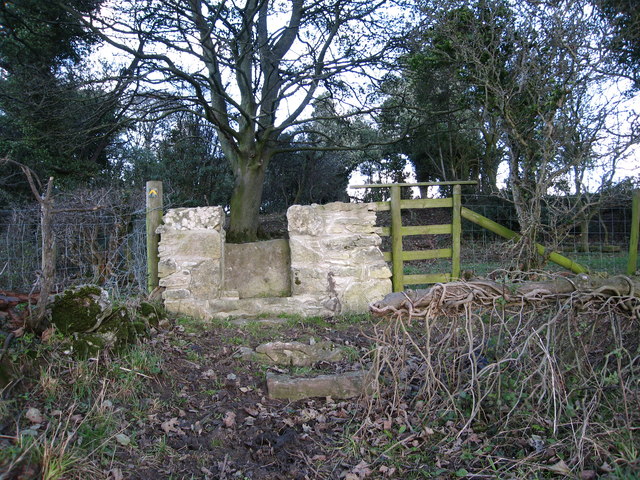
Stone stile On a footpath from a minor lane near Ash Farm.  There are several of these stiles recently built in this traditional style through the boundaries between fields on this route
Stone stile
On a footpath from a minor lane near Ash Farm. There are several of these stiles recently built in this traditional style through the boundaries between fields on this route
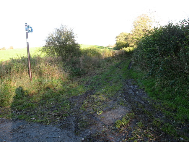
Bridleway from Ysceifiog Where it crosses a minor lane near Ash Farm, heading east through fields towards a road between Lixwm and Brynford
Bridleway from Ysceifiog
Where it crosses a minor lane near Ash Farm, heading east through fields towards a road between Lixwm and Brynford
Enclosed path Heading south east between fields from the junction of a footpath west of Lixwm
Enclosed path
Heading south east between fields from the junction of a footpath west of Lixwm
Quarry entrance near Pant-y-groes
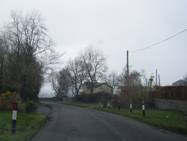
Lane near Llwyn-y-cosyn Farm
Crossroads near Groesfford Farm
Show me another place!

Bwlch is located at Grid Ref: SJ1771 (Lat: 53.231968, Lng: -3.233988)

Unitary Authority: Flintshire

Police Authority: North Wales

What 3 Words

///drilling.hill.northward. Near Halkyn, Flintshire

Related Wikis

Lixwm

Lixwm (Welsh: Licswm) is a small village in Flintshire, Wales. It is part of the community of Ysceifiog. Lixwm was formerly a mining village, and one explanation...

Rhes-y-cae

Rhes-y-cae is a small parish and village in Flintshire, Wales. Literally translated from Welsh, Rhes-y-cae is 'Row of fields'. It is situated between...

Halkyn Common and Holywell Grasslands

Halkyn Common and Holywell Grasslands (Welsh: Comin Helygain a Glaswelltiroedd Treffynnon) is a Site of Special Scientific Interest in Flintshire, north...

Calcoed

Calcoed is a small village in Flintshire, Wales. It is located to the south west of the town of Holywell, to the north west of the village of Brynford...

Nearby Amenities

Located within 500m of 53.231968,-3.233988
Waen-trochwaed
Place: hamlet
Lat/Long: 53.2306894/-3.2290833
Power: pole
Lat/Long: 53.2359916/-3.2331745
Power: pole
Lat/Long: 53.2353233/-3.2326546
Power: pole
Lat/Long: 53.2350542/-3.2333683
Power: pole
Lat/Long: 53.2346917/-3.2343273
Power: pole
Lat/Long: 53.2342654/-3.2354358
Power: pole
Lat/Long: 53.2336058/-3.2356099
Power: pole
Lat/Long: 53.2329195/-3.2358136
Man Made: mineshaft
Lat/Long: 53.2319387/-3.240414
Man Made: mineshaft
Lat/Long: 53.234004/-3.2391796
Man Made: mineshaft
Lat/Long: 53.2339513/-3.2392644
Man Made: mineshaft
Lat/Long: 53.2339443/-3.2391785
Man Made: mineshaft
Lat/Long: 53.2339916/-3.2390713
Man Made: mineshaft
Lat/Long: 53.2339096/-3.2392356
Man Made: mineshaft
Lat/Long: 53.2338367/-3.2392721
Man Made: mineshaft
Lat/Long: 53.2337754/-3.2393437
Man Made: mineshaft
Lat/Long: 53.2337284/-3.2394628
Man Made: mineshaft
Lat/Long: 53.2338168/-3.239853
Man Made: mineshaft
Lat/Long: 53.233704/-3.2399146
Power: pole
Lat/Long: 53.2339107/-3.2398441
Power: pole
Lat/Long: 53.233993/-3.2389047
Power: pole
Lat/Long: 53.2341152/-3.2373862
Man Made: mineshaft
Lat/Long: 53.2344392/-3.236009
Man Made: mineshaft
Lat/Long: 53.2346546/-3.2360503
Man Made: mineshaft
Lat/Long: 53.2346591/-3.2358958
Man Made: mineshaft
Lat/Long: 53.2347789/-3.2360298
Man Made: mineshaft
Lat/Long: 53.2347855/-3.2358645
Power: pole
Lat/Long: 53.2333416/-3.2408401
Power: pole
Lat/Long: 53.2359588/-3.2373674
Power: pole
Lat/Long: 53.2359374/-3.2366864
Power: pole
Lat/Long: 53.2359007/-3.2359809
Man Made: mineshaft
Lat/Long: 53.228935/-3.2296698
Man Made: mineshaft
Lat/Long: 53.2290095/-3.2299721
Power: pole
Lat/Long: 53.2359674/-3.2309278
Power: pole
Lat/Long: 53.2356229/-3.2318445
The data included in this document is from www.openstreetmap.org. The data is made available under ODbL.

Have you been to Bwlch?

Leave your review of Bwlch below (or comments, questions and feedback).