Allowenshay

Settlement in Somerset South Somerset

England

Allowenshay

St John and All Saints church, Kingstone The medieval church <span class="nowrap"><a title="http://webapp1.somerset.gov.uk/her/details.asp?prn=56710" rel="nofollow ugc noopener" href="http://webapp1.somerset.gov.uk/her/details.asp?prn=56710">Link</a><img style="margin-left:2px;" alt="External link" title="External link - shift click to open in new window" src="https://s1.geograph.org.uk/img/external.png" width="10" height="10"/></span> from the south.
St John and All Saints church, Kingstone Credit: Derek Harper

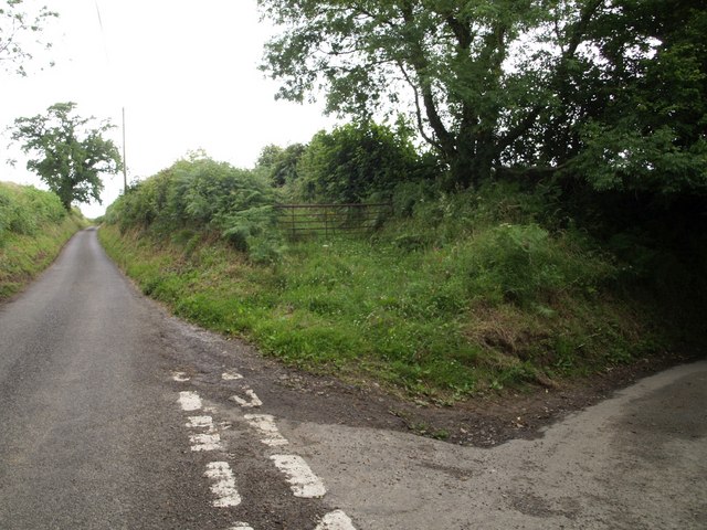
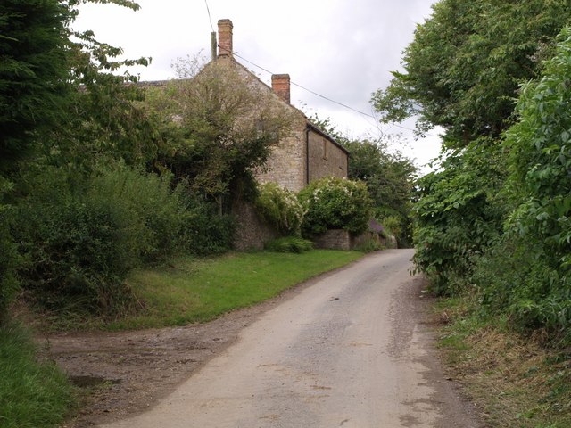
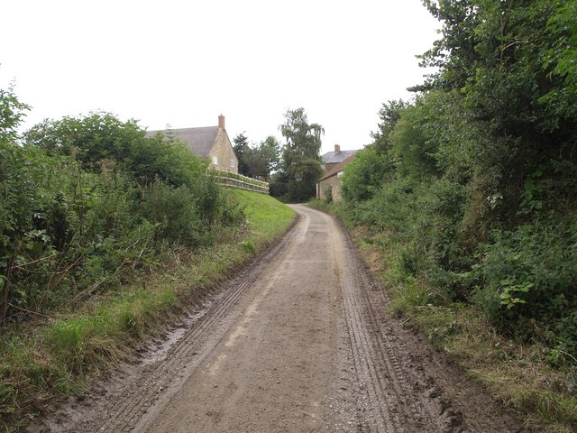
Allowenshay is a small village located within the county of Somerset, England. Situated in the South West region of the country, it lies approximately 10 miles south of the town of Taunton. The village is nestled amidst the picturesque countryside, boasting stunning views and a tranquil atmosphere.

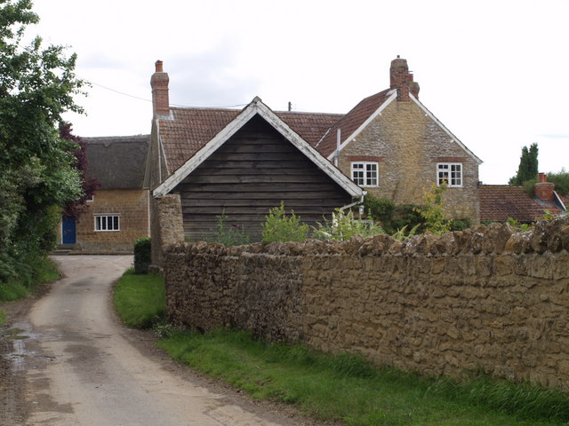
With a population of around 200 residents, Allowenshay exudes a strong sense of community. The village is characterized by its charming thatched-roof cottages and traditional architecture, which adds to its quaint and idyllic appeal. The surrounding landscape is predominantly agricultural, with rolling hills and green fields stretching as far as the eye can see.

Although small in size, Allowenshay offers a range of amenities to cater to the needs of its residents. These include a local pub, a primary school, and a village hall which serves as a hub for social gatherings and events. The village also benefits from its proximity to larger towns and cities, with Taunton providing additional services and facilities just a short drive away.

Allowenshay is blessed with an abundance of natural beauty, making it an attractive destination for nature enthusiasts and outdoor lovers. The nearby Blackdown Hills Area of Outstanding Natural Beauty offers ample opportunities for hiking, cycling, and exploring the great outdoors. Additionally, the village is within easy reach of the stunning Jurassic Coast, a UNESCO World Heritage site known for its dramatic cliffs and fossil-rich beaches.

In summary, Allowenshay is a charming and close-knit village in Somerset, boasting a peaceful setting and a strong community spirit. With its beautiful surroundings and convenient proximity to amenities and attractions, it offers an appealing lifestyle for both residents and visitors alike.

If you have any feedback on the listing, please let us know in the comments section below.

Allowenshay Images

Images are sourced within 2km of 50.914918/-2.863295 or Grid Reference ST3913. Thanks to Geograph Open Source API. All images are credited.

St John and All Saints church, Kingstone The medieval church <span class="nowrap"><a title="http://webapp1.somerset.gov.uk/her/details.asp?prn=56710" rel="nofollow ugc noopener" href="http://webapp1.somerset.gov.uk/her/details.asp?prn=56710">Link</a><img style="margin-left:2px;" alt="External link" title="External link - shift click to open in new window" src="https://s1.geograph.org.uk/img/external.png" width="10" height="10"/></span> from the south.
St John and All Saints church, Kingstone
The medieval church LinkExternal link from the south.
Dowlish Wake from the churchyard Looking SSW from the churchyard down the village street. A reverse view of <a href="https://www.geograph.org.uk/photo/3715773">ST3712 : Entrance to churchyard, Dowlish Wake</a>; on the right is the scene in <a href="https://www.geograph.org.uk/photo/3715820">ST3712 : Lane at Dowlish Wake</a>.
Dowlish Wake from the churchyard
Looking SSW from the churchyard down the village street. A reverse view of ST3712 : Entrance to churchyard, Dowlish Wake; on the right is the scene in ST3712 : Lane at Dowlish Wake.
Wake Hill, Kingstone Early C19 house - "in a later form of 'cottage ornee' (<span class="nowrap"><a title="http://webapp1.somerset.gov.uk/her/details.asp?prn=57246" rel="nofollow ugc noopener" href="http://webapp1.somerset.gov.uk/her/details.asp?prn=57246">Link</a><img style="margin-left:2px;" alt="External link" title="External link - shift click to open in new window" src="https://s1.geograph.org.uk/img/external.png" width="10" height="10"/></span> )
Wake Hill, Kingstone
Early C19 house - "in a later form of 'cottage ornee' (LinkExternal link )
Old Toll House, Kingstone <span class="nowrap"><a title="http://webapp1.somerset.gov.uk/her/details.asp?prn=57243" rel="nofollow ugc noopener" href="http://webapp1.somerset.gov.uk/her/details.asp?prn=57243">Link</a><img style="margin-left:2px;" alt="External link" title="External link - shift click to open in new window" src="https://s1.geograph.org.uk/img/external.png" width="10" height="10"/></span> . George V postbox TA19 19 is on the wall. See also <a href="https://www.geograph.org.uk/photo/3715963">ST3713 : Old Toll House, Kingstone</a>.
Old Toll House, Kingstone
LinkExternal link . George V postbox TA19 19 is on the wall. See also ST3713 : Old Toll House, Kingstone.
Barn conversion, Kingstone Farmhouse The pre-conversion photo, taken in 1986, at <span class="nowrap"><a title="http://webapp1.somerset.gov.uk/her/details.asp?prn=56718" rel="nofollow ugc noopener" href="http://webapp1.somerset.gov.uk/her/details.asp?prn=56718">Link</a><img style="margin-left:2px;" alt="External link" title="External link - shift click to open in new window" src="https://s1.geograph.org.uk/img/external.png" width="10" height="10"/></span> makes an interesting comparison. Listed and described at <span class="nowrap"><a title="https://historicengland.org.uk/listing/the-list/list-entry/1056989" rel="nofollow ugc noopener" href="https://historicengland.org.uk/listing/the-list/list-entry/1056989">Link</a><img style="margin-left:2px;" alt="External link" title="External link - shift click to open in new window" src="https://s1.geograph.org.uk/img/external.png" width="10" height="10"/></span>  .
Barn conversion, Kingstone Farmhouse
The pre-conversion photo, taken in 1986, at LinkExternal link makes an interesting comparison. Listed and described at LinkExternal link .
Kingstone church from the south Looking across a field of brassica, past a little stand of trees in its midst, from the footpath to Dowlish Wake.
Kingstone church from the south
Looking across a field of brassica, past a little stand of trees in its midst, from the footpath to Dowlish Wake.
St Andrew's church, Dowlish Wake <span class="nowrap"><a title="http://webapp1.somerset.gov.uk/her/details.asp?prn=57228" rel="nofollow ugc noopener" href="http://webapp1.somerset.gov.uk/her/details.asp?prn=57228">Link</a><img style="margin-left:2px;" alt="External link" title="External link - shift click to open in new window" src="https://s1.geograph.org.uk/img/external.png" width="10" height="10"/></span>
St Andrew's church, Dowlish Wake
Dower House , Dowlish Wake Fine 1664 house in Ham stone, with a five-light mullioned window, at the centre of the charming village. Details at <span class="nowrap"><a title="http://webapp1.somerset.gov.uk/her/details.asp?prn=57233" rel="nofollow ugc noopener" href="http://webapp1.somerset.gov.uk/her/details.asp?prn=57233">Link</a><img style="margin-left:2px;" alt="External link" title="External link - shift click to open in new window" src="https://s1.geograph.org.uk/img/external.png" width="10" height="10"/></span> .
Dower House , Dowlish Wake
Fine 1664 house in Ham stone, with a five-light mullioned window, at the centre of the charming village. Details at LinkExternal link .
Packhorse Bridge, Dowlish Wake The 2-arch bridge was widened in the 1990s as part of flood relief work - quite cleverly (can you see the joins?). <span class="nowrap"><a title="http://webapp1.somerset.gov.uk/her/details.asp?prn=17080" rel="nofollow ugc noopener" href="http://webapp1.somerset.gov.uk/her/details.asp?prn=17080">Link</a><img style="margin-left:2px;" alt="External link" title="External link - shift click to open in new window" src="https://s1.geograph.org.uk/img/external.png" width="10" height="10"/></span>
Packhorse Bridge, Dowlish Wake
The 2-arch bridge was widened in the 1990s as part of flood relief work - quite cleverly (can you see the joins?). LinkExternal link
Not St George's Day In Dowlish Wake village on St George's Eve. Hope it won whatever competition it was in for.
Not St George's Day
In Dowlish Wake village on St George's Eve. Hope it won whatever competition it was in for.
Perry's Cider Mill, Dowlish Wake Offering a tea room and shop as well as producing cider. <span class="nowrap"><a title="http://webapp1.somerset.gov.uk/her/details.asp?prn=57240" rel="nofollow ugc noopener" href="http://webapp1.somerset.gov.uk/her/details.asp?prn=57240">Link</a><img style="margin-left:2px;" alt="External link" title="External link - shift click to open in new window" src="https://s1.geograph.org.uk/img/external.png" width="10" height="10"/></span>
Perry's Cider Mill, Dowlish Wake
Offering a tea room and shop as well as producing cider. LinkExternal link
Lane to Allowenshay Trees line one side of the lane as it leaves Boyton Hill.
Lane to Allowenshay
Trees line one side of the lane as it leaves Boyton Hill.
Lane junction near Kingstone Longforward Lane, to the right, leads from Kingstone to Seavington St Mary. Park Lane, to the left, runs along the edge of the landscape park centred on Dillington House, which extends across much of Whitelackington parish.
Lane junction near Kingstone
Longforward Lane, to the right, leads from Kingstone to Seavington St Mary. Park Lane, to the left, runs along the edge of the landscape park centred on Dillington House, which extends across much of Whitelackington parish.
Park Lane On the right is Putcombe Copse, which was the site of a C16 deerpark, part of Whitelackington Park. The lane leads to Kingstone.
Park Lane
On the right is Putcombe Copse, which was the site of a C16 deerpark, part of Whitelackington Park. The lane leads to Kingstone.
Lane junction near Dinnington Wood Close Lane branches off to the right down a steep shady lane to Alleowenshay. The lane ahead, which has just emerged from a dark sunken stretch where it diverts from the line of the Fosse Way, leads to Dozens Corner.
Lane junction near Dinnington
Wood Close Lane branches off to the right down a steep shady lane to Alleowenshay. The lane ahead, which has just emerged from a dark sunken stretch where it diverts from the line of the Fosse Way, leads to Dozens Corner.
Allowenshay An attractive hamlet of stone cottages tucked away down lanes southeast of Ilminster. See <span class="nowrap"><a title="http://webapp1.somerset.gov.uk/her/details.asp?prn=54117" rel="nofollow ugc noopener" href="http://webapp1.somerset.gov.uk/her/details.asp?prn=54117">Link</a><img style="margin-left:2px;" alt="External link" title="External link - shift click to open in new window" src="https://s1.geograph.org.uk/img/external.png" width="10" height="10"/></span> for historical notes.
Allowenshay
An attractive hamlet of stone cottages tucked away down lanes southeast of Ilminster. See LinkExternal link for historical notes.
Higher Dairy House, Allowenshay Looking the opposite way along the lane from <a href="https://www.geograph.org.uk/photo/491961">ST3913 : Allowenshay</a>. Architectural details are at <span class="nowrap"><a title="http://webapp1.somerset.gov.uk/her/details.asp?prn=56703" rel="nofollow ugc noopener" href="http://webapp1.somerset.gov.uk/her/details.asp?prn=56703">Link</a><img style="margin-left:2px;" alt="External link" title="External link - shift click to open in new window" src="https://s1.geograph.org.uk/img/external.png" width="10" height="10"/></span> .
Higher Dairy House, Allowenshay
Looking the opposite way along the lane from ST3913 : Allowenshay. Architectural details are at LinkExternal link .
Approaching Allowenshay Wood Close Lane approaches the hamlet.
Approaching Allowenshay
Wood Close Lane approaches the hamlet.
Show me another place!

Allowenshay is located at Grid Ref: ST3913 (Lat: 50.914918, Lng: -2.863295)

Administrative County: Somerset

District: South Somerset

Police Authority: Avon and Somerset

What 3 Words

///register.nuzzling.stylists. Near Ilminster, Somerset

Nearby Locations

Allowenshay Kingstone

Related Wikis

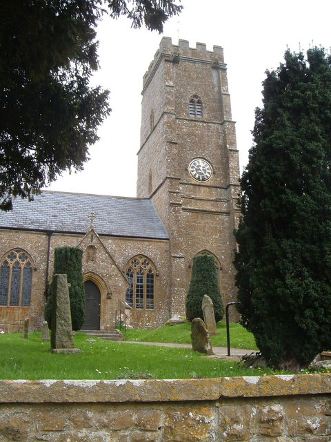
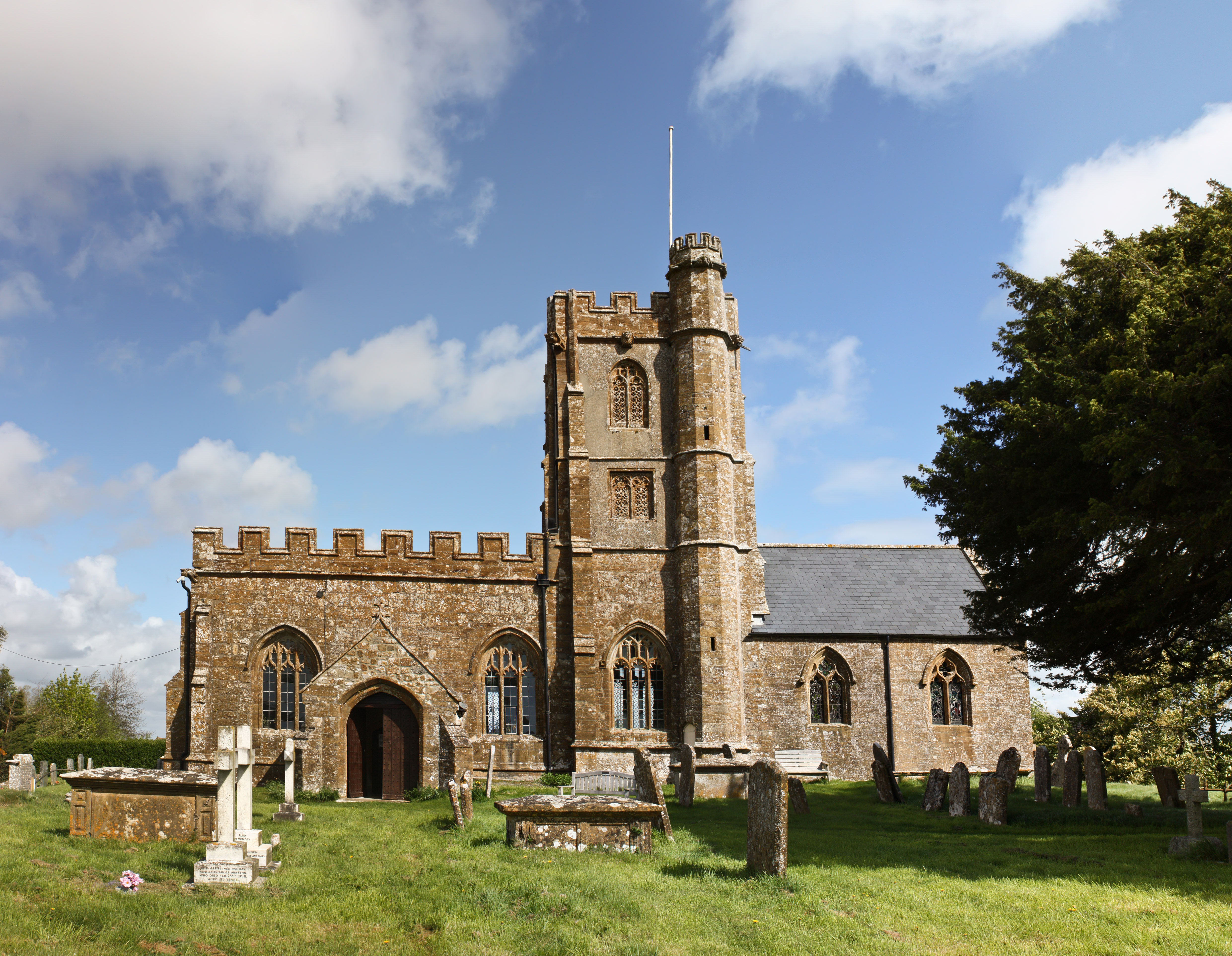
Church of St Nicholas, Dinnington

The Anglican Church of St Nicholas in Dinnington, Somerset, England was built in the 15th century. It is a Grade II* listed building. == History == A church...

Dinnington, Somerset

Dinnington is a village and civil parish in the English county of Somerset, situated 4 miles (6.4 km) north of Crewkerne in the South Somerset district...

Seavington St. Mary SSSI, Somerset

Seavington St. Mary (grid reference ST400144) is a 0.3 hectare geological Site of Special Scientific Interest near the village of Seavington St Mary in...

Church of St John the Evangelist and All Saints, Kingstone

The Anglican Church of St John the Evangelist and All Saints in Kingstone, Somerset, England was built in the 14th century. It is a Grade II* listed building...

Nearby Amenities

Located within 500m of 50.914918,-2.863295
Allowenshay
Place: hamlet
Lat/Long: 50.9161609/-2.865179
Power: pole
Lat/Long: 50.9182589/-2.8587386
Power: pole
Lat/Long: 50.9175115/-2.8591919
Power: pole
Lat/Long: 50.9174032/-2.8595969
Power: pole
Lat/Long: 50.9170955/-2.8607503
Power: pole
Lat/Long: 50.9168401/-2.8616917
Telephone
Defibrillator
Access: yes
Booth: K6
Covered: booth
Defibrillator Location: inside old red phone box, Castles Hill, Allowenshay
Emergency: defibrillator
Listed Status: Grade II
Ref GB The Circuit: 9816FFB7-C45A-477D-91FE-AE3100C15702
Lat/Long: 50.9157251/-2.8656883
Post Box
Post Box Type: wall
Lat/Long: 50.9160131/-2.8654687
The data included in this document is from www.openstreetmap.org. The data is made available under ODbL.

Have you been to Allowenshay?

Leave your review of Allowenshay below (or comments, questions and feedback).