Butley High Corner

Settlement in Suffolk East Suffolk

England

Butley High Corner

Red Crag Formation A series of Pliocene to Pleistocene deposits representing a tidal dune system with herringbone cross stratification and lenticular bedding. There are also several rhythmite beds depicting storm surges.
Red Crag Formation Credit: Matthew Chadwick

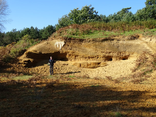
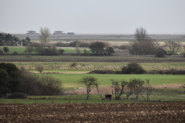
Butley High Corner is a small village located in the county of Suffolk, in eastern England. Situated near the coast, it is nestled within the Area of Outstanding Natural Beauty known as the Suffolk Coast and Heaths. The village is surrounded by picturesque countryside, with rolling hills, farmland, and woodlands.

The heart of Butley High Corner consists of a few residential properties and a local village hall. The village hall serves as a central meeting place for community events and activities, such as social gatherings, clubs, and charity fundraisers. The village also has a small primary school, providing education for the local children.

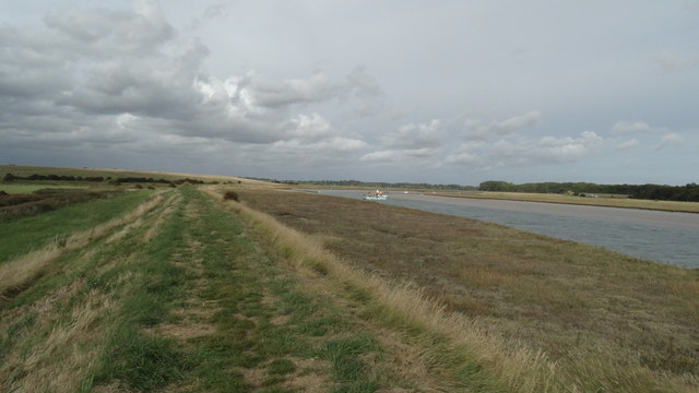
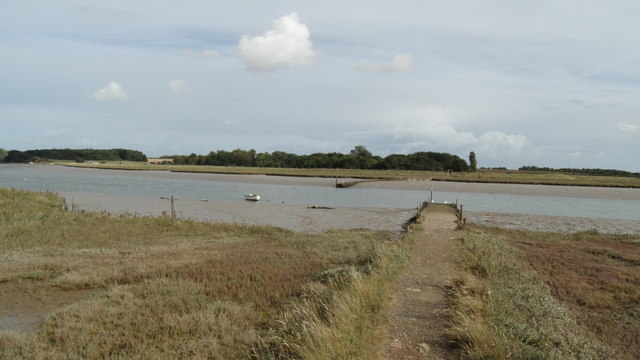
The area around Butley High Corner offers a range of outdoor recreational opportunities. The nearby Butley River is popular for fishing, kayaking, and boating, with its calm waters and scenic surroundings. The surrounding countryside is also ideal for walking, cycling, and horse riding, with numerous trails and paths to explore.

Despite its small size, Butley High Corner is well-connected to the surrounding areas. The nearby town of Woodbridge is just a short drive away, offering a wider range of amenities, including shops, restaurants, and leisure facilities. The village is also within easy reach of the Suffolk coast, with its charming seaside towns and beaches.

Overall, Butley High Corner is a tranquil and scenic village that offers a close-knit community, beautiful natural surroundings, and a range of outdoor activities for residents and visitors to enjoy.

If you have any feedback on the listing, please let us know in the comments section below.

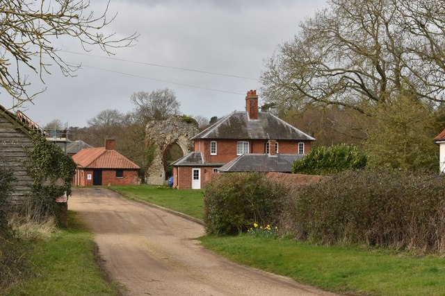
Butley High Corner Images

Images are sourced within 2km of 52.089937/1.477242 or Grid Reference TM3849. Thanks to Geograph Open Source API. All images are credited.

Red Crag Formation A series of Pliocene to Pleistocene deposits representing a tidal dune system with herringbone cross stratification and lenticular bedding. There are also several rhythmite beds depicting storm surges.
Red Crag Formation
A series of Pliocene to Pleistocene deposits representing a tidal dune system with herringbone cross stratification and lenticular bedding. There are also several rhythmite beds depicting storm surges.
On the Suffolk Coast Path approaching Butley Ferry on Butley River
On the Suffolk Coast Path - western jetty at Butley Ferry on Butley River
Pasture on the floodplain of Butley River Looking west from the lane above Banters Barn Farm, with concrete structures on Orford Ness visible in the background.
Pasture on the floodplain of Butley River
Looking west from the lane above Banters Barn Farm, with concrete structures on Orford Ness visible in the background.
Gates at Banters Barn Farm Looking south-east along the lane that leads to the RSPB reserve on Boyton Marshes.
Gates at Banters Barn Farm
Looking south-east along the lane that leads to the RSPB reserve on Boyton Marshes.
New barns at Banters Barn Farm Looking east, with the confluence of the river Ore and Butley River in the background.
New barns at Banters Barn Farm
Looking east, with the confluence of the river Ore and Butley River in the background.
The Tang valley near Dock Farm
Wet fields above Dock Farm
Brick barns at Home Farm
Home Farm, Capel St. Andrew
Pasture on the edge of Capel Green Looking north from the lane between Capel St. Andrew and Capel Green.
Pasture on the edge of Capel Green
Looking north from the lane between Capel St. Andrew and Capel Green.
Fallow field near Capel Green
Fallow field on the southern edge of Oak Wood
Driveway to Butley Priory Butley Priory was built in the early 18th Century around the gateway of Butley Abbey, an 12th Century Augustinian monastery that was dissolved in 1538.
Driveway to Butley Priory
Butley Priory was built in the early 18th Century around the gateway of Butley Abbey, an 12th Century Augustinian monastery that was dissolved in 1538.
Abbey Farm and ruins of the abbey The farm sits on the site of the 12th Century Augustinian monastery. A ruined masonry arch is visible behind the farm cottages.
Abbey Farm and ruins of the abbey
The farm sits on the site of the 12th Century Augustinian monastery. A ruined masonry arch is visible behind the farm cottages.
Sand pit on the edge of Broom Covert
Show me another place!

Butley High Corner is located at Grid Ref: TM3849 (Lat: 52.089937, Lng: 1.477242)

Administrative County: Suffolk

District: East Suffolk

Police Authority: Suffolk

What 3 Words

///greet.dean.pits. Near Rendlesham, Suffolk

Related Wikis

Butley Priory

Butley Priory, sometimes called Butley Abbey, was a religious house of Canons regular (Augustinians, Black canons) in Butley, Suffolk, dedicated to The...

Capel St Andrew

Capel St Andrew is a village and a civil parish in the East Suffolk district, in the county of Suffolk, England. It is near the larger settlement of Orford...

Boyton, Suffolk

Boyton is a village and civil parish in the East Suffolk district of Suffolk, England, about eight miles east of Woodbridge, and close to Orford Ness....

Alde–Ore Estuary

Alde–Ore Estuary is a 2,534 hectare biological and geological Site of Special Scientific Interest which stretches along the Suffolk coast between Aldeburgh...

Nearby Amenities

Located within 500m of 52.089937,1.477242
Butley High Corner
Nat Gaz Id: E0025117
Place: hamlet
Lat/Long: 52.0905493/1.4744629
Post Box
Collection Times: Mo-Fr 09:00; Sa 09:00
Post Box Type: wall
Ref: IP12 6241
Royal Cypher: EIIR
Royal Cypher Wikidata: Q33102113
Lat/Long: 52.0899435/1.4732125
Building: yes
Lat/Long: 52.0907243/1.4768367
Building: yes
Lat/Long: 52.0911857/1.4752381
Parking
Access: private
Lat/Long: 52.0904031/1.4735895
Parking
Access: private
Lat/Long: 52.0905411/1.4766908
Power: pole
Lat/Long: 52.0905011/1.4766794
Power: pole
Lat/Long: 52.0898139/1.4773929
Power: pole
Lat/Long: 52.0890195/1.4781976
Power: pole
Lat/Long: 52.0881642/1.4790639
Power: pole
Lat/Long: 52.0873418/1.4799303
Power: pole
Lat/Long: 52.0865111/1.4807618
Power: pole
Lat/Long: 52.0913597/1.4760089
Power: pole
Lat/Long: 52.0915146/1.4758748
Power: pole
Lat/Long: 52.0922232/1.4753383
Power: pole
Lat/Long: 52.093067/1.4746892
Parking
Access: private
Lat/Long: 52.090258/1.474362
Parking
Access: private
Lat/Long: 52.0902539/1.4748462
The data included in this document is from www.openstreetmap.org. The data is made available under ODbL.

Have you been to Butley High Corner?

Leave your review of Butley High Corner below (or comments, questions and feedback).