Bury Park

Settlement in Bedfordshire

England

Bury Park

The Sandwich Bar, 66 Park Street, Luton
The Sandwich Bar, 66 Park Street, Luton Credit: David Howard

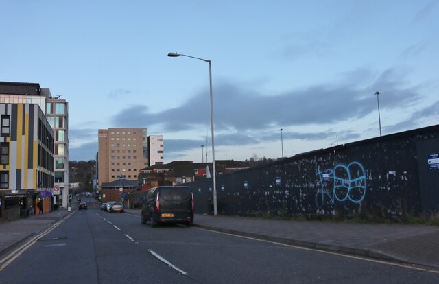
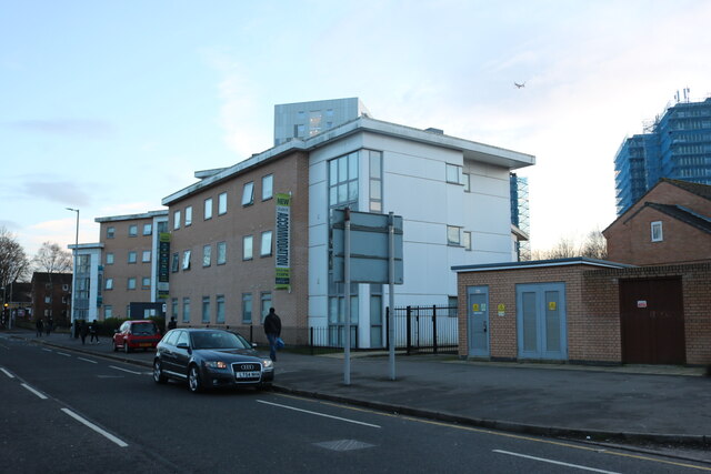
Bury Park is a vibrant and culturally diverse area located in Luton, Bedfordshire, England. Situated just north of the town center, it is known for its bustling atmosphere and lively community spirit. The area predominantly consists of residential properties, with a mix of terraced houses and apartments.

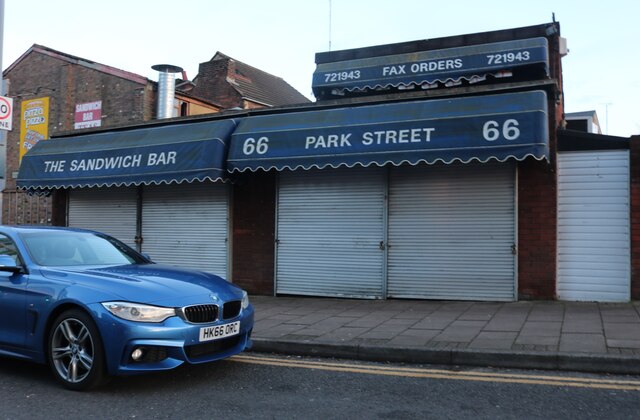
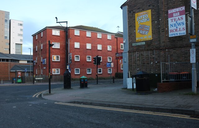
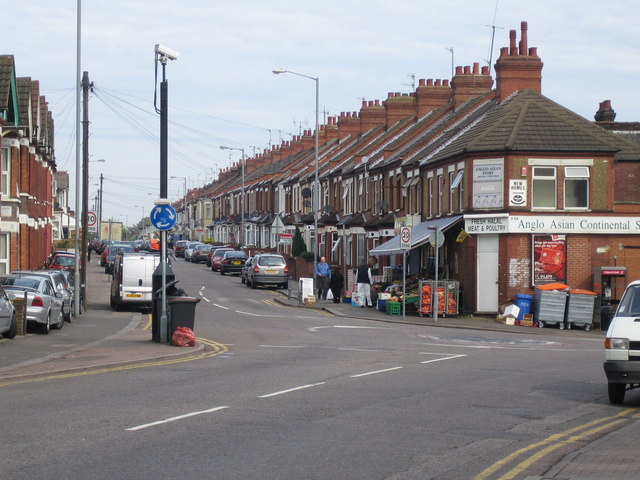
What sets Bury Park apart is its rich multicultural character. The streets are lined with various shops, restaurants, and businesses that reflect the diverse backgrounds of its residents. The area has a significant South Asian presence, with a range of Indian, Pakistani, and Bangladeshi businesses offering ethnic food, clothing, jewelry, and other goods.

Bury Park is also home to a number of religious institutions, including mosques, temples, and churches, catering to the different faiths represented in the community. These places of worship play a central role in the lives of residents, fostering a strong sense of identity and communal harmony.

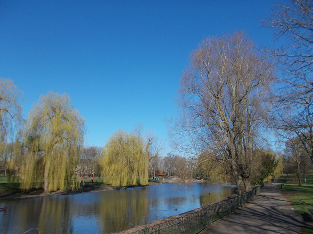
In addition to its cultural offerings, Bury Park boasts several green spaces, such as Wardown Park and Popes Meadow, where residents can enjoy leisurely walks and recreational activities. The area is well-served by public transportation, with regular bus services connecting it to the wider Bedfordshire region.

While Bury Park is known for its cultural vibrancy, it also faces some socioeconomic challenges, including higher levels of deprivation compared to other areas in Bedfordshire. However, community initiatives, local organizations, and ongoing efforts from authorities aim to address these issues and improve the overall quality of life in the area.

If you have any feedback on the listing, please let us know in the comments section below.

Bury Park Images

Images are sourced within 2km of 51.886129/-0.42977 or Grid Reference TL0822. Thanks to Geograph Open Source API. All images are credited.

The Sandwich Bar, 66 Park Street, Luton
Cumberland Street, Luton
Cumberland Street at the junction of Park Street
Don't take a fence Hatters Way, Luton looking towards the back of Hazelbury Crescent. Luton FC is on the left and runs along the main road hence its name.
Don't take a fence
Hatters Way, Luton looking towards the back of Hazelbury Crescent. Luton FC is on the left and runs along the main road hence its name.
Footbridge by Hatters Way, Luton
Hatters Way, Luton
Hatters Way, Luton
Royal Mail offices on Dunstable Road, Luton
Stuart Street, Luton
Stuart Street, Luton This is on the flight path from the nearby Luton Airport, as you can see.
Stuart Street, Luton
This is on the flight path from the nearby Luton Airport, as you can see.
Park Street, Luton
Park Street, Luton
Peach Court on Park Street, Luton
Student flats on Park Street, Luton
Park Street, Luton
Park Street, Luton
Tower blocks behind Park Street, Luton The cladding was put on in 2014. I hope it's not the nasty stuff.
Tower blocks behind Park Street, Luton
The cladding was put on in 2014. I hope it's not the nasty stuff.
The People's Park, Luton A park in the High Town area of Luton opposite Wardown Park.  This park comprises a sloping grassy area leading to woodland at the top.
The People's Park, Luton
A park in the High Town area of Luton opposite Wardown Park. This park comprises a sloping grassy area leading to woodland at the top.
The lake at Wardown Park
Tree shadows, Wardown Park
Weeping willows by the lake at Wardown Park
Show me another place!

Bury Park is located at Grid Ref: TL0822 (Lat: 51.886129, Lng: -0.42977)

Unitary Authority: Luton

Police Authority: Bedfordshire

What 3 Words

///charmingly.agents.bucks. Near Luton, Bedfordshire

Related Wikis

Bury Park

Bury Park is an area of Luton, Bedfordshire, England. It is located 1 mile north west of the town centre on the A505 road to Dunstable. The area is roughly...

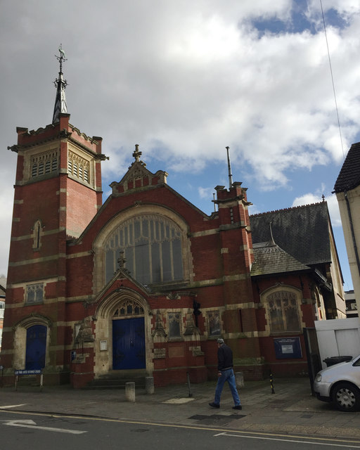
Bury Park United Reformed Church, Luton

Bury Park United Reformed Church is a Grade II listed former United Reformed church in Luton, Bedfordshire. == History == The initiative to build the chapel...
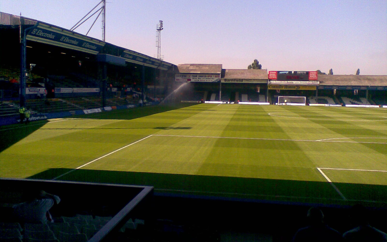
Kenilworth Road

Kenilworth Road, known affectionately as The Kenny, and The Old Girl, is an association football stadium in Bury Park, Luton, Bedfordshire, England. It...
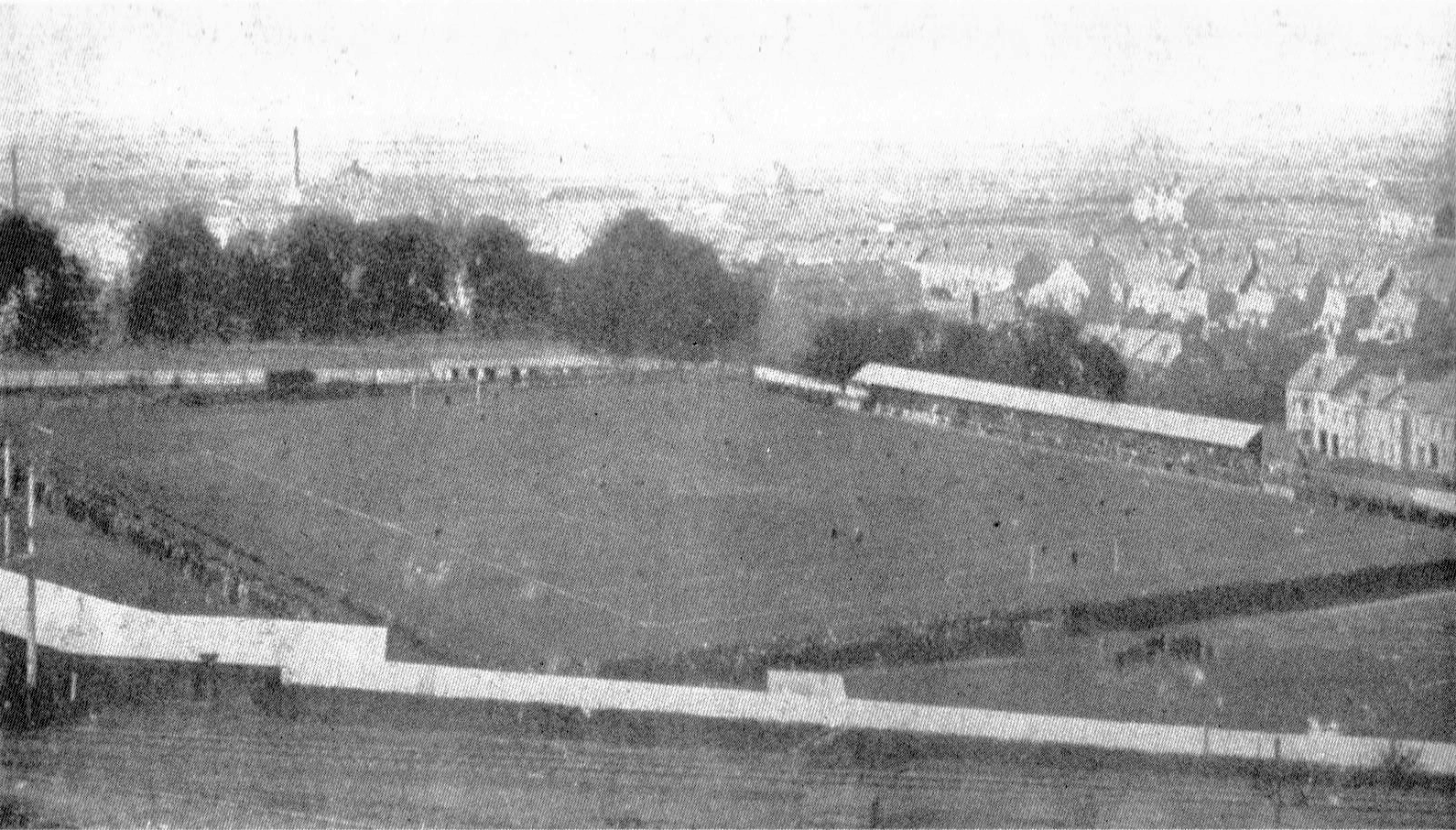
Dunstable Road

Dunstable Road, also known as Bury Park, was a football ground in Luton, England. It was the home ground of Luton Town between 1897 and 1905. == History... ==

Nearby Amenities

Located within 500m of 51.886129,-0.42977
Crossing
Crossing: marked
Lat/Long: 51.8868747/-0.4323783
Source: bing
Traffic Calming: hump
Lat/Long: 51.8845248/-0.4272632
Mini Roundabout
Direction: clockwise
Source: bing
Lat/Long: 51.8888709/-0.4324596
Traffic Signals
Source: bing
Lat/Long: 51.8860097/-0.4248018
Traffic Signals
Source: bing
Lat/Long: 51.8853465/-0.4264727
Traffic Signals
Source: bing
Traffic Calming: table
Lat/Long: 51.883768/-0.4264876
Crossing
Crossing: zebra
Crossing Ref: zebra
Traffic Calming: table
Lat/Long: 51.8887905/-0.4269228
Turning Circle
Lat/Long: 51.8853639/-0.4348533
Turning Circle
Lat/Long: 51.8855136/-0.4351039
Traffic Calming: hump
Lat/Long: 51.8835471/-0.4294596
Bury Park
Place: suburb
Lat/Long: 51.885776/-0.4282245
Post Box
Collection Plate: CP1
Collection Times: Mo-Fr 18:30; Sa 12:30
Post Box Type: pillar
Ref: LU1 4
Royal Cypher: GVIR
Royal Cypher Wikidata: Q33102169
Lat/Long: 51.8819505/-0.432419
Post Box
Collection Plate: CP8
Collection Times: Mo-Fr 18:30; Sa 12:30
Post Box Design: type_k
Post Box Type: pillar
Ref: LU1 33
Royal Cypher: EIIR
Royal Cypher Wikidata: Q33102113
Lat/Long: 51.88575/-0.4287994
Post Office
Bury Park Post Office
Brand: Post Office
Brand Wikidata: Q1783168
Check Date: 2023-09-27
Location: inside another shop
Ref Pol Id: 370
Lat/Long: 51.88584/-0.4288564
Crossing
Crossing: marked
Lat/Long: 51.8869103/-0.4343762
Crossing
Crossing: marked
Lat/Long: 51.8891311/-0.4324289
Crossing
Crossing: unmarked
Lat/Long: 51.8869745/-0.435338
Traffic Calming: island
Lat/Long: 51.8871253/-0.4360391
Traffic Calming: cushion
Lat/Long: 51.8863466/-0.4249872
Traffic Calming: hump
Lat/Long: 51.8842383/-0.4330643
Traffic Calming: hump
Lat/Long: 51.8844587/-0.4336834
Source: bing
Traffic Calming: hump
Lat/Long: 51.8861005/-0.429583
Source: bing
Traffic Calming: hump
Lat/Long: 51.8861601/-0.4295125
Crossing
Crossing: uncontrolled
Crossing Ref: zebra
Source: bing
Lat/Long: 51.8862634/-0.4294088
Crossing
Crossing: traffic_signals
Source: bing
Lat/Long: 51.8866347/-0.4310997
Crossing
Crossing: traffic_signals
Source: bing
Lat/Long: 51.8866836/-0.4309576
Crossing
Crossing: traffic_signals
Source: bing
Lat/Long: 51.8867385/-0.4311349
Crossing
Crossing: traffic_signals
Source: bing
Lat/Long: 51.8869517/-0.4304597
Crossing
Crossing: traffic_signals
Source: bing
Lat/Long: 51.8870717/-0.4306109
Crossing
Crossing: traffic_signals
Source: bing
Lat/Long: 51.8870904/-0.4304626
Source: bing
Traffic Calming: hump
Lat/Long: 51.8850025/-0.4278326
Source: bing
Traffic Calming: hump
Lat/Long: 51.8855662/-0.4286222
Bus Stop
Clifton Road
Bus: yes
Naptan AtcoCode: 02900028
Naptan NaptanCode: ltnawa
Public Transport: platform
Shelter: yes
Lat/Long: 51.8844743/-0.4348414
Luton North Junction
Railway: switch
Lat/Long: 51.8846911/-0.4235448
Post Box
Brand: Royal Mail
Brand Wikidata: Q638098
Brand Wikipedia: en:Royal Mail
Collection Times: Mo-Fr 17:30; Sa 12:30
Note: Notice plate missing. Collection times and reference assumed from Royal Mail data. Appeared to be vandalised.
Operator: Royal Mail
Operator Wikidata: Q638098
Post Box Type: pillar
Ref: LU4 46
Royal Cypher: EIIR
Royal Cypher Wikidata: Q33102113
Source: survey
Lat/Long: 51.8853632/-0.4334473
Post Box
Brand: Royal Mail
Brand Wikidata: Q638098
Brand Wikipedia: en:Royal Mail
Collection Times: Mo-Fr 17:30; Sa 12:00
Operator: Royal Mail
Operator Wikidata: Q638098
Post Box Type: lamp
Ref: LU3 137
Royal Cypher: EIIR
Royal Cypher Wikidata: Q33102113
Source: survey
Lat/Long: 51.8857534/-0.4228394
Post Box
Brand: Royal Mail
Brand Wikidata: Q638098
Brand Wikipedia: en:Royal Mail
Collection Times: Mo-Fr 17:30; Sa 12:30
Operator: Royal Mail
Operator Wikidata: Q638098
Post Box Type: pillar
Ref: LU3 27
Royal Cypher: EIIR
Royal Cypher Wikidata: Q33102113
Source: survey
Lat/Long: 51.8868108/-0.4254216
Place Of Worship
Bury Park Masjid
Denomination: sunni
Religion: muslim
Lat/Long: 51.8848517/-0.4258855
Place Of Worship
Holy Ghost Catholic Church
Addr City: Luton
Addr Housenumber: 33
Addr Postcode: LU4 8JD
Addr Street: Westbourne Road
Denomination: roman_catholic
Phone: +44 1582 728849
Religion: christian
Website: https://www.holyghostparish.co.uk/
Wheelchair: limited
Lat/Long: 51.887577/-0.4344766
Traffic Calming: hump
Lat/Long: 51.8879947/-0.4334819
The Textile Centre
Addr City: Luton
Addr Street: Dunstable Road
Shop: yes
Lat/Long: 51.8831036/-0.4254121
Ummah Welfare Trust
Office: association
Lat/Long: 51.8849402/-0.4280779
Claims Specialists
Office: lawyer
Lat/Long: 51.8848657/-0.4280108
Modern Mobile
Shop: mobile_phone
Lat/Long: 51.8848077/-0.4279491
House
Branch: of Jasmine
Brand: House
Brand Wikidata: Q9294202
Brand Wikipedia: pl:House (marka)
Shop: clothes
Lat/Long: 51.8847796/-0.4279196
House of Fabric
Shop: fabric
Lat/Long: 51.8847498/-0.4278982
Pharmacy
Harris Pharmacy
Healthcare: pharmacy
Lat/Long: 51.8846968/-0.4278338
Doctors
Bell House Medical Centre
Healthcare: doctor
Lat/Long: 51.8846124/-0.427748
Defibrillator
Emergency: defibrillator
Lat/Long: 51.8844743/-0.4275375
Kindergarten
Jigsaw Pre-School
Addr City: Luton
Addr Country: GB
Addr Housenumber: 161-161b
Addr Postcode: LU1 1BW
Addr Street: Dunstable Road
Fhrs Authority: Luton
Fhrs Id: 1005272
Fhrs Local Authority Id: 53760
Lat/Long: 51.8845213/-0.4276514
Giftique Enterprise
Shop: variety_store
Lat/Long: 51.8843491/-0.427461
Fatima
Shop: clothes
Lat/Long: 51.8843061/-0.4274234
7am - 10pm
Addr City: Luton
Addr Country: GB
Addr Housenumber: 157a
Addr Postcode: LU1 1BW
Addr Street: Dunstable Road
Fhrs Authority: Luton
Fhrs Id: 738348
Fhrs Local Authority Id: 5966
Shop: newsagent
Lat/Long: 51.884263/-0.4273859
Buy Best Store
Addr City: Luton
Addr Country: GB
Addr Housenumber: 137-155
Addr Postcode: LU1 1BW
Addr Street: Dunstable Road
Fhrs Authority: Luton
Fhrs Id: 691513
Fhrs Local Authority Id: 5948
Shop: variety_store
Lat/Long: 51.8840693/-0.4271632
La Chique
Shop: shoes
Lat/Long: 51.8839783/-0.4270667
Restaurant
A One Dosa
Addr City: Luton
Addr Country: GB
Addr Housenumber: 129
Addr Postcode: LU1 1BW
Addr Street: Dunstable Road
Fhrs Authority: Luton
Fhrs Id: 359452
Fhrs Local Authority Id: 5941
Lat/Long: 51.8839236/-0.4270265
Western Accomodation
Office: estate_agent
Lat/Long: 51.8833988/-0.4264846
Bohemian Glass and China
Shop: houseware
Lat/Long: 51.8833541/-0.4264364
Ideal Properties
Office: estate_agent
Lat/Long: 51.8833077/-0.4263961
Poplar Homes
Office: estate_agent
Lat/Long: 51.8832514/-0.4263264
Kashmir Stores
Addr City: Luton
Addr Country: GB
Addr Housenumber: 1a
Addr Postcode: LU1 1DW
Addr Street: Beech Road
Fhrs Authority: Luton
Fhrs Id: 914161
Fhrs Local Authority Id: 133376
Shop: convenience
Lat/Long: 51.8857216/-0.429765
Fast Food
Ambala Foods
Addr City: Luton
Addr Country: GB
Addr Housenumber: 211
Addr Postcode: LU1 1DD
Addr Street: Dunstable Road
Fhrs Authority: Luton
Fhrs Id: 359468
Fhrs Local Authority Id: 6040
Lat/Long: 51.8858987/-0.4295424
Amsons
Shop: clothes
Lat/Long: 51.8858408/-0.4294243
Medina Cash and Carry
Addr City: Luton
Addr Country: GB
Addr Housenumber: 207b
Addr Postcode: LU1 1DD
Addr Street: Dunstable Road
Fhrs Authority: Luton
Fhrs Id: 738349
Fhrs Local Authority Id: 6036
Shop: convenience
Lat/Long: 51.8857994/-0.4293439
Fast Food
Shahi Nan Kebab
Addr City: Luton
Addr Country: GB
Addr Housenumber: 205
Addr Postcode: LU1 1DD
Addr Street: Dunstable Road
Fhrs Authority: Luton
Fhrs Id: 359466
Fhrs Local Authority Id: 6032
Lat/Long: 51.8857514/-0.4292607
Haji Foods
Addr City: Luton
Addr Country: GB
Addr Housenumber: 203
Addr Postcode: LU1 1DD
Addr Street: Dunstable Road
Fhrs Authority: Luton
Fhrs Id: 359465
Fhrs Local Authority Id: 6029
Shop: convenience
Lat/Long: 51.8857001/-0.4291508
Haji & Sons
Addr City: Luton
Addr Country: GB
Addr Housenumber: 197
Addr Postcode: LU1 1DD
Addr Street: Dunstable Road
Fhrs Authority: Luton
Fhrs Id: 359463
Fhrs Local Authority Id: 6019
Shop: greengrocer
Lat/Long: 51.8856504/-0.4290274
Badar Halal Meat Centre
Shop: butcher
Lat/Long: 51.885513/-0.4288048
Al Yamama
Shop: jewelry
Lat/Long: 51.8854815/-0.4287565
Afia Online
Shop: clothes
Lat/Long: 51.8854368/-0.4287028
Luton Halal Meat Centre
Addr City: Luton
Addr Country: GB
Addr Housenumber: 189
Addr Postcode: LU1 1BT
Addr Street: Dunstable Road
Fhrs Authority: Luton
Fhrs Id: 449590
Fhrs Local Authority Id: 22176
Shop: butcher
Lat/Long: 51.885412/-0.4286599
Fast Food
Top Grill House
Lat/Long: 51.885364/-0.428609
Ibn-Sarah
Shop: clothes
Lat/Long: 51.8852978/-0.4285499
Luton Mobiles
Shop: mobile_phone
Lat/Long: 51.8852696/-0.428507
Luton Fruit and Veg
Addr City: Luton
Addr Country: GB
Addr Housenumber: 181
Addr Postcode: LU1 1BT
Addr Street: Dunstable Road
Fhrs Authority: Luton
Fhrs Id: 906272
Fhrs Local Authority Id: 125494
Shop: greengrocer
Lat/Long: 51.8852448/-0.4284534
Fast Food
Oodles Chinese
Addr City: Luton
Addr Country: GB
Addr Housenumber: 177
Addr Postcode: LU1 1BT
Addr Street: Dunstable Road
Fhrs Authority: Luton
Fhrs Id: 359457
Fhrs Local Authority Id: 5985
Lat/Long: 51.8852001/-0.4283863
Cafe
Ice Box
Addr City: Luton
Addr Country: GB
Addr Housenumber: 175
Addr Postcode: LU1 1BT
Addr Street: Dunstable Road
Fhrs Authority: Luton
Fhrs Id: 673740
Fhrs Local Authority Id: 31971
Lat/Long: 51.8851653/-0.4283381
Xpressions Beauty Clinic
Shop: beauty
Lat/Long: 51.8851438/-0.4282898
Mustafa Jewellers
Shop: jewelry
Lat/Long: 51.8850875/-0.4282281
Kanzaria Optical
Shop: optician
Lat/Long: 51.884821/-0.4274288
Firdous
Shop: fabric
Lat/Long: 51.8847713/-0.4273939
Pharmacy
Sai Pharmacy
Healthcare: pharmacy
Lat/Long: 51.8847233/-0.4273483
Fast Food
Kebabish Original
Addr City: Luton
Addr Country: GB
Addr Housenumber: 98
Addr Postcode: LU1 1EH
Addr Street: Dunstable Road
Fhrs Authority: Luton
Fhrs Id: 359387
Fhrs Local Authority Id: 45829
Lat/Long: 51.8846835/-0.4272947
Sandhersons
Addr City: Luton
Addr Country: GB
Addr Housenumber: 94-96
Addr Postcode: LU1 1EH
Addr Street: Dunstable Road
Fhrs Authority: Luton
Fhrs Id: 359447
Fhrs Local Authority Id: 5915
Shop: supermarket
Lat/Long: 51.8845991/-0.427182
Fast Food
KFC
Addr City: Luton
Addr Country: GB
Addr Housenumber: 92
Addr Postcode: LU1 1EH
Addr Street: Dunstable Road
Alt Name: Kentucky Fried Chicken
Brand: KFC
Brand Wikidata: Q524757
Brand Wikipedia: en:KFC
Contact Website: https://www.kfc.co.uk/kfc-near-me/luton-dunstable-road
Cuisine: chicken
Drive Through: no
Fhrs Authority: Luton
Fhrs Id: 449630
Fhrs Local Authority Id: 5914
Takeaway: yes
Lat/Long: 51.8845163/-0.4271069
Place Of Worship
Restoration Revival Fellowship
Religion: christian
Lat/Long: 51.8845213/-0.426828
Alexandra Opticians
Shop: optician
Lat/Long: 51.8843524/-0.4269326
Soloman Solicitors
Office: lawyer
Lat/Long: 51.8841569/-0.4267041
Bedfordshire Accomodation Bureau
Office: estate_agent
Lat/Long: 51.8841206/-0.4266804
Fast Food
Khyber House
Lat/Long: 51.8840743/-0.4266456
Restaurant
Punjabi Haveli
Addr City: Luton
Addr Country: GB
Addr Housenumber: 74
Addr Postcode: LU1 1EH
Addr Street: Dunstable Road
Fhrs Authority: Luton
Fhrs Id: 404617
Fhrs Local Authority Id: 42761
Lat/Long: 51.8840445/-0.426608
Restaurant
Man Ho Banquet Room
Addr City: Luton
Addr Country: GB
Addr Housenumber: 72
Addr Postcode: LU1 1EH
Addr Street: Dunstable Road
Fhrs Authority: Luton
Fhrs Id: 359445
Fhrs Local Authority Id: 5906
Lat/Long: 51.8839965/-0.4265302
DSF Beds Carpet & Gurniture
Shop: carpet
Lat/Long: 51.8839336/-0.4264846
Saba Furntiture
Shop: furniture
Lat/Long: 51.8838889/-0.4264337
Cycle King
Shop: bicycle
Lat/Long: 51.8837509/-0.4262637
Cafe
Cafe Italia
Addr City: Luton
Addr Country: GB
Addr Housenumber: 38c
Addr Postcode: LU1 1HE
Addr Street: Bury Park Road
Fhrs Authority: Luton
Fhrs Id: 1024609
Fhrs Local Authority Id: 2865
Lat/Long: 51.8854848/-0.4265705
SS Food and Wine
Addr City: Luton
Addr Country: GB
Addr Housenumber: 15a
Addr Postcode: LU1 1HG
Addr Street: Waldeck Road
Fhrs Authority: Luton
Fhrs Id: 743198
Fhrs Local Authority Id: 16821
Shop: convenience
Lat/Long: 51.8854252/-0.4264283
Bank
Barclays
Atm: yes
Brand: Barclays
Brand Wikidata: Q245343
Brand Wikipedia: en:Barclays
Lat/Long: 51.886157/-0.4293117
Bangla Bazar
Addr City: Luton
Addr Country: GB
Addr Housenumber: 166
Addr Postcode: LU1 1EW
Addr Street: Dunstable Road
Fhrs Authority: Luton
Fhrs Id: 359455
Fhrs Local Authority Id: 5977
Shop: convenience
Lat/Long: 51.886109/-0.4292473
Rimmys
Shop: clothes
Lat/Long: 51.8860709/-0.4291937
Blackstone
Shop: clothes
Lat/Long: 51.8860378/-0.4291347
Ruposhi
Shop: clothes
Lat/Long: 51.8859964/-0.4290837
Nafees Bakers and Sweets
Addr City: Luton
Addr Country: GB
Addr Housenumber: 158
Addr Postcode: LU1 1EW
Addr Street: Dunstable Road
Fhrs Authority: Luton
Fhrs Id: 359454
Fhrs Local Authority Id: 5967
Shop: bakery
Lat/Long: 51.8859567/-0.4290354
Mas R Kasha Bazar
Addr City: Luton
Addr Country: GB
Addr Housenumber: 156
Addr Postcode: LU1 1EW
Addr Street: Dunstable Road
Fhrs Authority: Luton
Fhrs Id: 744479
Fhrs Local Authority Id: 5963
Shop: convenience
Lat/Long: 51.8859269/-0.4289737
Modern Footwear
Shop: shoes
Lat/Long: 51.8858954/-0.4289362
Fast Food
Pizza Junction
Addr City: Luton
Addr Country: GB
Addr Housenumber: 152
Addr Postcode: LU1 1EW
Addr Street: Dunstable Road
Fhrs Authority: Luton
Fhrs Id: 359453
Fhrs Local Authority Id: 5959
Lat/Long: 51.8858623/-0.4288933
Memsaab
Shop: clothes
Lat/Long: 51.8857679/-0.4287377
C & S
Shop: clothes
Lat/Long: 51.885715/-0.4286599
Pyarelal
Shop: jewelry
Lat/Long: 51.8856587/-0.428558
Kushiara Bazzar
Addr City: Luton
Addr Country: GB
Addr Housenumber: 138
Addr Postcode: LU1 1EW
Addr Street: Dunstable Road
Fhrs Authority: Luton
Fhrs Id: 459604
Fhrs Local Authority Id: 5949
Shop: seafood
Lat/Long: 51.8856206/-0.4285285
Restaurant
Nirala
Addr City: Luton
Addr Country: GB
Addr Housenumber: 136
Addr Postcode: LU1 1EW
Addr Street: Dunstable Road
Fhrs Authority: Luton
Fhrs Id: 812870
Fhrs Local Authority Id: 36252
Lat/Long: 51.8855875/-0.4284561
ZAM ZAM
Addr City: Luton
Addr Country: GB
Addr Housenumber: 134
Addr Postcode: LU1 1EW
Addr Street: Dunstable Road
Fhrs Authority: Luton
Fhrs Id: 1013511
Fhrs Local Authority Id: 36649
Shop: clothes
Lat/Long: 51.8855478/-0.4284078
Restaurant
Al Bilal
Addr City: Luton
Addr Country: GB
Addr Housenumber: 132
Addr Postcode: LU1 1EW
Addr Street: Dunstable Road
Fhrs Authority: Luton
Fhrs Id: 449631
Fhrs Local Authority Id: 5943
Lat/Long: 51.8855031/-0.4283434
Restaurant
A1 Lahori Zaiqa
Addr City: Luton
Addr Country: GB
Addr Housenumber: 130
Addr Postcode: LU1 1EW
Addr Street: Dunstable Road
Fhrs Authority: Luton
Fhrs Id: 359273
Fhrs Local Authority Id: 21579
Lat/Long: 51.885465/-0.4282951
William Hill
Brand: William Hill
Brand Wikidata: Q4053147
Brand Wikipedia: en:William Hill (bookmaker)
Shop: bookmaker
Lat/Long: 51.8854252/-0.4282254
Luton Home Store
Shop: houseware
Lat/Long: 51.8853756/-0.4281503
Tani Fashion
Shop: clothes
Lat/Long: 51.8853491/-0.4281101
Fast Food
Spicy Karahi
Addr City: Luton
Addr Country: GB
Addr Housenumber: 122
Addr Postcode: LU1 1EW
Addr Street: Dunstable Road
Fhrs Authority: Luton
Fhrs Id: 359451
Fhrs Local Authority Id: 5936
Lat/Long: 51.8853094/-0.4280484
Fast Food
Zaika Grill
Addr City: Luton
Addr Country: GB
Addr Housenumber: 120
Addr Postcode: LU1 1EW
Addr Street: Dunstable Road
Fhrs Authority: Luton
Fhrs Id: 487048
Fhrs Local Authority Id: 5935
Lat/Long: 51.8852713/-0.4280081
Kreative Klicks
Craft: photographer
Lat/Long: 51.8852365/-0.4279518
Al Halal Butchers
Shop: butcher
Lat/Long: 51.8851984/-0.4278982
Fast Food
Shahi Grill
Addr City: Luton
Addr Country: GB
Addr Housenumber: 114
Addr Postcode: LU1 1EW
Addr Street: Dunstable Road
Fhrs Authority: Luton
Fhrs Id: 359449
Fhrs Local Authority Id: 5928
Lat/Long: 51.8851653/-0.4278553
Euro Halal Cash & Carry
Addr City: Luton
Addr Country: GB
Addr Housenumber: 108-112
Addr Postcode: LU1 1EW
Addr Street: Dunstable Road
Fhrs Authority: Luton
Fhrs Id: 359448
Fhrs Local Authority Id: 5926
Shop: convenience
Lat/Long: 51.8850908/-0.4277667
Fast Food
Shawarma Place
Addr City: Luton
Addr Country: GB
Addr Housenumber: 106
Addr Postcode: LU1 1EW
Addr Street: Dunstable Road
Fhrs Authority: Luton
Fhrs Id: 359274
Fhrs Local Authority Id: 21828
Lat/Long: 51.8850147/-0.4276729
Travel Net
Shop: travel_agency
Lat/Long: 51.8849517/-0.4271337
K N Travel
Shop: travel_agency
Lat/Long: 51.8849782/-0.4270586
Money Transfer
Samad Overseas Service
Lat/Long: 51.8852994/-0.4268494
Ujan Bhati
Addr City: Luton
Addr Country: GB
Addr Housenumber: 104a
Addr Postcode: LU1 1EH
Addr Street: Dunstable Road
Fhrs Authority: Luton
Fhrs Id: 359327
Fhrs Local Authority Id: 31988
Shop: seafood
Lat/Long: 51.8849766/-0.4276219
Mas Bazaar
Addr City: Luton
Addr Country: GB
Addr Housenumber: 1a
Addr Postcode: LU1 1HG
Addr Street: Waldeck Road
Fhrs Authority: Luton
Fhrs Id: 359224
Fhrs Local Authority Id: 16805
Shop: convenience
Lat/Long: 51.8851289/-0.4273134
Fast Food
Halal Fish and Chips
Addr City: Luton
Addr Country: GB
Addr Housenumber: 40
Addr Postcode: LU1 1PD
Addr Street: Wimborne Road
Fhrs Authority: Luton
Fhrs Id: 449583
Fhrs Local Authority Id: 17671
Lat/Long: 51.8833955/-0.4333699
Granville Tool Hire
Shop: hardware
Lat/Long: 51.8823723/-0.4330024
Dallow Karahi
Addr City: Luton
Addr Country: GB
Addr Housenumber: 2a
Addr Postcode: LU1 1PA
Addr Street: Granville Road
Craft: caterer
Fhrs Authority: Luton
Fhrs Id: 858445
Fhrs Local Authority Id: 7264
Lat/Long: 51.8823028/-0.4330453
Majestic Move
Office: estate_agent
Lat/Long: 51.8819799/-0.4325169
Pharmacy
Acorn Chemists
Healthcare: pharmacy
Lat/Long: 51.8819087/-0.4322433
Barrier: yes
Lat/Long: 51.8829627/-0.4276697
Kindergarten
Rise and Shine Day Nursery
Lat/Long: 51.8903602/-0.4280698
Fast Food
Juniors Peri Peri
Lat/Long: 51.8899679/-0.4277775
A1 Tuition Centre
Office: educational_institution
Lat/Long: 51.889905/-0.4277024
Fast Food
Sahara
Lat/Long: 51.8897444/-0.4276058
R V Food & Wine
Addr City: Luton
Addr Country: GB
Addr Housenumber: 76a
Addr Postcode: LU3 1AX
Addr Street: Biscot Road
Fhrs Authority: Luton
Fhrs Id: 741153
Fhrs Local Authority Id: 1981
Shop: convenience
Lat/Long: 51.8891733/-0.4271016
Kindergarten
Oak Tree Kindergarten
Addr City: Luton
Addr Country: GB
Addr Housenumber: 42
Addr Postcode: LU3 1EE
Addr Street: Lansdowne Road
Fhrs Authority: Luton
Fhrs Id: 359547
Fhrs Local Authority Id: 9720
Lat/Long: 51.8884118/-0.4262942
Kindergarten
First Steps Pre-School
Addr City: Luton
Addr Country: GB
Addr Housenumber: 21
Addr Postcode: LU3 1AH
Addr Street: Biscot Road
Fhrs Authority: Luton
Fhrs Id: 666368
Fhrs Local Authority Id: 1947
Lat/Long: 51.8865378/-0.4253393
Arabil Travel
Shop: travel_agency
Lat/Long: 51.8863573/-0.424827
Streamlink International
Shop: mobile_phone
Lat/Long: 51.8862563/-0.4247922
Inspire Beauty
Shop: beauty
Lat/Long: 51.8861173/-0.4247251
Miah Brothers General Stores
Addr City: Luton
Addr Country: GB
Addr Housenumber: 58
Addr Postcode: LU3 1AE
Addr Street: Highbury Road
Fhrs Authority: Luton
Fhrs Id: 359513
Fhrs Local Authority Id: 8440
Shop: convenience
Lat/Long: 51.8868358/-0.4269165
Sparky's Corner
Shop: doityourself
Lat/Long: 51.8901963/-0.4322514
NDN Food City
Addr City: Luton
Addr Country: GB
Addr Housenumber: 172
Addr Postcode: LU3 1JB
Addr Street: Leagrave Road
Fhrs Authority: Luton
Fhrs Id: 449650
Fhrs Local Authority Id: 9920
Shop: convenience
Lat/Long: 51.8901582/-0.4322259
Faridas Designs
Shop: clothes
Lat/Long: 51.8901218/-0.4321964
Bismillah Hair Salon
Shop: hairdresser
Lat/Long: 51.8900837/-0.4321817
Fatima
Shop: clothes
Lat/Long: 51.8900523/-0.4321468
Ar-Raya
Shop: clothes
Lat/Long: 51.8900159/-0.4321146
Social Facility
Rosedale
Addr City: Luton
Addr Country: GB
Addr Housenumber: 36
Addr Postcode: LU3 1EE
Addr Street: Lansdowne Road
Fhrs Authority: Luton
Fhrs Id: 359546
Fhrs Local Authority Id: 9719
Social Facility: assisted_living
Social Facility For: senior
Lat/Long: 51.8886601/-0.4253715
Social Facility
Ambassador House
Addr City: Luton
Addr Country: GB
Addr Housenumber: 31
Addr Postcode: LU3 1EE
Addr Street: Lansdowne Road
Fhrs Authority: Luton
Fhrs Id: 359545
Fhrs Local Authority Id: 9717
Social Facility: assisted_living
Social Facility For: senior
Lat/Long: 51.8884929/-0.4248673
Social Facility
St Anne's Care Home
Addr City: Luton
Addr Country: GB
Addr Housenumber: 30
Addr Postcode: LU3 1EE
Addr Street: Lansdowne Road
Fhrs Authority: Luton
Fhrs Id: 359544
Fhrs Local Authority Id: 9716
Social Facility: assisted_living
Social Facility For: senior
Lat/Long: 51.8888471/-0.4247358
S N Food and Wine
Addr City: Luton
Addr Country: GB
Addr Housenumber: 55
Addr Postcode: LU3 1DP
Addr Street: Cromwell Road
Fhrs Authority: Luton
Fhrs Id: 926985
Fhrs Local Authority Id: 5005
Shop: convenience
Lat/Long: 51.8863176/-0.423376
Luton Estate & Lettings
Office: estate_agent
Lat/Long: 51.8866967/-0.4226384
Sri Lankan Tamil Shop
Addr City: Luton
Addr Country: GB
Addr Housenumber: 235
Addr Postcode: LU4 8BN
Addr Street: Dunstable Road
Fhrs Authority: Luton
Fhrs Id: 738350
Fhrs Local Authority Id: 6061
Shop: convenience
Lat/Long: 51.8865601/-0.4311906
Fabeha
Shop: clothes
Lat/Long: 51.8865088/-0.4310498
Pinki Gym
Leisure: fitness_centre
Lat/Long: 51.8864078/-0.4307936
Restaurant
Tastee Treats
Addr City: Luton
Addr Country: GB
Addr Housenumber: 233
Addr Postcode: LU4 8BN
Addr Street: Dunstable Road
Fhrs Authority: Luton
Fhrs Id: 609617
Fhrs Local Authority Id: 119508
Lat/Long: 51.8864442/-0.4308566
Best Buy Luton
Shop: variety_store
Lat/Long: 51.8862331/-0.4301593
Babulal j Pattni
Shop: jewelry
Lat/Long: 51.886205/-0.4300976
Aman Solicitors
Office: lawyer
Lat/Long: 51.886186/-0.4300252
Fast Food
New Ambala
Addr City: Luton
Addr Country: GB
Addr Housenumber: 221
Addr Postcode: LU4 8BN
Addr Street: Dunstable Road
Fhrs Authority: Luton
Fhrs Id: 449632
Fhrs Local Authority Id: 6049
Lat/Long: 51.8861653/-0.4299648
Cake Box
Addr City: Luton
Addr Country: GB
Addr Housenumber: 219
Addr Postcode: LU4 8BN
Addr Street: Dunstable Road
Brand: Cake Box
Brand Wikidata: Q110057905
Fhrs Authority: Luton
Fhrs Id: 666371
Fhrs Local Authority Id: 39694
Shop: pastry
Lat/Long: 51.8861446/-0.4299071
Kindergarten
Leo Cubs Nursery
Addr City: Luton
Addr Country: GB
Addr Housenumber: 213
Addr Postcode: LU4 8BN
Addr Street: Dunstable Road
Fhrs Authority: Luton
Fhrs Id: 449610
Fhrs Local Authority Id: 40055
Lat/Long: 51.886003/-0.4298039
Pharmacy
Acorn Chemists
Healthcare: pharmacy
Lat/Long: 51.886085/-0.4297851
Restaurant
Luton Town Football Club
Addr City: Luton
Addr Country: GB
Addr Housenumber: 1
Addr Postcode: LU4 8AW
Addr Street: Maple Road East
Fhrs Authority: Luton
Fhrs Id: 615458
Fhrs Local Authority Id: 28591
Lat/Long: 51.8840064/-0.4327396
Bangla Store
Addr City: Luton
Addr Country: GB
Addr Housenumber: 98
Addr Postcode: LU4 8AQ
Addr Street: Ash Road
Fhrs Authority: Luton
Fhrs Id: 449647
Fhrs Local Authority Id: 906
Shop: greengrocer
Lat/Long: 51.884845/-0.4341196
Zamir Halal Meat
Shop: butcher
Lat/Long: 51.8853002/-0.4334356
New Way
Shop: houseware
Lat/Long: 51.8853981/-0.4332674
Bar
Luton Bobbers Supporters Club
Addr City: Luton
Addr Country: GB
Addr Housenumber: 101
Addr Postcode: LU4 8AA
Addr Street: Oak Road
Fhrs Authority: Luton
Fhrs Id: 1005269
Fhrs Local Authority Id: 12180
Lat/Long: 51.8846844/-0.4326282
Bargain Furniture
Shop: furniture
Lat/Long: 51.885138/-0.4323694
The Cake Family
Addr City: Luton
Addr Country: GB
Addr Housenumber: 26
Addr Postcode: LU4 8AD
Addr Street: Oak Road
Fhrs Authority: Luton
Fhrs Id: 958913
Fhrs Local Authority Id: 12116
Shop: pastry
Lat/Long: 51.8858747/-0.4312992
Red Barbers
Shop: hairdresser
Lat/Long: 51.8861156/-0.4305294
Home Improvement Centre
Shop: doityourself
Lat/Long: 51.886258/-0.430288
Ranzan Fashions
Shop: clothes
Lat/Long: 51.8872695/-0.4367843
Age Concern Luton
Addr City: Luton
Addr Country: GB
Addr Housename: Vesper House
Addr Housenumber: 261
Addr Postcode: LU4 8BP
Addr Street: Dunstable Road
Fhrs Authority: Luton
Fhrs Id: 359356
Fhrs Local Authority Id: 39045
Office: association
Lat/Long: 51.8872397/-0.4367012
Marigolds
Office: estate_agent
Lat/Long: 51.887051/-0.4362479
A Family Food Store
Addr City: Luton
Addr Country: GB
Addr Housenumber: 247
Addr Postcode: LU4 8BP
Addr Street: Dunstable Road
Fhrs Authority: Luton
Fhrs Id: 359472
Fhrs Local Authority Id: 6072
Shop: convenience
Lat/Long: 51.8869715/-0.4357329
Afghan Supermarket
Addr City: Luton
Addr Country: GB
Addr Housenumber: 237a
Addr Postcode: LU4 8BW
Addr Street: Dunstable Road
Fhrs Authority: Luton
Fhrs Id: 972735
Fhrs Local Authority Id: 133711
Shop: convenience
Lat/Long: 51.8865046/-0.4316358
Restaurant
Al Badar
Addr City: Luton
Addr Country: GB
Addr Housenumber: 237
Addr Postcode: LU4 8BW
Addr Street: Dunstable Road
Fhrs Authority: Luton
Fhrs Id: 359470
Fhrs Local Authority Id: 6062
Lat/Long: 51.8865841/-0.4315151
Promptmove
Office: estate_agent
Lat/Long: 51.8865626/-0.4319966
Naeem's Fabric Market
Shop: fabric
Lat/Long: 51.8866785/-0.4316774
Tayyaba
Shop: travel_agency
Lat/Long: 51.886647/-0.4316251
Asmis Fashions
Shop: clothes
Lat/Long: 51.8866131/-0.4315755
Restaurant
Arabella Lounge
Addr City: Luton
Addr Country: GB
Addr Housenumber: 172
Addr Postcode: LU4 8FG
Addr Street: Dunstable Road
Addr Unit: Nadeem Plaza Roof Top Cafe/Garden
Fhrs Authority: Luton
Fhrs Id: 550922
Fhrs Local Authority Id: 119319
Lat/Long: 51.8864566/-0.4301888
Jiqra Fashions
Shop: clothes
Lat/Long: 51.8864293/-0.4301257
Saphire Boutique
Shop: clothes
Lat/Long: 51.8864061/-0.4300573
Sinsa
Shop: mobile_phone
Lat/Long: 51.8863846/-0.4299957
Red Hairdressers
Shop: hairdresser
Lat/Long: 51.8863639/-0.429938
Cafe
Coffee Pot
Addr City: Luton
Addr Country: GB
Addr Housenumber: 172
Addr Postcode: LU4 8FG
Addr Street: Dunstable Road
Addr Unit: Unit 1, Nadeem Plaza
Fhrs Authority: Luton
Fhrs Id: 359414
Fhrs Local Authority Id: 51106
Lat/Long: 51.8863333/-0.4298052
Banoful
Addr City: Luton
Addr Country: GB
Addr Housenumber: 17a
Addr Postcode: LU4 8HT
Addr Street: Leagrave Road
Fhrs Authority: Luton
Fhrs Id: 743206
Fhrs Local Authority Id: 50972
Shop: confectionery
Lat/Long: 51.8868093/-0.4302974
Fast Food
Niralla Sweets
Addr City: Luton
Addr Country: GB
Addr Housenumber: 15-17
Addr Postcode: LU4 8HT
Addr Street: Leagrave Road
Fhrs Authority: Luton
Fhrs Id: 359433
Fhrs Local Authority Id: 56012
Lat/Long: 51.8867762/-0.4302491
Shisha Planet
Shop: tobacco
Lat/Long: 51.8867488/-0.4302169
Sahib Jaan
Shop: clothes
Lat/Long: 51.8866967/-0.4301445
BM Travel
Shop: travel_agency
Lat/Long: 51.8866379/-0.4300869
Studio 21
Shop: clothes
Lat/Long: 51.8865891/-0.4300345
HMK Mobiles
Shop: mobile_phone
Lat/Long: 51.886479/-0.4299353
Mipur Jewellers
Shop: jewelry
Lat/Long: 51.88645/-0.4298978
Araisha
Shop: hairdresser
Lat/Long: 51.8864004/-0.4298562
Islam Travels
Shop: travel_agency
Lat/Long: 51.8870791/-0.4302371
Ghzala
Shop: clothes
Lat/Long: 51.8870576/-0.4301834
Fatima
Shop: clothes
Lat/Long: 51.8869847/-0.4300869
Haque Associates
Office: accountant
Lat/Long: 51.886945/-0.4300466
Diamond Jewellers
Shop: jewelry
Lat/Long: 51.8869152/-0.4300037
MK Carpets
Shop: carpet
Lat/Long: 51.8867877/-0.4298455
Taxi
Tiger
Lat/Long: 51.8867414/-0.4298052
Accident Specialists
Office: company
Lat/Long: 51.8867/-0.429765
aa Carpets and Furniture
Shop: carpet
Lat/Long: 51.8865858/-0.4296523
Rivaaj
Shop: clothes
Lat/Long: 51.8865179/-0.4295987
Suits Me
Shop: clothes
Lat/Long: 51.8864782/-0.4295611
Carpetzone
Shop: carpet
Lat/Long: 51.8864434/-0.4295236
Coral
Brand: Coral
Brand Wikidata: Q54621344
Brand Wikipedia: en:Coral (bookmaker)
Shop: bookmaker
Lat/Long: 51.886402/-0.4294887
Kashmir Jewellers
Shop: jewelry
Lat/Long: 51.886359/-0.4294512
Safia
Shop: clothes
Lat/Long: 51.8866437/-0.4307333
Rick-naa House of Beauty
Shop: beauty
Lat/Long: 51.8866172/-0.4306877
Trish Asian Boutique
Shop: clothes
Lat/Long: 51.886599/-0.4306179
Riaz Travel
Shop: travel_agency
Lat/Long: 51.8865742/-0.4305495
Iinskin
Shop: beauty
Lat/Long: 51.8865485/-0.4304771
Shahaidrashid
Shop: charity
Lat/Long: 51.8865195/-0.4303578
Internet Cafe
Luton Internet Cafe
Lat/Long: 51.8864732/-0.4302505
Mega Mobiles
Shop: mobile_phone
Lat/Long: 51.8885831/-0.4320596
The Closet
Shop: clothes
Lat/Long: 51.8885376/-0.4320247
Fast Food
Sam's Chicken
Addr City: Luton
Addr Country: GB
Addr Housenumber: 140a
Addr Postcode: LU4 8HX
Addr Street: Leagrave Road
Brand: Sam's Chicken
Brand Wikidata: Q24439129
Brand Wikipedia: en:Sam's Chicken
Cuisine: chicken
Fhrs Authority: Luton
Fhrs Id: 359557
Fhrs Local Authority Id: 9904
Takeaway: yes
Lat/Long: 51.8885185/-0.4320046
Pharmacy
Rank Pharmacy
Healthcare: pharmacy
Lat/Long: 51.8884813/-0.4319671
Your Choice Foods
Addr City: Luton
Addr Country: GB
Addr Housenumber: 136
Addr Postcode: LU4 8HX
Addr Street: Leagrave Road
Fhrs Authority: Luton
Fhrs Id: 1042777
Fhrs Local Authority Id: 56355
Shop: butcher
Lat/Long: 51.8884217/-0.4319081
AZ Auto Spares
Shop: car_parts
Lat/Long: 51.8883638/-0.4318571
Hassan Catering
Addr City: Luton
Addr Country: GB
Addr Housenumber: 130
Addr Postcode: LU4 8HX
Addr Street: Leagrave Road
Craft: caterer
Fhrs Authority: Luton
Fhrs Id: 359556
Fhrs Local Authority Id: 9899
Lat/Long: 51.8882752/-0.4317619
Cafe
Cafe Luton
Addr City: Luton
Addr Country: GB
Addr Housenumber: 130a
Addr Postcode: LU4 8HX
Addr Street: Leagrave Road
Fhrs Authority: Luton
Fhrs Id: 736011
Fhrs Local Authority Id: 131473
Lat/Long: 51.8883017/-0.4317968
Punjab
Shop: clothes
Lat/Long: 51.888228/-0.4317284
Fast Food
Laziza
Addr City: Luton
Addr Country: GB
Addr Housenumber: 126
Addr Postcode: LU4 8HX
Addr Street: Leagrave Road
Fhrs Authority: Luton
Fhrs Id: 359555
Fhrs Local Authority Id: 9896
Lat/Long: 51.8881742/-0.4316667
Is-Haaq Fabrics
Shop: fabric
Lat/Long: 51.8880029/-0.4314829
Fades
Shop: hairdresser
Lat/Long: 51.8879631/-0.431432
Newsway
Shop: newsagent
Lat/Long: 51.8879259/-0.4313783
Fast Food
Shawarma Express
Addr City: Luton
Addr Country: GB
Addr Housenumber: 114
Addr Postcode: LU4 8HX
Addr Street: Leagrave Road
Fhrs Authority: Luton
Fhrs Id: 878341
Fhrs Local Authority Id: 131897
Lat/Long: 51.8878853/-0.431318
QKI Food store
Addr City: Luton
Addr Country: GB
Addr Housenumber: 114
Addr Postcode: LU4 8HX
Addr Street: Leagrave Road
Fhrs Authority: Luton
Fhrs Id: 743201
Fhrs Local Authority Id: 24651
Shop: convenience
Lat/Long: 51.8878539/-0.4312764
Air Express
Shop: travel_agency
Lat/Long: 51.8877819/-0.4311758
MH Jewellers
Shop: jewelry
Lat/Long: 51.8876635/-0.4310028
Fast Food
Baba Lal
Addr City: Luton
Addr Country: GB
Addr Housenumber: 90
Addr Postcode: LU4 8HZ
Addr Street: Leagrave Road
Fhrs Authority: Luton
Fhrs Id: 404608
Fhrs Local Authority Id: 27358
Lat/Long: 51.8876271/-0.4309639
Surma Stores
Addr City: Luton
Addr Country: GB
Addr Housenumber: 86a
Addr Postcode: LU4 8HZ
Addr Street: Leagrave Road
Fhrs Authority: Luton
Fhrs Id: 359554
Fhrs Local Authority Id: 9866
Shop: greengrocer
Lat/Long: 51.8875509/-0.4308365
Halal Sweet Shop
Addr City: Luton
Addr Country: GB
Addr Housenumber: 82
Addr Postcode: LU4 8HZ
Addr Street: Leagrave Road
Fhrs Authority: Luton
Fhrs Id: 737430
Fhrs Local Authority Id: 119501
Shop: confectionery
Lat/Long: 51.8874599/-0.4307333
Town Tub
Shop: laundry
Lat/Long: 51.8874872/-0.4307775
Scarves & Hijabs
Shop: clothes
Lat/Long: 51.8874185/-0.4306836
P & R Travel
Shop: travel_agency
Lat/Long: 51.8873862/-0.4306407
Fast Food
Spicy Chicken
Addr City: Luton
Addr Country: GB
Addr Housenumber: 64
Addr Postcode: LU4 8HZ
Addr Street: Leagrave Road
Fhrs Authority: Luton
Fhrs Id: 404645
Fhrs Local Authority Id: 9855
Lat/Long: 51.8873382/-0.4305308
RK Hair Salon
Shop: hairdresser
Lat/Long: 51.8873026/-0.4304878
Saba's Collection
Shop: clothes
Lat/Long: 51.8872662/-0.4304463
Sheen
Shop: clothes
Lat/Long: 51.8872372/-0.4304034
Alauddin Sweetcentre
Addr City: Luton
Addr Country: GB
Addr Housenumber: 56
Addr Postcode: LU4 8HZ
Addr Street: Leagrave Road
Fhrs Authority: Luton
Fhrs Id: 459620
Fhrs Local Authority Id: 9848
Shop: confectionery
Lat/Long: 51.8872091/-0.4303645
Link Fast Services
Shop: travel_agency
Lat/Long: 51.8871685/-0.4303068
Bar
Beech Hill Conservative Club
Addr City: Luton
Addr Country: GB
Addr Housenumber: 18a
Addr Postcode: LU4 8HZ
Addr Street: Leagrave Road
Fhrs Authority: Luton
Fhrs Id: 1005274
Fhrs Local Authority Id: 9810
Lat/Long: 51.8871164/-0.4293345
Restaurant
Anando Mahal
Lat/Long: 51.8881767/-0.4320771
Fast Food
JJ's Pizza & Peri Peri Express
Addr City: Luton
Addr Country: GB
Addr Housenumber: 67
Addr Postcode: LU4 8HT
Addr Street: Leagrave Road
Fhrs Authority: Luton
Fhrs Id: 359552
Fhrs Local Authority Id: 9857
Lat/Long: 51.8880385/-0.4319148
Zaina's Boutique
Shop: clothes
Lat/Long: 51.8880062/-0.4318705
Ali Home Bargains
Shop: variety_store
Lat/Long: 51.8877943/-0.4316103
The Fountain
Shop: variety_store
Lat/Long: 51.8875782/-0.4313287
B P Shah
Office: accountant
Lat/Long: 51.8872753/-0.4309036
Rahmah Travel
Shop: travel_agency
Lat/Long: 51.8872422/-0.4308727
Rakesh Jewellers
Shop: jewelry
Lat/Long: 51.887152/-0.430748
Access Homes
Office: estate_agent
Lat/Long: 51.8890946/-0.4322863
Akram Second Hand Retailers
Addr City: Luton
Addr Country: GB
Addr Housenumber: 158b
Addr Postcode: LU4 8HX
Addr Street: Leagrave Road
Fhrs Authority: Luton
Fhrs Id: 973613
Fhrs Local Authority Id: 53073
Shop: variety_store
Lat/Long: 51.8890491/-0.4322205
One Stop
Brand: One Stop
Brand Wikidata: Q65954217
Check Date: 2020-02-16
Shop: convenience
Lat/Long: 51.8890119/-0.4321575
Gul-e-Rana
Shop: clothes
Lat/Long: 51.8889407/-0.4322581
Money Transfer
Rajab Techo Luton
Lat/Long: 51.8889018/-0.432238
Aaghaz
Shop: clothes
Lat/Long: 51.8888562/-0.4322246
Anchal Boutique
Shop: clothes
Lat/Long: 51.8888173/-0.4322138
Polish Mini Market
Addr City: Luton
Addr Country: GB
Addr Housenumber: 150
Addr Postcode: LU4 8HX
Addr Street: Leagrave Road
Fhrs Authority: Luton
Fhrs Id: 669830
Fhrs Local Authority Id: 9912
Shop: convenience
Lat/Long: 51.888776/-0.4321978
Romanian Minimarket
Shop: convenience
Lat/Long: 51.8887321/-0.4321669
Cafe
Lahore Palace
Lat/Long: 51.8886924/-0.4321441
Express Dry Cleaners
Shop: dry_cleaning
Lat/Long: 51.8886609/-0.4321307
Usman's Blend
Shop: hairdresser
Lat/Long: 51.8886328/-0.4321039
Malicks & Khan Solicitors
Office: it
Lat/Long: 51.8874748/-0.4365926
The Quality Skyline Hotel
Addr City: Luton
Addr Country: GB
Addr Housenumber: 244-262
Addr Postcode: LU4 8JL
Addr Street: Dunstable Road
Fhrs Authority: Luton
Fhrs Id: 359471
Fhrs Local Authority Id: 6071
Tourism: hotel
Lat/Long: 51.8870882/-0.4349524
British Red Cross
Ambulance Station
Addr City: Luton
Addr Country: GB
Addr Housenumber: 232
Addr Postcode: LU4 8JL
Addr Street: Dunstable Road
Emergency: ambulance_station
Fhrs Authority: Luton
Fhrs Id: 359469
Fhrs Local Authority Id: 6060
Lat/Long: 51.8871577/-0.4339278
Bushra Fahions
Shop: clothes
Lat/Long: 51.8869392/-0.4323466
Lucky Furniture
Shop: furniture
Lat/Long: 51.8871205/-0.4320623
Pharmacy
Westbourne Pharmacy
Healthcare: pharmacy
Lat/Long: 51.8870021/-0.4320905
Cafe
Baguette Corner
Addr City: Luton
Addr Country: GB
Addr Housenumber: 198
Addr Postcode: LU4 8JJ
Addr Street: Dunstable Road
Fhrs Authority: Luton
Fhrs Id: 656105
Fhrs Local Authority Id: 6023
Lat/Long: 51.886969/-0.4320127
Money Transfer
Best Business Centre
Lat/Long: 51.8869641/-0.4319201
Mercy Universal
Shop: charity
Lat/Long: 51.8869541/-0.4318048
Al Madina Superstore
Addr City: Luton
Addr Country: GB
Addr Housenumber: 192
Addr Postcode: LU4 8JJ
Addr Street: Dunstable Road
Fhrs Authority: Luton
Fhrs Id: 359461
Fhrs Local Authority Id: 6011
Shop: convenience
Lat/Long: 51.8869293/-0.4317431
Afghan Naan House
Addr City: Luton
Addr Country: GB
Addr Housenumber: 190
Addr Postcode: LU4 8JJ
Addr Street: Dunstable Road
Fhrs Authority: Luton
Fhrs Id: 943850
Fhrs Local Authority Id: 6007
Shop: greengrocer
Lat/Long: 51.8869185/-0.4316586
Instalink
Shop: travel_agency
Lat/Long: 51.8869003/-0.4315875
Tariq's Gents Hairdressers
Shop: hairdresser
Lat/Long: 51.8868862/-0.4315111
Shah Jahal Discount Store
Shop: variety_store
Lat/Long: 51.886873/-0.431436
Victoria Estates
Office: estate_agent
Lat/Long: 51.8868548/-0.4313663
Fast Food
Peri Peri Original
Addr City: Luton
Addr Country: GB
Addr Housenumber: 180
Addr Postcode: LU4 8JJ
Addr Street: Dunstable Road
Fhrs Authority: Luton
Fhrs Id: 459605
Fhrs Local Authority Id: 5992
Lat/Long: 51.8868333/-0.4312885
Hafsah
Shop: clothes
Lat/Long: 51.8890243/-0.4326591
Jabbran & Co
Office: lawyer
Lat/Long: 51.8889895/-0.4325947
Traffic Calming: hump
Lat/Long: 51.8839754/-0.4298591
Traffic Calming: hump
Lat/Long: 51.8844522/-0.4332027
Traffic Calming: hump
Lat/Long: 51.8866447/-0.4364449
Traffic Calming: hump
Lat/Long: 51.8867362/-0.435731
Traffic Calming: hump
Lat/Long: 51.8864697/-0.4352726
Traffic Calming: hump
Lat/Long: 51.8862314/-0.4348629
Traffic Calming: hump
Lat/Long: 51.8859128/-0.4343151
Traffic Calming: hump
Lat/Long: 51.8855284/-0.4336503
Crossing
Crossing: unmarked
Lat/Long: 51.8873584/-0.4366422
Traffic Calming: hump
Lat/Long: 51.88304/-0.4269726
Traffic Calming: cushion
Lat/Long: 51.8871872/-0.4256418
Traffic Calming: hump
Lat/Long: 51.886629/-0.4267483
Traffic Calming: hump
Lat/Long: 51.8870251/-0.4274226
Traffic Calming: hump
Lat/Long: 51.8873887/-0.4280383
Direction: 160
Generator Method: photovoltaic
Generator Output Electricity: yes
Generator Solar Modules: 6
Generator Source: solar
Generator Type: solar_photovoltaic_panel
Location: roof
Power: generator
Lat/Long: 51.8886127/-0.4265381
Traffic Calming: cushion
Lat/Long: 51.890457/-0.4298493
Traffic Calming: cushion
Lat/Long: 51.8901564/-0.4307114
Traffic Calming: cushion
Lat/Long: 51.8897996/-0.4317362
Traffic Calming: table
Lat/Long: 51.889683/-0.4321785
Traffic Calming: hump
Lat/Long: 51.8904263/-0.4318957
Traffic Calming: hump
Lat/Long: 51.8848193/-0.4285629
Traffic Calming: hump
Lat/Long: 51.8831904/-0.4282894
Traffic Calming: hump
Lat/Long: 51.8834676/-0.4276536
Traffic Calming: cushion
Lat/Long: 51.8863238/-0.4301461
Traffic Calming: cushion
Lat/Long: 51.8865509/-0.4307856
Direction: 220
Generator Method: photovoltaic
Generator Output Electricity: yes
Generator Solar Modules: 10
Generator Source: solar
Generator Type: solar_photovoltaic_panel
Location: roof
Power: generator
Lat/Long: 51.8854215/-0.4332808
Direction: 185
Generator Method: photovoltaic
Generator Output Electricity: yes
Generator Solar Modules: 16
Generator Source: solar
Generator Type: solar_photovoltaic_panel
Location: roof
Power: generator
Lat/Long: 51.8869572/-0.4319888
Traffic Calming: hump
Lat/Long: 51.8869849/-0.4321649
Direction: 135
Generator Method: photovoltaic
Generator Output Electricity: yes
Generator Solar Modules: 14
Generator Source: solar
Generator Type: solar_photovoltaic_panel
Location: roof
Power: generator
Lat/Long: 51.8886532/-0.4346354
Traffic Calming: cushion
Lat/Long: 51.8889749/-0.4327549
Traffic Calming: cushion
Lat/Long: 51.8895266/-0.4336008
Traffic Calming: hump
Lat/Long: 51.8873552/-0.4364763
Direction: 140
Generator Method: photovoltaic
Generator Output Electricity: yes
Generator Solar Modules: 12
Generator Source: solar
Generator Type: solar_photovoltaic_panel
Location: roof
Power: generator
Lat/Long: 51.8881935/-0.4348739
Traffic Calming: hump
Lat/Long: 51.8894098/-0.4346857
Traffic Calming: hump
Lat/Long: 51.8890048/-0.4353367
Noexit: yes
Lat/Long: 51.8857736/-0.4246795
Fixme: suvey needed: solar panels?
Lat/Long: 51.8840517/-0.4236527
Give Way
Direction: backward
Lat/Long: 51.8838578/-0.42489
Traffic Calming: hump
Lat/Long: 51.888657/-0.424961
Traffic Calming: hump
Lat/Long: 51.8889072/-0.4240402
Parking
Lat/Long: 51.8876695/-0.4235855
Parking
Lat/Long: 51.88882/-0.4271266
Parking
Lat/Long: 51.8885843/-0.4276676
Parking
Lat/Long: 51.8881672/-0.4275122
Parking
Lat/Long: 51.8885462/-0.4289742
Parking
Lat/Long: 51.8884318/-0.4294253
Parking
Lat/Long: 51.8882712/-0.4289686
Parking
Lat/Long: 51.889467/-0.4280438
Traffic Calming: table
Lat/Long: 51.8890806/-0.4270787
Traffic Calming: hump
Lat/Long: 51.8892616/-0.4264496
Traffic Calming: hump
Lat/Long: 51.8894802/-0.4256427
Traffic Calming: hump
Lat/Long: 51.8896879/-0.4263801
Direction: 115
Generator Method: photovoltaic
Generator Output Electricity: yes
Generator Solar Modules: 24
Generator Source: solar
Generator Type: solar_photovoltaic_panel
Location: roof
Power: generator
Lat/Long: 51.8817456/-0.4297362
Direction: 130
Generator Method: photovoltaic
Generator Output Electricity: yes
Generator Solar Modules: 12
Generator Source: solar
Generator Type: solar_photovoltaic_panel
Location: roof
Power: generator
Lat/Long: 51.8821456/-0.4291589
Direction: 130
Generator Method: photovoltaic
Generator Output Electricity: yes
Generator Solar Modules: 12
Generator Source: solar
Generator Type: solar_photovoltaic_panel
Location: roof
Power: generator
Lat/Long: 51.882191/-0.4291032
Direction: 200
Generator Method: photovoltaic
Generator Output Electricity: yes
Generator Solar Modules: 16
Generator Source: solar
Generator Type: solar_photovoltaic_panel
Location: roof
Power: generator
Lat/Long: 51.8823294/-0.4293961
Direction: 200
Generator Method: photovoltaic
Generator Output Electricity: yes
Generator Solar Modules: 8
Generator Source: solar
Generator Type: solar_photovoltaic_panel
Location: roof
Power: generator
Lat/Long: 51.8820645/-0.430519
Direction: 200
Generator Method: photovoltaic
Generator Output Electricity: yes
Generator Solar Modules: 8
Generator Source: solar
Generator Type: solar_photovoltaic_panel
Location: roof
Power: generator
Lat/Long: 51.8820826/-0.4305935
Direction: 200
Generator Method: photovoltaic
Generator Output Electricity: yes
Generator Solar Modules: 8
Generator Source: solar
Generator Type: solar_photovoltaic_panel
Location: roof
Power: generator
Lat/Long: 51.8820953/-0.4306643
Fixme: solar panels? unclear from Bing image
Lat/Long: 51.8825595/-0.4312207
Crossing
Crossing: unmarked
Lat/Long: 51.8819329/-0.4323614
Traffic Calming: hump
Lat/Long: 51.8820566/-0.4312685
Traffic Calming: hump
Lat/Long: 51.8825624/-0.4309612
Traffic Calming: hump
Lat/Long: 51.8829978/-0.4312791
Traffic Calming: hump
Lat/Long: 51.8832046/-0.4321486
Traffic Calming: hump
Lat/Long: 51.8833796/-0.4328832
Place Of Worship
Madinah Masjid
Addr City: Luton
Addr Housenumber: 128/130
Addr Street: Oak Road
Religion: muslim
Lat/Long: 51.8844559/-0.4333538
Crossing
Crossing: traffic_signals
Crossing Markings: no
Crossing Ref: pelican
Lat/Long: 51.8829041/-0.4256643
Crossing
Crossing: traffic_signals
Crossing Markings: no
Crossing Ref: pelican
Lat/Long: 51.882969/-0.4255961
Crossing
Crossing: unmarked
Crossing Island: no
Crossing Markings: no
Tactile Paving: yes
Lat/Long: 51.8832126/-0.4261194
Crossing
Crossing: unmarked
Crossing Island: no
Crossing Markings: no
Tactile Paving: yes
Lat/Long: 51.8827655/-0.4255695
Crossing
Crossing: unmarked
Crossing Island: no
Crossing Markings: no
Tactile Paving: yes
Lat/Long: 51.8830056/-0.4258587
Crossing
Crossing: unmarked
Crossing Island: no
Crossing Markings: no
Tactile Paving: yes
Lat/Long: 51.883463/-0.425795
Crossing
Crossing: unmarked
Crossing Island: no
Crossing Markings: no
Tactile Paving: yes
Lat/Long: 51.8834755/-0.4258087
Crossing
Lat/Long: 51.8843475/-0.434546
Bus Stop
Clifton Road
Bus: yes
Public Transport: platform
Shelter: yes
Lat/Long: 51.8844101/-0.43495
The data included in this document is from www.openstreetmap.org. The data is made available under ODbL.

Have you been to Bury Park?

Leave your review of Bury Park below (or comments, questions and feedback).