Burton-le-Coggles

Settlement in Lincolnshire South Kesteven

England

Burton-le-Coggles

Lincolnshire Sheep Part of the exhibition of sheep breeds and sheering at the 783rd Corby Glen sheep fair.  This is "Lenny" the Lincoln Longwool, very much representing an endangered breed.
Lincolnshire Sheep Credit: Bob Harvey

Burton-le-Coggles is a charming village located in the county of Lincolnshire, England. Situated approximately 10 miles south of Grantham, this rural settlement is known for its picturesque landscapes and peaceful atmosphere. With a population of around 200 residents, the village retains a close-knit community feel.

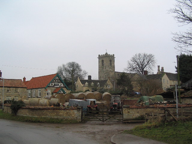
The village is surrounded by beautiful rolling hills and farmland, making it an ideal location for those seeking a tranquil and idyllic setting. The landscape is dotted with traditional English cottages and historic buildings, giving Burton-le-Coggles a timeless appeal.

Despite its small size, the village offers a range of amenities for its residents. The village hall serves as a hub for community activities and events, while the local pub provides a gathering place for locals and visitors alike. Additionally, there is a primary school within the village, ensuring that families have access to education facilities.

The village is well-connected to nearby towns and cities, with good road links to Grantham and the A1 motorway. This allows residents to easily access amenities and services beyond the village. The surrounding countryside also offers plenty of opportunities for outdoor activities such as hiking, cycling, and horse riding.

Overall, Burton-le-Coggles offers a tranquil escape from the hustle and bustle of city life. Its picturesque setting, close community, and convenient location make it an appealing place to live or visit for those seeking a rural retreat in Lincolnshire.

If you have any feedback on the listing, please let us know in the comments section below.

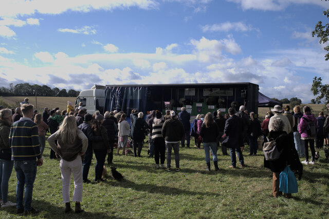
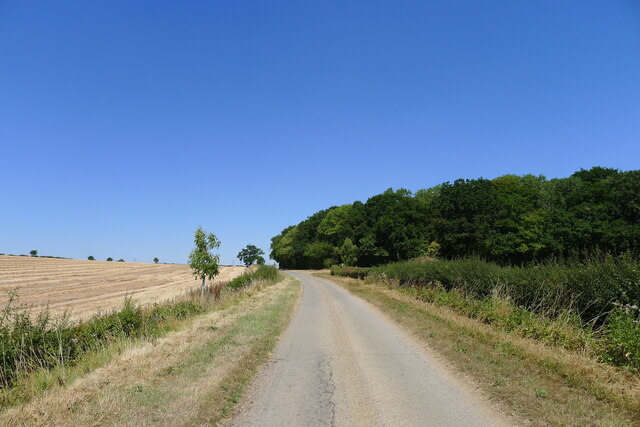
Burton-le-Coggles Images

Images are sourced within 2km of 52.820758/-0.547958 or Grid Reference SK9725. Thanks to Geograph Open Source API. All images are credited.

Lincolnshire Sheep Part of the exhibition of sheep breeds and sheering at the 783rd Corby Glen sheep fair.  This is "Lenny" the Lincoln Longwool, very much representing an endangered breed.
Lincolnshire Sheep
Part of the exhibition of sheep breeds and sheering at the 783rd Corby Glen sheep fair. This is "Lenny" the Lincoln Longwool, very much representing an endangered breed.
At the funfair
At the funfair
Watching the Sheep Show At the 783rd Corby Glen Sheep Fair, Richard Savory and his animals (<span class="nowrap"><a title="https://www.thesheepshow.co.uk/" rel="nofollow ugc noopener" href="https://www.thesheepshow.co.uk/">Link</a><img style="margin-left:2px;" alt="External link" title="External link - shift click to open in new window" src="https://s1.geograph.org.uk/img/external.png" width="10" height="10"/></span> )
Watching the Sheep Show
At the 783rd Corby Glen Sheep Fair, Richard Savory and his animals (LinkExternal link )
Sheep sale pens Part of the 783rd Corby Glen Sheep Fair - the sales are now held on the Monday after the weekend's jollities, so I missed the chance to photograph them again!
Sheep sale pens
Part of the 783rd Corby Glen Sheep Fair - the sales are now held on the Monday after the weekend's jollities, so I missed the chance to photograph them again!
Showman's Lorry One of the wagons that brought Dorman's funfair to the sheep fair.
Showman's Lorry
One of the wagons that brought Dorman's funfair to the sheep fair.
Railway bridge over Station Road (A151)
A151 towards Colsterworth
Westby Road approaching Lownd Wood The Dictionaries of the Scots Language lists 'Lownd' as a variant (possibly past participle) of 'Lown', meaning calm (of weather), sheltered, peaceful <span class="nowrap"><a title="https://www.dsl.ac.uk/entry/snd/lown" rel="nofollow ugc noopener" href="https://www.dsl.ac.uk/entry/snd/lown">Link</a><img style="margin-left:2px;" alt="External link" title="External link - shift click to open in new window" src="https://s1.geograph.org.uk/img/external.png" width="10" height="10"/></span> . It may also be a family name.
Westby Road approaching Lownd Wood
The Dictionaries of the Scots Language lists 'Lownd' as a variant (possibly past participle) of 'Lown', meaning calm (of weather), sheltered, peaceful LinkExternal link . It may also be a family name.
Burton Coggles - Church of St Thomas of Canterbury
Corby Road, Corby Glen
Fields by Corby Road, Burton-le-Coggles
Corby Road, Bolton-le-Coggles
Colsterworth Lane
Colsterworth Lane
Pylon and farmland
Pylon and farmland
St Thomas Anglican Church, Burton le Coggles, Lincolnshire
Church of Our Lady of Mount Carmel, Corby Glen In 1855-56 the church was moved, stone by stone, from the nearby Irnham Estate
Church of Our Lady of Mount Carmel, Corby Glen
In 1855-56 the church was moved, stone by stone, from the nearby Irnham Estate
Show me another place!

Burton-le-Coggles is located at Grid Ref: SK9725 (Lat: 52.820758, Lng: -0.547958)

Division: Parts of Kesteven

Administrative County: Lincolnshire

District: South Kesteven

Police Authority: Lincolnshire

What 3 Words

///flops.enlighten.seating. Near Corby Glen, Lincolnshire

Related Wikis

Burton Coggles

Burton Coggles (full name Burton-le-Coggles from Byrton-en-les-Coggles) is a small village and civil parish in the South Kesteven district of Lincolnshire...

Beltisloe

Beltisloe is a Deanery of the Diocese of Lincoln in England, and a former Wapentake.The Wapentake of Beltisloe was established as an ancient administrative...

Corby Glen railway station

Corby Glen railway station was a station on the Great Northern Railway main line serving Corby Glen, Lincolnshire. It was west of the village on the Melton...

Corby Glen

Corby Glen is a village and civil parish in the South Kesteven district of Lincolnshire, England. It is approximately 9 miles (14 km) south-east of the...

Nearby Amenities

Located within 500m of 52.820758,-0.547958
Burton le Coggles
Is In: Lincolnshire, England, UK
Note: Name appears as Burton Coggles on route signs
Place: village
Source Name: Village signposts
Lat/Long: 52.820533/-0.5481757
Bus Stop
Post Office Lane
Naptan AtcoCode: 270000008611
Naptan Bearing: NW
Naptan CommonName: Post Office Lane
Naptan Indicator: adj
Naptan Landmark: Post Office Lane
Naptan NaptanCode: lingtjmg
Naptan Street: Manor Road
Naptan Verified: no
Source: naptan_import
Lat/Long: 52.8192991/-0.5472271
Bus Stop
Post Office Lane
Naptan AtcoCode: 2700LBCT1486
Naptan Bearing: SE
Naptan CommonName: Post Office Lane
Naptan Indicator: opp
Naptan Landmark: Post Office Lane
Naptan Street: Manor Road
Naptan Verified: no
Source: naptan_import
Lat/Long: 52.8193332/-0.5470775
Ele: 65.0000000
Lat/Long: 52.8170715/-0.5514723
Ele: 63.5725098
Lat/Long: 52.8174158/-0.55093
Ele: 70.5418701
Lat/Long: 52.8219015/-0.5524589
Ele: 64.0000000
Lat/Long: 52.8181959/-0.5488607
Ele: 73
Lat/Long: 52.8201064/-0.5506615
Ele: 70.7822266
Lat/Long: 52.8217145/-0.5523984
Ele: 63.0917969
Lat/Long: 52.8181361/-0.5489781
Information: board
Source: View from South
Tourism: information
Lat/Long: 52.8193805/-0.5473263
Public Bookcase
Booth: K6
Disused Amenity: telephone
Listed Status: Grade II
Man Made: telephone_box
Old Phone: +44 1476 550330
Public Bookcase Type: phone_box
Source: View from South
Lat/Long: 52.8192578/-0.5471729
Post Box
Ele: 63.0917969
Post Box Type: wall
Lat/Long: 52.8189173/-0.5469445
Bench
Ele: 62.6110840
Lat/Long: 52.8190209/-0.5467039
Bench
Ele: 63.8127441
Lat/Long: 52.8214926/-0.5496026
Ele: 62
Lat/Long: 52.8180493/-0.5448288
Ele: 60
Lat/Long: 52.8176899/-0.5438958
Ele: 62
Lat/Long: 52.8190967/-0.546829
Ele: 61.8901367
Lat/Long: 52.8215545/-0.5487416
Ele: 61
Lat/Long: 52.8177255/-0.5443669
Ele: 48
Lat/Long: 52.8215402/-0.5470417
Ele: 48
Lat/Long: 52.8215154/-0.5469424
Ele: 47.9511719
Lat/Long: 52.8215065/-0.5445407
Ele: 48.4317627
Lat/Long: 52.821561/-0.5445204
Ele: 47.2301025
Lat/Long: 52.8215503/-0.5445925
Ele: 48.1915283
Lat/Long: 52.8214943/-0.5449726
Ele: 56
Lat/Long: 52.8215542/-0.5406852
Forge Farm
Place: farm
Source: Bing
Lat/Long: 52.8184408/-0.5452817
Barrier: kissing_gate
Lat/Long: 52.823625/-0.5431309
Barrier: kissing_gate
Lat/Long: 52.8216039/-0.546936
M J Thorpe
Craft: welder
Fixme: Check north or south of the road
Lat/Long: 52.8182955/-0.5455185
Historic Amenity: place_of_worship
Religion: christian
Lat/Long: 52.8184386/-0.5475115
Man Made: tower
Tower Type: communication
Lat/Long: 52.820029/-0.547632
Power: pole
Lat/Long: 52.8183483/-0.5436248
Power: pole
Lat/Long: 52.8174211/-0.5432117
The data included in this document is from www.openstreetmap.org. The data is made available under ODbL.

Have you been to Burton-le-Coggles?

Leave your review of Burton-le-Coggles below (or comments, questions and feedback).