Burton Coggles

Civil Parish in Lincolnshire South Kesteven

England

Burton Coggles

Railway bridge over Station Road (A151)
Railway bridge over Station Road (A151) Credit: JThomas

Burton Coggles is a civil parish located in the county of Lincolnshire, England. It is situated approximately 10 miles south of Grantham and 16 miles north of Stamford. The parish covers an area of about 1,200 acres and is home to a small population of around 200 residents.

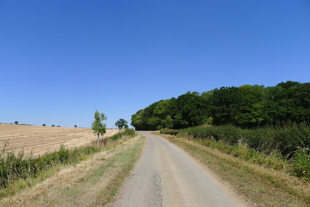
The village itself is characterized by its charming rural setting, with picturesque countryside and rolling hills surrounding it. The landscape is predominantly agricultural, with fields and farmland dominating the scenery. The village is located on the B1176 road, providing easy access to nearby towns and cities.

The history of Burton Coggles dates back centuries, with evidence of human settlement in the area since Roman times. The name "Burton" is derived from the Old English word "burh," meaning fort or fortified settlement, suggesting the presence of a defensive structure in the past.

Today, Burton Coggles is a peaceful and close-knit community, with a strong sense of community spirit. The village has a few amenities to cater to the needs of its residents, including a village hall and a church. There are also a number of footpaths and bridleways in the surrounding countryside, making it an ideal location for outdoor enthusiasts and nature lovers.

Overall, Burton Coggles offers a tranquil and idyllic setting for those seeking a peaceful rural lifestyle, while still being within easy reach of nearby towns and cities.

If you have any feedback on the listing, please let us know in the comments section below.

Burton Coggles Images

Images are sourced within 2km of 52.821856/-0.556915 or Grid Reference SK9725. Thanks to Geograph Open Source API. All images are credited.

Railway bridge over Station Road (A151)
A151 towards Colsterworth
Tree Nursery Broadleaf trees being grown up for transplanting
Tree Nursery
Broadleaf trees being grown up for transplanting
Westby Road approaching Lownd Wood The Dictionaries of the Scots Language lists 'Lownd' as a variant (possibly past participle) of 'Lown', meaning calm (of weather), sheltered, peaceful <span class="nowrap"><a title="https://www.dsl.ac.uk/entry/snd/lown" rel="nofollow ugc noopener" href="https://www.dsl.ac.uk/entry/snd/lown">Link</a><img style="margin-left:2px;" alt="External link" title="External link - shift click to open in new window" src="https://s1.geograph.org.uk/img/external.png" width="10" height="10"/></span> . It may also be a family name.
Westby Road approaching Lownd Wood
The Dictionaries of the Scots Language lists 'Lownd' as a variant (possibly past participle) of 'Lown', meaning calm (of weather), sheltered, peaceful LinkExternal link . It may also be a family name.
Burton Coggles - Church of St Thomas of Canterbury
Fields by Corby Road, Burton-le-Coggles
Corby Road, Bolton-le-Coggles
Colsterworth Lane
Colsterworth Lane
Pylon and farmland
Pylon and farmland
St Thomas Anglican Church, Burton le Coggles, Lincolnshire
Footpath north of Corby Glen
Footbridge over the West Glen, near Burton-le-Coggles
Road to Burton-le-Coggles
Low Bridge This bridge carries the East Coast Mainline over the A151.  Just to the left of this image is the site of a former railway station, serving, I assume, Corby Glen.
Low Bridge
This bridge carries the East Coast Mainline over the A151. Just to the left of this image is the site of a former railway station, serving, I assume, Corby Glen.
Fields Not much growing in this field!
Fields
Not much growing in this field!
Towards Burton-le-Coggles View from Lownd Wood towards Burton-le-Coggles
Towards Burton-le-Coggles
View from Lownd Wood towards Burton-le-Coggles
Show me another place!

Burton Coggles is located at Grid Ref: SK9725 (Lat: 52.821856, Lng: -0.556915)

Administrative County: Lincolnshire

District: South Kesteven

Police Authority: Lincolnshire

What 3 Words

///causes.built.surveyors. Near Corby Glen, Lincolnshire

Related Wikis

Burton Coggles

Burton Coggles (full name Burton-le-Coggles from Byrton-en-les-Coggles) is a small village and civil parish in the South Kesteven district of Lincolnshire...

Beltisloe

Beltisloe is a Deanery of the Diocese of Lincoln in England, and a former Wapentake.The Wapentake of Beltisloe was established as an ancient administrative...

Corby Glen railway station

Corby Glen railway station was a station on the Great Northern Railway main line serving Corby Glen, Lincolnshire. It was west of the village on the Melton...

Westby, Lincolnshire

Westby is a hamlet in the civil parish of Bitchfield and Bassingthorpe, in the South Kesteven district of Lincolnshire, England. It is situated approximately...

Nearby Amenities

Located within 500m of 52.821856,-0.556915
Design: barrel
Line Attachment: suspension
Material: steel
Power: tower
Structure: lattice
Lat/Long: 52.8193327/-0.5580886
Design: barrel
Line Attachment: anchor
Material: steel
Power: tower
Structure: lattice
Lat/Long: 52.8217284/-0.5594432
Ele: 70.5418701
Lat/Long: 52.8219015/-0.5524589
Ele: 73
Lat/Long: 52.8201064/-0.5506615
Ele: 70.7822266
Lat/Long: 52.8217145/-0.5523984
Bench
Ele: 63.8127441
Lat/Long: 52.8214926/-0.5496026
The data included in this document is from www.openstreetmap.org. The data is made available under ODbL.

Have you been to Burton Coggles?

Leave your review of Burton Coggles below (or comments, questions and feedback).