Allington
Settlement in Wiltshire
England
Allington
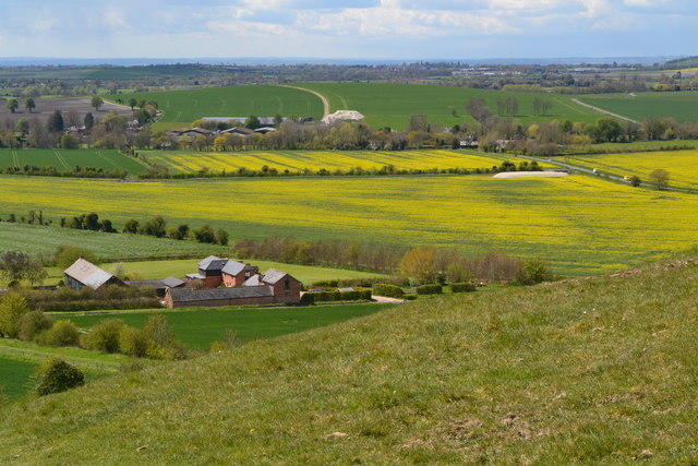
![A walk from Allington to the Wansdyke and back [1] The bridleway approaches the Kennet and Avon Canal.
The walk leaves Allington and goes south to run along the towpath of the Kennet and Avon Canal before turning north to cross the minor road at Cannings Cross. Ascending steeply, the path leads to the causewayed enclosure and hillfort of Rybury atop Clifford’s Hill. After a short descent, there is a long climb up Tan Hill to the Wansdyke. A short way along the dyke, the return journey starts, a long descent down a well surfaced track, a public bridleway, to Allington. Just over 4½ miles.](https://s1.geograph.org.uk/geophotos/07/36/37/7363773_f6531b1e.jpg)
Allington is a charming village located in the county of Wiltshire, England. Situated about three miles northeast of the bustling town of Chippenham, Allington offers a tranquil and picturesque setting for its residents and visitors alike. The village is nestled amidst the rolling countryside, surrounded by lush green fields and dotted with traditional cottages and period houses.
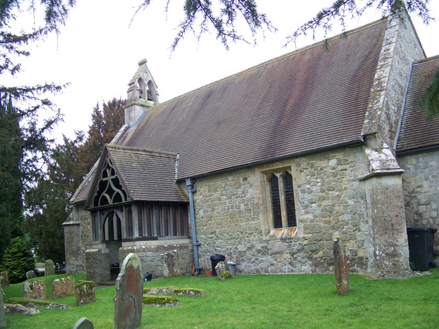
One of the notable features of Allington is its beautiful parish church, St. John the Baptist. This historic church, constructed in the 13th century, is a prominent landmark in the village and showcases stunning architecture and intricate stonework. The churchyard provides a peaceful resting place, with gravestones dating back centuries.
Allington also benefits from its close proximity to the River Avon, which meanders through the surrounding countryside. This allows residents to enjoy leisurely walks along the riverbank and the opportunity to engage in various water activities such as boating and fishing.
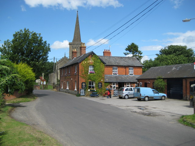
The village has a strong sense of community, with a local pub at its heart where residents can gather for a pint and socialize. In addition, Allington has a primary school, providing education for the younger population.
For those seeking a more vibrant atmosphere, the nearby town of Chippenham offers an array of amenities, including shops, supermarkets, restaurants, and leisure facilities. Allington benefits from excellent transport links, with easy access to the M4 motorway and regular train services to London and other major cities.
In summary, Allington is a delightful village that combines the tranquility of rural living with convenient access to nearby towns and cities. Its idyllic setting, rich history, and strong community spirit make it an attractive place to call home.
If you have any feedback on the listing, please let us know in the comments section below.
Allington Images
Images are sourced within 2km of 51.365794/-1.90617 or Grid Reference SU0662. Thanks to Geograph Open Source API. All images are credited.
![A walk from Allington to the Wansdyke and back [2] This swing bridge carries the bridleway over the Kennet and Avon Canal.
The walk leaves Allington and goes south to run along the towpath of the Kennet and Avon Canal before turning north to cross the minor road at Cannings Cross. Ascending steeply, the path leads to the causewayed enclosure and hillfort of Rybury atop Clifford’s Hill. After a short descent, there is a long climb up Tan Hill to the Wansdyke. A short way along the dyke, the return journey starts, a long descent down a well surfaced track, a public bridleway, to Allington. Just over 4½ miles.](https://s2.geograph.org.uk/geophotos/07/36/37/7363774_594bbe42.jpg)
![A walk from Allington to the Wansdyke and back [3] Boats along the Kennet and Avon Canal. Seen from the towpath.
The walk leaves Allington and goes south to run along the towpath of the Kennet and Avon Canal before turning north to cross the minor road at Cannings Cross. Ascending steeply, the path leads to the causewayed enclosure and hillfort of Rybury atop Clifford’s Hill. After a short descent, there is a long climb up Tan Hill to the Wansdyke. A short way along the dyke, the return journey starts, a long descent down a well surfaced track, a public bridleway, to Allington. Just over 4½ miles.](https://s3.geograph.org.uk/geophotos/07/36/37/7363775_6e5245be.jpg)
![A walk from Allington to the Wansdyke and back [4] 'Lest we forget' on a boat on the Kennet and Avon Canal.
The walk leaves Allington and goes south to run along the towpath of the Kennet and Avon Canal before turning north to cross the minor road at Cannings Cross. Ascending steeply, the path leads to the causewayed enclosure and hillfort of Rybury atop Clifford’s Hill. After a short descent, there is a long climb up Tan Hill to the Wansdyke. A short way along the dyke, the return journey starts, a long descent down a well surfaced track, a public bridleway, to Allington. Just over 4½ miles.](https://s2.geograph.org.uk/geophotos/07/36/37/7363778_0b0f2cf7.jpg)
![A walk from Allington to the Wansdyke and back [5] Perfectly reflected in the canal is Woodway Bridge. This accommodation bridge was built circa 1807 of brick with an oval arch. There is another image of the bridge at <a href="https://www.geograph.org.uk/photo/7363787">SU0762 : A walk from Allington to the Wansdyke and back [6]</a> Listed, grade II, with details at: <span class="nowrap"><a title="https://historicengland.org.uk/listing/the-list/list-entry/1033771" rel="nofollow ugc noopener" href="https://historicengland.org.uk/listing/the-list/list-entry/1033771">Link</a><img style="margin-left:2px;" alt="External link" title="External link - shift click to open in new window" src="https://s1.geograph.org.uk/img/external.png" width="10" height="10"/></span>
The walk leaves Allington and goes south to run along the towpath of the Kennet and Avon Canal before turning north to cross the minor road at Cannings Cross. Ascending steeply, the path leads to the causewayed enclosure and hillfort of Rybury atop Clifford’s Hill. After a short descent, there is a long climb up Tan Hill to the Wansdyke. A short way along the dyke, the return journey starts, a long descent down a well surfaced track, a public bridleway, to Allington. Just over 4½ miles.](https://s3.geograph.org.uk/geophotos/07/36/37/7363783_0583b20f.jpg)
![A walk from Allington to the Wansdyke and back [6] Woodway Bridge is an accommodation bridge built circa 1807 of brick with an oval arch. There is another image of the bridge at <a href="https://www.geograph.org.uk/photo/7363783">SU0762 : A walk from Allington to the Wansdyke and back [5]</a> Listed, grade II, with details at: <span class="nowrap"><a title="https://historicengland.org.uk/listing/the-list/list-entry/1033771" rel="nofollow ugc noopener" href="https://historicengland.org.uk/listing/the-list/list-entry/1033771">Link</a><img style="margin-left:2px;" alt="External link" title="External link - shift click to open in new window" src="https://s1.geograph.org.uk/img/external.png" width="10" height="10"/></span>
The walk leaves Allington and goes south to run along the towpath of the Kennet and Avon Canal before turning north to cross the minor road at Cannings Cross. Ascending steeply, the path leads to the causewayed enclosure and hillfort of Rybury atop Clifford’s Hill. After a short descent, there is a long climb up Tan Hill to the Wansdyke. A short way along the dyke, the return journey starts, a long descent down a well surfaced track, a public bridleway, to Allington. Just over 4½ miles.](https://s3.geograph.org.uk/geophotos/07/36/37/7363787_8bb1f32e.jpg)
![A walk from Allington to the Wansdyke and back [7] The long, straight path runs across the field towards Cannings Cross.
The walk leaves Allington and goes south to run along the towpath of the Kennet and Avon Canal before turning north to cross the minor road at Cannings Cross. Ascending steeply, the path leads to the causewayed enclosure and hillfort of Rybury atop Clifford’s Hill. After a short descent, there is a long climb up Tan Hill to the Wansdyke. A short way along the dyke, the return journey starts, a long descent down a well surfaced track, a public bridleway, to Allington. Just over 4½ miles.](https://s2.geograph.org.uk/geophotos/07/36/37/7363794_8d41863c.jpg)
![A walk from Allington to the Wansdyke and back [8] The long, straight path runs across the field towards Cannings Cross.
The walk leaves Allington and goes south to run along the towpath of the Kennet and Avon Canal before turning north to cross the minor road at Cannings Cross. Ascending steeply, the path leads to the causewayed enclosure and hillfort of Rybury atop Clifford’s Hill. After a short descent, there is a long climb up Tan Hill to the Wansdyke. A short way along the dyke, the return journey starts, a long descent down a well surfaced track, a public bridleway, to Allington. Just over 4½ miles.](https://s0.geograph.org.uk/geophotos/07/36/37/7363796_b1196d10.jpg)
![A walk from Allington to the Wansdyke and back [9] The path continues as a track at Cannings Cross.
The walk leaves Allington and goes south to run along the towpath of the Kennet and Avon Canal before turning north to cross the minor road at Cannings Cross. Ascending steeply, the path leads to the causewayed enclosure and hillfort of Rybury atop Clifford’s Hill. After a short descent, there is a long climb up Tan Hill to the Wansdyke. A short way along the dyke, the return journey starts, a long descent down a well surfaced track, a public bridleway, to Allington. Just over 4½ miles.](https://s0.geograph.org.uk/geophotos/07/36/38/7363800_53cd558d.jpg)
![A walk from Allington to the Wansdyke and back [10] Cottages and garages at Cannings Cross.
The walk leaves Allington and goes south to run along the towpath of the Kennet and Avon Canal before turning north to cross the minor road at Cannings Cross. Ascending steeply, the path leads to the causewayed enclosure and hillfort of Rybury atop Clifford’s Hill. After a short descent, there is a long climb up Tan Hill to the Wansdyke. A short way along the dyke, the return journey starts, a long descent down a well surfaced track, a public bridleway, to Allington. Just over 4½ miles.](https://s3.geograph.org.uk/geophotos/07/36/45/7364547_03e15912.jpg)
![A walk from Allington to the Wansdyke and back [11] After crossing the minor road at Cannings Cross, the route, now a bridleway, heads towards Clifford&#039;s Hill.
The walk leaves Allington and goes south to run along the towpath of the Kennet and Avon Canal before turning north to cross the minor road at Cannings Cross. Ascending steeply, the path leads to the causewayed enclosure and hillfort of Rybury atop Clifford’s Hill. After a short descent, there is a long climb up Tan Hill to the Wansdyke. A short way along the dyke, the return journey starts, a long descent down a well surfaced track, a public bridleway, to Allington. Just over 4½ miles.](https://s0.geograph.org.uk/geophotos/07/36/45/7364548_83059f84.jpg)
![A walk from Allington to the Wansdyke and back [12] The footpath branches off the bridleway and starts a steep ascent past the water trough and the covered reservoir.
The walk leaves Allington and goes south to run along the towpath of the Kennet and Avon Canal before turning north to cross the minor road at Cannings Cross. Ascending steeply, the path leads to the causewayed enclosure and hillfort of Rybury atop Clifford’s Hill. After a short descent, there is a long climb up Tan Hill to the Wansdyke. A short way along the dyke, the return journey starts, a long descent down a well surfaced track, a public bridleway, to Allington. Just over 4½ miles.](https://s1.geograph.org.uk/geophotos/07/36/45/7364549_e5555da9.jpg)
![A walk from Allington to the Wansdyke and back [13] Looking back down the path, past the covered reservoir to the water trough. The buildings of Cannings Cross and the Vale of Pewsey are beyond.
The walk leaves Allington and goes south to run along the towpath of the Kennet and Avon Canal before turning north to cross the minor road at Cannings Cross. Ascending steeply, the path leads to the causewayed enclosure and hillfort of Rybury atop Clifford’s Hill. After a short descent, there is a long climb up Tan Hill to the Wansdyke. A short way along the dyke, the return journey starts, a long descent down a well surfaced track, a public bridleway, to Allington. Just over 4½ miles.](https://s2.geograph.org.uk/geophotos/07/36/45/7364550_1c08bad5.jpg)
![A walk from Allington to the Wansdyke and back [14] The path follows the fence line.
The walk leaves Allington and goes south to run along the towpath of the Kennet and Avon Canal before turning north to cross the minor road at Cannings Cross. Ascending steeply, the path leads to the causewayed enclosure and hillfort of Rybury atop Clifford’s Hill. After a short descent, there is a long climb up Tan Hill to the Wansdyke. A short way along the dyke, the return journey starts, a long descent down a well surfaced track, a public bridleway, to Allington. Just over 4½ miles.](https://s3.geograph.org.uk/geophotos/07/36/45/7364551_9ce1bbdc.jpg)
![A walk from Allington to the Wansdyke and back [15] The line of the Right of Way is to the right but the path heads left.
The walk leaves Allington and goes south to run along the towpath of the Kennet and Avon Canal before turning north to cross the minor road at Cannings Cross. Ascending steeply, the path leads to the causewayed enclosure and hillfort of Rybury atop Clifford’s Hill. After a short descent, there is a long climb up Tan Hill to the Wansdyke. A short way along the dyke, the return journey starts, a long descent down a well surfaced track, a public bridleway, to Allington. Just over 4½ miles.](https://s0.geograph.org.uk/geophotos/07/36/45/7364552_f7b654e3.jpg)
![A walk from Allington to the Wansdyke and back [16] The humps and hollows in the foreground are Rybury, a causewayed enclosure and slight univallate hillfort. Situated on the summit of a very steeply sloping and prominent downland ridge, Clifford’s Hill. A Scheduled Ancient Monument with details at: <span class="nowrap"><a title="https://historicengland.org.uk/listing/the-list/list-entry/1005695?section=official-list-entry" rel="nofollow ugc noopener" href="https://historicengland.org.uk/listing/the-list/list-entry/1005695?section=official-list-entry">Link</a><img style="margin-left:2px;" alt="External link" title="External link - shift click to open in new window" src="https://s1.geograph.org.uk/img/external.png" width="10" height="10"/></span>
The walk leaves Allington and goes south to run along the towpath of the Kennet and Avon Canal before turning north to cross the minor road at Cannings Cross. Ascending steeply, the path leads to the causewayed enclosure and hillfort of Rybury atop Clifford’s Hill. After a short descent, there is a long climb up Tan Hill to the Wansdyke. A short way along the dyke, the return journey starts, a long descent down a well surfaced track, a public bridleway, to Allington. Just over 4½ miles.](https://s1.geograph.org.uk/geophotos/07/36/45/7364553_4bb68461.jpg)
![A walk from Allington to the Wansdyke and back [18] The humps and hollows of Rybury, a causewayed enclosure and slight univallate hillfort. Situated on the summit of a very steeply sloping and prominent downland ridge, Clifford’s Hill. A Scheduled Ancient Monument with details at: <span class="nowrap"><a title="https://historicengland.org.uk/listing/the-list/list-entry/1005695?section=official-list-entry" rel="nofollow ugc noopener" href="https://historicengland.org.uk/listing/the-list/list-entry/1005695?section=official-list-entry">Link</a><img style="margin-left:2px;" alt="External link" title="External link - shift click to open in new window" src="https://s1.geograph.org.uk/img/external.png" width="10" height="10"/></span>
The walk leaves Allington and goes south to run along the towpath of the Kennet and Avon Canal before turning north to cross the minor road at Cannings Cross. Ascending steeply, the path leads to the causewayed enclosure and hillfort of Rybury atop Clifford’s Hill. After a short descent, there is a long climb up Tan Hill to the Wansdyke. A short way along the dyke, the return journey starts, a long descent down a well surfaced track, a public bridleway, to Allington. Just over 4½ miles.](https://s2.geograph.org.uk/geophotos/07/36/45/7364558_2d81ac28.jpg)
![A walk from Allington to the Wansdyke and back [20] The path has descended from Rybury and joins a bridleway which ascends the other side of Clifford&#039;s Hill. The bridleway is seen here on the flank of the hill with the Vale of Pewsey beyond.
The walk leaves Allington and goes south to run along the towpath of the Kennet and Avon Canal before turning north to cross the minor road at Cannings Cross. Ascending steeply, the path leads to the causewayed enclosure and hillfort of Rybury atop Clifford’s Hill. After a short descent, there is a long climb up Tan Hill to the Wansdyke. A short way along the dyke, the return journey starts, a long descent down a well surfaced track, a public bridleway, to Allington. Just over 4½ miles.](https://s2.geograph.org.uk/geophotos/07/36/45/7364562_3cc622c5.jpg)
Allington is located at Grid Ref: SU0662 (Lat: 51.365794, Lng: -1.90617)
Unitary Authority: Wiltshire
Police Authority: Wiltshire
What 3 Words
///flattered.arranger.date. Near Woodborough, Wiltshire
Nearby Locations
Related Wikis

Long Barrow at All Cannings
The Long Barrow at All Cannings is a modern barrow near All Cannings, Wiltshire, England, inspired by the neolithic barrows built 5,500 years ago. It was...

All Cannings
All Cannings (pronounced "Allcannings") is a village and civil parish in the Vale of Pewsey in the English county of Wiltshire, about 4 miles (6 km) east...
All Cannings Cross
All Cannings Cross is the name of farm and an archaeological site close to All Cannings, near Devizes in the English county of Wiltshire. The site is a...

Tan Hill, Wiltshire
Tan Hill (grid reference SU081646) is a hill north of Allington in the parish of All Cannings, Wiltshire, England. Its summit is 294 metres (965 ft) above...

Stanton St Bernard
Stanton St Bernard is a village and civil parish in the Vale of Pewsey, Wiltshire, England. Its nearest town is Devizes, about 6 miles (10 km) away to...
Bishops Cannings
Bishops Cannings is a village and civil parish in the Vale of Pewsey in Wiltshire, England, 3 miles (5 km) north-east of Devizes. The parish includes the...
Etchilhampton
Etchilhampton is a small village and civil parish in Wiltshire, England, in the Vale of Pewsey 3 miles (4.8 km) east of Devizes. == History == The Domesday...

River Avon, Hampshire
The River Avon () is in the south of England, rising in Wiltshire, flowing through that county's city of Salisbury and then west Hampshire, before reaching...
Related Videos
2 Youtubers go camping to The Barge Inn at Pewsey
Rick achieved a long standing ambition to see the famous painting at The Barge Inn, Pewsey. It was an interesting video........ We ...

We Went for a Walk AND FOUND A...
Come and join us, where we travelled to walk and explore the Kennet and Avon Canal and found a nice pub at the end! Comment ...

Sakura Shower
Camping around @ The Homestead.

🇬🇧 VanLife Gathering S14E80 Wiltshire Solstice 2023
I befriended a group of campervanists at a remote park up in Wiltshire who recommended that I go along to a huge vanlife meet in ...
Nearby Amenities
Located within 500m of 51.365794,-1.90617Have you been to Allington?
Leave your review of Allington below (or comments, questions and feedback).