Allington

Settlement in Wiltshire

England

Allington

St John the Baptist, Allington
St John the Baptist, Allington Credit: Richard Webb

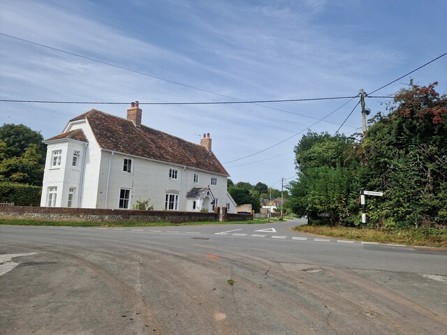
Allington is a small village located in the county of Wiltshire, England. Situated about 4 miles west of the town of Devizes, Allington is nestled in the picturesque Vale of Pewsey. The village is surrounded by beautiful countryside, with rolling hills and farmland adding to its scenic charm.

With a population of around 300 residents, Allington is a close-knit community that exudes a sense of tranquility and rural charm. The village is primarily residential, consisting of a mix of traditional stone-built cottages and more modern housing developments. The architecture reflects the village's long history, with some buildings dating back several centuries.

Despite its small size, Allington boasts a few amenities to cater to its residents. These include a village hall, a primary school, and a local pub, serving as a social hub for the community. The village hall hosts various events throughout the year, such as community gatherings, clubs, and classes.

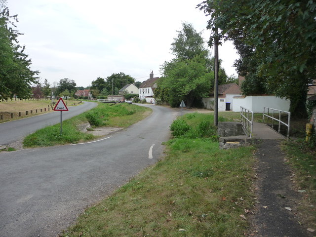
Surrounded by the stunning Wiltshire countryside, Allington offers residents and visitors ample opportunities for outdoor activities. The village is surrounded by footpaths and bridleways, making it an excellent location for walking, cycling, and horse riding. The nearby Pewsey Downs National Nature Reserve is a popular spot for nature enthusiasts, offering breathtaking views and a diverse range of flora and fauna.

Overall, Allington is a peaceful and idyllic village that offers a sense of community and a connection to nature. Its proximity to larger towns and its charming countryside make it an appealing place to live for those seeking a quiet and rural lifestyle.

If you have any feedback on the listing, please let us know in the comments section below.

Allington Images

Images are sourced within 2km of 51.153034/-1.7080446 or Grid Reference SU2039. Thanks to Geograph Open Source API. All images are credited.

St John the Baptist, Allington
Churchyard, Allington
Path through the churchyard, Allington
Boscombe: the city limits
Rush hour in Allington
Allington: two bridges, no water...
St Andrew, Newton Toney: September 2023
St Andrew, Newton Toney: grave of a baronet That of Sir Henry Charles Eden Malet, 3rd Baronet. His father <span class="nowrap"><a title="https://en.wikipedia.org/wiki/Sir_Alexander_Malet,_2nd_Baronet" rel="nofollow ugc noopener" href="https://en.wikipedia.org/wiki/Sir_Alexander_Malet,_2nd_Baronet">Link</a><img style="margin-left:2px;" alt="External link" title="External link - shift click to open in new window" src="https://s1.geograph.org.uk/img/external.png" width="10" height="10"/></span> and son <span class="nowrap"><a title="https://en.wikipedia.org/wiki/Edward_Malet" rel="nofollow ugc noopener" href="https://en.wikipedia.org/wiki/Edward_Malet">Link</a><img style="margin-left:2px;" alt="External link" title="External link - shift click to open in new window" src="https://s1.geograph.org.uk/img/external.png" width="10" height="10"/></span> have Wikipedia entries.
St Andrew, Newton Toney: grave of a baronet
That of Sir Henry Charles Eden Malet, 3rd Baronet. His father LinkExternal link and son LinkExternal link have Wikipedia entries.
The Lodge, Wilbury House: September 2023 For more about the house see <span class="nowrap"><a title="https://en.wikipedia.org/wiki/Wilbury_House" rel="nofollow ugc noopener" href="https://en.wikipedia.org/wiki/Wilbury_House">Link</a><img style="margin-left:2px;" alt="External link" title="External link - shift click to open in new window" src="https://s1.geograph.org.uk/img/external.png" width="10" height="10"/></span>
The Lodge, Wilbury House: September 2023
For more about the house see LinkExternal link
Restricted byway near Amesbury Junction The restricted byway takes you across downland to Grately Lodge.
Restricted byway near Amesbury Junction
The restricted byway takes you across downland to Grately Lodge.
Restricted byway near Amesbury Junction The restricted byway makes its way between fields to join the Roman Road.
Restricted byway near Amesbury Junction
The restricted byway makes its way between fields to join the Roman Road.
Farm track near Newton Tony The farm track crosses the course of the dismantled railway.  It is not a right of way.
Farm track near Newton Tony
The farm track crosses the course of the dismantled railway. It is not a right of way.
A338 at The Old Inn, Allington
A338 at Boscombe village boundary
The Malet Arms, Newton Tony The Malet Arms is a 16th century former coaching inn eight miles north east of Salisbury. The grassy hollow below the bridge is in fact the River Bourne which usually dries up in the summer and flows again in the winter. There are flood marks inside the pub!
The Malet Arms, Newton Tony
The Malet Arms is a 16th century former coaching inn eight miles north east of Salisbury. The grassy hollow below the bridge is in fact the River Bourne which usually dries up in the summer and flows again in the winter. There are flood marks inside the pub!
Newton Tony Ford This ford on the River Bourne is found at Newton Tony.
Newton Tony Ford
This ford on the River Bourne is found at Newton Tony.
Allington Ford Surprisingly dry on the day of our visit this ford on the River Bourne is found at Allington.
Allington Ford
Surprisingly dry on the day of our visit this ford on the River Bourne is found at Allington.
Dry ford, Newton Tony
Show me another place!

Allington is located at Grid Ref: SU2039 (Lat: 51.153034, Lng: -1.7080446)

Unitary Authority: Wiltshire

Police Authority: Wiltshire

What 3 Words

///disbelief.regarding.bridge. Near Allington, Wiltshire

Nearby Locations

Allington

Related Wikis

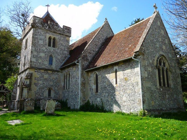
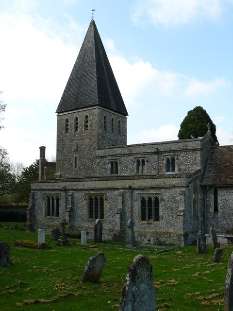
St John the Baptist's Church, Allington

St John the Baptist's Church in the village of Allington, south-east of Amesbury in Wiltshire, England, is a redundant Anglican parish church which was...

Allington, Salisbury

Allington is a village and civil parish in Wiltshire, England, about 3 miles (5 km) southeast of Amesbury and 7 miles (11 km) northeast of Salisbury. The...

Boscombe, Wiltshire

Boscombe is a small village and former civil parish, now in the parish of Allington, Wiltshire, England. It lies about 3 miles (5 km) southeast of Amesbury...

Newton Tony

Newton Tony (formerly Newton Toney) is a rural English village and civil parish in the county of Wiltshire, close to the border with Hampshire. Situated...

All Saints Church, Idmiston

All Saints Church in Idmiston, Wiltshire, England, was built in the 12th century. It is recorded in the National Heritage List for England as a Grade I...

Idmiston

Idmiston is a village and civil parish in Wiltshire, England. The village is about 3 miles (4.8 km) southeast of Amesbury and 6 miles (10 km) northeast...

Idmiston Halt railway station

Idmiston Halt railway station served Porton Down military camp in Idmiston, Wiltshire, England, from 1943 to 1968 on the West of England line. == History... ==
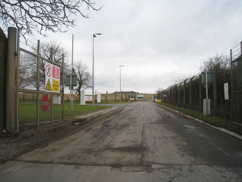
Porton Down

Porton Down is a science and defence technology campus in Wiltshire, England, just north-east of the village of Porton, near Salisbury. It is home to two...

Nearby Amenities

Located within 500m of 51.153034,-1.7080446
Allington
Place: hamlet
Source: OS_OpenData_Streetview
Wikidata: Q2800304
Wikipedia: en:Allington, Salisbury
Lat/Long: 51.1537712/-1.7089857
Pub
The Olde Inn
Addr Postcode: SP4 0BN
Website: http://www.oldinnallington.com/
Lat/Long: 51.1517997/-1.7090077
Post Box
Post Box Type: lamp
Ref: SP4 434D
Royal Cypher: EIIR
Royal Cypher Wikidata: Q33102113
Lat/Long: 51.1554432/-1.7107511
Noexit: yes
Lat/Long: 51.1565648/-1.7107008
Maxspeed: 40 mph
Traffic Sign: maxspeed
Lat/Long: 51.1544359/-1.7105413
Ford: yes
Lat/Long: 51.1536029/-1.7075578
Post Box
Drive Through: no
Post Box Type: wall
Royal Cypher: VR
Royal Cypher Wikidata: Q33102356
Lat/Long: 51.1526742/-1.7082235
The data included in this document is from www.openstreetmap.org. The data is made available under ODbL.

Have you been to Allington?

Leave your review of Allington below (or comments, questions and feedback).