Coed Gwydyr

Wood, Forest in Caernarfonshire

Wales

Coed Gwydyr

View from Plas Maenan over the Afon Conwy A view from the terrace of the Plas Maenan Hotel towards Dolgarrog.  The bridge over the Afon (River) Conwy is in the centre of the picture.  This bridge once carried a railway branch from Dolgarrog Station to the aluminium works.  The rail tracks were removed in the 1960's and the bridge now carries water mains and a currently closed footpath.
View from Plas Maenan over the Afon Conwy Credit: Bob Walters

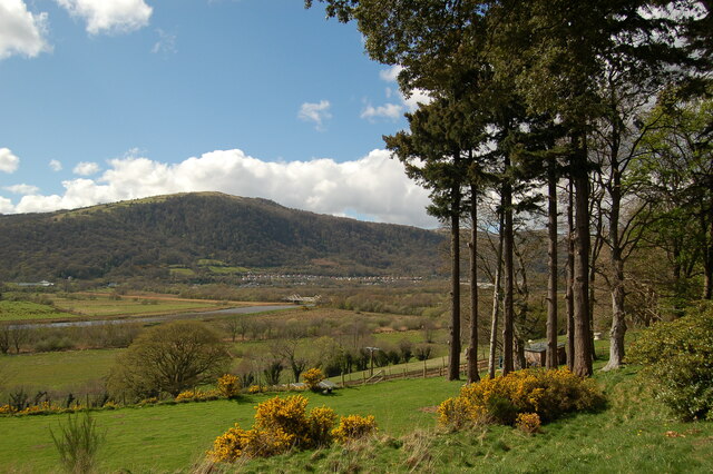
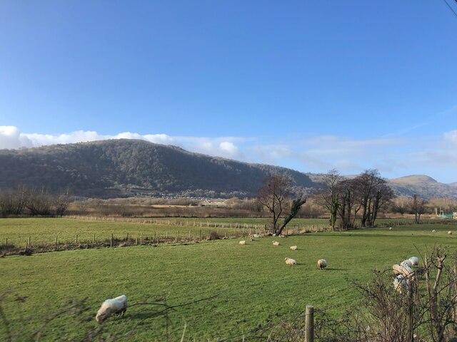
Coed Gwydyr, located in the county of Caernarfonshire, Wales, is a beautiful and expansive woodland area that captivates visitors with its natural splendor. Covering an area of approximately 72 hectares, this enchanting forest is nestled within Snowdonia National Park, one of the most picturesque regions in the United Kingdom.

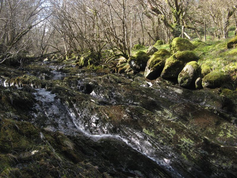
The name "Coed Gwydyr" translates to "Wood of Glass" in English, possibly alluding to the shimmering reflections of sunlight on the nearby Llyn Gwynant lake. The forest boasts a diverse range of tree species, including oak, beech, birch, and rowan, creating a rich and varied ecosystem. This biodiversity attracts a wide array of wildlife, with sightings of red squirrels, badgers, and numerous species of birds being common.

Coed Gwydyr offers an extensive network of paths and trails, allowing visitors to explore its natural wonders at their own pace. Whether hiking, cycling, or horse riding, there are activities suitable for all levels of outdoor enthusiasts. The forest is also home to several historic ruins, such as the remains of Gwydyr Castle, providing a glimpse into the area's intriguing past.

The tranquility and serenity of Coed Gwydyr make it a popular destination for those seeking solace in nature. Its breathtaking beauty, combined with the opportunity for outdoor recreation, make it an ideal location for individuals and families alike. With its accessibility and proximity to other attractions within Snowdonia National Park, Coed Gwydyr is indeed a gem worth exploring.

If you have any feedback on the listing, please let us know in the comments section below.
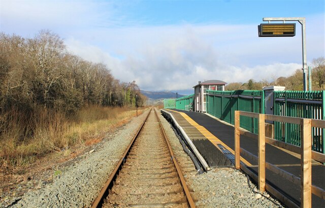
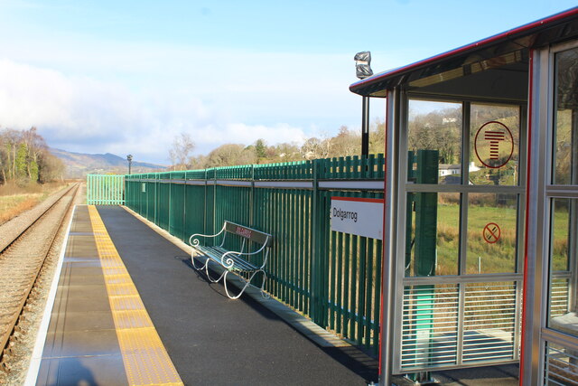
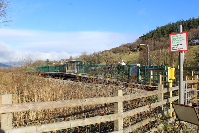
Coed Gwydyr Images

Images are sourced within 2km of 53.172324/-3.8330088 or Grid Reference SH7765. Thanks to Geograph Open Source API. All images are credited.

View from Plas Maenan over the Afon Conwy A view from the terrace of the Plas Maenan Hotel towards Dolgarrog.  The bridge over the Afon (River) Conwy is in the centre of the picture.  This bridge once carried a railway branch from Dolgarrog Station to the aluminium works.  The rail tracks were removed in the 1960's and the bridge now carries water mains and a currently closed footpath.
View from Plas Maenan over the Afon Conwy
A view from the terrace of the Plas Maenan Hotel towards Dolgarrog. The bridge over the Afon (River) Conwy is in the centre of the picture. This bridge once carried a railway branch from Dolgarrog Station to the aluminium works. The rail tracks were removed in the 1960's and the bridge now carries water mains and a currently closed footpath.
Rusty rails to Llandudno Junction As seen from Dolgarrog station.
The reason?
No regular trains have passed by since before 8 January. Flooding etc has caused yet another issue for this scenic railway line to Blaenau Ffestiniog to close on numerous occasions. <a href="https://www.geograph.org.uk/photo/7085730">SH7866 : Information board at Dolgarrog station</a>
Viewed from the apparent safety of the footpath crossing.
Rusty rails to Llandudno Junction
As seen from Dolgarrog station. The reason? No regular trains have passed by since before 8 January. Flooding etc has caused yet another issue for this scenic railway line to Blaenau Ffestiniog to close on numerous occasions. SH7866 : Information board at Dolgarrog station Viewed from the apparent safety of the footpath crossing.
Former track area to the aluminium factory Seen to the left of the existing track.
In 1916 a short branch line was opened from the Conwy Valley railway, east of the river. It made a sharp turn through almost 180 degrees to cross the river and run along the valley to the factory. From the entrance gate, sidings fanned out into seven areas of the factory.
- History points <span class="nowrap"><a title="https://historypoints.org/index.php?page=the-dolgarrog-railway)" rel="nofollow ugc noopener" href="https://historypoints.org/index.php?page=the-dolgarrog-railway)">Link</a><img style="margin-left:2px;" alt="External link" title="External link - shift click to open in new window" src="https://s1.geograph.org.uk/img/external.png" width="10" height="10"/></span>
It was here the railway joined the line to Llandudno Junction.
Former track area to the aluminium factory
Seen to the left of the existing track. In 1916 a short branch line was opened from the Conwy Valley railway, east of the river. It made a sharp turn through almost 180 degrees to cross the river and run along the valley to the factory. From the entrance gate, sidings fanned out into seven areas of the factory. - History points LinkExternal link It was here the railway joined the line to Llandudno Junction.
Information board at Dolgarrog station Deals with Covid rules and the announcement of a replacement bus service.
The Conwy Valley Line which runs between Blaenau Ffestiniog and Llandudno did not reopen on 28 January as expected, and a bus replacement service will operate until further notice.

The line, which runs from Blaenau Ffestiniog to Llandudno, had closed again on Tuesday, 19 January following flood damage caused by Storm Christoph. This is coupled with staff shortages.
Information board at Dolgarrog station
Deals with Covid rules and the announcement of a replacement bus service. The Conwy Valley Line which runs between Blaenau Ffestiniog and Llandudno did not reopen on 28 January as expected, and a bus replacement service will operate until further notice. The line, which runs from Blaenau Ffestiniog to Llandudno, had closed again on Tuesday, 19 January following flood damage caused by Storm Christoph. This is coupled with staff shortages.
Shelter and seat at Dolgarrog station
Dolgarrog station viewed from the footpath The footpath is signed as 'closed'. The reason being about 200 metres behind the photographer is a bridge <a href="https://www.geograph.org.uk/photo/3744648">SH7866 : Dolgarrog bridge viewed south westwards</a> across the river which is closed for safety reasons.
Moves are in hand to have the bridge repaired. In theory this must be the only village which has a station but it cannot be reached unless a long circuitous route is taken by road.
Equally it is a station without a village.
Dolgarrog station viewed from the footpath
The footpath is signed as 'closed'. The reason being about 200 metres behind the photographer is a bridge SH7866 : Dolgarrog bridge viewed south westwards across the river which is closed for safety reasons. Moves are in hand to have the bridge repaired. In theory this must be the only village which has a station but it cannot be reached unless a long circuitous route is taken by road. Equally it is a station without a village.
Rough ground beside footpath from Dolgarrog station It was in this area a short branch line was opened from the Conwy Valley railway, east of the river. It made a sharp turn through almost 180 degrees to cross the river and run along the valley to the aluminium works factory. From the entrance gate, sidings fanned out into seven areas of the factory.
There are no visible signs of the old railway it having been lifted in 1965.
Rough ground beside footpath from Dolgarrog station
It was in this area a short branch line was opened from the Conwy Valley railway, east of the river. It made a sharp turn through almost 180 degrees to cross the river and run along the valley to the aluminium works factory. From the entrance gate, sidings fanned out into seven areas of the factory. There are no visible signs of the old railway it having been lifted in 1965.
Footpath to Dolgarrog station Currently closed as the bridge <a href="https://www.geograph.org.uk/photo/3744648">SH7866 : Dolgarrog bridge viewed south westwards</a> about 200 metres behind the photographer is closed for safety reasons.
The path does however lead to the Afon Conwy. A popular spot for dog walkers.
Footpath to Dolgarrog station
Currently closed as the bridge SH7866 : Dolgarrog bridge viewed south westwards about 200 metres behind the photographer is closed for safety reasons. The path does however lead to the Afon Conwy. A popular spot for dog walkers.
View to Dolgarrog from the A470 At the centre of the photo is Dolgarrog Bridge which used to carry a branch line from the Aluminium works across the Afon Conwy to join with the Conwy Valley line. The line closed and the railway dismantled, it now carries two large water pipes and a footpath.
View to Dolgarrog from the A470
At the centre of the photo is Dolgarrog Bridge which used to carry a branch line from the Aluminium works across the Afon Conwy to join with the Conwy Valley line. The line closed and the railway dismantled, it now carries two large water pipes and a footpath.
Peaceful cows Cows with their young calves are enjoying the spring sunshine on the rough meadows adjacent to the railway and A470 by Dolgarrog Station. Compare with a previous view during preparation for railway works: <a href="https://www.geograph.org.uk/photo/6533287">SH7866 : Access to the railway</a>.
Peaceful cows
Cows with their young calves are enjoying the spring sunshine on the rough meadows adjacent to the railway and A470 by Dolgarrog Station. Compare with a previous view during preparation for railway works: SH7866 : Access to the railway.
Dolgarrog bridge A view from the riverside at a low state of tide.
Dolgarrog bridge
A view from the riverside at a low state of tide.
Afon Conwy A view of the river at a low tide level with reeds and mudbanks.
Afon Conwy
A view of the river at a low tide level with reeds and mudbanks.
The viewpoint at Cadair Ifan Coch From a forest track heading north from Maenan, a branch path brings one out, with a slight scramble, to the viewpoint at Cadair Ifan Coch, where rocks form a gap in the woodland, about 35m below the summit of the hill. The spot commands a panorama over the lower Conwy valley and across to woodland beyond Trefriw. The only thing marring the view is the former aluminium works, now converted to the tourist attraction of Surf Snowdonia, and the ugly Trefriw Hilton, soon to be housing asylum seekers instead of granting them temporary permits to work and pay taxes which any sane government would see as an answer to the current permacrisis (largely of the insane government's own making).
The viewpoint at Cadair Ifan Coch
From a forest track heading north from Maenan, a branch path brings one out, with a slight scramble, to the viewpoint at Cadair Ifan Coch, where rocks form a gap in the woodland, about 35m below the summit of the hill. The spot commands a panorama over the lower Conwy valley and across to woodland beyond Trefriw. The only thing marring the view is the former aluminium works, now converted to the tourist attraction of Surf Snowdonia, and the ugly Trefriw Hilton, soon to be housing asylum seekers instead of granting them temporary permits to work and pay taxes which any sane government would see as an answer to the current permacrisis (largely of the insane government's own making).
Approach to Dolgarrog bridge (1) The river bridge has reopened after more than two years. The Dolgarrog Pipe Bridge over the Afon Conwy - which carries two water pipes that supply drinking water to over 43,000 local homes and businesses - closed to the public in January 2021 due to concerns over its condition. 
Funding of £1.2m from Dwr Cymru and a £735,000 Welsh Government grant for Conwy County Borough Council was obtained. Work to strengthen, repair, and improve the bridge started in May 2022 and was completed earlier this month (June 2023).
Dolgarrog railway station, a halt, is behind the photographer.
Built in 1916 this carried a branch line from the Aluminium works across the Afon Conwy to join with the Conwy Valley line.
Passenger services were withdrawn in 1932 and goods traffic ceased in 1960. The track was lifted in 1964.
Someone had mislaid a red T K Maxx shopping bag full of what appeared to be socks and ....?
Rather a change since <a href="https://www.geograph.org.uk/photo/3744648">SH7866 : Dolgarrog bridge viewed south westwards</a>
Approach to Dolgarrog bridge (1)
The river bridge has reopened after more than two years. The Dolgarrog Pipe Bridge over the Afon Conwy - which carries two water pipes that supply drinking water to over 43,000 local homes and businesses - closed to the public in January 2021 due to concerns over its condition. Funding of £1.2m from Dwr Cymru and a £735,000 Welsh Government grant for Conwy County Borough Council was obtained. Work to strengthen, repair, and improve the bridge started in May 2022 and was completed earlier this month (June 2023). Dolgarrog railway station, a halt, is behind the photographer. Built in 1916 this carried a branch line from the Aluminium works across the Afon Conwy to join with the Conwy Valley line. Passenger services were withdrawn in 1932 and goods traffic ceased in 1960. The track was lifted in 1964. Someone had mislaid a red T K Maxx shopping bag full of what appeared to be socks and ....? Rather a change since SH7866 : Dolgarrog bridge viewed south westwards
Approach to Dolgarrog bridge (2) The river bridge has reopened after more than two years. The Dolgarrog Pipe Bridge over the Afon Conwy - which carries two water pipes that supply drinking water to over 43,000 local homes and businesses - closed to the public in January 2021 due to concerns over its condition. 
Funding of £1.2m from Dwr Cymru and a £735,000 Welsh Government grant for Conwy County Borough Council was obtained. Work to strengthen, repair, and improve the bridge started in May 2022 and was completed earlier this month (June 2023).
Dolgarrog railway station, a halt, is the other side of the bridge.
Built in 1916 this carried a branch line from the Aluminium works across the Afon Conwy to join with the Conwy Valley line.
Passenger services were withdrawn in 1932 and goods traffic ceased in 1960. The track was lifted in 1964.
Different to view 10 years ago. <a href="https://www.geograph.org.uk/photo/3743222">SH7766 : Dolgarrog bridge</a>
Approach to Dolgarrog bridge (2)
The river bridge has reopened after more than two years. The Dolgarrog Pipe Bridge over the Afon Conwy - which carries two water pipes that supply drinking water to over 43,000 local homes and businesses - closed to the public in January 2021 due to concerns over its condition. Funding of £1.2m from Dwr Cymru and a £735,000 Welsh Government grant for Conwy County Borough Council was obtained. Work to strengthen, repair, and improve the bridge started in May 2022 and was completed earlier this month (June 2023). Dolgarrog railway station, a halt, is the other side of the bridge. Built in 1916 this carried a branch line from the Aluminium works across the Afon Conwy to join with the Conwy Valley line. Passenger services were withdrawn in 1932 and goods traffic ceased in 1960. The track was lifted in 1964. Different to view 10 years ago. SH7766 : Dolgarrog bridge
Newly cleared approach to Dolgarrog bridge The river bridge has reopened after more than two years. The Dolgarrog Pipe Bridge over the Afon Conwy - which carries two water pipes that supply drinking water to over 43,000 local homes and businesses - closed to the public in January 2021 due to concerns over its condition. 
Funding of £1.2m from Dwr Cymru and a £735,000 Welsh Government grant for Conwy County Borough Council was obtained. Work to strengthen, repair, and improve the bridge started in May 2022 and was completed earlier this month (June 2023).
The work has left an enhanced approach. 
Dolgarrog railway station, a halt, is the other side of the bridge.
Built in 1916 this carried a branch line from the Aluminium works across the Afon Conwy to join with the Conwy Valley line.
Passenger services were withdrawn in 1932 and goods traffic ceased in 1960. The track was lifted in 1964.
Newly cleared approach to Dolgarrog bridge
The river bridge has reopened after more than two years. The Dolgarrog Pipe Bridge over the Afon Conwy - which carries two water pipes that supply drinking water to over 43,000 local homes and businesses - closed to the public in January 2021 due to concerns over its condition. Funding of £1.2m from Dwr Cymru and a £735,000 Welsh Government grant for Conwy County Borough Council was obtained. Work to strengthen, repair, and improve the bridge started in May 2022 and was completed earlier this month (June 2023). The work has left an enhanced approach. Dolgarrog railway station, a halt, is the other side of the bridge. Built in 1916 this carried a branch line from the Aluminium works across the Afon Conwy to join with the Conwy Valley line. Passenger services were withdrawn in 1932 and goods traffic ceased in 1960. The track was lifted in 1964.
Footpath beside the Afon Conwy Viewed from the recently renovated bridge which carries two water pipes across the Afon Conwy.
Built in 1916 the bridge carried a branch line from the Aluminium works across the river to join with the Conwy Valley line.
Passenger services were withdrawn in 1932 and goods traffic ceased in 1960. The track was lifted in 1964.
Footpath beside the Afon Conwy
Viewed from the recently renovated bridge which carries two water pipes across the Afon Conwy. Built in 1916 the bridge carried a branch line from the Aluminium works across the river to join with the Conwy Valley line. Passenger services were withdrawn in 1932 and goods traffic ceased in 1960. The track was lifted in 1964.
One of two water pipes carried across the Afon Conwy The river bridge carrying the pipes has reopened after more than two years. The Dolgarrog Pipe Bridge over the Afon Conwy - which carries two water pipes that supply drinking water to over 43,000 local homes and businesses - closed to the public in January 2021 due to concerns over its condition. 
Funding of £1.2m from Dwr Cymru and a £735,000 Welsh Government grant for Conwy County Borough Council was obtained. Work to strengthen, repair, and improve the bridge started in May 2022 and was completed earlier this month (June 2023).
Dolgarrog railway station, a halt, is behind the photographer.
Built in 1916 the bridge carried a branch line from the Aluminium works across the Afon Conwy to join with the Conwy Valley line.
Passenger services were withdrawn in 1932 and goods traffic ceased in 1960. The track was lifted in 1964.
Rather a change since <a href="https://www.geograph.org.uk/photo/3744648">SH7866 : Dolgarrog bridge viewed south westwards</a> The pipe in question is the one on the right.
One of two water pipes carried across the Afon Conwy
The river bridge carrying the pipes has reopened after more than two years. The Dolgarrog Pipe Bridge over the Afon Conwy - which carries two water pipes that supply drinking water to over 43,000 local homes and businesses - closed to the public in January 2021 due to concerns over its condition. Funding of £1.2m from Dwr Cymru and a £735,000 Welsh Government grant for Conwy County Borough Council was obtained. Work to strengthen, repair, and improve the bridge started in May 2022 and was completed earlier this month (June 2023). Dolgarrog railway station, a halt, is behind the photographer. Built in 1916 the bridge carried a branch line from the Aluminium works across the Afon Conwy to join with the Conwy Valley line. Passenger services were withdrawn in 1932 and goods traffic ceased in 1960. The track was lifted in 1964. Rather a change since SH7866 : Dolgarrog bridge viewed south westwards The pipe in question is the one on the right.
Show me another place!

Coed Gwydyr is located at Grid Ref: SH7765 (Lat: 53.172324, Lng: -3.8330088)

Unitary Authority: Conwy

Police Authority: North Wales

What 3 Words

///avoid.preparing.collide. Near Llanrwst, Conwy

Nearby Locations

Coed Gwydyr

Related Wikis

Nod Glas Formation

The Nod Glas Formation (also known as the Nod Glas Black Shale, the Cadnant Shale, the Penarwel Mudstones or just Nod Glas) is an Ordovician lithostratigraphic...

Afon Ddu

Afon Ddu (Welsh for black river) is the name of several rivers in Snowdonia in north-west Wales: The largest of these flows from Llyn Cowlyd on the south...

Coed Dolgarrog National Nature Reserve

Coed Dolgarrog National Nature Reserve is a nature reserve which covers the steep western side of the Conwy Valley, outside the village of Dolgarrog, around...

Cedryn Quarry Tramway

The Cedryn Quarry Tramway (later largely used as the route of the Eigiau Tramway) was an industrial narrow gauge railway that connected the slate quarries...

Nearby Amenities

Located within 500m of 53.172324,-3.8330088
Cae Coch No.2 Adit
Man Made: adit
Lat/Long: 53.1707386/-3.8340774
Cae Coch No.3 Adit
Man Made: adit
Lat/Long: 53.1701761/-3.8328569
Cae Coch No.4 Adit
Man Made: adit
Lat/Long: 53.1698494/-3.8326285
Cae Coch No.1 Adit
Man Made: adit
Lat/Long: 53.1721696/-3.8348965
Rhibo
Place: hamlet
Lat/Long: 53.168822/-3.8360165
Man Made: adit
Lat/Long: 53.171517/-3.8339725
Man Made: adit
Lat/Long: 53.1720462/-3.8351576
Barrier: cattle_grid
Lat/Long: 53.1707214/-3.8380515
Power: pole
Lat/Long: 53.1699389/-3.8275535
Power: pole
Lat/Long: 53.1703787/-3.8286121
Power: pole
Lat/Long: 53.1707237/-3.8293571
Power: pole
Lat/Long: 53.1702333/-3.8281294
Man Made: adit
Lat/Long: 53.1697833/-3.8343145
Power: pole
Lat/Long: 53.1705925/-3.8290627
Power: pole
Lat/Long: 53.1702113/-3.8290468
Power: pole
Lat/Long: 53.1700759/-3.829351
The data included in this document is from www.openstreetmap.org. The data is made available under ODbL.

Have you been to Coed Gwydyr?

Leave your review of Coed Gwydyr below (or comments, questions and feedback).