Coed Iolyn
Wood, Forest in Caernarfonshire
Wales
Coed Iolyn

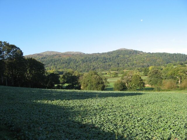
Coed Iolyn is a picturesque woodland located in Caernarfonshire, Wales. Spread over an area of approximately X square kilometers, it is a popular destination for nature enthusiasts and outdoor adventurers. The name "Coed Iolyn" translates to "Wood" or "Forest" in English, which accurately depicts the lush greenery and dense vegetation that can be found here.
The woodland boasts a diverse range of plant species, including oak, ash, beech, and conifers, creating a stunning tapestry of colors throughout the year. The forest floor is carpeted with a variety of wildflowers, adding to the natural beauty of the surroundings. Additionally, Coed Iolyn is home to numerous species of animals, including birds, mammals, and insects, making it an ideal spot for birdwatching and wildlife photography.
There are several well-maintained trails within Coed Iolyn, allowing visitors to explore the woodland at their own pace. These trails offer breathtaking views of the surrounding countryside and provide opportunities for peaceful walks, jogging, or cycling. Along the way, visitors may stumble upon hidden streams, small waterfalls, and charming picnic spots, perfect for a peaceful break amidst nature.
Coed Iolyn is not only a haven for nature lovers but also serves as an important ecological site. The woodland contributes to the overall biodiversity of the region and plays a crucial role in maintaining the local ecosystem. Efforts are made to preserve and protect this natural treasure, ensuring that future generations can continue to enjoy its beauty and tranquility.
If you have any feedback on the listing, please let us know in the comments section below.
Coed Iolyn Images
Images are sourced within 2km of 53.262589/-3.8426555 or Grid Reference SH7775. Thanks to Geograph Open Source API. All images are credited.


Coed Iolyn is located at Grid Ref: SH7775 (Lat: 53.262589, Lng: -3.8426555)
Unitary Authority: Conwy
Police Authority: North Wales
What 3 Words
///monkey.livid.lakes. Near Conwy
Nearby Locations
Related Wikis
Henryd
Henryd () is a village and community on the western slopes of the Conwy valley in Conwy county borough, north Wales. It lies about 2 miles (3.2 km) south...

Conwy town walls
Conwy's town walls are a medieval defensive structure around the town of Conwy in Wales. The walls were constructed between 1283 and 1287 after the foundation...
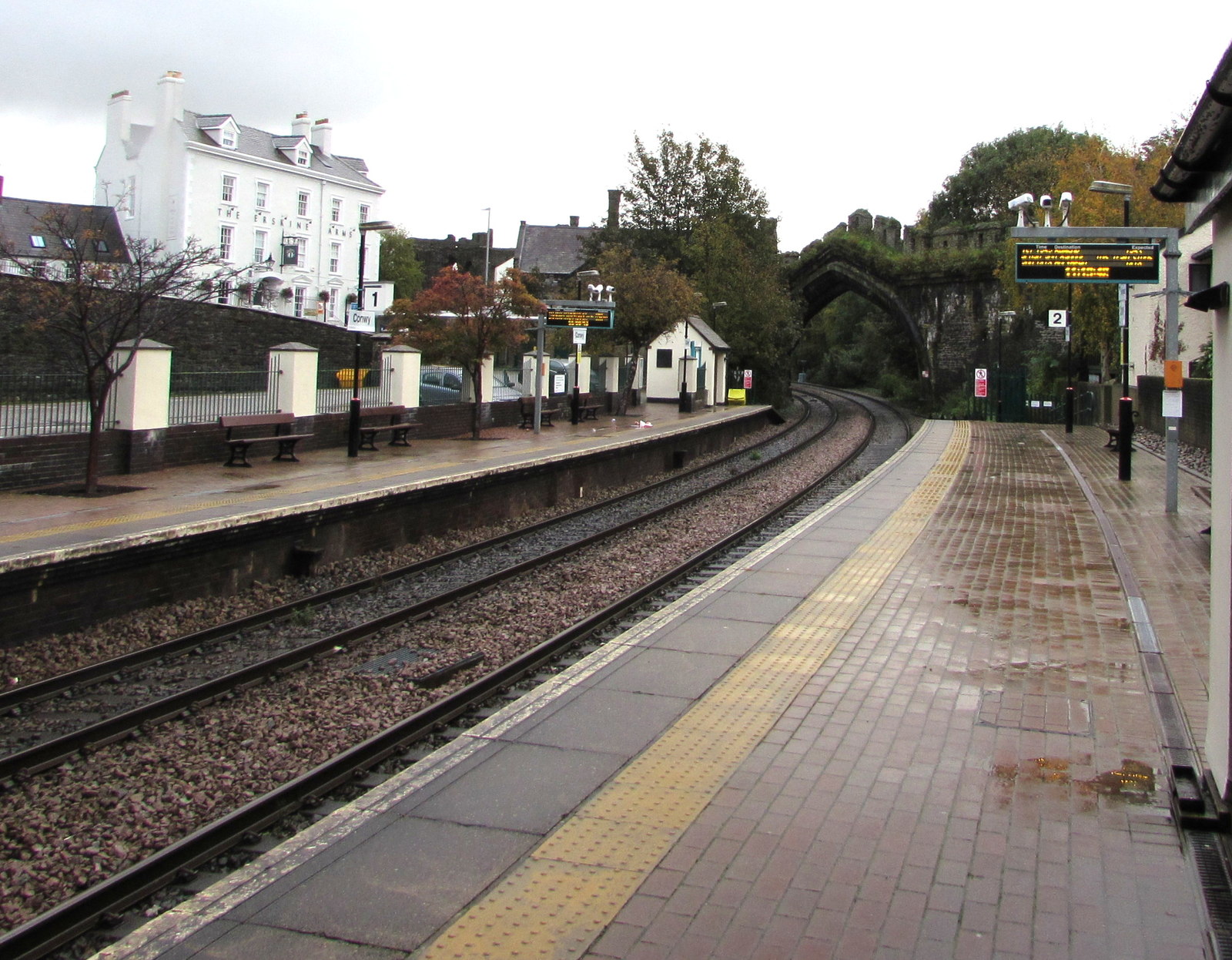
Conwy railway station
Conwy railway station serves the town of Conwy, north Wales, and is located on the North Wales Main Line, between Crewe and Holyhead. It is served by Transport...

Albion Ale House
The Albion Ale House or The Albion is a Grade II listed public house in Conwy, North Wales. Built in 1921, it is a three-room pub with Art Nouveau decor...
Nearby Amenities
Located within 500m of 53.262589,-3.8426555Have you been to Coed Iolyn?
Leave your review of Coed Iolyn below (or comments, questions and feedback).