Allt Gron

Wood, Forest in Cardiganshire

Wales

Allt Gron

View towards Cwm Ystwyth from the Arch
View towards Cwm Ystwyth from the Arch Credit: Nigel Brown

The requested URL returned error: 429 Too Many Requests

If you have any feedback on the listing, please let us know in the comments section below.
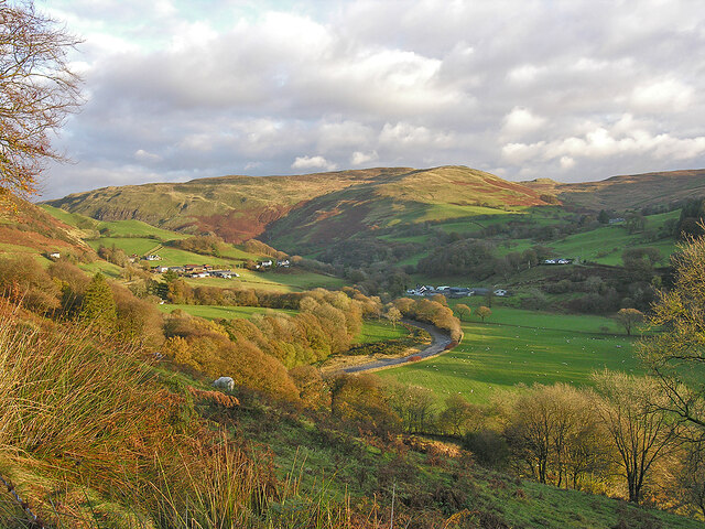
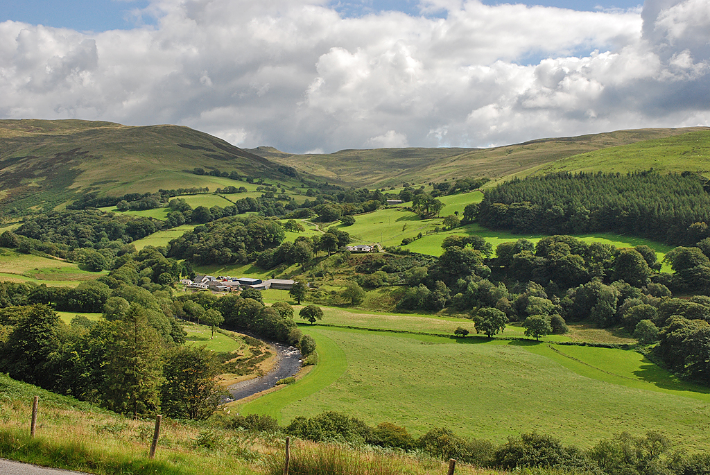
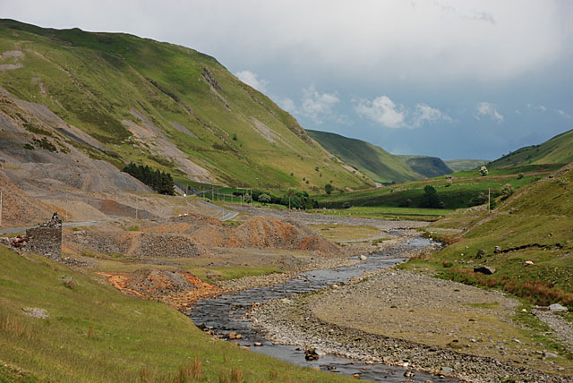
Allt Gron Images

Images are sourced within 2km of 52.355102/-3.8043411 or Grid Reference SN7774. Thanks to Geograph Open Source API. All images are credited.

View towards Cwm Ystwyth from the Arch
Entrance to the Myherin Forest at the Arch
Forestry road in Coed yr Arch
The Arch area Various country walks can be made from here.
The Arch area
Various country walks can be made from here.
Forestry site safety notice In Coed-yr Arch
Forestry site safety notice
In Coed-yr Arch
Afon Ystwyth, Hafod The river cuts through a deep chasm near the edge of the Hafod estate.
Afon Ystwyth, Hafod
The river cuts through a deep chasm near the edge of the Hafod estate.
Nant Gau, Hafod Nant Gau flows under a bridge just short of joining the Afon Ystwyth.
Nant Gau, Hafod
Nant Gau flows under a bridge just short of joining the Afon Ystwyth.
Cavern Cascade, Hafod Of the many eccentric Picturesque adornments that Thomas Johnes (1748 - 1816) made to his Hafod estate, blowing a curved tunnel through a massive rock, in order to afford the visitor an intimate view of a waterfall on the Nant Gau, was something of a pièce-de-resistance. Even today, it is thrilling.
Cavern Cascade, Hafod
Of the many eccentric Picturesque adornments that Thomas Johnes (1748 - 1816) made to his Hafod estate, blowing a curved tunnel through a massive rock, in order to afford the visitor an intimate view of a waterfall on the Nant Gau, was something of a pièce-de-resistance. Even today, it is thrilling.
Entrance to the Cavern Cascade, Hafod The Cavern Cascade (see my 2013 photo <a href="https://www.geograph.org.uk/photo/7313481">SN7772 : Cavern Cascade, Hafod</a>) is one of the most dazzling highlights of the eighteenth century Picturesque features dotted around the Hafod estate. Clear felling the forestry above the cave's entrance resulted in a minor rock fall, which Natural Resources Wales have used as an excuse to close the cave and fall to visitors. There is currently no stated intention nor timetable to re-open it.
Entrance to the Cavern Cascade, Hafod
The Cavern Cascade (see my 2013 photo SN7772 : Cavern Cascade, Hafod) is one of the most dazzling highlights of the eighteenth century Picturesque features dotted around the Hafod estate. Clear felling the forestry above the cave's entrance resulted in a minor rock fall, which Natural Resources Wales have used as an excuse to close the cave and fall to visitors. There is currently no stated intention nor timetable to re-open it.
Rhaedrau, Hafod Looking up from the Rustic Bridge.
Rhaedrau, Hafod
Looking up from the Rustic Bridge.
Y Bont Wladaidd, Hafod A recreated 'Rustic Bridge' on the Hafod estate.
Y Bont Wladaidd, Hafod
A recreated 'Rustic Bridge' on the Hafod estate.
The Arch near Cwmystwyth
Autumnal evening light over Cwm Ystwyth
Field below the B4574 in Cwm Ystwyth
Forestry entrance near Cwymystwyth
B4574 south east of Devils Bridge
B4574 east of The Arch
B4574 at Cwmystwyth village boundary
Show me another place!

Allt Gron is located at Grid Ref: SN7774 (Lat: 52.355102, Lng: -3.8043411)

Unitary Authority: Ceredigion

Police Authority: Dyfed Powys

What 3 Words

///forge.jots.rungs. Near Cwmystwyth, Ceredigion

Nearby Locations

Allt Gron

Related Wikis

Eglwys Newydd Church

Eglwys Newydd Church (also known as St Michael's Church, Hafod) is an early 19th-century church which replaced a previous chapel of ease. The chapel of...

Hafod Uchtryd

Hafod Uchtryd (English: Uchtryd summer mansion) is a wooded and landscaped estate in the Ystwyth valley in Ceredigion, Wales. Near Devil's Bridge, Cwmystwyth...

Cwmystwyth

Cwmystwyth (also Cwm Ystwyth, Welsh pronunciation: [kʊmˈəstʊɨθ]; English: "valley of the River Ystwyth") is a village in Ceredigion, Wales near Devil's...

Cwmystwyth Mines

Cwmystwyth mines are located in Cwmystwyth, Ceredigion, Wales and exploited a part of the Central Wales Orefield. Cwm Ystwyth is a scheduled monument,...

Nearby Amenities

Located within 500m of 52.355102,-3.8043411
Barrier: stile
Source: Local_Knowledge
Lat/Long: 52.3551197/-3.7977072
Barrier: stile
Source: Local_Knowledge
Lat/Long: 52.3546806/-3.7987801
Barrier: stile
Lat/Long: 52.3520299/-3.8046595
Barrier: stile
Lat/Long: 52.3551721/-3.7976268
Post Box
Post Box Type: lamp
Ref: SY23 63
Royal Cypher: EIIR
Royal Cypher Wikidata: Q33102113
Lat/Long: 52.3557096/-3.7979677
The data included in this document is from www.openstreetmap.org. The data is made available under ODbL.

Have you been to Allt Gron?

Leave your review of Allt Gron below (or comments, questions and feedback).