Burstock

Settlement in Dorset

England

Burstock

Lower Sandpit Farm
Lower Sandpit Farm Credit: Vieve Forward

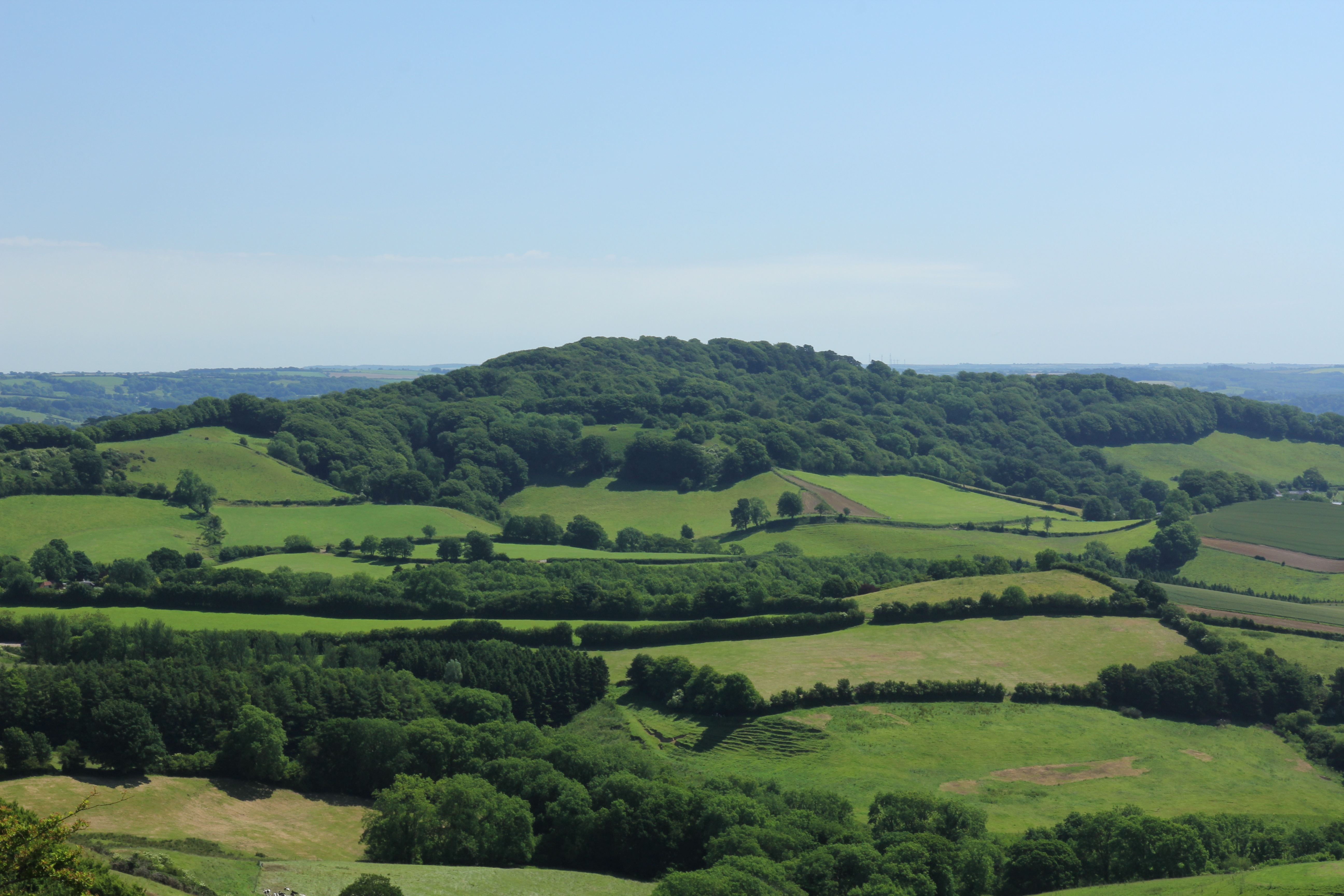
Burstock is a small rural village located in the county of Dorset, England. It is situated about 5 miles northeast of the market town of Beaminster, in an area known for its picturesque countryside and rolling hills. With a population of less than 100 residents, Burstock exudes a tranquil and close-knit community feel.

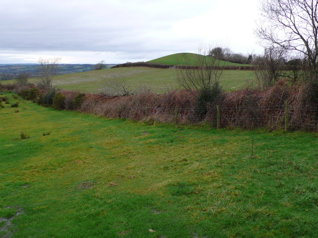
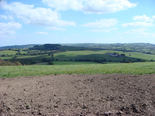
The village is characterized by its quaint thatched cottages, many of which date back several centuries, giving the area a timeless charm. Surrounded by lush green fields and woodlands, Burstock offers a peaceful retreat for those seeking a break from the hustle and bustle of city life.

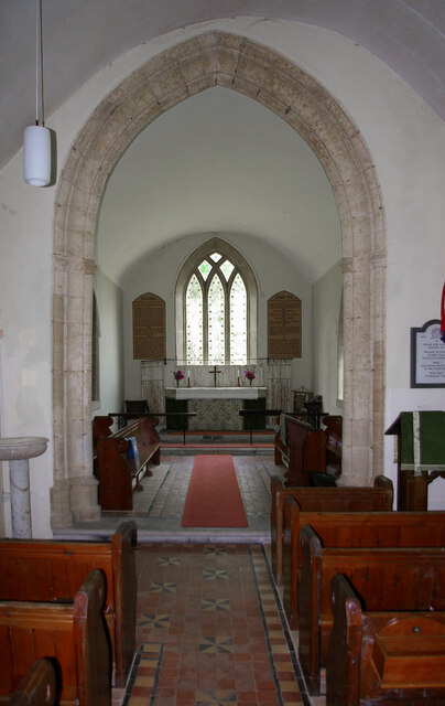
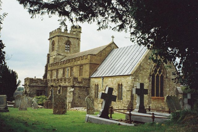
Despite its small size, Burstock boasts a rich history. The village church, St. Andrew's, stands as a centerpiece and is believed to have been built in the 14th century, with some parts dating back even earlier. Its architecture and historical features make it a popular attraction for visitors interested in local heritage.

The village has limited amenities, with no shops or pubs within its boundaries. However, nearby Beaminster provides all the necessary facilities, including shops, cafes, and restaurants. The surrounding area offers ample opportunities for outdoor activities, such as walking, cycling, and horse riding, thanks to the network of footpaths and bridleways crisscrossing the picturesque Dorset countryside.

In conclusion, Burstock, Dorset is a charming and idyllic village, offering a peaceful retreat and a glimpse into the area's rich history. Its natural beauty and close-knit community make it an attractive destination for those seeking a slower pace of life.

If you have any feedback on the listing, please let us know in the comments section below.

Burstock Images

Images are sourced within 2km of 50.819746/-2.82212 or Grid Reference ST4202. Thanks to Geograph Open Source API. All images are credited.

Lower Sandpit Farm
Lower Sandpit Farm
Direction Sign – Signpost on High Street, Broadwindsor Located against the wall of the Old Schoolhouse, on the east side of the B3164 High Street in Broadwindsor parish. 2 arms and annulus finial. 

Milestone Society National ID: DO_ST4302C
Direction Sign – Signpost on High Street, Broadwindsor
Located against the wall of the Old Schoolhouse, on the east side of the B3164 High Street in Broadwindsor parish. 2 arms and annulus finial. Milestone Society National ID: DO_ST4302C
Direction Sign – Signpost opposite Crosskeys House, Broadwindsor Located diagonally opposite Crosskeys House, on the southwest side of the junction of the B3162 and B3163 in Broadwindsor parish. 8 arms and annulus & bar finial. See also <span class="nowrap"><a title="https://www.flickr.com/photos/13706945@N00/8754826669" rel="nofollow ugc noopener" href="https://www.flickr.com/photos/13706945@N00/8754826669">Link</a><img style="margin-left:2px;" alt="External link" title="External link - shift click to open in new window" src="https://s1.geograph.org.uk/img/external.png" width="10" height="10"/></span> , <a title="https://www.geograph.org.uk/photo/1784566" href="https://www.geograph.org.uk/photo/1784566">Link</a> and <a title="https://www.geograph.org.uk/photo/1383085" href="https://www.geograph.org.uk/photo/1383085">Link</a>.

Milestone Society National ID: DO_ST4302
Direction Sign – Signpost opposite Crosskeys House, Broadwindsor
Located diagonally opposite Crosskeys House, on the southwest side of the junction of the B3162 and B3163 in Broadwindsor parish. 8 arms and annulus & bar finial. See also LinkExternal link , Link and Link. Milestone Society National ID: DO_ST4302
Direction Sign – Signpost at Knowle Cross, Burstock Located at Knowle Cross north of Burstock, on the west side of the junction of Rookery Lane, Whetham Mill Lane and Childhay Lane in Burstock parish. 4 arms and annulus finial. 

Milestone Society National ID: DO_ST4103
Direction Sign – Signpost at Knowle Cross, Burstock
Located at Knowle Cross north of Burstock, on the west side of the junction of Rookery Lane, Whetham Mill Lane and Childhay Lane in Burstock parish. 4 arms and annulus finial. Milestone Society National ID: DO_ST4103
Specket Cottage, Specket Lane
Lowdown Farm
Lowdown Farm
Rusty David Brown tractors, Lowdown Farm
Rusty tractor, Lowdown Farm
The Jubilee Trail above Lowdown Farm The trail is extremely boggy here, especially through the fern forest beyond the gate, where your feet are likely to sink ankle-deep in soggy soil even in midsummer.
The Jubilee Trail above Lowdown Farm
The trail is extremely boggy here, especially through the fern forest beyond the gate, where your feet are likely to sink ankle-deep in soggy soil even in midsummer.
Church of the Nativity of St John The Baptist
Church of the Nativity of St John The Baptist East wall window.
Church of the Nativity of St John The Baptist
East wall window.
St Andrew's, Burstock, Somerset
St. Andrew's, Burstock, Somerset A brief description
St. Andrew's, Burstock, Somerset
A brief description
Show me another place!

Burstock is located at Grid Ref: ST4202 (Lat: 50.819746, Lng: -2.82212)

Unitary Authority: Dorset

Police Authority: Dorset

What 3 Words

///ourselves.ironclad.clap. Near Beaminster, Dorset

Nearby Locations

Burstock Burstock

Related Wikis

Burstock

Burstock is a village and civil parish in west Dorset, England, 5 miles (8.0 km) south of Crewkerne. In the 2011 census the parish had 59 dwellings, 49...

Broadwindsor

Broadwindsor ( ) is a village and civil parish in the county of Dorset in South West England. It lies 2 miles (3.2 km) west of Beaminster. Broadwindsor...

Pilsdon Pen

Pilsdon Pen is a 277-metre (909 ft) hill in Dorset in South West England, situated at the north end of the Marshwood Vale, approximately 4.5 miles (7.2...

Conegar Road Cutting

Conegar Road Cutting (grid reference ST439028) is a 0.15 hectare geological Site of Special Scientific Interest in Dorset, notified in 1996. == Sources... ==

Conegar Hill

Conegar Hill is a prominent rise, 214 metres (702 ft) high, just north of the village of Broadwindsor in the Yeovil Scarplands, in the county of Dorset...

Seaborough Hill

Seaborough Hill is a prominent ridge, 204 metres (669 ft) high, on the Dorset-Somerset border in the Yeovil Scarplands in southwestern England. It has...

Lewesdon Hill

Lewesdon Hill is a hill in west Dorset, England. With a maximum elevation of 279 m (915 ft), it is the highest point in Dorset. == Geography == === Location... ===

Blackdown, Dorset

Blackdown is a small village in western Dorset, England; situated 7 miles (11 km) west of Beaminster. With the creation of the new Dorset Council, Blackdown...

Nearby Amenities

Located within 500m of 50.819746,-2.82212
Burstock
Place: village
Wikipedia: en:Burstock
Lat/Long: 50.8236805/-2.8224129
Power: pole
Lat/Long: 50.8163918/-2.8176364
Power: pole
Lat/Long: 50.8164511/-2.8198251
Power: pole
Lat/Long: 50.8164986/-2.8226817
Power: pole
Lat/Long: 50.8165172/-2.8243554
Power: pole
Lat/Long: 50.8166748/-2.8260934
Material: wood
Power: pole
Source: bing
Lat/Long: 50.8224718/-2.8203696
Material: wood
Power: pole
Source: bing
Lat/Long: 50.8223888/-2.8191331
Material: wood
Power: pole
Source: bing
Lat/Long: 50.822321/-2.817733
Direction: 145
Generator Method: photovoltaic
Generator Output Electricity: yes
Generator Solar Modules: 4
Generator Source: solar
Generator Type: solar_photovoltaic_panel
Location: roof
Power: generator
Lat/Long: 50.8238609/-2.8235645
Direction: SSE
Generator Method: photovoltaic
Generator Output Electricity: yes
Generator Solar Modules: 13
Generator Source: solar
Generator Type: solar_photovoltaic_panel
Location: roof
Power: generator
Lat/Long: 50.819813/-2.8219075
Direction: 145
Generator Method: photovoltaic
Generator Output Electricity: yes
Generator Solar Modules: 6
Generator Source: solar
Generator Type: solar_photovoltaic_panel
Location: roof
Power: generator
Lat/Long: 50.8238951/-2.8234967
Power: pole
Lat/Long: 50.8164729/-2.8211347
Direction: 20
Generator Method: photovoltaic
Generator Output Electricity: yes
Generator Source: solar
Generator Type: solar_photovoltaic_panel
Power: generator
Lat/Long: 50.8231957/-2.8215209
The data included in this document is from www.openstreetmap.org. The data is made available under ODbL.

Have you been to Burstock?

Leave your review of Burstock below (or comments, questions and feedback).