Allt Aberrhaedr

Wood, Forest in Carmarthenshire

Wales

Allt Aberrhaedr

Above the Tywi/Towey valley View over the Tywi/Towey valley to the east of Cilycwm.
Above the Tywi/Towey valley Credit: Philip Halling

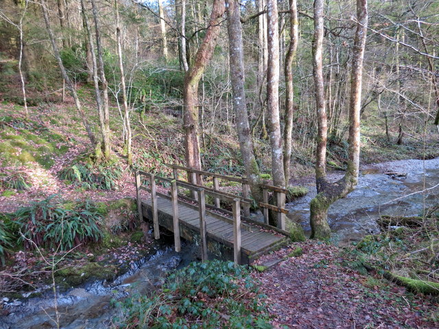
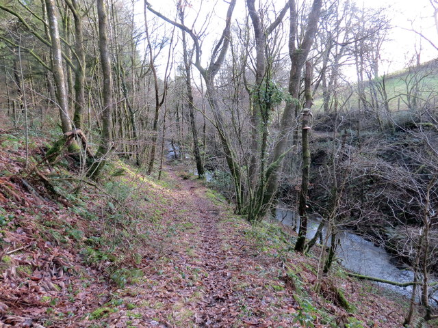
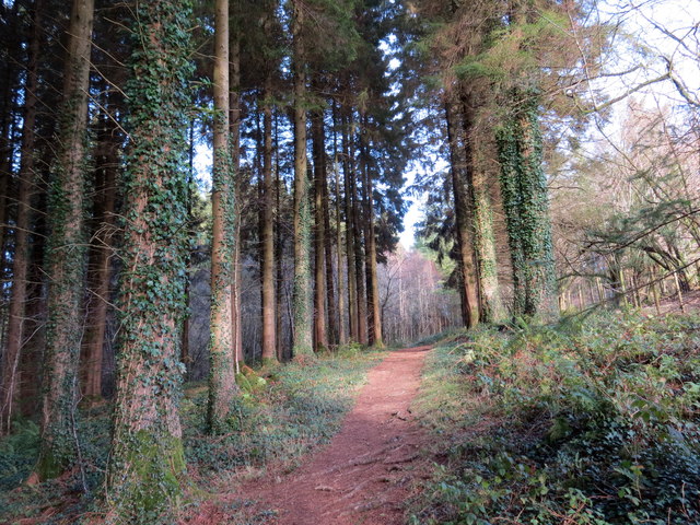
Allt Aberrhaedr is a picturesque woodland located in Carmarthenshire, Wales. Spanning over a vast area, it is a popular destination for nature lovers and outdoor enthusiasts. The woodland is known for its dense forest cover, comprising a variety of tree species, including oak, beech, and ash.

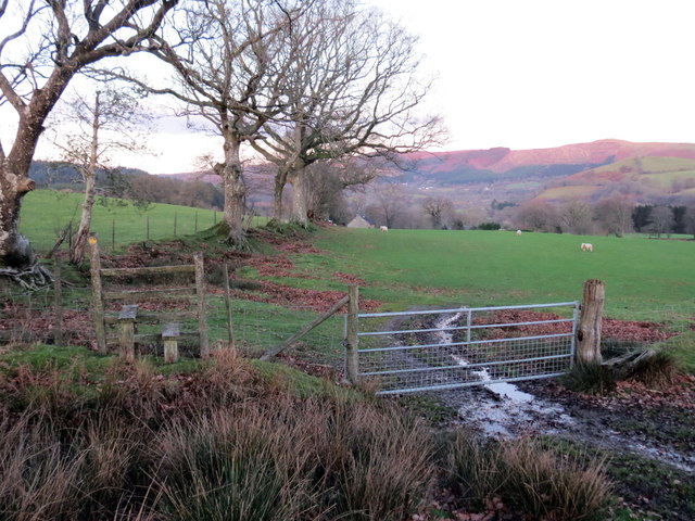
Situated on the slopes of Allt Aberrhaedr Hill, the woodland offers breathtaking views of the surrounding countryside. The area is crisscrossed by several walking trails, allowing visitors to explore its beauty on foot. These paths lead through enchanting groves, past meandering streams, and alongside tranquil ponds, providing a peaceful and serene atmosphere.

Allt Aberrhaedr is not only a haven for flora but also a habitat for a diverse range of wildlife. It is home to various bird species, such as woodpeckers, thrushes, and owls, making it an ideal spot for birdwatching. The forest also houses numerous mammals, including foxes, badgers, and squirrels, which can often be spotted amidst the trees.

The woodland is well-maintained, with clear signage and designated picnic areas for visitors to relax and enjoy the surroundings. It is a popular spot for family outings, nature walks, and photography enthusiasts seeking to capture the area's natural beauty.

Allt Aberrhaedr, Carmarthenshire offers a tranquil escape from the hustle and bustle of everyday life, providing a serene and peaceful sanctuary where visitors can immerse themselves in the beauty of nature.

If you have any feedback on the listing, please let us know in the comments section below.

Allt Aberrhaedr Images

Images are sourced within 2km of 52.058076/-3.8026278 or Grid Reference SN7641. Thanks to Geograph Open Source API. All images are credited.

Above the Tywi/Towey valley View over the Tywi/Towey valley to the east of Cilycwm.
Above the Tywi/Towey valley
View over the Tywi/Towey valley to the east of Cilycwm.
Cilycwm church Cilycwm church is dedicated to St Michael; it is a grade I listed building.  The boarded window gives the impression that it is disused, however it is still in use and has some interesting memorials within.
Cilycwm church
Cilycwm church is dedicated to St Michael; it is a grade I listed building. The boarded window gives the impression that it is disused, however it is still in use and has some interesting memorials within.
Houses in Cilycwm Houses on the main street in the small village of Cilycwm.
Houses in Cilycwm
Houses on the main street in the small village of Cilycwm.
Neuadd Fawr Arms, Cilycwm Neuadd Fawr Arms in Cilycwm is named after a long abandoned nearby country house.
Neuadd Fawr Arms, Cilycwm
Neuadd Fawr Arms in Cilycwm is named after a long abandoned nearby country house.
Soar Chapel, Ty-newydd
Farmland east of Cilcym
Ger Penstacan / Near Penstacan Llwybr i'e ucheldir yn gadael trac.

A path to the high ground leaving a track.
Ger Penstacan / Near Penstacan
Llwybr i'e ucheldir yn gadael trac. A path to the high ground leaving a track.
Pompren Nant y Rhaeadr / Nant y Rhaeadr Footbridge Pompren yn rhychwantu Nant y Rhaeadr.


A footbridge spanning Nant y Rhaeadr (trans. stream of the waterfall).
Pompren Nant y Rhaeadr / Nant y Rhaeadr Footbridge
Pompren yn rhychwantu Nant y Rhaeadr. A footbridge spanning Nant y Rhaeadr (trans. stream of the waterfall).
Llwybr glanafon / Riverside path Llwybr cyhoeddus ar lan Nant y Rhaeadr.

A public footpath above Nant y Rhaeadr (trans. stream of the waterfall).
Llwybr glanafon / Riverside path
Llwybr cyhoeddus ar lan Nant y Rhaeadr. A public footpath above Nant y Rhaeadr (trans. stream of the waterfall).
Llwybr y coedwig / Woodland path Llwybr o fewn planhigfa goniferaidd Coed y Rhaeadr.

A path within Coed y Rhaeadr (trans. waterfall wood) conifer plantation.
Llwybr y coedwig / Woodland path
Llwybr o fewn planhigfa goniferaidd Coed y Rhaeadr. A path within Coed y Rhaeadr (trans. waterfall wood) conifer plantation.
Tuag at Graig Rhosan / Towards Craig Rhosan Llwybr cyhoeddus yn arwain at Graig Rhosan, y bryn yn y pellter.


A public footpath heading towards Craig Rhosan (trans. little moor crag), the hill in the distance.
Tuag at Graig Rhosan / Towards Craig Rhosan
Llwybr cyhoeddus yn arwain at Graig Rhosan, y bryn yn y pellter. A public footpath heading towards Craig Rhosan (trans. little moor crag), the hill in the distance.
Llwybr o dan Craig Rhosan / A footpath below Craig Rhosan Llwybr cyhoeddus o dan Craig Rhosan yn arwain at Nant Rhosan.

A public footpath below Craig Rhosan heading towards Nant Rhosan (trans. little moor stream).
Llwybr o dan Craig Rhosan / A footpath below Craig Rhosan
Llwybr cyhoeddus o dan Craig Rhosan yn arwain at Nant Rhosan. A public footpath below Craig Rhosan heading towards Nant Rhosan (trans. little moor stream).
Llwybr ger Craig Rhosan / Path near Craig Rhosan Llwybr cyhoeddus yn arwain at Graig Rhosan, y bryn yn y pellter.

A public footpath heading towards Craig Rhosan (trans. little moor crag), the hill in the distance.
Llwybr ger Craig Rhosan / Path near Craig Rhosan
Llwybr cyhoeddus yn arwain at Graig Rhosan, y bryn yn y pellter. A public footpath heading towards Craig Rhosan (trans. little moor crag), the hill in the distance.
Llwybr Home Farm / Home Farm Path Llwybr cyhoeddus yn mynd heibio i eiddo Home Ffarm.

A public footpath passing the property of Home Farm.
Llwybr Home Farm / Home Farm Path
Llwybr cyhoeddus yn mynd heibio i eiddo Home Ffarm. A public footpath passing the property of Home Farm.
Llwybr Glanrhosan / Glanrhosan Path Llwybr cyhoeddus yn croesi pont faen sy'n rhychwantu Nant Rhosan.


A public footpath crosses a stone bridge spanning Nant Rhosan (trans. little moor stream).
Llwybr Glanrhosan / Glanrhosan Path
Llwybr cyhoeddus yn croesi pont faen sy'n rhychwantu Nant Rhosan. A public footpath crosses a stone bridge spanning Nant Rhosan (trans. little moor stream).
Llwybr ger Glanrhosan / Footpath near Glanrhosan Llwybr cyhoeddus ger Ffarm Glanrhosan yn  gadael yr heol.

A public footpath near Glanrhosan Farm (trans. bank of the little moor [stream]) exiting the road.
Llwybr ger Glanrhosan / Footpath near Glanrhosan
Llwybr cyhoeddus ger Ffarm Glanrhosan yn gadael yr heol. A public footpath near Glanrhosan Farm (trans. bank of the little moor [stream]) exiting the road.
Llwybr Pen Fedw Fach / Pen Fedw Fach Path Llwybr cyhoeddus yn mynd tuag at Ffarm Pen Fedw Fach.

A public footpath heading towards Pen Fedw Fach Farm (top /end of the birch grove lesser farm).
Llwybr Pen Fedw Fach / Pen Fedw Fach Path
Llwybr cyhoeddus yn mynd tuag at Ffarm Pen Fedw Fach. A public footpath heading towards Pen Fedw Fach Farm (top /end of the birch grove lesser farm).
Show me another place!

Allt Aberrhaedr is located at Grid Ref: SN7641 (Lat: 52.058076, Lng: -3.8026278)

Unitary Authority: Carmarthenshire

Police Authority: Dyfed Powys

What 3 Words

///ramps.warriors.fake. Near Llandovery, Carmarthenshire

Related Wikis

Cilycwm transmitting station

The Cilycwm television relay station is sited on high ground to the east of the village of Cilycwm to the north of Llandovery in Carmarthenshire, South...

Cilycwm

Cilycwm (Welsh: Cil-y-cwm, IPA: [ˈkiːl ə ˈkʊm]) is a village, parish and community located in Carmarthenshire, Wales. The community population taken at...

Church of St Michael, Cilycwm

The Church of St Michael, Cilycwm is the Church in Wales parish church for the parish of Cilycwm, near Llandovery, Wales. The rubble building with pink...

Pwllpriddog Oak

The Pwllpriddog Oak (Welsh: Derwen Pwllpriddog), also known as the Rhandirmwyn Oak, is a 600–700 year old tree located in farmland near Rhandirmwyn in...

Fforest (Carmarthenshire)

Fforest is the name applied to a small upland area adjoining the Vale of Towy, some 4 km north of the town of Llandovery in Carmarthenshire, Wales. Stretching...

Rhandirmwyn

Rhandirmwyn (or Rhandir-mwyn) is a small village in the north east of Carmarthenshire, Wales. Located in the upper Towy valley, 3 km north of Cilycwm village...

Mynydd Mallaen

Mynydd Mallaen (Welsh: [ˈmənɨð ˈmaɬain]) is an expansive plateau to the northwest of Cilycwm in northeast Carmarthenshire, Wales. It forms part of the...

Cynghordy railway station

Cynghordy railway station () serves the rural community of Cynghordy near Llandovery, Carmarthenshire, Wales. The station is on the Heart of Wales Line...

Nearby Amenities

Located within 500m of 52.058076,-3.8026278
Place: farm
Lat/Long: 52.0599545/-3.8065191
Power: pole
Lat/Long: 52.0591486/-3.7964362
Power: pole
Lat/Long: 52.0580486/-3.7974635
Power: pole
Lat/Long: 52.0572619/-3.7982118
Power: pole
Lat/Long: 52.0563367/-3.7990835
Power: pole
Lat/Long: 52.0555104/-3.7998614
Power: pole
Transformer: distribution
Lat/Long: 52.0545604/-3.8007894
Power: pole
Transformer: distribution
Lat/Long: 52.0605685/-3.8065133
The data included in this document is from www.openstreetmap.org. The data is made available under ODbL.

Have you been to Allt Aberrhaedr?

Leave your review of Allt Aberrhaedr below (or comments, questions and feedback).