Coed Cae-du

Wood, Forest in Merionethshire

Wales

Coed Cae-du

The north side of Bwlch Goriwared A mixture of heather-covered hillside and better grazing, through which the old drove road to Bwlch Goriwared climbs.
The north side of Bwlch Goriwared Credit: Nigel Brown

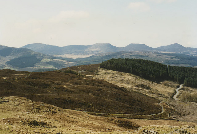
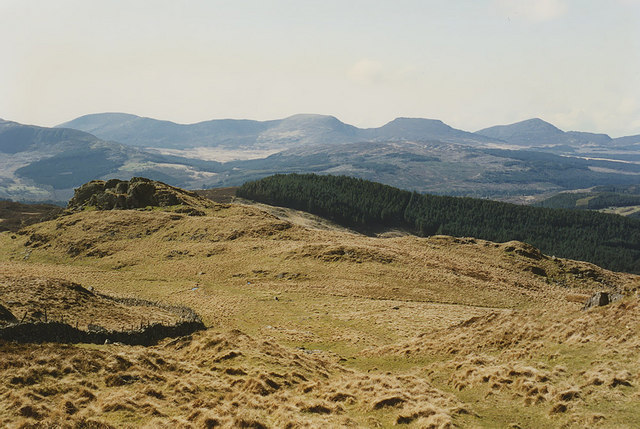
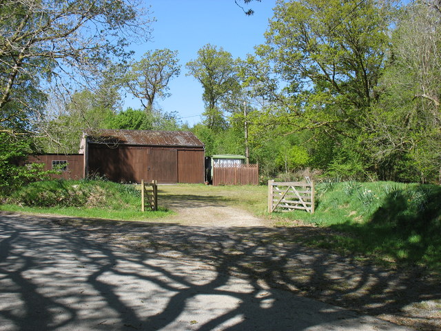
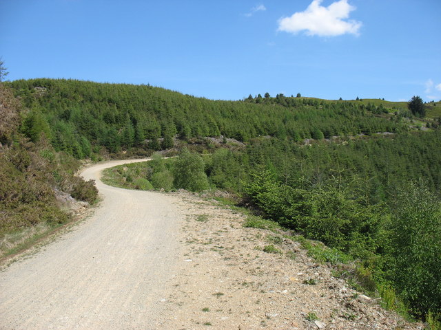
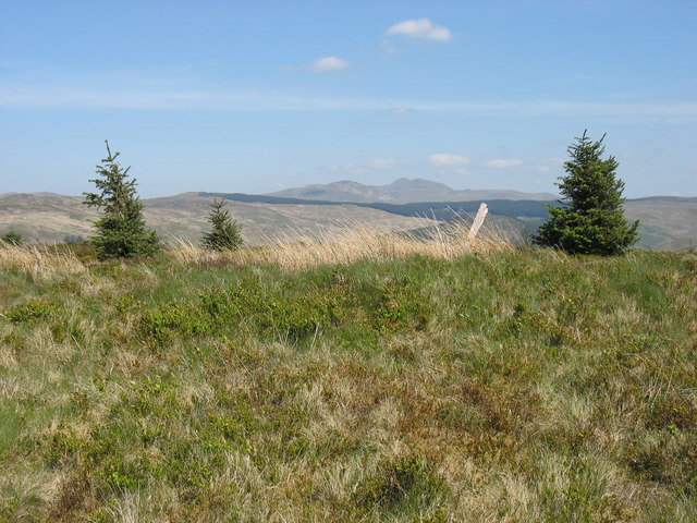
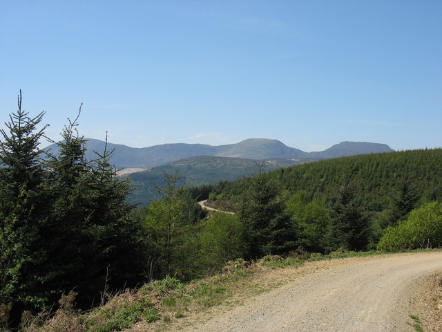
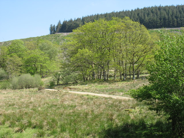
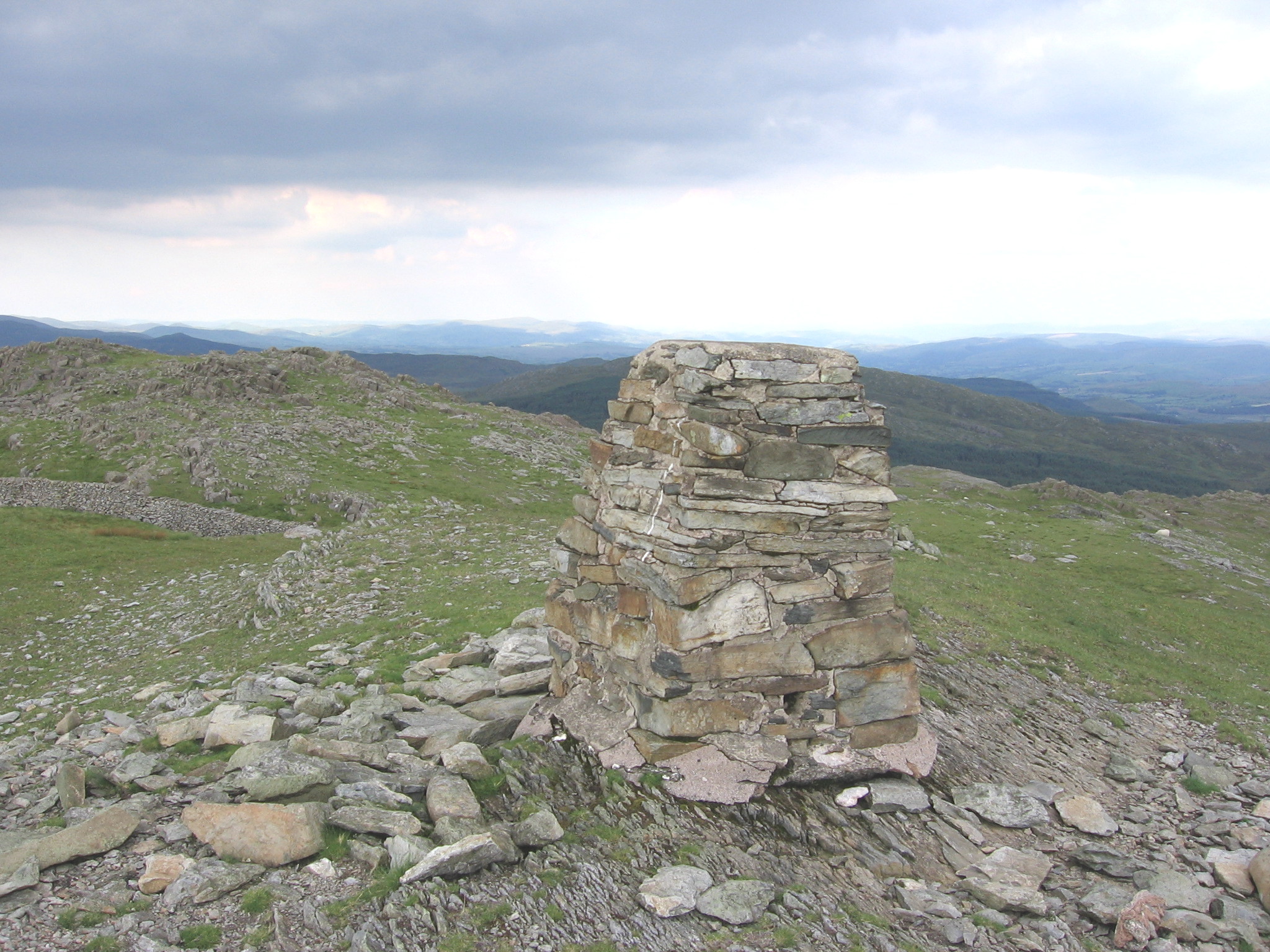
Coed Cae-du, located in Merionethshire, is a picturesque woodland area renowned for its breathtaking natural beauty. Situated in the heart of North Wales, this ancient forest covers a vast expanse of land, offering visitors a tranquil retreat amidst nature's splendor.

Home to a diverse array of flora and fauna, Coed Cae-du boasts an impressive variety of tree species, including oak, beech, birch, and pine. The dense canopy provides a haven for numerous woodland creatures, such as deer, badgers, foxes, and a plethora of bird species. Nature enthusiasts can expect to witness an abundance of wildlife in their natural habitat while exploring the forest's well-maintained trails.

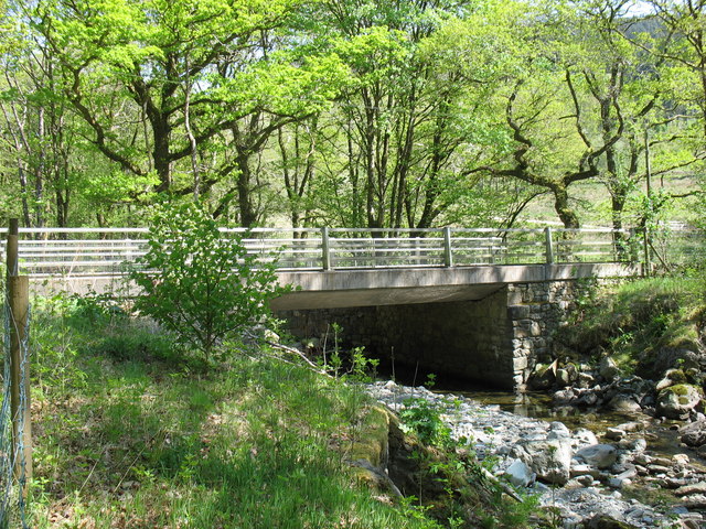
The forest's enchanting atmosphere is further enhanced by a series of babbling brooks and small waterfalls that meander through the landscape, creating a soothing soundtrack for visitors to enjoy. These water features also contribute to the rich biodiversity of the area, providing a habitat for various aquatic plants and animals.

Coed Cae-du has long been cherished by locals and tourists alike for its recreational opportunities. The forest offers a range of activities, including hiking, cycling, and picnicking, making it an ideal destination for outdoor enthusiasts and families seeking a day of adventure and relaxation.

For those seeking a deeper connection with nature, the forest also offers opportunities for wildlife spotting, birdwatching, and even wild camping in designated areas. The peaceful ambiance and stunning scenery make Coed Cae-du a popular destination for nature photography and painting enthusiasts as well.

In summary, Coed Cae-du in Merionethshire is a majestic woodland retreat that offers visitors a chance to immerse themselves in the beauty of nature. With its diverse flora and fauna, tranquil water features, and recreational opportunities, this forest is a must-visit destination for nature lovers seeking a truly memorable experience.

If you have any feedback on the listing, please let us know in the comments section below.
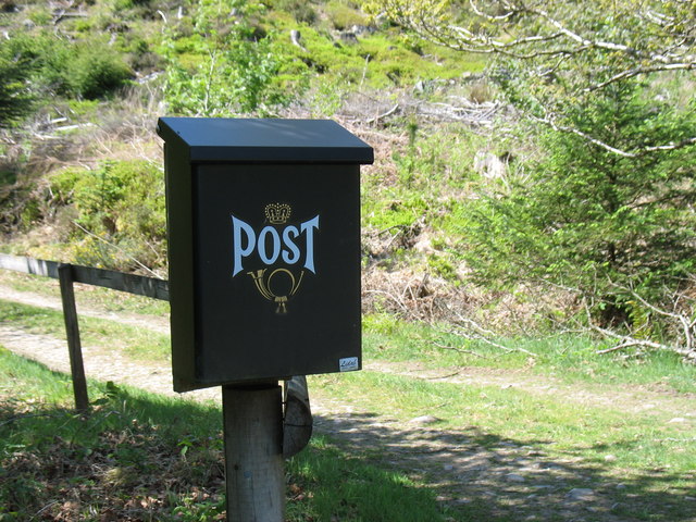
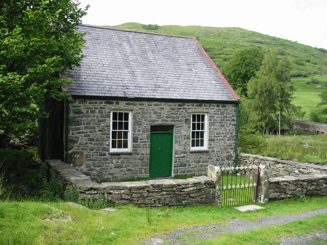
Coed Cae-du Images

Images are sourced within 2km of 52.822894/-3.8375727 or Grid Reference SH7626. Thanks to Geograph Open Source API. All images are credited.

The north side of Bwlch Goriwared A mixture of heather-covered hillside and better grazing, through which the old drove road to Bwlch Goriwared climbs.
The north side of Bwlch Goriwared
A mixture of heather-covered hillside and better grazing, through which the old drove road to Bwlch Goriwared climbs.
View west from near Ffynnon Shôn Looking down the lower part of the long western approach to Rhobell Fawr in the direction of Bwlch Goriwared. The distinctive rocky knoll on the left can be seen from below in <a href="https://www.geograph.org.uk/photo/671999">SH7624 : Hillside east of Bwlch Goriwared</a>. The Rhinogydd form the horizon.
View west from near Ffynnon Shôn
Looking down the lower part of the long western approach to Rhobell Fawr in the direction of Bwlch Goriwared. The distinctive rocky knoll on the left can be seen from below in SH7624 : Hillside east of Bwlch Goriwared. The Rhinogydd form the horizon.
Near Dolfrwynog
Near Dolfrwynog
A track in the Coed-y-Brenin forest The approach to climb Moel Hafodowen.
A track in the Coed-y-Brenin forest
The approach to climb Moel Hafodowen.
Information board in the Coed-y-Brenin forest This information board and the one adjacent to it (shown in <a href="https://www.geograph.org.uk/photo/2471360">SH7526 : Information board in the Coed-y-Brenin forest</a>) seem particularly ambitious, but I wonder how many people ever see them.
Information board in the Coed-y-Brenin forest
This information board and the one adjacent to it (shown in SH7526 : Information board in the Coed-y-Brenin forest) seem particularly ambitious, but I wonder how many people ever see them.
Information board in the Coed-y-Brenin forest This information board and the one adjacent to it (shown in <a href="https://www.geograph.org.uk/photo/2471351">SH7526 : Information board in the Coed-y-Brenin forest</a>) seem particularly ambitious, but I wonder how many people ever see them.
Information board in the Coed-y-Brenin forest
This information board and the one adjacent to it (shown in SH7526 : Information board in the Coed-y-Brenin forest) seem particularly ambitious, but I wonder how many people ever see them.
The summit of Moel Hafodowen
A track in the Coed-y-Brenin forest The Rhinogs (rough walking indeed!) make a pleasing backdrop to this photo.
A track in the Coed-y-Brenin forest
The Rhinogs (rough walking indeed!) make a pleasing backdrop to this photo.
Waiting for the post! The sight of this postbox made me wonder if I had been transported from Wales to Bavaria! (However I have subsequently learnt that this particular postbox is Swedish.)
Waiting for the post!
The sight of this postbox made me wonder if I had been transported from Wales to Bavaria! (However I have subsequently learnt that this particular postbox is Swedish.)
Coed Cae-cocyn from Dolydd
Road bridge over Afon Wen at Dolydd The road downstream along the east side of the Afon Wen, heading for Dolgellau, is one of many narrow lanes in this part of Wales
Road bridge over Afon Wen at Dolydd
The road downstream along the east side of the Afon Wen, heading for Dolgellau, is one of many narrow lanes in this part of Wales
View across to Cader Idris Range Glorious view of the full Cader Idris Range
View across to Cader Idris Range
Glorious view of the full Cader Idris Range
Coed-y-Brenin Porphyry Cu-Mo Deposit - Phyllic Zone Porphyry copper deposits are of a major economic importance due to the high tonnage (but often low grades) of copper, molybdenum and gold. This deposit contains 200Mt of ore at 0.3% Cu with some Mo and Au. It would be economic only through opencasting, which I can't see happening any time soon!
A process that made PCDs economic was developed in the area, at Glasdir copper mine SE of here. <a href="https://www.geograph.org.uk/photo/3392787">SH7422 : Glasdir Copper Mine</a> <span class="nowrap"><a title="http://en.wikipedia.org/wiki/Bingham_Canyon_Mine" rel="nofollow ugc noopener" href="http://en.wikipedia.org/wiki/Bingham_Canyon_Mine">Link</a><img style="margin-left:2px;" alt="External link" title="External link - shift click to open in new window" src="https://s1.geograph.org.uk/img/external.png" width="10" height="10"/></span>

Hydrothermal and magmatic fluids circulate to create alteration zones. The ore is usually hosted in the outer edge of the stock. 

Potassic zone, usually an igneous stock (volcanic magma chamber). 
Can be rich in secondary orthoclase, quartz, biotite and chlorite/sericite. 

Phyllic zone, altered host rocks. In this case volcanics and sediments.
Pyrite rich (10-15%), quartz, sericite, chlorite and illite. 

+/- Argillic zone. Varies in size, clay alteration. 

Propylitic zone, always present. Lightly altered with pyrite, chlorite, quartz, carbonates and epidote. 

This shows the phyllic zone. The pyrite has oxidised to produce the red stained colour.
Coed-y-Brenin Porphyry Cu-Mo Deposit - Phyllic Zone
Porphyry copper deposits are of a major economic importance due to the high tonnage (but often low grades) of copper, molybdenum and gold. This deposit contains 200Mt of ore at 0.3% Cu with some Mo and Au. It would be economic only through opencasting, which I can't see happening any time soon! A process that made PCDs economic was developed in the area, at Glasdir copper mine SE of here. SH7422 : Glasdir Copper Mine LinkExternal link Hydrothermal and magmatic fluids circulate to create alteration zones. The ore is usually hosted in the outer edge of the stock. Potassic zone, usually an igneous stock (volcanic magma chamber). Can be rich in secondary orthoclase, quartz, biotite and chlorite/sericite. Phyllic zone, altered host rocks. In this case volcanics and sediments. Pyrite rich (10-15%), quartz, sericite, chlorite and illite. +/- Argillic zone. Varies in size, clay alteration. Propylitic zone, always present. Lightly altered with pyrite, chlorite, quartz, carbonates and epidote. This shows the phyllic zone. The pyrite has oxidised to produce the red stained colour.
Coed-y-Brenin The forestry commission forest in Mid Wales.
Coed-y-Brenin
The forestry commission forest in Mid Wales.
Forestry Track
Forestry Track
Coed-y-Brenin Forest A view of the forest from Moel Hafodowen.
Coed-y-Brenin Forest
A view of the forest from Moel Hafodowen.
Show me another place!

Coed Cae-du is located at Grid Ref: SH7626 (Lat: 52.822894, Lng: -3.8375727)

Unitary Authority: Gwynedd

Police Authority: North Wales

What 3 Words

///speaker.prevents.thousands. Near Bronaber, Gwynedd

Related Wikis

Merionethshire

Until 1974, Merionethshire or Merioneth (Welsh: Meirionnydd or Sir Feirionnydd) was an administrative county in the north-west of Wales, later classed...

Abergeirw

Abergeirw is a hamlet located in Gwynedd, North Wales. The village of nine properties is located between Dolgellau and Trawsfynydd. On 19 December 2008...

Rhobell Fawr

Rhobell Fawr is the site of an ancient volcano that was active during the Early Ordovician period in the Arenig range within the Snowdonia National Park...

Pistyll Cain

Pistyll Cain, also written as Pistill Cain and Pistill Y Caen, is a renowned waterfall in Meirionnydd (Sir Feirionnydd) in north Wales. It lies north-east...

Nearby Amenities

Located within 500m of 52.822894,-3.8375727
Ford: yes
Lat/Long: 52.8223613/-3.8402462
Power: pole
Lat/Long: 52.8206343/-3.8433807
Power: pole
Lat/Long: 52.8212049/-3.8425653
Power: pole
Lat/Long: 52.8217738/-3.8425545
Power: pole
Lat/Long: 52.8223038/-3.8425465
Power: pole
Lat/Long: 52.8232423/-3.8425438
Power: pole
Lat/Long: 52.8238695/-3.842525
Power: pole
Lat/Long: 52.8232974/-3.8416667
Power: pole
Lat/Long: 52.8233428/-3.8410149
Power: pole
Lat/Long: 52.8232018/-3.8403229
Power: pole
Lat/Long: 52.8234935/-3.8389979
Ford: yes
Lat/Long: 52.8234249/-3.8398026
Cwm Blaen-y-glyn
Place: locality
Lat/Long: 52.8216501/-3.8408477
The data included in this document is from www.openstreetmap.org. The data is made available under ODbL.

Have you been to Coed Cae-du?

Leave your review of Coed Cae-du below (or comments, questions and feedback).