Burrygreen

Settlement in Glamorgan
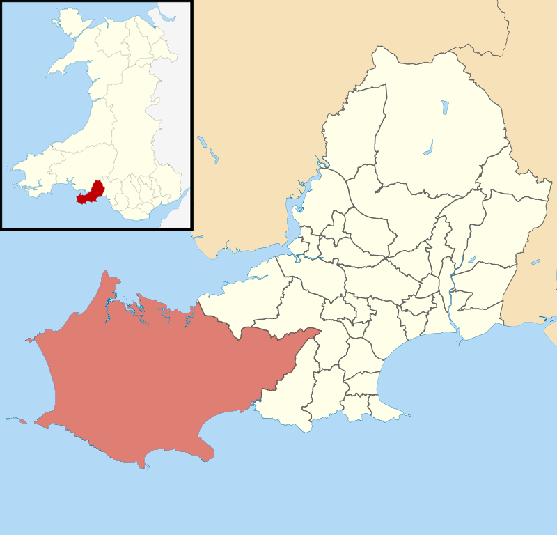
Wales

Burrygreen

Gate into Cors Landimore / Landimore Marsh The National Trust protect this area of saltmarsh in conjunction with local farmers who graze their sheep on it of course. Ponies and cattle also freely graze the marsh area in summer. The signage with WGWA on it refers to a private shoot by the West Glamorgan Wildfowlers Association I assume. There is a car park and turning circle here for accessing the marsh footpaths.
Gate into Cors Landimore / Landimore Marsh Credit: Jeremy Bolwell

Burrygreen, located in the county of Glamorgan, Wales, is a quaint and picturesque village nestled in the rolling hills of the Welsh countryside. With a population of approximately 500 residents, it offers a peaceful and close-knit community atmosphere.

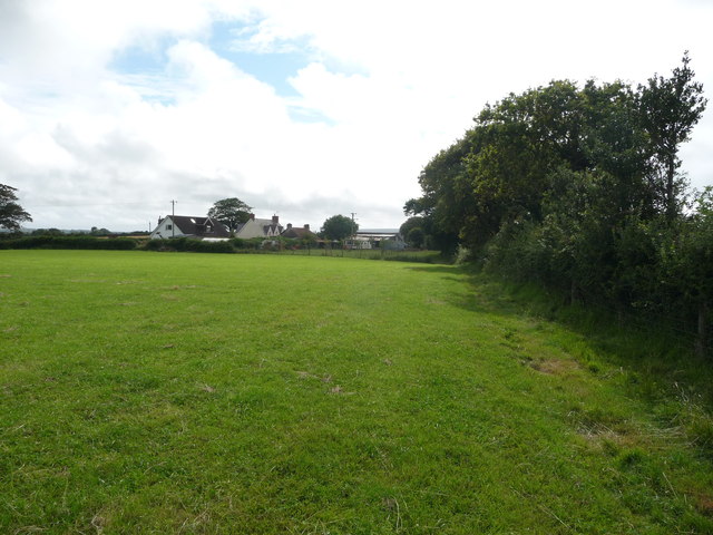
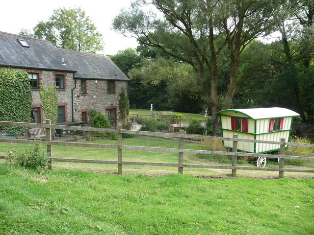
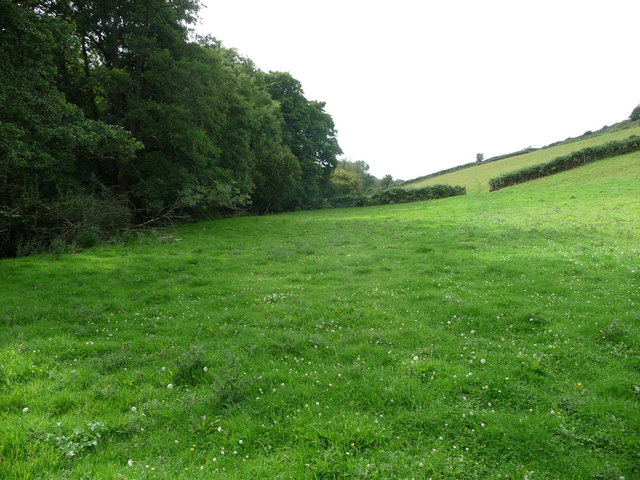
The village is renowned for its stunning natural beauty, with lush green landscapes, meandering streams, and charming stone cottages dotting the countryside. Burrygreen is also blessed with an abundance of wildlife, making it a haven for nature enthusiasts and birdwatchers.

The heart of the village is its historic square, which features a village green surrounded by a few local shops, a traditional pub, and a small church. The pub, known as The Green Dragon, is a popular gathering spot for locals and visitors alike, offering a cozy atmosphere and traditional Welsh cuisine.

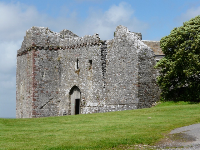
Burrygreen is rich in history, with several historical landmarks scattered throughout the area. One notable landmark is Burrygreen Castle, a 12th-century fortification built by the Normans. The castle ruins stand proudly on a hilltop, offering panoramic views of the surrounding countryside.

The village also boasts a strong sense of community spirit, with various events and festivals held throughout the year. The Burrygreen Summer Fair is a highlight, featuring local crafts, food stalls, and live music, attracting visitors from far and wide.

Overall, Burrygreen, Glamorgan, is a delightful village that offers a peaceful retreat from the hustle and bustle of modern life. With its natural beauty, rich history, and welcoming community, it is a place that captures the essence of Welsh charm.

If you have any feedback on the listing, please let us know in the comments section below.
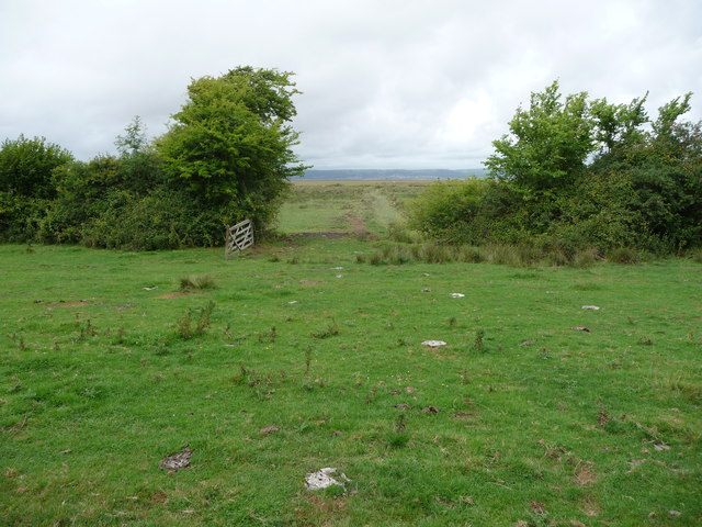
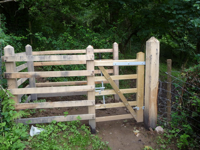
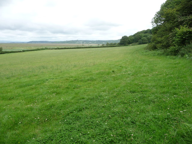
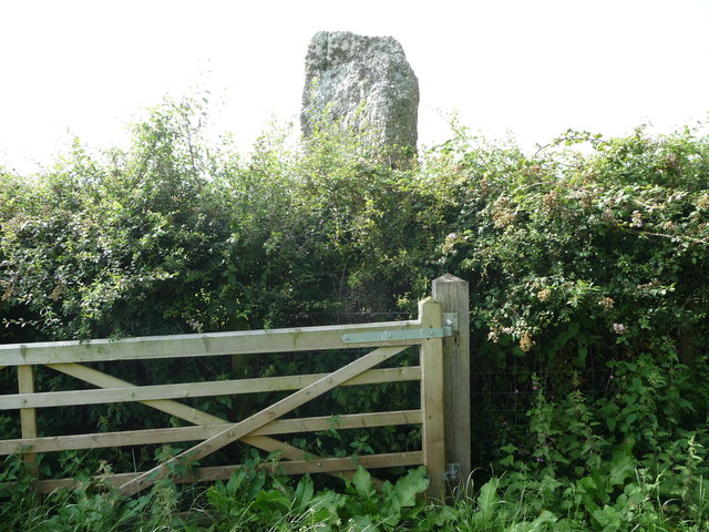
Burrygreen Images

Images are sourced within 2km of 51.601315/-4.222901 or Grid Reference SS4691. Thanks to Geograph Open Source API. All images are credited.

Gate into Cors Landimore / Landimore Marsh The National Trust protect this area of saltmarsh in conjunction with local farmers who graze their sheep on it of course. Ponies and cattle also freely graze the marsh area in summer. The signage with WGWA on it refers to a private shoot by the West Glamorgan Wildfowlers Association I assume. There is a car park and turning circle here for accessing the marsh footpaths.
Gate into Cors Landimore / Landimore Marsh
The National Trust protect this area of saltmarsh in conjunction with local farmers who graze their sheep on it of course. Ponies and cattle also freely graze the marsh area in summer. The signage with WGWA on it refers to a private shoot by the West Glamorgan Wildfowlers Association I assume. There is a car park and turning circle here for accessing the marsh footpaths.
House at Landimore above the marsh A cool looking property beside the lane and overlooking the wonderful marshes below.
House at Landimore above the marsh
A cool looking property beside the lane and overlooking the wonderful marshes below.
Open gate from fields onto Llanrhidian Marsh The cattle and sheep have vacated this field in favour of the richer grazing out on the saltmarsh.
Open gate from fields onto Llanrhidian Marsh
The cattle and sheep have vacated this field in favour of the richer grazing out on the saltmarsh.
New kissing-gate near Weobley Castle The mud stains look very recent.
New kissing-gate near Weobley Castle
The mud stains look very recent.
Footpath across fields above Llanrhidian Marsh The footpath follows the field edge here towards Weobley Castle.
Footpath across fields above Llanrhidian Marsh
The footpath follows the field edge here towards Weobley Castle.
Samson's Jack standing stone on Gower The standing stone is in horse paddocks on the other side of the hedge to the public footpath.
Samson's Jack standing stone on Gower
The standing stone is in horse paddocks on the other side of the hedge to the public footpath.
Approaching Manselfold The footpath follows the field edge.
Approaching Manselfold
The footpath follows the field edge.
Treelined track This track leads to a renovated property.
Treelined track
This track leads to a renovated property.
Renovated property with gypsy caravan The cottages may well be holiday lets or a second home, maybe more likely the latter, and the caravan is interesting and eyecatching.
Renovated property with gypsy caravan
The cottages may well be holiday lets or a second home, maybe more likely the latter, and the caravan is interesting and eyecatching.
Footpath across fields beside Burry Pill Burry Pill is a little stream that runs along the valley bottom.
Footpath across fields beside Burry Pill
Burry Pill is a little stream that runs along the valley bottom.
Part of Burry Pill A lively little brook that runs in this narrow valley bottom.
Part of Burry Pill
A lively little brook that runs in this narrow valley bottom.
Footpaths below Kittlehill In the wood edge footpaths cross and branch off.
Footpaths below Kittlehill
In the wood edge footpaths cross and branch off.
Gate onto hillside This new gate, one of a few in this immediate area, opens onto, or from a steep overgrown hillside.
Gate onto hillside
This new gate, one of a few in this immediate area, opens onto, or from a steep overgrown hillside.
Trig point on Ryer's Down, Gower A well preserved pillar on the summit of Ryer's Down, easily reached from the lane to the west on National Trust land. 
This is the view across the Burry Inlet / Loughor Estuary to Llanelli. In the distance on the shoreline just to the right of the pillar you can see the row of residences from this photo <a href="https://www.geograph.org.uk/photo/276923">SS4999 : Millennium Quay development</a> ending in this white building <a href="https://www.geograph.org.uk/photo/1025504">SS4999 : Discovery Visitor Centre for the Millennium Coastal Park</a> at the centre of shot.
Trig point on Ryer's Down, Gower
A well preserved pillar on the summit of Ryer's Down, easily reached from the lane to the west on National Trust land. This is the view across the Burry Inlet / Loughor Estuary to Llanelli. In the distance on the shoreline just to the right of the pillar you can see the row of residences from this photo SS4999 : Millennium Quay development ending in this white building SS4999 : Discovery Visitor Centre for the Millennium Coastal Park at the centre of shot.
Ryer's Down - summit trig point Trig S2383 at the 114m summit of Ryer's Down, immediately above the village of Burry Green.
Ryer's Down - summit trig point
Trig S2383 at the 114m summit of Ryer's Down, immediately above the village of Burry Green.
Recumbent stone Given the proliferation of Bronze Age stones and cairns elsewehere on Gower, particularly on the hills, it's easy to believe that this (unmarked) stone at the summit of Ryer's Down was once standing.
Recumbent stone
Given the proliferation of Bronze Age stones and cairns elsewehere on Gower, particularly on the hills, it's easy to believe that this (unmarked) stone at the summit of Ryer's Down was once standing.
Path to the top of Ryer's Down The considerably higher Llanmadoc Hill at 186m forms the background.
Path to the top of Ryer's Down
The considerably higher Llanmadoc Hill at 186m forms the background.
The remains of Llanmadoc school All that remains in 2011 - a few low walls and some rubble - of the school that educated the children of the parish from 1860 to 1935. A small bench has been erected to commemorate the school's existence. The Llanmadoc, Cheriton and Landimore History Society has also undertaken considerable restoration work at the school and members have erected a new information board sponsored by the Gower Society. There is also a video available locally which features some old photos of the school, along with the original plans, and some recollections of former pupils recorded 75 years after the school's closure.
The remains of Llanmadoc school
All that remains in 2011 - a few low walls and some rubble - of the school that educated the children of the parish from 1860 to 1935. A small bench has been erected to commemorate the school's existence. The Llanmadoc, Cheriton and Landimore History Society has also undertaken considerable restoration work at the school and members have erected a new information board sponsored by the Gower Society. There is also a video available locally which features some old photos of the school, along with the original plans, and some recollections of former pupils recorded 75 years after the school's closure.
Show me another place!

Burrygreen is located at Grid Ref: SS4691 (Lat: 51.601315, Lng: -4.222901)

Unitary Authority: Swansea

Police Authority: South Wales

Also known as: Burry Green

What 3 Words

///notes.ignore.discount. Near Rhossili, Swansea

Related Wikis

Landimore

Landimore (Welsh: Llandîmôr) is a hamlet on the north coast of the Gower, in the City and County of Swansea, south Wales. To the north are the extensive...

Weobley Castle, Gower

Weobley Castle (pronounced "weblee "; Welsh: Castell Weble) is a 14th-century fortified manor house on the Gower Peninsula, Wales, in the care of Cadw...

Gower (electoral ward)

Gower (Welsh: Gŵyr) electoral ward is an electoral ward in Britain. It is a ward of the City and County of Swansea, and comprises the western part of the...

Reynoldston

Reynoldston is a rural village and a community in the City and County of Swansea, Wales, which had a population of 439 in 2011. The community has its own...

Nearby Amenities

Located within 500m of 51.601315,-4.222901
Bus Stop
Bethesda Church (NW)
Bench: yes
Bin: yes
Bus: yes
Lit: yes
Naptan AtcoCode: 5810AWC50540
Naptan Bearing: NW
Naptan CommonName: Bethesda Church (NW)
Naptan Landmark: Bethesda Presbyterian Church
Naptan NaptanCode: swadjad
Naptan ShortCommonName: Bethesda Presbyterian Church
Naptan Street: Llangennith Road
Naptan Verified: no
Public Transport: platform
Shelter: yes
Source: naptan_import
Tactile Paving: no
Lat/Long: 51.600461/-4.2222572
Barrier: stile
Lat/Long: 51.6005867/-4.2205533
Barrier: stile
Lat/Long: 51.6045605/-4.2193329
Barrier: stile
Lat/Long: 51.604305/-4.2192837
Post Box
Collection Times: Mo-Fr 16:30; Sa 11:15
Post Box Type: lamp
Ref: SA3 669
Royal Cypher: EIIR
Royal Cypher Wikidata: Q33102113
Lat/Long: 51.6005981/-4.2234912
Direction: 185
Generator Method: photovoltaic
Generator Output Electricity: yes
Generator Solar Modules: 5
Generator Source: solar
Generator Type: solar_photovoltaic_panel
Location: roof
Power: generator
Lat/Long: 51.6010508/-4.2221827
Direction: 185
Generator Method: photovoltaic
Generator Output Electricity: yes
Generator Solar Modules: 3
Generator Source: solar
Generator Type: solar_photovoltaic_panel
Location: roof
Power: generator
Lat/Long: 51.6010508/-4.2222497
Direction: 185
Generator Method: photovoltaic
Generator Output Electricity: yes
Generator Solar Modules: 5
Generator Source: solar
Generator Type: solar_photovoltaic_panel
Location: roof
Power: generator
Lat/Long: 51.6010581/-4.2223454
The data included in this document is from www.openstreetmap.org. The data is made available under ODbL.

Have you been to Burrygreen?

Leave your review of Burrygreen below (or comments, questions and feedback).