Coed Garthmaelan

Wood, Forest in Merionethshire

Wales

Coed Garthmaelan

Canu yn yr awyr agored An album launch (by the very talented Osian Morris, centre) on a crag on the side of Foel Offwrm as the sun went down.
Canu yn yr awyr agored Credit: Mike Parker

Coed Garthmaelan is a picturesque woodland located in Merionethshire, Wales. Covering an area of approximately 200 acres, it is considered one of the most stunning forests in the region. The woodland is situated near the village of Llanuwchllyn, nestled within the breathtaking Snowdonia National Park.

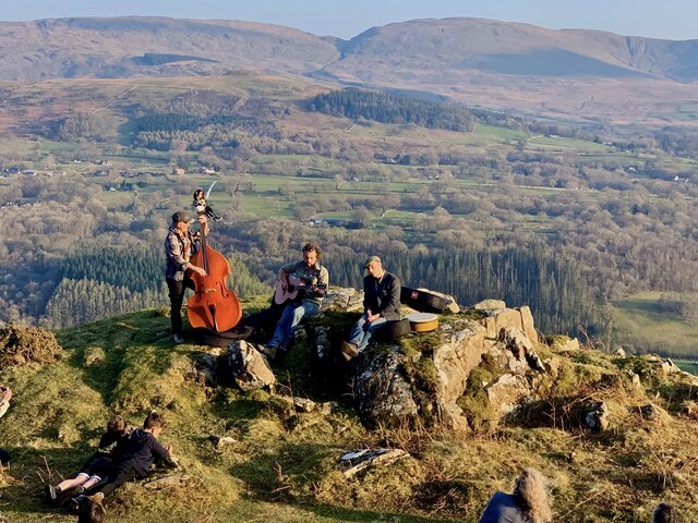
Coed Garthmaelan is known for its diverse range of tree species, including oak, beech, ash, and birch. The forest floor is carpeted with a rich variety of flora, such as bluebells, ferns, and wildflowers, creating a vibrant and enchanting atmosphere. The dense canopy provides a haven for numerous bird species, such as woodpeckers, owls, and red kites, making it a paradise for birdwatchers and nature enthusiasts.

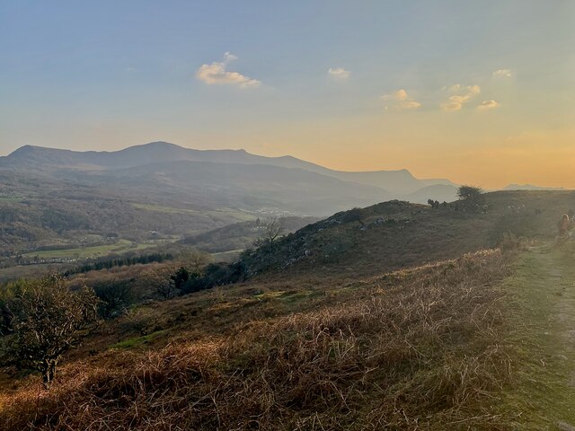
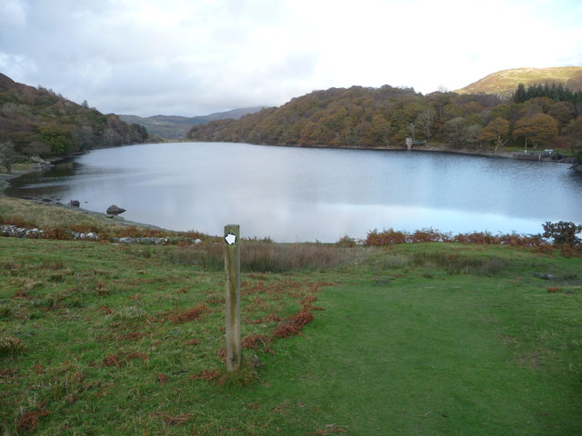
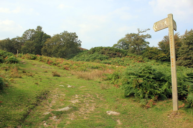
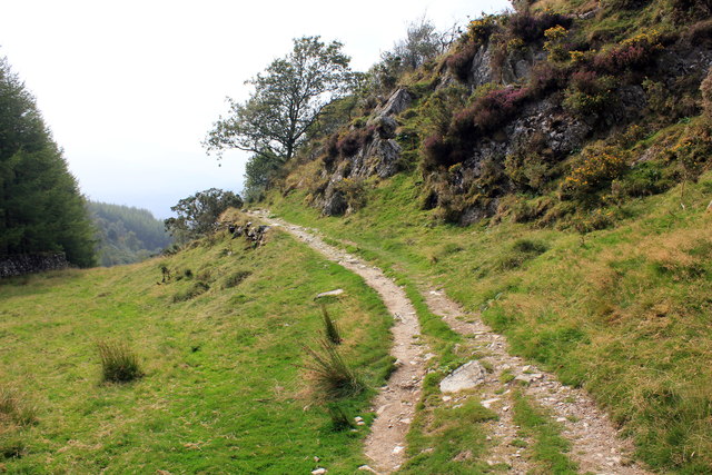
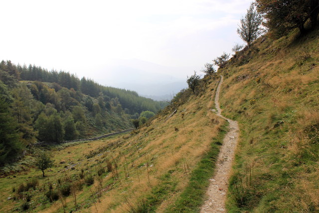
Tranquil walking trails wind their way through the forest, offering visitors the opportunity to immerse themselves in the natural beauty that surrounds them. The trails are well-marked and suitable for all abilities, making it an ideal location for families and outdoor enthusiasts alike. Along the way, visitors may stumble upon hidden streams, cascading waterfalls, and stunning viewpoints that provide breathtaking vistas of the surrounding countryside.

Coed Garthmaelan also holds historical significance, with remnants of an ancient hillfort visible within the woodland. This archaeological site adds an intriguing element to the forest, allowing visitors to explore and learn about the area's rich history.

Overall, Coed Garthmaelan is a captivating woodland that seamlessly blends natural beauty, wildlife, and history. It serves as a haven for those seeking tranquility, a connection with nature, and an escape from the hustle and bustle of everyday life.

If you have any feedback on the listing, please let us know in the comments section below.

Coed Garthmaelan Images

Images are sourced within 2km of 52.751605/-3.8613605 or Grid Reference SH7418. Thanks to Geograph Open Source API. All images are credited.

Canu yn yr awyr agored An album launch (by the very talented Osian Morris, centre) on a crag on the side of Foel Offwrm as the sun went down.
Canu yn yr awyr agored
An album launch (by the very talented Osian Morris, centre) on a crag on the side of Foel Offwrm as the sun went down.
Machlud yr haul ar Foel Offrwmm Sunset from the path around Foel Offrwm, with Cadair Idris in the distance.
Machlud yr haul ar Foel Offrwmm
Sunset from the path around Foel Offrwm, with Cadair Idris in the distance.
Llyn Cynwch A tranquil setting for a reservoir and a lovely walk.
Llyn Cynwch
A tranquil setting for a reservoir and a lovely walk.
Small crag on Foel Offrwm The crag lies to the east of a well built ridge wall on the south side of the hill. The distant low cloud conceals peaks of the Cadair Idris range.
Small crag on Foel Offrwm
The crag lies to the east of a well built ridge wall on the south side of the hill. The distant low cloud conceals peaks of the Cadair Idris range.
Llyn Cynwch from the Precipice Walk Looking down on Llyn Cynwch from the Precipice Walk. In 1968 a dam was built to raise the level of the existing lake to supply water to Dolgellau. It is a popular lake for trout fishing.
Llyn Cynwch from the Precipice Walk
Looking down on Llyn Cynwch from the Precipice Walk. In 1968 a dam was built to raise the level of the existing lake to supply water to Dolgellau. It is a popular lake for trout fishing.
The Precipice Walk The Precipice Walk as it heads south from Llyn Cynwch. The Precipice Walk is not a public footpath but a private walk over part of the Nannau estate, which dates back to the twelfth century. The public have been allowed to use the walk by the estate since 1890 on the understanding that they observe the country code, follow the route indicated and use the proper access.
The Precipice Walk
The Precipice Walk as it heads south from Llyn Cynwch. The Precipice Walk is not a public footpath but a private walk over part of the Nannau estate, which dates back to the twelfth century. The public have been allowed to use the walk by the estate since 1890 on the understanding that they observe the country code, follow the route indicated and use the proper access.
The Precipice Walk The Precipice Walk as it heads clockwise from Llyn Cynwch. The recommended route for the walk is anti-clockwise as it offers better views south west along the valley. The Precipice Walk is not a public footpath but a private walk over part of the Nannau estate, which dates back to the twelfth century. The public have been allowed to use the walk by the estate since 1890 on the understanding that they observe the country code, follow the route indicated and use the proper access.
The Precipice Walk
The Precipice Walk as it heads clockwise from Llyn Cynwch. The recommended route for the walk is anti-clockwise as it offers better views south west along the valley. The Precipice Walk is not a public footpath but a private walk over part of the Nannau estate, which dates back to the twelfth century. The public have been allowed to use the walk by the estate since 1890 on the understanding that they observe the country code, follow the route indicated and use the proper access.
The Precipice Walk The Precipice Walk as it heads clockwise from the south. The recommended route for the walk is anti-clockwise as it offers better views south west along the valley. The Precipice Walk is not a public footpath but a private walk over part of the Nannau estate, which dates back to the twelfth century. The public have been allowed to use the walk by the estate since 1890 on the understanding that they observe the country code, follow the route indicated and use the proper access.
The Precipice Walk
The Precipice Walk as it heads clockwise from the south. The recommended route for the walk is anti-clockwise as it offers better views south west along the valley. The Precipice Walk is not a public footpath but a private walk over part of the Nannau estate, which dates back to the twelfth century. The public have been allowed to use the walk by the estate since 1890 on the understanding that they observe the country code, follow the route indicated and use the proper access.
Llyn Cynwch Lake Cerddwyr ar lan Llyn Cynwch.

Walkers on the banks of Llyn Cynwch.
Llyn Cynwch Lake
Cerddwyr ar lan Llyn Cynwch. Walkers on the banks of Llyn Cynwch.
Grazing near Nannau Several pairs of twin lambs were in the field; two pairs can be seen bottom left.
Grazing near Nannau
Several pairs of twin lambs were in the field; two pairs can be seen bottom left.
Hywel Sele Lodge, Llanfachreth Hywel Sele (Howel Sele) Lodge is en route to Llanfachreth and formed part of the Nannau Estate and is overlooking a Deer Park.  Probably built between 1794 and 1818 by Sir Robert Williams Vaughan.  It is a Tudor-Gothic folly lodge that has recently been restored as a get-away-from-it-all holiday let.
The Arch is Tudor in origin.
Hywel Sele Lodge, Llanfachreth
Hywel Sele (Howel Sele) Lodge is en route to Llanfachreth and formed part of the Nannau Estate and is overlooking a Deer Park. Probably built between 1794 and 1818 by Sir Robert Williams Vaughan. It is a Tudor-Gothic folly lodge that has recently been restored as a get-away-from-it-all holiday let. The Arch is Tudor in origin.
Deer Park, Llanfachreth The Deer Park from Sele Lodge.  In the distance, Dollgellau.
Deer Park, Llanfachreth
The Deer Park from Sele Lodge. In the distance, Dollgellau.
Nannau estate deer park
A larch tree barrier Hiding the view of Foel Offrwm.
A larch tree barrier
Hiding the view of Foel Offrwm.
A GR postbox Set in the wall beside the lane from Nannau to Dolgellau.
A GR postbox
Set in the wall beside the lane from Nannau to Dolgellau.
Road descending from Nannau towards Dolgellau
The minor road near Nannau With Foel Offrwm ahead.
The minor road near Nannau
With Foel Offrwm ahead.
The minor road next to Coed y Môch Presumably meaning "The Wood of the Pigs", but the Welsh word for pigs is 'moch', not 'môch'. (The circumflex changes the pronunciation.)
The minor road next to Coed y Môch
Presumably meaning "The Wood of the Pigs", but the Welsh word for pigs is 'moch', not 'môch'. (The circumflex changes the pronunciation.)
Show me another place!

Coed Garthmaelan is located at Grid Ref: SH7418 (Lat: 52.751605, Lng: -3.8613605)

Unitary Authority: Gwynedd

Police Authority: North Wales

What 3 Words

///blows.legal.directors. Near Dolgellau, Gwynedd

Related Wikis

Dolserau Halt railway station

Dolserau Halt (Pron: Dol-seh-rye) in Gwynedd, Wales, was on the Ruabon to Barmouth line. The platform edge was made of timber and was situated on the north...

Ysgol y Gader

Ysgol y Gader was a bilingual comprehensive school for pupils aged 11–16 that served the town of Dolgellau and the surrounding area in South Meirionnydd...

Dolgellau transmitting station

The Dolgellau transmitting station is a broadcasting and telecommunications facility located on a hill about 1 km north of the town of Dolgellau, in Gwynedd...

Dolgellau railway station

Dolgellau railway station (Welsh pronunciation: [dɔlˈɡɛɬaɨ]) in Gwynedd, North Wales, was a station on the Ruabon to Barmouth line, originally the terminus...

Nearby Amenities

Located within 500m of 52.751605,-3.8613605
Source: npe
Lat/Long: 52.7481823/-3.863635
Source: npe
Lat/Long: 52.7506625/-3.8602983
Source: npe
Lat/Long: 52.7517671/-3.8590162
Source: npe
Lat/Long: 52.7524006/-3.8568013
Power: pole
Lat/Long: 52.7492219/-3.8553107
Power: pole
Lat/Long: 52.7485839/-3.8565579
Power: pole
Lat/Long: 52.7479109/-3.8583282
Power: pole
Lat/Long: 52.7473881/-3.8595673
The data included in this document is from www.openstreetmap.org. The data is made available under ODbL.

Have you been to Coed Garthmaelan?

Leave your review of Coed Garthmaelan below (or comments, questions and feedback).