Coed Cae-ty
Wood, Forest in Montgomeryshire
Wales
Coed Cae-ty

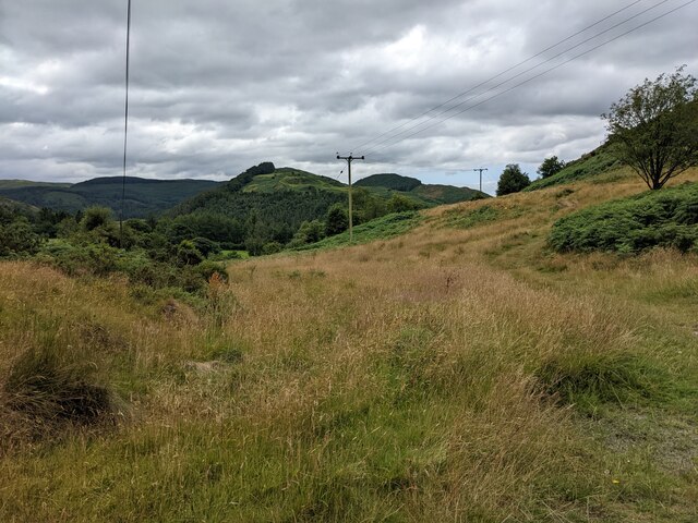
Coed Cae-ty, located in Montgomeryshire, is a picturesque woodland area that offers a serene and natural escape for visitors. This enchanting forest covers an extensive area and is characterized by its dense vegetation, towering trees, and diverse wildlife. Coed Cae-ty is situated in a rural setting, surrounded by rolling hills and breathtaking landscapes.
The woodland is home to a wide variety of tree species, including oak, beech, and birch. The dense canopy of the forest provides a cool and shaded environment, perfect for leisurely walks or picnics. The forest floor is covered in a lush carpet of ferns, moss, and wildflowers, creating a vibrant and colorful atmosphere.
Nature enthusiasts will be delighted by the abundant wildlife that calls Coed Cae-ty home. Squirrels can be seen darting between the trees, while a variety of bird species can be heard chirping and singing their melodious tunes. Lucky visitors may even spot deer, foxes, and other small mammals during their exploration of the forest.
For those seeking outdoor activities, Coed Cae-ty offers a network of well-maintained walking trails that wind through the woodland. These trails cater to different levels of fitness and provide opportunities for hikers to immerse themselves in the natural beauty of the area. Additionally, the forest is equipped with picnic areas, providing a pleasant spot to rest and enjoy a meal amidst the tranquil surroundings.
Coed Cae-ty is a true haven for nature lovers and offers a peaceful retreat from the hustle and bustle of everyday life. Whether you are seeking a quiet walk in the woods or a chance to observe wildlife in their natural habitat, this charming woodland in Montgomeryshire is sure to captivate and rejuvenate.
If you have any feedback on the listing, please let us know in the comments section below.
Coed Cae-ty Images
Images are sourced within 2km of 52.570921/-3.8557777 or Grid Reference SN7498. Thanks to Geograph Open Source API. All images are credited.


Coed Cae-ty is located at Grid Ref: SN7498 (Lat: 52.570921, Lng: -3.8557777)
Unitary Authority: Powys
Police Authority: Dyfed Powys
What 3 Words
///dominate.surfaces.sparkles. Near Machynlleth, Powys
Nearby Locations
Related Wikis

Machynlleth F.C.
Machynlleth Football Club (Welsh: Clwb Pêl Droed Machynlleth) is a Welsh football team based in Machynlleth, Powys, Wales. They played in the Ardal Leagues...

Plas Machynlleth
Plas Machynlleth is the former Welsh residence of the Marquesses of Londonderry. It is situated in the market town of Machynlleth in Powys (formerly Montgomeryshire...

Celtica (visitor centre)
Celtica was an educational guest centre located in Machynlleth, Wales. Formed in 1995, Celtica provided domestic and foreign tourists with information...
Ysgol Bro Hyddgen
Ysgol Bro Hyddgen is a bilingual, all-age (4-19) school situated in Machynlleth, Powys. The school is a combination of two previous schools, namely Machynlleth...
Derwenlas
Derwenlas is a hamlet in northern Powys, Wales. It is part of the community of Cadfarch. Part of the historic county of Montgomeryshire (Sir Drefaldwyn...
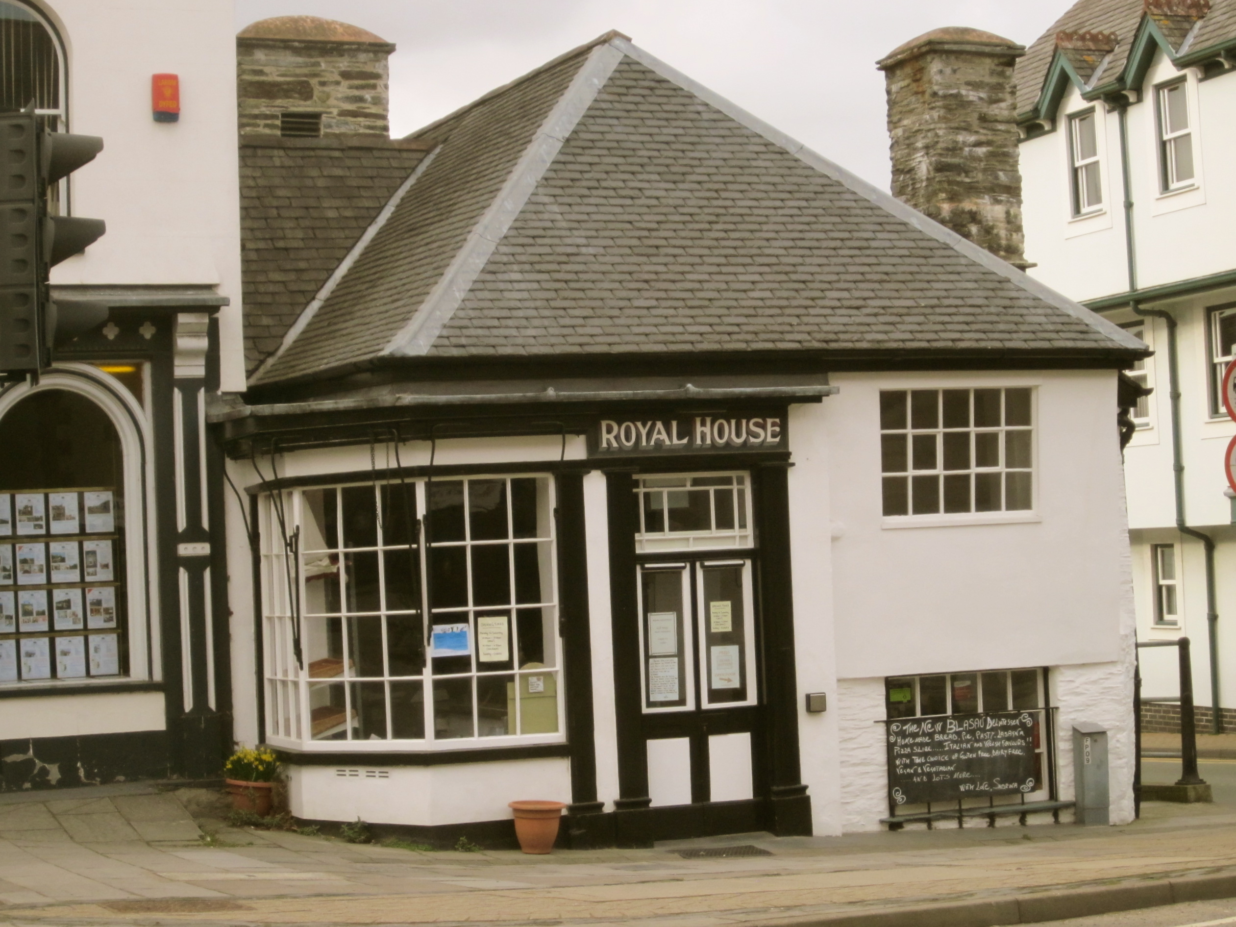
Royal House, Machynlleth
The Royal House in Machynlleth is a 16th-century merchant’s house with extensive interior timber framing, clad in stone on the outside, with two massive...
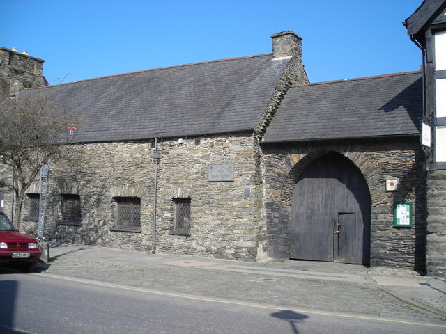
Owain Glyndŵr's Parliament House
Owain Glyndŵr's Parliament House (Welsh: Senedd-dy Owain Glyndŵr) was traditionally the building where Owain Glyndŵr held a parliament after being crowned...
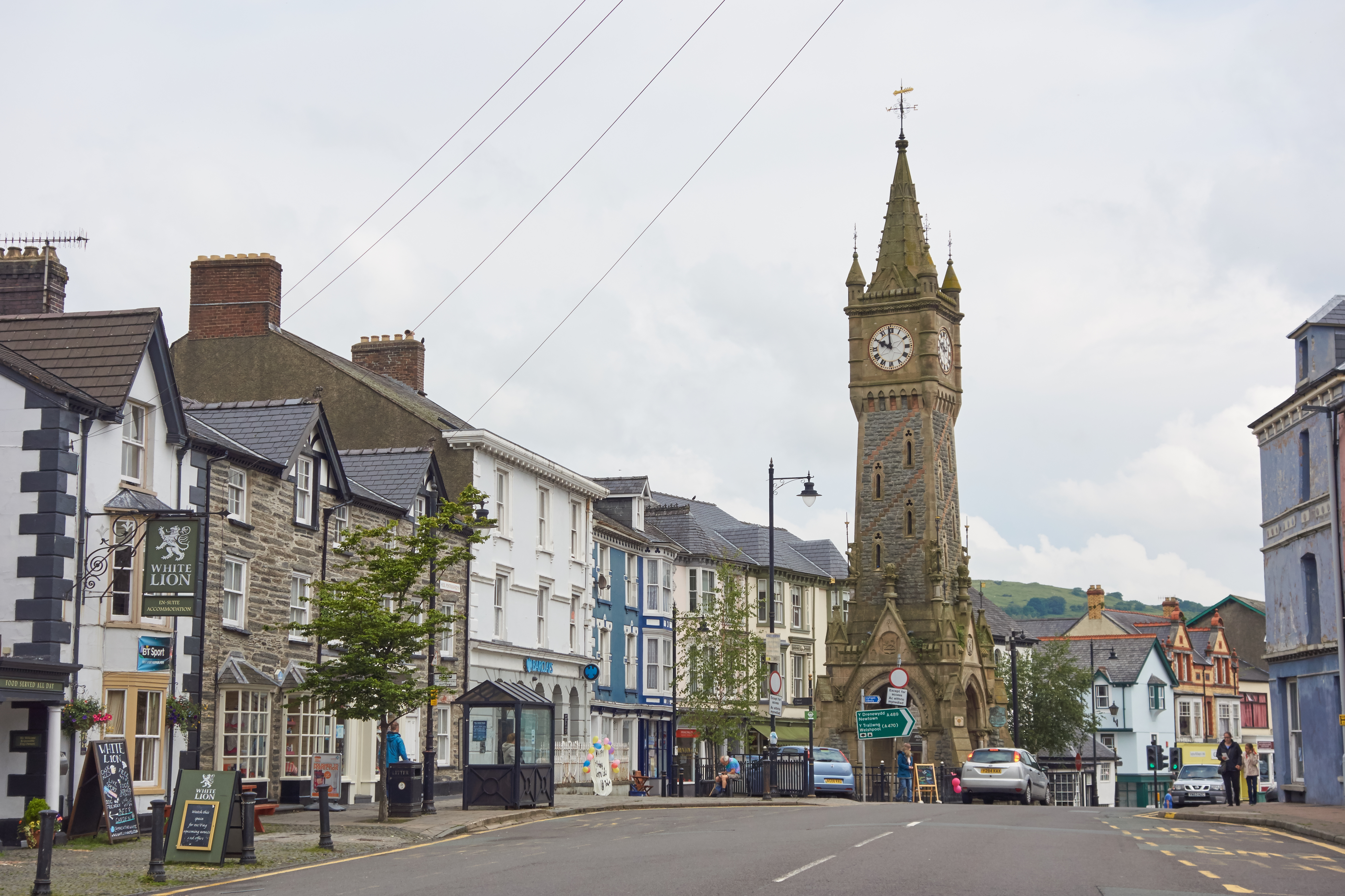
Machynlleth
Machynlleth (pronounced [maˈχənɬɛθ] ) is a market town, community and electoral ward in Powys, Wales and within the historic boundaries of Montgomeryshire...
Nearby Amenities
Located within 500m of 52.570921,-3.8557777Have you been to Coed Cae-ty?
Leave your review of Coed Cae-ty below (or comments, questions and feedback).