Coed Cae'rbobian

Wood, Forest in Montgomeryshire

Wales

Coed Cae'rbobian

Gelli-gau, Glaspwll The house of Gelli-gau seen in late afternoon sunlight from the bridleway approaching it.
Gelli-gau, Glaspwll Credit: Mike Parker

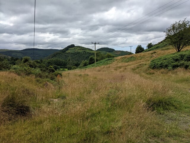
Coed Cae'rbobian, located in Montgomeryshire, Wales, is a picturesque woodland area known for its natural beauty and rich biodiversity. Covering an expansive area of land, the forest is characterized by dense tree coverage, primarily consisting of native species such as oak, beech, and birch.

The woodland is home to a diverse range of wildlife, including various bird species, mammals, and insects. Visitors to Coed Cae'rbobian can often spot red kites soaring above the canopy, while the forest floor is teeming with rabbits, badgers, and foxes. The tranquil atmosphere of the woodland provides a haven for nature enthusiasts and wildlife photographers.

The forest offers several well-maintained walking trails, allowing visitors to explore its beauty at their own pace. These paths wind through the trees, offering glimpses of babbling brooks, wildflowers, and moss-covered rocks. The forest also boasts a small picnic area, providing an ideal spot for families and groups to relax and enjoy the natural surroundings.

Coed Cae'rbobian is not only a haven for wildlife but also an important ecological site. The forest plays a crucial role in carbon sequestration, helping to mitigate the effects of climate change. It also serves as a natural water catchment area, contributing to the maintenance of local water sources.

In conclusion, Coed Cae'rbobian is a magnificent woodland area in Montgomeryshire, Wales, offering visitors a chance to immerse themselves in the beauty of nature. With its diverse wildlife, well-maintained trails, and ecological significance, the forest is a must-visit destination for those seeking tranquility and a deep connection with the natural world.

If you have any feedback on the listing, please let us know in the comments section below.

Coed Cae'rbobian Images

Images are sourced within 2km of 52.572982/-3.8602329 or Grid Reference SN7498. Thanks to Geograph Open Source API. All images are credited.

Gelli-gau, Glaspwll The house of Gelli-gau seen in late afternoon sunlight from the bridleway approaching it.
Gelli-gau, Glaspwll
The house of Gelli-gau seen in late afternoon sunlight from the bridleway approaching it.
Underneath the larches From the bridleway above the Afon Llyfnant, the colour of the autumnal larch woods seems almost to stain the air.
Underneath the larches
From the bridleway above the Afon Llyfnant, the colour of the autumnal larch woods seems almost to stain the air.
Pompren Llyfnant The footbridge spans not just the lovely Afon Llyfnant, but the counties of Powys (far side) and Ceredigion (near).
Pompren Llyfnant
The footbridge spans not just the lovely Afon Llyfnant, but the counties of Powys (far side) and Ceredigion (near).
Lôn olaf yng Ngheredigion, Glaspwll The Afon Llyfnant is the northernmost border of Ceredigion, so this lane is the last in the county. It was closed to through traffic a decade ago, as it is extremely narrow and the rock face to the right - dripping with ferns and mosses - was considered too risky.
Lôn olaf yng Ngheredigion, Glaspwll
The Afon Llyfnant is the northernmost border of Ceredigion, so this lane is the last in the county. It was closed to through traffic a decade ago, as it is extremely narrow and the rock face to the right - dripping with ferns and mosses - was considered too risky.
Dyffryn Llyfnant Sign at the Glaspwll junction, with the autumn afternoon sun catching the forested peak of Cefn Coch behind. Cwmyrhaiadr farm, down the lane to the left, is now home to the Dyfi Falls pheasant shoot.
Dyffryn Llyfnant
Sign at the Glaspwll junction, with the autumn afternoon sun catching the forested peak of Cefn Coch behind. Cwmyrhaiadr farm, down the lane to the left, is now home to the Dyfi Falls pheasant shoot.
Old milestone by Hen Gapel, Derwenlas This classic old Welsh slate milestone stands in front of Hen Gapel, Derwenlas alongside the A487. The top is damaged and it appears to have two lots of inscriptions both apparently indicating 2 miles to Machynlleth. The milestone isn't marked on any maps I've seen, but does appear to be equidistant between milestones 'Mach 1', which is now in a cut off section of the A487 (if the MS exists), and 'Mach 3' further west, which may have been lost to an RTC, where there is a hole in the hedge. 
For a wider view of this milestone see <a href="https://www.geograph.org.uk/photo/7519195">SN7299 : Derwenlas by the A487, and a milestone</a>

Inscription reads:-
         2 M
MA(CH)
2 M.

Surveyed

Milestone Society National ID: MOT_AYMC15
Old milestone by Hen Gapel, Derwenlas
This classic old Welsh slate milestone stands in front of Hen Gapel, Derwenlas alongside the A487. The top is damaged and it appears to have two lots of inscriptions both apparently indicating 2 miles to Machynlleth. The milestone isn't marked on any maps I've seen, but does appear to be equidistant between milestones 'Mach 1', which is now in a cut off section of the A487 (if the MS exists), and 'Mach 3' further west, which may have been lost to an RTC, where there is a hole in the hedge. For a wider view of this milestone see SN7299 : Derwenlas by the A487, and a milestone Inscription reads:- 2 M MA(CH) 2 M. Surveyed Milestone Society National ID: MOT_AYMC15
Derwenlas by the A487, and a milestone Looking west along the A487 in Derwenlas. On the right there is a slate milestone in front of Hen Gapel <a href="https://www.geograph.org.uk/photo/7519171">SN7299 : Old milestone by Hen Gapel, Derwenlas</a>
Derwenlas by the A487, and a milestone
Looking west along the A487 in Derwenlas. On the right there is a slate milestone in front of Hen Gapel SN7299 : Old milestone by Hen Gapel, Derwenlas
A487 at Bryn Siriol
A487 at Bryn Siriol
A plaque marking the centenary of a death In 2021 it was the centenary of the death of local man Harold Owen Owen in the Abermule train disaster, which is still Britain's worst rail accident. See: <span class="nowrap"><a title="https://en.wikipedia.org/wiki/Abermule_train_collision" rel="nofollow ugc noopener" href="https://en.wikipedia.org/wiki/Abermule_train_collision">Link</a><img style="margin-left:2px;" alt="External link" title="External link - shift click to open in new window" src="https://s1.geograph.org.uk/img/external.png" width="10" height="10"/></span>
A plaque marking the centenary of a death
In 2021 it was the centenary of the death of local man Harold Owen Owen in the Abermule train disaster, which is still Britain's worst rail accident. See: LinkExternal link
The road junction near Glaspwll
An avenue in the trees in Coed Cae'rbobian The name of the wood on the map seems to be an OS typo, as the nearby farm is called Cae'r-bobian.
An avenue in the trees in Coed Cae'rbobian
The name of the wood on the map seems to be an OS typo, as the nearby farm is called Cae'r-bobian.
The road through the trees next to Coed Cae'rbobian The name of the wood on the map seems to be an OS typo, as the nearby farm is called Cae'r-bobian.
The road through the trees next to Coed Cae'rbobian
The name of the wood on the map seems to be an OS typo, as the nearby farm is called Cae'r-bobian.
Luxuriant vegetation on the roadside
Moorland by the side of the road
Taking the road most travelled The track to the left is a bridleway, but not on today's route plan, which follows the minor road.
Taking the road most travelled
The track to the left is a bridleway, but not on today's route plan, which follows the minor road.
Steep rock, moss and ferns on the road bank It seems that the restricted byway has been carved from the hillside in this area.
Steep rock, moss and ferns on the road bank
It seems that the restricted byway has been carved from the hillside in this area.
A deep trench by the trackside Possibly an old mine working.
A deep trench by the trackside
Possibly an old mine working.
The road below Coed Mynydd Eithaf
Show me another place!

Coed Cae'rbobian is located at Grid Ref: SN7498 (Lat: 52.572982, Lng: -3.8602329)

Unitary Authority: Powys

Police Authority: Dyfed Powys

What 3 Words

///match.clear.newer. Near Machynlleth, Powys

Related Wikis

Derwenlas

Derwenlas is a hamlet in northern Powys, Wales. It is part of the community of Cadfarch. Part of the historic county of Montgomeryshire (Sir Drefaldwyn...

Plas Machynlleth

Plas Machynlleth is the former Welsh residence of the Marquesses of Londonderry. It is situated in the market town of Machynlleth in Powys (formerly Montgomeryshire...

Machynlleth F.C.

Machynlleth Football Club (Welsh: Clwb Pêl Droed Machynlleth) is a Welsh football team based in Machynlleth, Powys, Wales. They played in the Ardal Leagues...

Celtica (visitor centre)

Celtica was an educational guest centre located in Machynlleth, Wales. Formed in 1995, Celtica provided domestic and foreign tourists with information...

Nearby Amenities

Located within 500m of 52.572982,-3.8602329
Man Made: utility_pole
Lat/Long: 52.575476/-3.8626009
Man Made: utility_pole
Lat/Long: 52.5761902/-3.862812
Man Made: utility_pole
Lat/Long: 52.5768864/-3.8630257
Direction: SSW
Generator Method: photovoltaic
Generator Output Electricity: yes
Generator Solar Modules: 16
Generator Source: solar
Generator Type: solar_photovoltaic_panel
Location: roof
Power: generator
Lat/Long: 52.5704767/-3.8630395
The data included in this document is from www.openstreetmap.org. The data is made available under ODbL.

Have you been to Coed Cae'rbobian?

Leave your review of Coed Cae'rbobian below (or comments, questions and feedback).