Coed-cyd

Wood, Forest in Cardiganshire

Wales

Coed-cyd

'Sorry we cannot stop here' Poster in the waiting shelter at Rhiwfron station. In normal times this would have been a timetable but during the pandemic, passengers cannot board or alight at intermediate stations on the Vale of Rheidol Railway, so no train times are given here for now.
'Sorry we cannot stop here' Credit: John Lucas

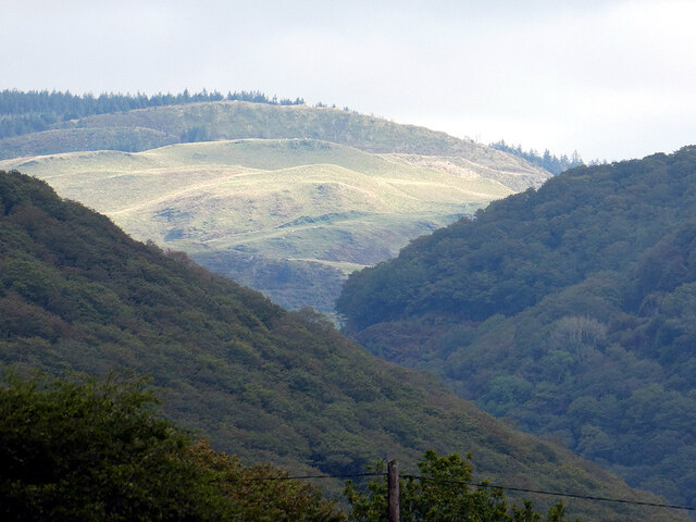
Coed-cyd is a small village located in the county of Cardiganshire, Wales. Nestled amidst the picturesque landscapes, it is renowned for its beautiful wood and forest area. The village is situated on the western coast of Wales, offering breathtaking views of the surrounding countryside and the nearby Cardigan Bay.

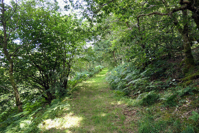
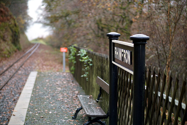
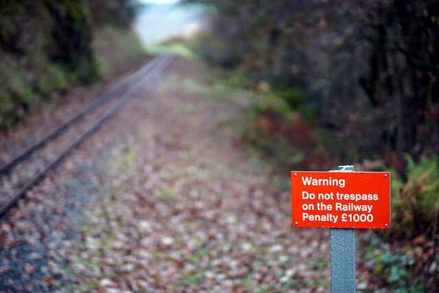
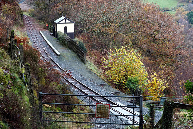
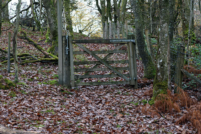
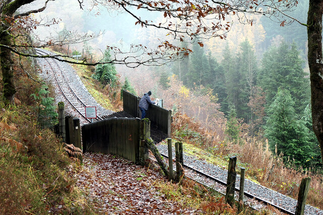
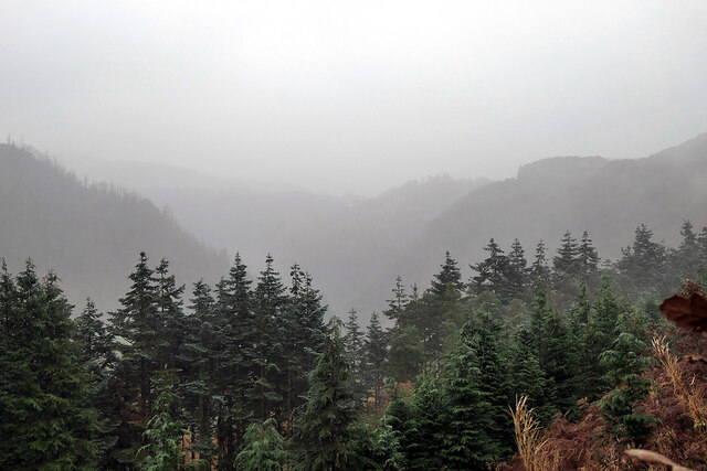
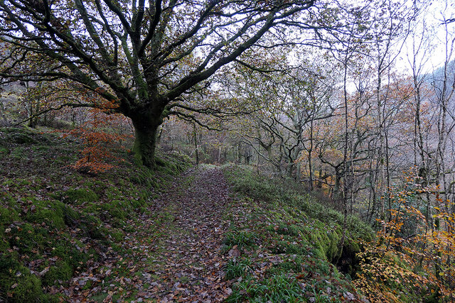
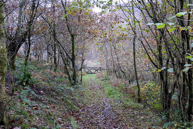
The wood and forest in Coed-cyd are a prominent feature of the village, covering a vast area of lush greenery. It is home to a diverse range of flora and fauna, making it a haven for nature enthusiasts and wildlife lovers. The forest boasts a variety of tree species, including oak, beech, and pine, creating a serene and tranquil atmosphere for visitors.

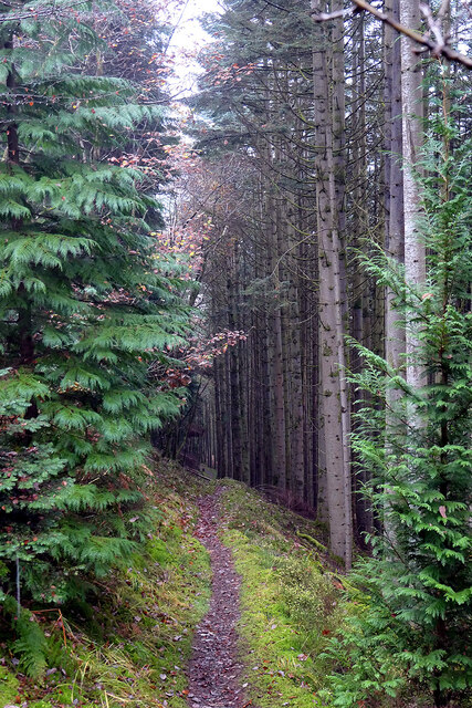
The woodlands in Coed-cyd also provide ample opportunities for outdoor activities such as hiking, walking, and cycling. There are numerous well-maintained trails and pathways that wind through the forest, allowing visitors to explore and immerse themselves in the natural beauty of the surroundings.

In addition to its natural charm, Coed-cyd offers a peaceful and idyllic atmosphere for those seeking a retreat from the bustling city life. The village itself is small, with a close-knit community and a handful of local amenities such as a village shop and a quaint pub.

Visitors to Coed-cyd can also enjoy the nearby attractions, including the stunning coastline of Cardigan Bay, famous for its sandy beaches and crystal-clear waters. The village is also within easy reach of other popular destinations in Cardiganshire, such as the historic town of Cardigan and the scenic Ceredigion Coast Path.

In summary, Coed-cyd, Cardiganshire, is a charming village known for its wood and forest area, offering a haven of natural beauty and a peaceful retreat for visitors.

If you have any feedback on the listing, please let us know in the comments section below.
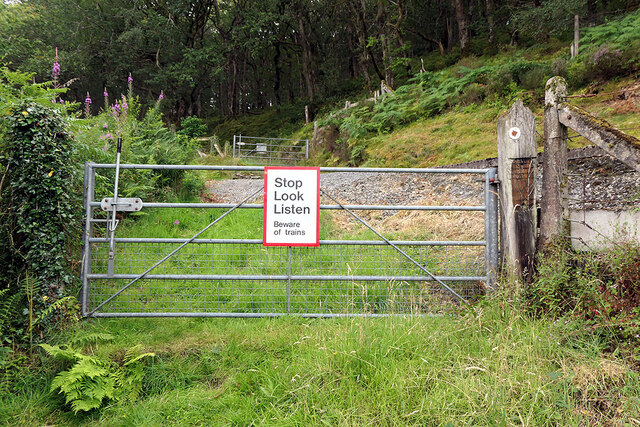
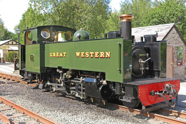
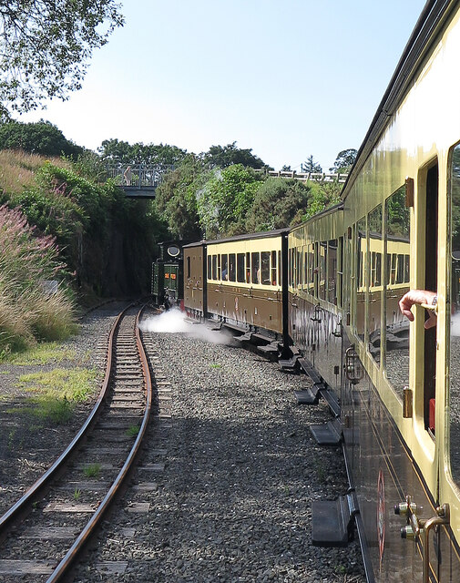
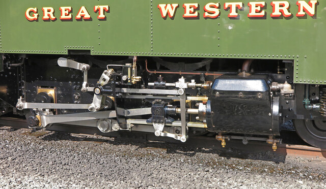
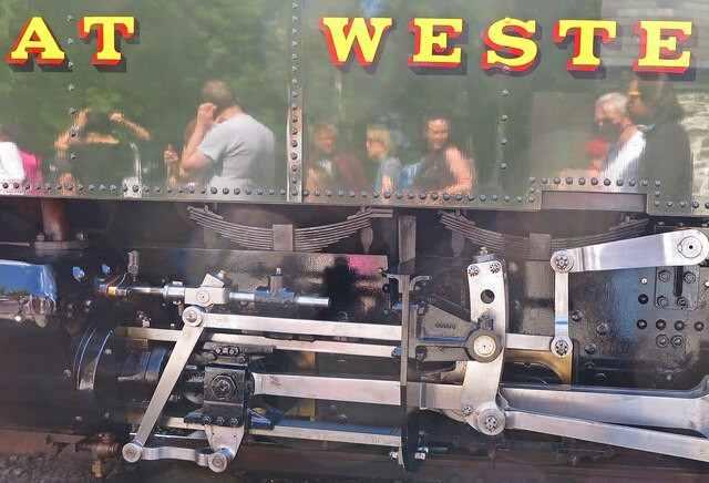
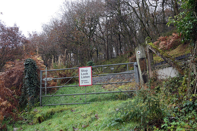
Coed-cyd Images

Images are sourced within 2km of 52.378026/-3.8527899 or Grid Reference SN7377. Thanks to Geograph Open Source API. All images are credited.

'Sorry we cannot stop here' Poster in the waiting shelter at Rhiwfron station. In normal times this would have been a timetable but during the pandemic, passengers cannot board or alight at intermediate stations on the Vale of Rheidol Railway, so no train times are given here for now.
'Sorry we cannot stop here'
Poster in the waiting shelter at Rhiwfron station. In normal times this would have been a timetable but during the pandemic, passengers cannot board or alight at intermediate stations on the Vale of Rheidol Railway, so no train times are given here for now.
Crossing gate by Rhiwfron station On a bridleway leading from Cwm Rheidol to Ty'n-y-castell.
Crossing gate by Rhiwfron station
On a bridleway leading from Cwm Rheidol to Ty'n-y-castell.
Vale of Rheidol Railway locomotive at Devil's Bridge This is No. 7 ("Owain Glyndŵr")
Vale of Rheidol Railway locomotive at Devil's Bridge
This is No. 7 ("Owain Glyndŵr")
Train leaving Devil's Bridge
Locomotive Valve Gear Vale of Rheidol Railway No. 7 ("Owain Glyndŵr") standing at Devil's Bridge.
Locomotive Valve Gear
Vale of Rheidol Railway No. 7 ("Owain Glyndŵr") standing at Devil's Bridge.
Locomotive and disembarking passengers The Vale of Rheidol Railway at Devil's Bridge. The locos and rolling stock were all in immaculate condition on this morning; some, as here, newly renovated. The photographer must be there somewhere.
Locomotive and disembarking passengers
The Vale of Rheidol Railway at Devil's Bridge. The locos and rolling stock were all in immaculate condition on this morning; some, as here, newly renovated. The photographer must be there somewhere.
Path in Cwm Rheidol An uphill slog to Rhiwfron station, Vale of Rheidol Railway.
Path in Cwm Rheidol
An uphill slog to Rhiwfron station, Vale of Rheidol Railway.
Hillside above Devil's Bridge A long view of Bryn Tyn-llwyn from the Statkraft visitor centre in Cwm Rheidol.
Hillside above Devil's Bridge
A long view of Bryn Tyn-llwyn from the Statkraft visitor centre in Cwm Rheidol.
Approaching the Vale of Rheidol foot crossing A bridleway, which follows the route of an ancient road, crosses the railway here. Rhiwfron Halt is off to the right.
Approaching the Vale of Rheidol foot crossing
A bridleway, which follows the route of an ancient road, crosses the railway here. Rhiwfron Halt is off to the right.
On Rhiwfron station Vale of Rheidol passenger trains ceased running at the end of October this year, so no trains today.

Some 'retro' fun today - using a manually operated lens, which I haven't done for a good many years! In this case, I set it at maximum aperture, thereby minimising the depth of field. Hence, the station name board is in focus, but beyond is not. I know this is possible with fully automatic cameras, but with them, I tend to be lazy and just use automatic settings. Let Intelligent Auto be your friend!
On Rhiwfron station
Vale of Rheidol passenger trains ceased running at the end of October this year, so no trains today. Some 'retro' fun today - using a manually operated lens, which I haven't done for a good many years! In this case, I set it at maximum aperture, thereby minimising the depth of field. Hence, the station name board is in focus, but beyond is not. I know this is possible with fully automatic cameras, but with them, I tend to be lazy and just use automatic settings. Let Intelligent Auto be your friend!
Do not trespass! Sign at the end of the platform on Rhiwfron station. See also comment for <a href="https://www.geograph.org.uk/photo/7020119">SN7277 : On Rhiwfron station</a>
Do not trespass!
Sign at the end of the platform on Rhiwfron station. See also comment for SN7277 : On Rhiwfron station
Looking down onto Rhiwfron station From the path leading over the hill through Coed Tynycastell.
Looking down onto Rhiwfron station
From the path leading over the hill through Coed Tynycastell.
Gate on the path in Coed Tynycastell
Looking down on the Coed Tynycastell foot crossing Unexpectedly meeting another walker who was waiting for the other member of his party to climb the steep path through Coed Rheidol.
Looking down on the Coed Tynycastell foot crossing
Unexpectedly meeting another walker who was waiting for the other member of his party to climb the steep path through Coed Rheidol.
A gloomy day in Cwm Rheidol Looking towards Devil's Bridge.
A gloomy day in Cwm Rheidol
Looking towards Devil's Bridge.
Descending into Cwm Rheidol Through Coed Rheidol on a wet day.
Descending into Cwm Rheidol
Through Coed Rheidol on a wet day.
Path in Coed Rheidol Above Afon Rheidol.
Path in Coed Rheidol
Above Afon Rheidol.
Heading for the stile in Cwm Rheidol The gate is nailed shut and cannot be opened, so it's the stile or nothing. The path leads down into the valley and crosses Afon Rheidol be means of a footbridge. It forms part of the Borth to Devil's Bridge trail.
Heading for the stile in Cwm Rheidol
The gate is nailed shut and cannot be opened, so it's the stile or nothing. The path leads down into the valley and crosses Afon Rheidol be means of a footbridge. It forms part of the Borth to Devil's Bridge trail.
Show me another place!

Coed-cyd is located at Grid Ref: SN7377 (Lat: 52.378026, Lng: -3.8527899)

Unitary Authority: Ceredigion

Police Authority: Dyfed Powys

What 3 Words

///sharpened.anchovies.cakes. Near Cwmystwyth, Ceredigion

Related Wikis

Afon Mynach

Afon Mynach (Welsh pronunciation: [ˈmənaχ]; also known as the River Mynach) is a river in Ceredigion, Wales. Its source is at the meeting of two smaller...
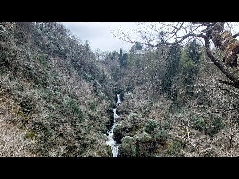
Mynach Falls

Mynach Falls (Welsh: Rhaeadr Mynach) is a waterfall near Aberystwyth in the county of Ceredigion, Wales. It occurs where the River Mynach drops 90 metres...

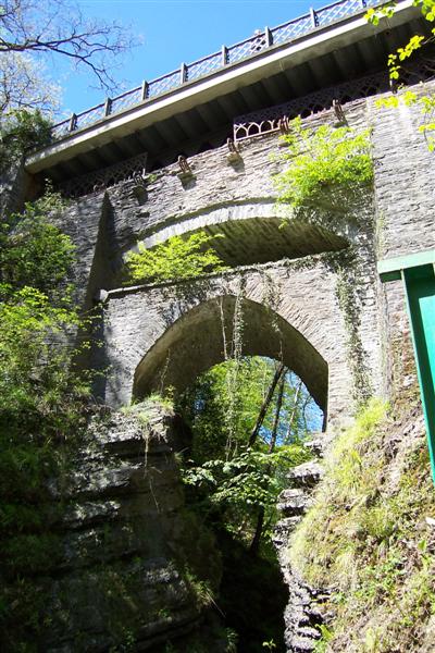
Devil's Bridge, Ceredigion

Devil's Bridge (Welsh: Pontarfynach, lit. "The bridge on the Mynach") is a village and community in Ceredigion, Wales. Above the River Mynach on the edge...

Devil's Bridge railway station

Devil's Bridge railway station is a railway station serving Devil's Bridge in Ceredigion in Mid-Wales. It is the eastern terminus of the preserved Vale...

Related Videos

Lower Devils Bridge Waterfall and the Steps Walking POV. Filmed Easter 2024.

Enjoy a POV of the amazing lower Devils Bridge Waterfalls and the steps and walking path. Filmed Easter 2024.

Jacobs Ladder at Devil's Bridge Falls

devilsbridge #devilsbridgefalls #steps #jacobsladder #wales #walking #ramblers Impressive steps down in Devils Bridge Falls.

Nearby Amenities

Located within 500m of 52.378026,-3.8527899
Source: npe
Lat/Long: 52.3789808/-3.8554815
Created By: POI Editor
Source: npe
Lat/Long: 52.3795597/-3.854287
Source: npe
Lat/Long: 52.3790621/-3.8507538
Source: npe
Lat/Long: 52.3780573/-3.8499165
Source: npe
Lat/Long: 52.3762324/-3.8491874
Source: npe
Lat/Long: 52.3759571/-3.8481505
Source: npe
Lat/Long: 52.3801584/-3.8493901
Source: npe
Lat/Long: 52.3816854/-3.8491958
Source: npe
Lat/Long: 52.3797231/-3.8589042
Source: npe
Lat/Long: 52.3792746/-3.8565403
Created By: POI Editor
Source: npe
Lat/Long: 52.3794687/-3.8547308
Source: npe
Lat/Long: 52.3789795/-3.8531249
Source: npe
Lat/Long: 52.3795485/-3.8503471
Devil's Bridge / Pontarfynach
Name Cy: Pontarfynach
Name En: Devil's Bridge
Naptan AtcoCode: 940GZZVRDVB
Public Transport: station
Railway: station
Source: NPE
Usage: tourism
Wikidata: Q5267072
Wikipedia: en:Devil's Bridge railway station
Lat/Long: 52.376061/-3.8545939
Waterway: waterfall
Lat/Long: 52.3770434/-3.8562548
Toilets
Lat/Long: 52.3761516/-3.8544754
Parking
Lat/Long: 52.3762776/-3.8548777
Devil's Bridge Falls
Waterway: waterfall
Website: http://www.devilsbridgefalls.co.uk/
Lat/Long: 52.3781088/-3.8499517
Devils Bridge Viewpoint
Tourism: viewpoint
Lat/Long: 52.376934/-3.8503061
Barrier: entrance
Fee: yes
Foot: yes
Note: Entrance Devil's Bridge Falls
Lat/Long: 52.3769398/-3.8497477
Barrier: turnstile
Description: exit Devil's Bridge Falls
Foot: yes
Lat/Long: 52.3771939/-3.8515162
Shelter
Lat/Long: 52.3790711/-3.8494705
Pontarfynach
Name Cy: Pontarfynach
Name En: Devil's Bridge
Place: village
Source: OS_OpenData_StreetView
Wikidata: Q3398339
Lat/Long: 52.3757076/-3.8568653
View of Waterfall
Tourism: viewpoint
Lat/Long: 52.3801363/-3.8542784
Barrier: stile
Foot: yes
Lat/Long: 52.3807504/-3.8513338
View of Waterfall
Tourism: viewpoint
Lat/Long: 52.3819247/-3.8505665
Barrier: stile
Foot: yes
Lat/Long: 52.382023/-3.8504994
Post Office
Devil's Bridge Stores and Post Office
Shop: convenience
Lat/Long: 52.3754168/-3.8557691
Place Of Worship
Religion: christian
Lat/Long: 52.374959/-3.8574142
Devil's Cauldron
Tourism: viewpoint
Lat/Long: 52.3767679/-3.8498709
Barrier: full-height_turnstile
Fee: yes
Note: £1 in 2017.
Lat/Long: 52.3769301/-3.8496785
Tourism: viewpoint
Lat/Long: 52.3764434/-3.8504117
Post Box
Collection Times: Mo-Fr 12:00; Sa 11:00
Post Box Type: lamp
Ref: SY23 223
Lat/Long: 52.3786076/-3.8464413
Telephone
Booth: K6
Covered: booth
Lat/Long: 52.3785569/-3.8462374
Telephone
Booth: K6
Covered: booth
Lat/Long: 52.3785781/-3.8462347
Colour: black and yellow
Covered: yes
Description: Historic AA Box
Heritage: 2
Heritage Operator: CADW
Historic Operator: AA
Listed Status: Grade II
Man Made: telephone_box
Ref: 289
Wikidata: Q29506196
Lat/Long: 52.3768078/-3.8507474
Telephone
Booth: K6
Covered: booth
Indoor: no
Operator: BT
Lat/Long: 52.3771015/-3.8494371
Historic: memorial
Memorial: war_memorial
Lat/Long: 52.3754252/-3.8566974
Toilets
Check Date: 2022-08-08
Lat/Long: 52.3769092/-3.8495148
Bus Stop
Devil's Bridge Station
Bus: yes
Naptan AtcoCode: 5230AWD71661
Naptan NaptanCode: cejapmg
Public Transport: platform
Lat/Long: 52.3756006/-3.8541642
Bus Stop
Devil's Bridge Station
Bus: yes
Naptan AtcoCode: 5230CGX16364
Naptan NaptanCode: cejapmj
Public Transport: platform
Lat/Long: 52.3757245/-3.8539613
Post Box
Post Box Type: lamp
Ref: SY23 160
Royal Cypher: EIIR
Royal Cypher Wikidata: Q33102113
Lat/Long: 52.3755042/-3.8557667
Post Box
Brand: Royal Mail
Brand Wikidata: Q638098
Brand Wikipedia: en:Royal Mail
Operator: Royal Mail
Operator Wikidata: Q638098
Post Box Type: wall
Ref: SY23 68
Royal Cypher: GR
Royal Cypher Wikidata: Q33102273
Lat/Long: 52.3770401/-3.851073
Hiking: yes
Information: guidepost
Tourism: information
Lat/Long: 52.3808158/-3.8512927
Board Type: nature
Description: Woodland
Information: board
Tourism: information
Lat/Long: 52.3819585/-3.850472
Defibrillator
Emergency: defibrillator
Indoor: no
Lat/Long: 52.3770466/-3.8512337
Direction: WSW
Generator Method: photovoltaic
Generator Output Electricity: yes
Generator Solar Modules: 7
Generator Source: solar
Generator Type: solar_photovoltaic_panel
Location: roof
Power: generator
Lat/Long: 52.3756663/-3.8561153
Direction: SSE
Generator Method: photovoltaic
Generator Output Electricity: yes
Generator Solar Modules: 8
Generator Source: solar
Generator Type: solar_photovoltaic_panel
Location: roof
Power: generator
Lat/Long: 52.3756892/-3.8561958
Direction: 105
Generator Method: photovoltaic
Generator Output Electricity: yes
Generator Solar Modules: 17
Generator Source: solar
Generator Type: solar_photovoltaic_panel
Location: roof
Power: generator
Lat/Long: 52.3759005/-3.8569066
Bicycle Parking
Bicycle Parking: stands
Capacity: 6
Lat/Long: 52.3757333/-3.8539202
AED
Defibrillator
Emergency: defibrillator
Lat/Long: 52.37626/-3.8544152
Direction: 175
Generator Method: photovoltaic
Generator Output Electricity: yes
Generator Solar Modules: 1
Generator Source: solar
Generator Type: solar_photovoltaic_panel
Location: roof
Power: generator
Lat/Long: 52.3749275/-3.8559928
Bench
Backrest: yes
Direction: NE
Seats: 2
Lat/Long: 52.3754219/-3.8567618
The data included in this document is from www.openstreetmap.org. The data is made available under ODbL.

Have you been to Coed-cyd?

Leave your review of Coed-cyd below (or comments, questions and feedback).