Cwm Berwyn Plantation

Wood, Forest in Cardiganshire

Wales

Cwm Berwyn Plantation

Ordnance Survey Cut Mark This OS cut mark can be found on the NW parapet of the bridge. It marks a point 256.634m above mean sea level.
Ordnance Survey Cut Mark Credit: Adrian Dust

The requested URL returned error: 429 Too Many Requests

If you have any feedback on the listing, please let us know in the comments section below.

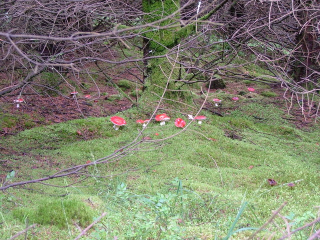
Cwm Berwyn Plantation Images

Images are sourced within 2km of 52.193784/-3.8566901 or Grid Reference SN7356. Thanks to Geograph Open Source API. All images are credited.

Ordnance Survey Cut Mark This OS cut mark can be found on the NW parapet of the bridge. It marks a point 256.634m above mean sea level.
Ordnance Survey Cut Mark
This OS cut mark can be found on the NW parapet of the bridge. It marks a point 256.634m above mean sea level.
Forest and moorland near Esgair Llethr in Ceredigion Looking east, with part of the Cwm Berwyn Plantation in the Doethie Fawr valley in the foreground. The buzzard is in "hover mode".
Forest and moorland near Esgair Llethr in Ceredigion
Looking east, with part of the Cwm Berwyn Plantation in the Doethie Fawr valley in the foreground. The buzzard is in "hover mode".
The road to Tregaron at Cwmberwyn, Ceredigion This is part of the former drovers' road between Abergwesyn and Tregaron. The moorland route is now a popular single track tourist route, more spectacular for passengers than drivers, and impassable during icy conditions.
The road to Tregaron at Cwmberwyn, Ceredigion
This is part of the former drovers' road between Abergwesyn and Tregaron. The moorland route is now a popular single track tourist route, more spectacular for passengers than drivers, and impassable during icy conditions.
Valley floor and crags, Cwm Berwyn, Ceredigion Pastel colours dominate in this beautiful valley at the end of the winter, before spring growth appears.
Valley floor and crags, Cwm Berwyn, Ceredigion
Pastel colours dominate in this beautiful valley at the end of the winter, before spring growth appears.
Moorland north of Blaendoethie, Ceredigion Although no public right of way is marked, this has long been part of a route known as the Cambrian Way "Hostel Variant". Walkers on the way between Ty'n Cornel and Blaencaron (near Tregaron) hostels also trod this way on a regular basis until the latter establishment was culled by the YHA. A glimpse of the Cwm Berwyn Plantation can be seen on the left.
Compare with the July 2007 image: <a href="https://www.geograph.org.uk/photo/508584">SN7455 : Towards Esgair Wynt, Ceredigion</a>
Moorland north of Blaendoethie, Ceredigion
Although no public right of way is marked, this has long been part of a route known as the Cambrian Way "Hostel Variant". Walkers on the way between Ty'n Cornel and Blaencaron (near Tregaron) hostels also trod this way on a regular basis until the latter establishment was culled by the YHA. A glimpse of the Cwm Berwyn Plantation can be seen on the left. Compare with the July 2007 image: SN7455 : Towards Esgair Wynt, Ceredigion
Moorland near Esgair Cerrig, Ceredigion Looking across the head of Cwm Doethie Fach to where the water from Llyn Berwyn used to flow between the felled area in the forest. Now the water diverts off to the south-west along the forest boundary to join the Afon Doethie Fawr. Did human intervention in the 1960s(?) when the Cwm Berwyn was planted, maybe, occur to speed up the drainage from the forest near the lake?

The "hostel variant" of the Cambrian Way leads along the ridge on the left in front of the trees, the tussocky boggy area, where the easiest crossing is sometimes to walk the straight ditches, which have solid beds, to the ridge on the right past the rocky outcrop, then continue to the telephone box by Nantymaen.
Moorland near Esgair Cerrig, Ceredigion
Looking across the head of Cwm Doethie Fach to where the water from Llyn Berwyn used to flow between the felled area in the forest. Now the water diverts off to the south-west along the forest boundary to join the Afon Doethie Fawr. Did human intervention in the 1960s(?) when the Cwm Berwyn was planted, maybe, occur to speed up the drainage from the forest near the lake? The "hostel variant" of the Cambrian Way leads along the ridge on the left in front of the trees, the tussocky boggy area, where the easiest crossing is sometimes to walk the straight ditches, which have solid beds, to the ridge on the right past the rocky outcrop, then continue to the telephone box by Nantymaen.
Ruined shelter by Esgair Cerrig, Ceredigion Looking across tussocky and boggy ground near the head of Cwm Doethie Fach, and  towards Cyrnau on the left skyline, and Esgair Wynt to the right.
Ruined shelter by Esgair Cerrig, Ceredigion
Looking across tussocky and boggy ground near the head of Cwm Doethie Fach, and towards Cyrnau on the left skyline, and Esgair Wynt to the right.
Esgair Wynt, Ceredigion The "hostel variant" of the Cambrian Way leads along this ridge and continues to the telephone box by Nantymaen. It is not a designated public right of way, and fences do need to be negotiated. Walkers on the way between Ty'n Cornel and Blaencaron (near Tregaron) hostels also trod this way on a regular basis until the latter establishment was culled by the YHA. A glimpse of the Cwm Berwyn Plantation can be seen on the left. Cwm Doethie Fach falls away to the right.

Not exactly the same view - but close in July 2007: <a href="https://www.geograph.org.uk/photo/518316">SN7455 : Elenydd Landscape north-east from Esgair Wynt, Ceredigion</a>
Esgair Wynt, Ceredigion
The "hostel variant" of the Cambrian Way leads along this ridge and continues to the telephone box by Nantymaen. It is not a designated public right of way, and fences do need to be negotiated. Walkers on the way between Ty'n Cornel and Blaencaron (near Tregaron) hostels also trod this way on a regular basis until the latter establishment was culled by the YHA. A glimpse of the Cwm Berwyn Plantation can be seen on the left. Cwm Doethie Fach falls away to the right. Not exactly the same view - but close in July 2007: SN7455 : Elenydd Landscape north-east from Esgair Wynt, Ceredigion
Landscape across Cwm Doethie Fach, Ceredigion Near the head of the cwm, this is the scene looking north-east from Esgair Wynt. Nant Esgaircerrig is the stream descending the far side of the valley towards the infant Afon Doethie Fach, which appears to have been deprived of its original source at Llyn Berwyn. Information on that subject will be appreciated.
The summit straight ahead is Esgair Hir, topped by a triangulation pillar.
Landscape across Cwm Doethie Fach, Ceredigion
Near the head of the cwm, this is the scene looking north-east from Esgair Wynt. Nant Esgaircerrig is the stream descending the far side of the valley towards the infant Afon Doethie Fach, which appears to have been deprived of its original source at Llyn Berwyn. Information on that subject will be appreciated. The summit straight ahead is Esgair Hir, topped by a triangulation pillar.
Moorland and forest from Esgair Wynt, Ceredigion The Cwm Berwyn Plantation is part of the Tywi Forest in which trees are mature enough for felling, so there are many clear areas within it.
Moorland and forest from Esgair Wynt, Ceredigion
The Cwm Berwyn Plantation is part of the Tywi Forest in which trees are mature enough for felling, so there are many clear areas within it.
Northwest edge of Cwm Berwyn Plantation The edge approximates to the steeply dropping Nant yr Arian ('stream of silver/money')
Northwest edge of Cwm Berwyn Plantation
The edge approximates to the steeply dropping Nant yr Arian ('stream of silver/money')
Esgair Wynt beyond forest ride
Small clearing and fence in forestry
One of the last bilberries
Vivid red fungi
Vivid red fungi
Abergwesyn mountain road beside Cwm Berwyn Plantation We met a logging truck just now, 30 foot long with a 20 foot trailer - guess which of us reversed 100 yards into a passing place?
Abergwesyn mountain road beside Cwm Berwyn Plantation
We met a logging truck just now, 30 foot long with a 20 foot trailer - guess which of us reversed 100 yards into a passing place?
Show me another place!

Cwm Berwyn Plantation is located at Grid Ref: SN7356 (Lat: 52.193784, Lng: -3.8566901)

Unitary Authority: Ceredigion

Police Authority: Dyfed Powys

What 3 Words

///simply.professes.value. Near Tregaron, Ceredigion

Nearby Locations

Cwm Berwyn Plantation

Related Wikis

Camddwr

For the tributary of the River Wye, see Camddwr, Wye and for the tributary of the River Teifi, see Camddwr, Teifi.The Camddwr is a significant right-bank...

Pentre, Ceredigion

Pentre is a small area in the community of Tregaron, Ceredigion, Wales, which is 60.4 miles (97.2 km) from Cardiff and 169.5 miles (272.8 km) from London...

Tregaron Hospital

Tregaron Hospital (Welsh: Ysbyty Tregaron) is a community hospital in Tregaron, Wales. It is managed by the Hywel Dda University Health Board. == History... ==

River Brenig

The River Brenig (Afon Brenig) is a tributary river of the River Teifi and runs through the market town of Tregaron in Ceredigion, Wales. It is formed...

Have you been to Cwm Berwyn Plantation?

Leave your review of Cwm Berwyn Plantation below (or comments, questions and feedback).