Coed Dol-fawr

Wood, Forest in Merionethshire

Wales

Coed Dol-fawr

Signpost Near the northern end of the Precipice Walk.
Signpost Credit: John H Darch

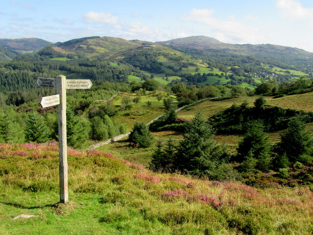
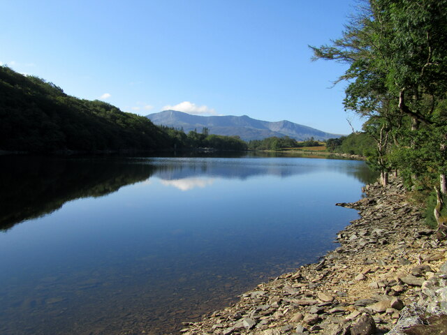
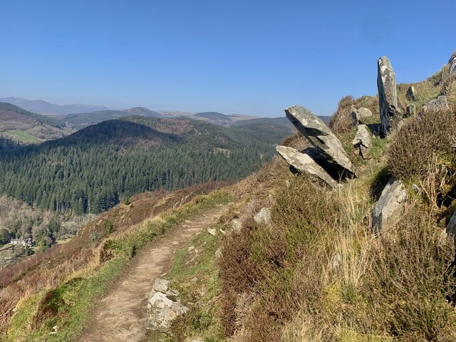
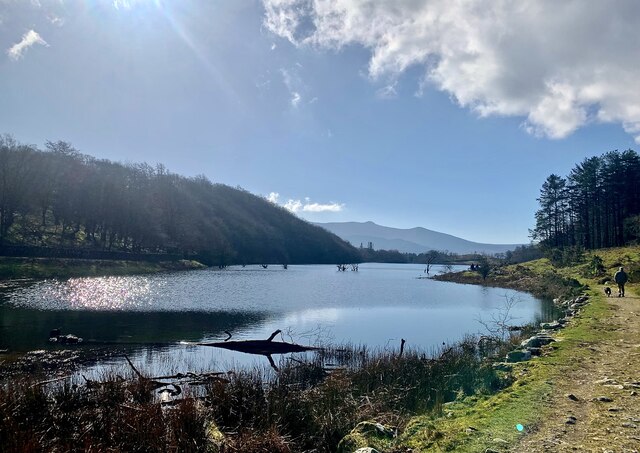
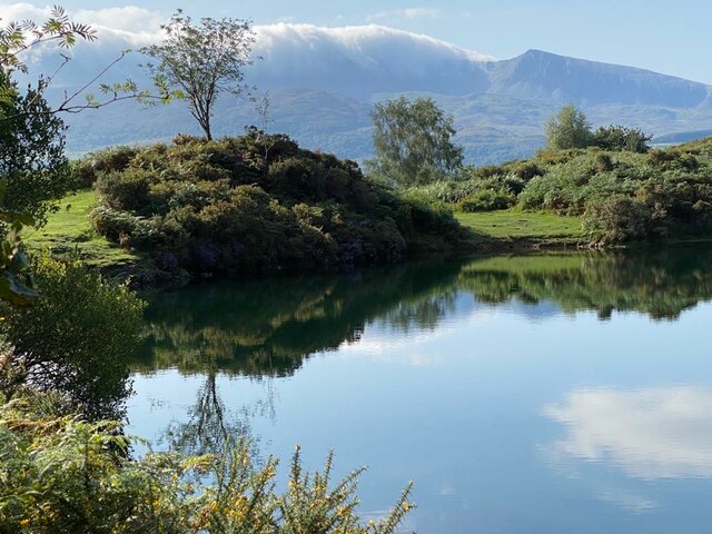
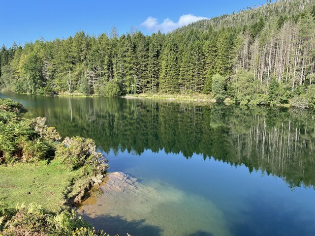
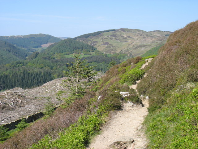
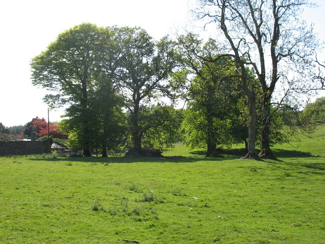
Coed Dol-fawr, located in Merionethshire, Wales, is a picturesque wood/forest that captivates visitors with its natural beauty and rich history. Covering an expansive area of land, this enchanting woodland is a haven for nature enthusiasts and history buffs alike.

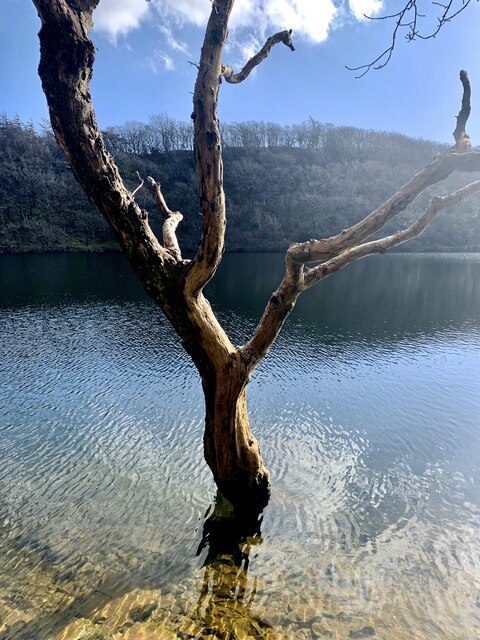
As you delve into Coed Dol-fawr, you are immediately embraced by a serene and tranquil atmosphere. Towering trees, including oak, beech, and birch, create a dense canopy overhead, filtering rays of sunlight and casting enchanting shadows on the forest floor. The lush undergrowth is adorned with a diverse array of plant species, such as bluebells, foxgloves, and ferns, further enhancing the magical ambiance of the wood.

The history of Coed Dol-fawr adds another layer of intrigue to its allure. This ancient forest has witnessed countless events and civilizations throughout the centuries. It is believed that the wood has existed since prehistoric times, and the remnants of Iron Age hillforts and burial mounds provide evidence of human presence in the area during ancient times.

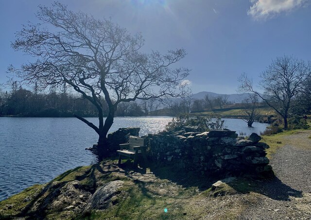
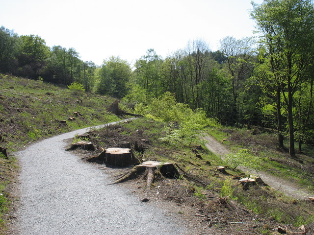
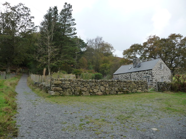
Walking through Coed Dol-fawr, you may stumble upon remnants of old structures, including stone walls and abandoned cottages, which offer glimpses into the lives of those who once inhabited the wood. These historical artifacts serve as a testament to the cultural heritage of the region.

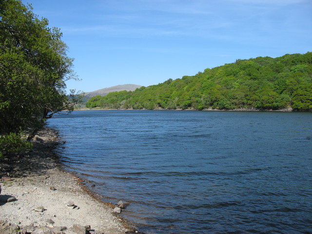
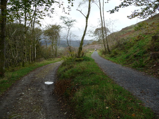
Coed Dol-fawr is not only a sanctuary for flora and fauna but also a refuge for visitors seeking solace and tranquility amidst nature's embrace. Whether exploring its scenic trails, observing wildlife, or simply basking in the peaceful ambiance, this Merionethshire woodland promises an unforgettable experience for all who venture within its mystical borders.

If you have any feedback on the listing, please let us know in the comments section below.

Coed Dol-fawr Images

Images are sourced within 2km of 52.764576/-3.889379 or Grid Reference SH7220. Thanks to Geograph Open Source API. All images are credited.

Signpost Near the northern end of the Precipice Walk.
Signpost
Near the northern end of the Precipice Walk.
Llyn Cynwch Cader Idris in the background.
Llyn Cynwch
Cader Idris in the background.
Llyn Cynwch Ar y Llwybr Cynwch / On the Precipice Walk.
Llyn Cynwch
Ar y Llwybr Cynwch / On the Precipice Walk.
Llyn Cynwch & Cadair Idris A place to linger on the famous Precipice Walk.
Llyn Cynwch & Cadair Idris
A place to linger on the famous Precipice Walk.
Ar y Llwybr Cynwch A view on the Precipice Walk.
Ar y Llwybr Cynwch
A view on the Precipice Walk.
Llywbr a Llyn Cynwch The Precipice Walk alongside Llyn Cynwch.
Llywbr a Llyn Cynwch
The Precipice Walk alongside Llyn Cynwch.
A470 near Coed y Brenin
Llyn Tan-y-Graig A spectacular September morning shows the lake off at its very best.
Llyn Tan-y-Graig
A spectacular September morning shows the lake off at its very best.
Cadair Idris a Llyn Tan-y-Graig The morning mist and cloud is fast burning off the summits of Cadair Idris, as the sun takes hold on a beautifully warm early September morning.
Cadair Idris a Llyn Tan-y-Graig
The morning mist and cloud is fast burning off the summits of Cadair Idris, as the sun takes hold on a beautifully warm early September morning.
Dying larches, Llyn Tan-y-Graig Unfortunately, many of the larch trees in these forests are dying or already dead, thanks to the rapid spread of the Phytophthora ramorum fungus. There will be major felling over the winter, and this view will soon be gone.
Dying larches, Llyn Tan-y-Graig
Unfortunately, many of the larch trees in these forests are dying or already dead, thanks to the rapid spread of the Phytophthora ramorum fungus. There will be major felling over the winter, and this view will soon be gone.
Llyn Cynwch
Llyn Cynwch
The summit cairn on Foel Cynwch The well-known Precipice Walk encircles this summit, but few walkers seem to venture to the top of the hill.
The summit cairn on Foel Cynwch
The well-known Precipice Walk encircles this summit, but few walkers seem to venture to the top of the hill.
Start of the Precipice Walk The only tree to have avoided the axe appears to have decided on hara-kiri, and fallen across the path!
Start of the Precipice Walk
The only tree to have avoided the axe appears to have decided on hara-kiri, and fallen across the path!
The south-west slopes of Foel Faner Looking to the Afon Mawddach estuary.
The south-west slopes of Foel Faner
Looking to the Afon Mawddach estuary.
On the Precipice Walk
Field by Nannau Home Farm
Paths leading to and from the Precipice Walk A popular walk with all sorts of walkers.
Paths leading to and from the Precipice Walk
A popular walk with all sorts of walkers.
Renovated cottage near the Precipice Walk Possibly a holiday cottage associated with the nearby hotel. Nice anyway.
Renovated cottage near the Precipice Walk
Possibly a holiday cottage associated with the nearby hotel. Nice anyway.
Show me another place!

Coed Dol-fawr is located at Grid Ref: SH7220 (Lat: 52.764576, Lng: -3.889379)

Unitary Authority: Gwynedd

Police Authority: North Wales

What 3 Words

///saved.demanding.rejoiced. Near Dolgellau, Gwynedd

Nearby Locations

Coed Dol-fawr

Related Wikis

Cymer Abbey

Cymer Abbey (Welsh: Abaty Cymer) is a ruined Cistercian abbey near the village of Llanelltyd, just north of Dolgellau, Gwynedd, in north-west Wales, United...

Llanelltyd

Llanelltyd (Welsh: Llanelltyd) is a small village and community in Gwynedd, to the northwest of Dolgellau. The community population taken at the 2011 Census...

Hengwrt

Hengwrt (English: Old Court) was a mansion near Dolgellau in Meirionnydd, Gwynedd. It lay in the parish of Llanelltyd near the confluence of the River...

Dolgellau transmitting station

The Dolgellau transmitting station is a broadcasting and telecommunications facility located on a hill about 1 km north of the town of Dolgellau, in Gwynedd...

Nannau, Wales

Nannau (Welsh for 'the place of many streams'') is a Georgian mansion and estate near the village of Llanfachreth, Gwynedd, North Wales, UK. The mansion...

River Wnion

The River Wnion is a river in the southeast of Gwynedd, Wales. It begins high on the slopes of Aran Benllyn about five miles south of Lanuwchllyn and...

Dolgellau railway station

Dolgellau railway station (Welsh pronunciation: [dɔlˈɡɛɬaɨ]) in Gwynedd, North Wales, was a station on the Ruabon to Barmouth line, originally the terminus...

Coleg Meirion-Dwyfor

Coleg Meirion-Dwyfor (meaning in English "Meirion-Dwyfor College"), also known as CMD, is a college in Gwynedd, Wales with its main campus in Dolgellau...

Nearby Amenities

Located within 500m of 52.764576,-3.889379
Barrier: cattle_grid
Lat/Long: 52.762364/-3.894308
Parking
Access: yes
Fee: no
Parking: layby
Lat/Long: 52.7660345/-3.8957512
Power: pole
Lat/Long: 52.768476/-3.8906166
Power: pole
Lat/Long: 52.7677295/-3.8913783
Power: pole
Lat/Long: 52.766918/-3.892183
Power: pole
Lat/Long: 52.7650776/-3.8931325
Power: pole
Lat/Long: 52.7659547/-3.89268
Power: pole
Lat/Long: 52.7617803/-3.8947346
Power: pole
Lat/Long: 52.7624766/-3.8946139
Power: pole
Lat/Long: 52.7632654/-3.8941365
Power: pole
Lat/Long: 52.7640786/-3.8935491
Power: pole
Lat/Long: 52.7645151/-3.8933667
Power: pole
Lat/Long: 52.767915/-3.8892714
Power: pole
Lat/Long: 52.7671392/-3.8900308
Power: pole
Lat/Long: 52.768597/-3.8886213
Power: pole
Lat/Long: 52.7664093/-3.8907872
Power: pole
Lat/Long: 52.7647376/-3.8923113
Power: pole
Lat/Long: 52.7641322/-3.8924427
Power: pole
Lat/Long: 52.7631697/-3.8926385
Power: pole
Lat/Long: 52.7622592/-3.8928156
Power: pole
Lat/Long: 52.7655199/-3.8916123
Power: pole
Lat/Long: 52.7606937/-3.8928708
Power: pole
Lat/Long: 52.7614627/-3.8929974
View & Bench
Name En: View & Bench
Tourism: viewpoint
Lat/Long: 52.7662767/-3.8832462
The data included in this document is from www.openstreetmap.org. The data is made available under ODbL.

Have you been to Coed Dol-fawr?

Leave your review of Coed Dol-fawr below (or comments, questions and feedback).